What's new

Truth/Facts About Pakistani Claim Over Siachen Glacier

Xeric

RETIRED THINK TANK
Joined
Mar 31, 2008
Messages
8,297
Reaction score
42
Country
Pakistan
Location
Pakistan
Xeric's Primer: Truth/Facts About Pakistani Claim Over Siachen Glacier

It is usually said or quoted that the LOC beyond NJ 9842 will be extended to “North” or “Northwards”. Any stance based on such a statement is incorrect, here's why:

(These slides are the brief which were once delivered by Pakistani Foreign Office to Diplomats)

http://xerics.blogspot.com/2014/07/truthfacts-about-pakistani-claim-over.html#.U9pTtWOE4hM

Slide1 by Khakiate, on Flickr

Slide2 by Khakiate, on Flickr

Slide3 by Khakiate, on Flickr
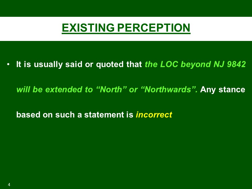
Slide4 by Khakiate, on Flickr
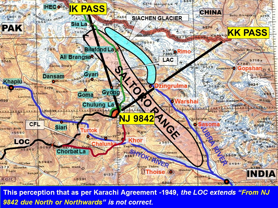
Slide5 by Khakiate, on Flickr


Slide6 by Khakiate, on Flickr
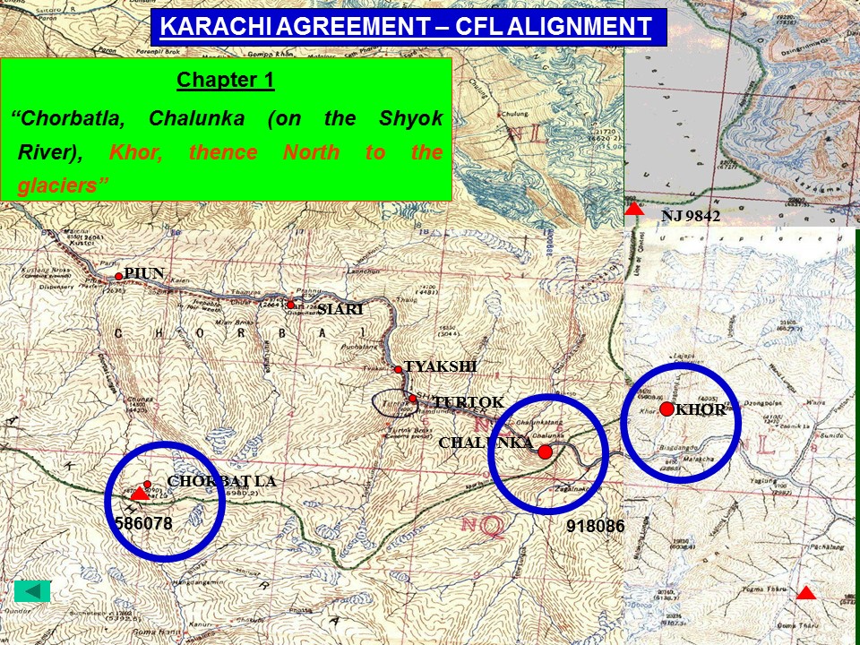

Slide7 by Khakiate, on Flickr
Slide8 by Khakiate, on Flickr
Slide9 by Khakiate, on Flickr

Slide10 by Khakiate, on Flickr
 
Last edited:
@Xeric, sir a novice question. What strategic importance does Siachin Glacier has. If none then doesn't it suit us to let them tie resources to it while we just keep surrounding it from comparatively easier locations to stop further expansion?
 
Idiot, these slides are the brief which were once delivered by our foreign office to diplomats. Just found them from somewhere.

Why dont you counter the facts, even a blog would do if it's authentic ;)

Thank you for a very interesting and relevant thread Sir.

The text that I wish to highlight from the 1949 Cease Fire Agreement is this, followed by a question:

QUOTE: "(d) From DALUNANG eastwards the cease-fire line will follow the general line Point 15495, ISHMAN, MANUS, GANGAM, GUNDERMAN, Point 13620, JUNKAR (Point 17628), MARMAK, NATSARA, SHANGRUTH (Point 17531), CHORBAT LA (Point 15700), CHALUNKA (on the SHYOK River), KHOR, thence north to the glaciers. This portion of the cease-fire line shall be demarcated in detail on the basis of the factual position as of 27 July 1949 by the local commanders, assisted by United Nations Military Observers."/QUOTE.

Is there any official record of this formal determination in detail that is supposed to have occurred on July 27?
Did you read Slide # 13?
 
Did you read Slide # 13?

Yes Sir, I did. I am hoping to find an official record that demarcated the CFL "in detail" on July 27, as I find primary sources to be more robust, if they can be located and verified.
 
Yes Sir, I did. I am hoping to find an official record that demarcated the CFL "in detail" on July 27, as I find primary sources to be more robust, if they can be located and verified.
How else do you think the CFL aka the LoC was demarcated then?

If you are asking for a 'stamp paper' signed by those NCOs who demarcated this line, i am sorry that would be difficult to procure.
 
How else do you think the CFL aka the LoC was demarcated then?

If you are asking for a 'stamp paper' signed by those NCOs who demarcated this line, i am sorry that would be difficult to procure.

That is exactly why I asked the question: How was the line demarcated in detail? The robustness of any claims must be verified against the relevant official record. If the the said meeting never took place, or if the record is not available, then any subsequent arguments fall more into the "he says - he says" domain.
 
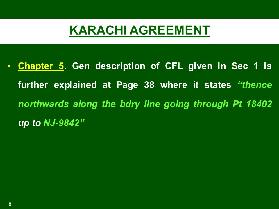
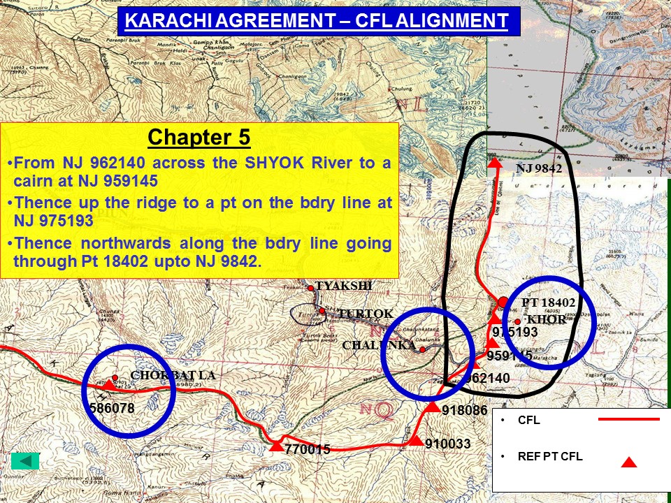
So, although Part B/2(a)/III(d) of Karachi Agreement, 1949, states that CFL, shall run 'north to the glaciers', from 'Khor' it is still irrelevant simply because troops of either countries were not stationed there at the time of Agreement.

And Pakistanis wonder why they loose almost all international legal cases against India.

That paragraph also stipulates a further meeting to demarcate the CFL in detail. Any claims cannot be regarded as robust by either side without referring to this important primary source.
 
That is exactly why I asked the question: How was the line demarcated in detail? The robustness of any claims must be verified against the relevant official record. If the the said meeting never took place, or if the record is not available, then any subsequent arguments fall more into the "he says - he says" domain.
Are you smoking something, sir?

The CFL/LoC was demarcated on ground by both the forces. The BPs are recorded and present on ground, details of which are held by both sides. i am sorry if you didnt get a memo of the same from the either side.

The only major difference between LoC and international border is that the former is violable.
 
That paragraph also stipulates a further meeting to demarcate the CFL in detail. Any claims cannot be regarded as robust by either side without referring to this important primary source.
CFL upto NJ 9842 was demarcated in detail. Detail maps are available at UN. Mind you, this map was the basis for demarcating LoC during 1972. LoC is CFL with minor adjustments.
 

Back
Top Bottom