Shan-e-ibrahim
BANNED

- Joined
- May 8, 2015
- Messages
- 1,142
- Reaction score
- -1
- Country

- Location

I knew you will run when presented with facts.Not fifteen minutes ago, you were quite eager to compare Karachi with Mumbai.
That's why I asked you, whether you understand what UNDP is or not, and quoted the report which clearly says Orangi town has become bigger than Dharavi, while Karachi is three times smaller than Mumbai in terms of GDP. Any problem with your comprehension power ?
And finally, you want to talk about Siachen...Well go through the posts by Bang Galore and levina and the others in this thread. They have pretty much nailed it.
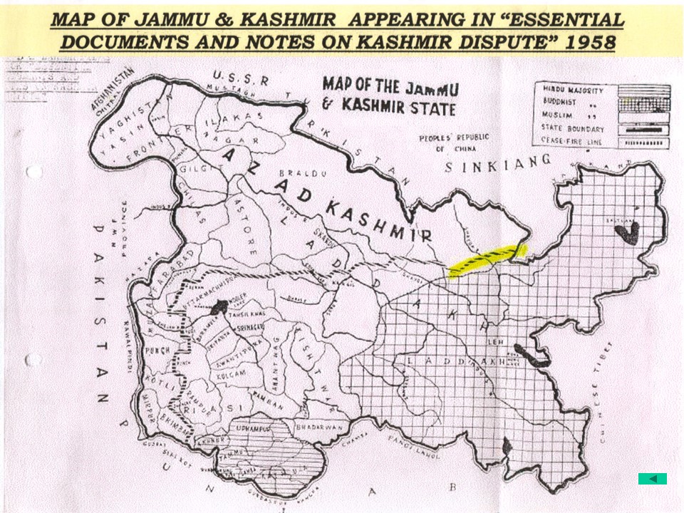
Kashmir is just power play, if we grab the land, we will stay, if you land the grab you will stay. but your Sarkar and Prasashan is peace lover and scared of escalation hence STALEMATE!