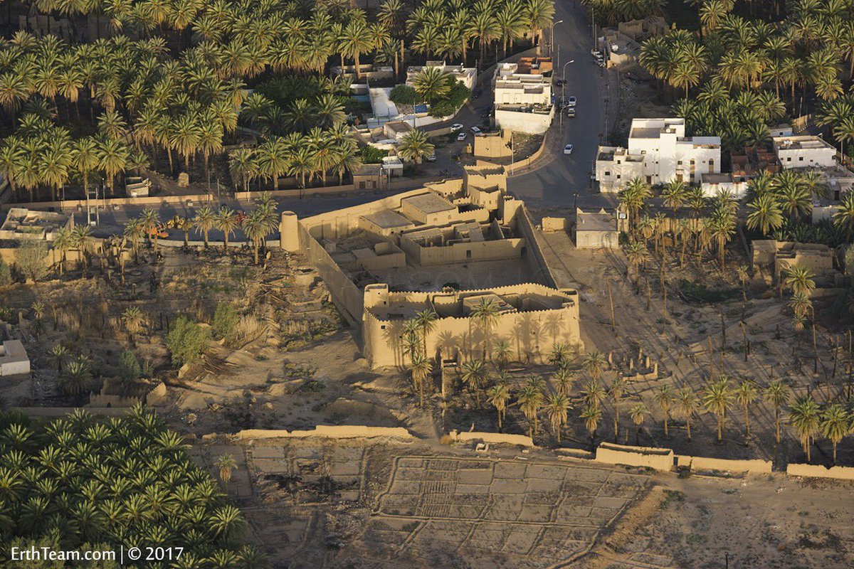
Saif al-Arab
BANNED

- Joined
- Mar 26, 2015
- Messages
- 8,873
- Reaction score
- 5
- Country

- Location

Follow along with the video below to see how to install our site as a web app on your home screen.
Note: This feature may not be available in some browsers.


Dank pics baddu ..
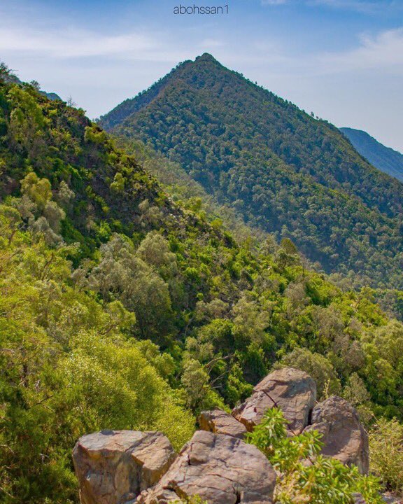
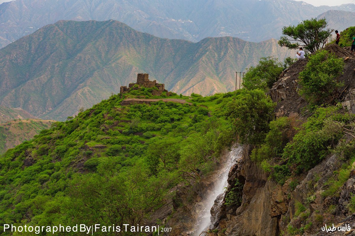
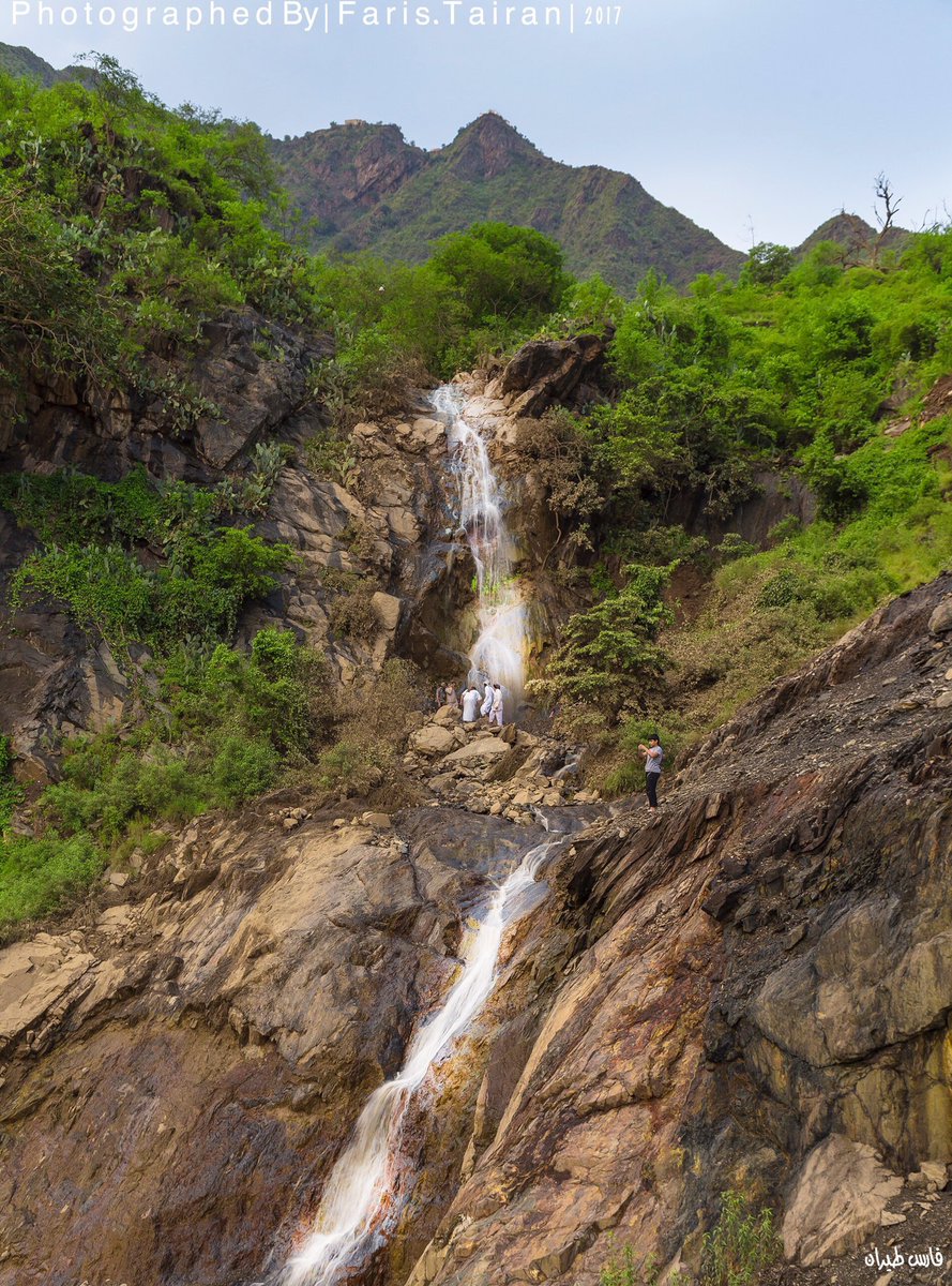
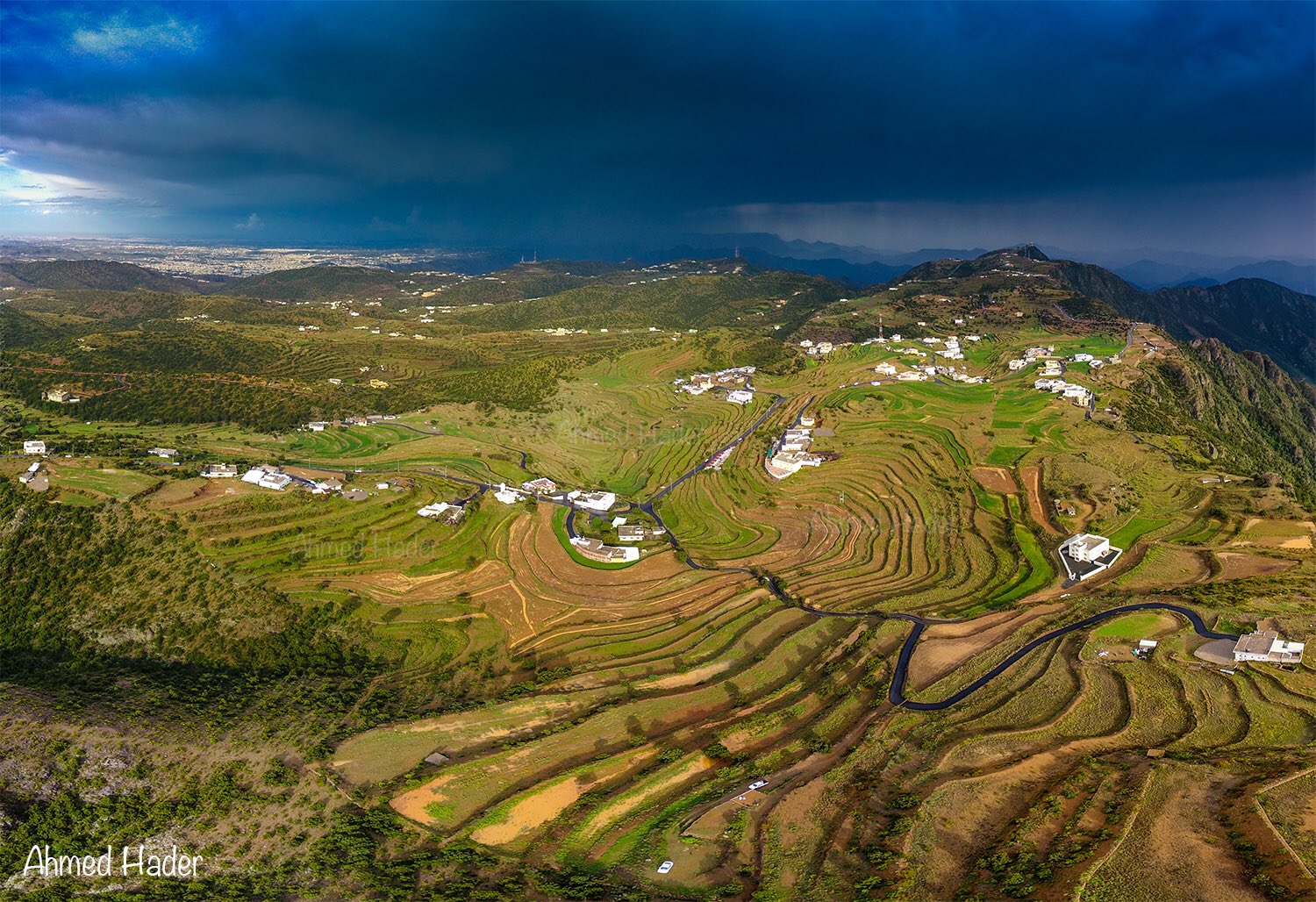
KSAs hilly regions look very similiar to Balochistan.
:


 Al Wadj Bank, Saudi Arabia (NASA, International Space Station Science, 12/30/07) by NASA's Marshall Space Flight Center, on Flickr


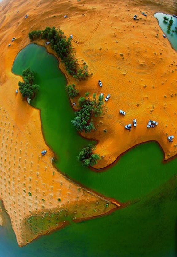
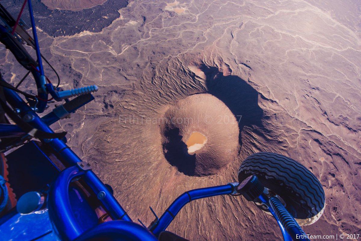
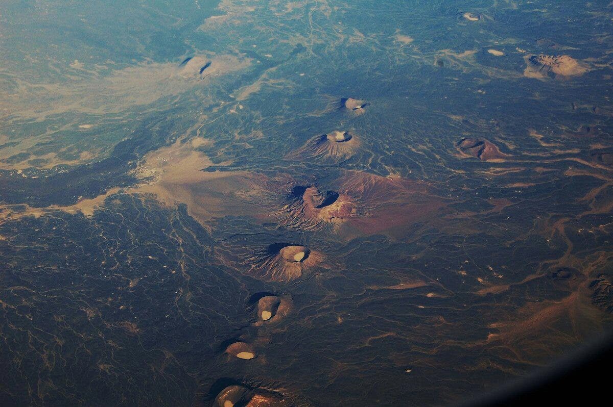
mud volcanos?


Absolutely stunning, all the pics but especially these three. Sobhan'Allah 3ala 2ard el Islam.
Any record of when the last time these volcanoes were active, Sharif?
Quite closely related as a matter of fact. When you listen to Aramaic spoken, there are many similar words in Arabic.


mud volcanos?
Look like craters too.After posing the question to Saif, I realized they might not necessarily be volcanoes but possibly craters?
After posing the question to Saif, I realized they might not necessarily be volcanoes but possibly craters?


")
mud volcanos?
In Balochistan
They are volcanoes bro. KSA has a lot of volcanoes (craters too) in particular in Hijaz and Western KSA.
See this thread below:
https://defence.pk/pdf/threads/the-...-arabia-near-the-prophets-saws-mosque.498804/
The story of the famous volcano in Saudi Arabia near the Prophet’s (saws) Mosque
The Medina region has the largest shares of these volcanic nests and craters with black rocks. (Supplied)
Staff writer, Al Arabiya English
Tuesday, 30 May 2017
Saudi Arabia stretches over 2,000 dormant volcanoes for thousands of years. They are not dead and have caused throughout their long history 13 main eruptions of lava.
The Medina region has the largest shares of these volcanic nests and craters with black rocks. The last volcanic eruption was in Hijaz, southeast of Medina in 1256. The eruption and flow took several days and the lava expanded over 23 kilometers. The longest flow of lava was 8.2 km away from the mosque of the Holy Prophet.
Mount al-Qadar is located in the center of the Khyber tract. It is an extinct volcanic mountain with a height of more than 2,000 meters above sea level. It is a rugged area, on which it is difficult to walk. The crater of Mount al-Qadr is very deep and has large cavities. Those who climb Mount al-Qadr will notice the spread of the lava over more than 50 kilometers.
Near the crater of Mount al-Qadr, you can find the crater of Mount al-Abyad volcano. It has a strange color and assorted formations and it is one of the most famous geological landmarks in the region.
Near the Taif, there is one of the deepest volcanic craters in Saudi Arabia and its depth reaches 240 meters with a diameter of more than 2,500 meters.
Saudi Arabia is a main destination for geologists with its large and prominent volcanoes having unique formations and craters. It has more than 2000 volcanic craters, some of which are among the most beautiful volcanic craters in the world.
According to the Geology Professor at King Saud University, Dr. Abdulaziz bin Laaboun, the volcanic craters in Saudi Arabia are among the most beautiful craters in the world; they represent important sites for those who are interested in geology, for tourists and researchers as well.
Last Update: Tuesday, 30 May 2017 KSA 16:49 - GMT 13:49
https://english.alarabiya.net/en/fe...no-in-Saudi-Arabia-near-the-Prophet-tomb.html
A few more of the 2000 dormant volcanoes in KSA. Almost all of them are located in Hijaz.
Albida Volcano, Kybar, saudi Arabia by Abdullah Alturaigy, on Flickr
Volcano Madina Saudi Arabia by Abdullah Alturaigy, on Flickr
A informative article about volcanoes in KSA:
http://archive.aramcoworld.com/issue/200602/volcanic.arabia.htm
Huge Geometric Shapes in Middle East May Be Prehistoric
By Owen Jarus, Live Science Contributor | December 1, 2015 10:25am ET
Thousands of stone structures that form geometric patterns in the Middle East are coming into clearer view, with archaeologists finding two wheel-shaped patterns date back some 8,500 years. That makes these "wheels" older than the famous geoglyphs in Peru called Nazca Lines.
And some of these giant designs located in Jordan's Azraq Oasis seem to have an astronomical significance, built to align with the sunrise on the winter solstice.
Those are just some of the findings of new research on these Middle East lines, which were first encountered by pilots during World War I. RAF Flight Lt. Percy Maitland published an account of them in 1927 in the journal Antiquity, reporting that the Bedouin called the structures "works of the old men," a name still sometimes used by modern-day researchers. [See Photos of the 'Nazca Lines' in the Middle East]
The "works of the old men" include wheels, which often have spokes radiating out from the center, kites (stone structures used for funnelling and killing animals), pendants (lines of stone cairns) and meandering walls, which are mysterious structures that meander across the landscape for up to several hundred feet.
The works "demonstrate specific geometric patterns and extend from a few tens of meters up to several kilometers, evoking parallels to the well-known system of geometric lines of Nazca, Peru," wrote an archaeological team in a paper published recently in the Journal of Archaeological Science. (Peru's Nazca Lines date to between 200 B.C. and A.D. 500.)
They "occur throughout the entire Arabia region, from Syria across Jordan and Saudi Arabia to Yemen," wrote the researchers. "The most startling thing about the 'Works' is that they are difficult to identify from the ground. This stands in contrast to their apparent visibility from the air."
New research on the Middle East lines was published recently in the Journal of Archaeological Science and the journal Arabian Archaeology and Epigraphy. Live Science also got an advance copy of an article set to be published in the journal Antiquity.
Prehistoric date
Tests indicate that some of the wheels date back around 8,500 years, a prehistoric time when the climate was wetter in parts of the Middle East.
Using a technique called optically stimulated luminescence (OSL), archaeologists dated two wheels at Wadi Wisad, in the Black Desert of Jordan. One wheel dated back 8,500 years, while the other wheel had a mix of dates that suggest it was built about 8,500 years and was remodeled or repaired around 5,500 years ago. [See Aerial Photos of the Giant Wheels]
At the time these wheels were built, the climate in the Black Desert was more hospitable, and Wadi Wisad was inhabited. "Charcoal from deciduous oak and tamarisk [a shrub] were recovered from two hearths in one building dated to ca. 6,500 B.C.," wrote researchers in a forthcoming issue of Antiquity.
Solar alignments?
Spatial analysis of the wheels showed that one cluster of wheels, located in the Azraq Oasis, has spokes with a southeast-northwest orientation that may align with sunrise during the winter solstice.
"The majority of the spokes of the wheels in that cluster are oriented for some reason to stretch in a SE-NW direction," researchers wrote in the Journal of Archaeological Science. This points to "where the sun rises during the winter solstice."
Whether this alignment was intentional is unknown, researchers wrote in the journal article. "As for the rest of the wheels, they do not seem to contain any archaeoastronomical information."
What were they used for?
The two dated wheels "are simple in form and not very rigidly made, according to geometric standards," said Gary Rollefson, a professor at Whitman College in Walla Walla, Washington. "They contrast sharply with some other wheels that appear to have been set out with almost as much attention to detail as the Nazca Lines."
It's possible that different wheels may have served different uses, Rollefson said. In the case of the two dated wheels, "the presence of cairns suggests some association with burials, since that is often the way of treating people once they died." Rollefson is careful to point out that "there are other wheels where cairns are entirely lacking, pointing to a different possible use."
Rollefson is co-director of the Eastern Badia Archaeological Project. His team is hoping to excavate a few of the cairns, which are located within the wheels, in the next few years.
Visible from the sky
Why people in prehistoric times would build wheel-shaped structures that can't be seen well from the ground remains a mystery. No balloon or glider technologies existed at that time. Additionally, researchers say that climbing to a higher elevation to view them was probably not possible, at least not in most cases. [In Photos: Google Earth Reveals Sprawling Geoglyphs in Kazakhstan]
Though the wheels are often difficult to make out on the ground, they are not invisible. "Granted, one can't see the finished product standing at ground level, but one can still determine a general geometric configuration," Rollefson told Live Science.
He said that to create the more precisely designed wheels, people might have used a long rope and stake.
Saudi Arabia wheels
Wheels located in Saudi Arabia and Yemen look different than those found farther north, a team with the Aerial Photographic Archive for Archaeology in the Middle East (APAAME) has found.
They've been investigating wheels, and other "works of the old men," by using free satellite imagery that is available through Google Earth and Bing. They are also using historical aerial images taken of Saudi Arabia and Yemen during the 20th century.
The circles tend to be small and have only one or two bars instead of spokes, said David Kennedy, of the University of Western Australia, who co-directs the project. Some of the "wheels" are actually shaped like squares, rectangles or triangles, he said.
One type of wheel structure actually looks like a bull's-eye, according to an image of the structure that Kennedy sent to Live Science. Three triangles point toward the bull's-eye wheel, and there are small piles of stones that lead from the three triangles to the wheel. Kennedy calls it "a central bull's-eye tomb with, in this case, three triangles each with at least a part of a connecting line of stone heaps running to the center."
Some of the "wheels" found in Saudi Arabia have a bull's-eye design.
Credit: Image courtesy Google Earth
At present, the archaeologists are not able to conduct fieldwork or aerial imaging (using planes or helicopters) in Saudi Arabia or Yemen.
Desert gates
Four "gates" were found on the slope of a volcano in Saudi Arabia. What they are and what they were used for is unknown. We can expect to hear more about them in 2016.
Credit: Image courtesy of Google Earth
Another form of "works of the old men," which Kennedy and his team have found in Saudi Arabia, is of structures that he calls "gates."
So far, 332 gates have been found in Saudi Arabia (none are known to exist farther north). The gates "consist of two short thick walls or heaps of stones, between which one or more connecting walls stretch," wrote researchers in an article published recently in the journal Arabian Archaeology and Epigraphy. The researchers note that, "from above, these features resemble an old-fashioned barred gate laid flat." The longest gate is over 500 meters (1,640 feet), but most are much smaller.
Scientists don't know how far back the gates date, nor their purpose. "I coined the term 'gate' for no better reason than that I needed a convenient label to describe them and they reminded me of the sort of field gates I saw all around in my rural childhood in Scotland," said Kennedy.
The researchers found that gates tend not to be located near kites (which were used for hunting). Indeed, some of the gates were built in places, such as barren volcanic slopes, which were unlikely to support large animal herds. Archaeologists found "five [gates] on the outer slopes of the bowl of one of the volcanoes [called Jabal al-Abyad]" in Saudi Arabia, they wrote in the Arabian Archaeology and Epigraphy journal article.
Kennedy said that his team is finishing up its research on the gates and will be publishing another journal article in the future describing the team's findings in greater detail.
Follow us @livescience, Facebook & Google+. Original article on Live Science.
http://www.livescience.com/52944-huge-geometric-shapes-in-middle-east-revealed.html
Simply amazing.
Lecture at University of Oxford.
http://www.arch.ox.ac.uk/MP1.html
http://www.shh.mpg.de/178394/petraglia
Fascinating.
Thousands of Tombs in Saudi Desert Spotted From Space
By Rebecca Kessler, LiveScience Contributor
Google Earth maps showed 1,977 structures built of basalt stone from the surrounding lava field in Jeddah, including various pendants, or circular mounds similar to collapsed tombs with processions of small stone piles branching out from them (A, B, C and D).
Credit: Google Earth, Courtesy of David Kennedy/Journal of Archaeological Science
Little is known about the archaeology of Saudi Arabia, as the government has historically forbid aerial photographs of the landscape and religious sensitivities have made access tricky. But Google Earth is changing that. Satellite images available via the Web-based 3-D map program show that large portions of the country hold a wealth of archaeological remains that predate Islam and may be several thousand years old.
Researchers recently discovered nearly 2,000 tombs by peering through one high-resolution "window" at a rocky lava field east of the city of Jeddah — all without having to set foot in the Saudi desert.
Judging by the sheer number of stone ruins identified in Saudi Arabia, as well as in other research in Jordan, there may well be a million such sites scattered throughout the Arabian Peninsula, said David Kennedy, an archaeologist at the University of Western Australia who led the study.
Eye in the sky
Kennedy has spent the past 35 years surveying Jordanian archaeological sites, mainly from aircraft — a technique that archaeologists have relied on for decades to identify and map sites not readily visible from the ground. He found plenty of sites near the Saudi border, but wondered what was on the other side. The Saudi government had commissioneda broad archaeological survey in the 1970s and 1980s that revealed about 1,800 tombs and other sites throughout the country, but the government all but prohibited the use of aerial photography even to its own surveyors.
Juris Zarins, an archaeologist who worked in Saudi Arabia for 15 years and led parts of the national survey, suggests religious sensitivities play a role in the government’s limitations on archaeology . "They don’t want people fooling around with prehistory because it contradicts the Koran — any more than fundamentalist Christians want anyone to say anything is older than six thousand years," Zarins told LiveScience.
Since satellite imagery has become widely available in the last decade, and particularly since Google Earth launched in 2005, archaeologists have used it to scan for ruins over large landscapes around the globe. About two years ago, a few sharp windows on Saudi Arabia opened up, and Kennedy got his first peek at the ground.
"I was able to actually see across the border, courtesy of Google," he said, and what he saw was "marvelous" — thousands of sites in just the handful of available windows.
Window on the desert
Kennedy and a Saudi collaborator started with a preliminary study of a small area 250 miles (400 kilometers) north of the Jeddah site. There they spotted hundreds of large stone structures called kites, which scientists think were used for trapping and corralling animals.
For the present study, published online Jan. 28 in the Journal of Archaeological Science, Kennedy and a colleague, M.C. Bishop, took a more methodical look at a 480-square-mile window near Jeddah. They located 1,977 structures built of basalt stone from the surrounding lava field. The most numerous are cairns — circular mounds similar to collapsed tombs found in Jordan and Yemen — and "pendants," which are cairns from which processions of small stone piles march as far as 3 miles off into the desert.
Some of the funeral monuments stand alone, others were built on top of one another; some are aligned, others are scattered willy-nilly across the landscape. Most of them were probably looted long ago, Kennedy said. A few less distinctively shaped ruins could be the remains of seasonal living quarters.
Kennedy sent the coordinates of a couple of sites to a friend living near Jeddah, who forayed into the desert with a GPS to photograph them. Where the satellite images clearly show a cairn and its pendant, photographs show a "rather uninspiring sea of boulders" that would be "a nightmare" to attempt to locate or map from the ground, Kennedy said.
So who were the people who built all these structures? Most likely pastoral nomads who moved between camps herding goats, sheep, donkeys, and later horses and camels, said Zarins. He said the structures probably date from between 4000 and 1000 B.C., a time when the region's climate was generally wetter and more hospitable than it is today.
Feet on the ground
While acknowledging that the new information offers new insights, it's not enough to simply peer down from space, said Zarins, who is now retired from Missouri State University and living in Oman, where he uses Google Earth in his own excavations.
"It helps you understand where you might want to dig, where you might want to look, where you might want to see. But you can't do anything with it unless you actually have people on the ground," Zarins said. "You have to have somebody go out there and dig."
And in that sense, he said, Kennedy and Bishop's paper failed to advance what he and others have known about for decades. The survey in the 1970s and 1980s showed that there are numerous tombs and other ruins throughout Saudi Arabia, but the lack of aerial photography made identifying or mapping all of them impossible.
"Yes, I can see there are tombs of various kinds in the lava fields of western Saudi Arabia. We've known about these for years and years and years," Zarins said. He added that the new imagery couldn't answer a number of crucial questions. "When was it? What period? How did they operate? Where did they live? What's the function? None of that can be done on the basis of just satellite imaging," he said.
Kennedy said he agreed — up to a point. "It's just so much more informative to see things from above. It's not going to give you the whole answer, it's just a starting point. But it's the ideal starting point," he said.
And with Google Earth's image collection constantly expanding, armchair archaeologists will have plenty of work for years to come, Kennedy said."The quality is constantly being enhanced for Saudi Arabia and the size of the windows is constantly increasing. So the potential is immense."
http://www.livescience.com/12864-google-earth-saudi-archaeology-tombs.html
Arabian archeology images revealed from the air
Ancient rock camps, cairns, tombs, traps and more, appear in the hundreds of thousands in aerial views of the Arabian desert.
The structures are very hard to see from the ground, but apparent when seen flying over the desert.
Here's a sampling of archeological views of the structures increasingly observed from "harrat" volcanic rock regions and a Q&A with study leader David Kennedy of the University of Western Australia in Perth:
First, here's a map of the harrat regions of the Arabian desert, to start off the Q& A.
Q: Who were the 'Old Men' of the Arabian Desert? Did the same culture make all these structures?
A: Several western travellers in 'Arabia' in the 19th century onwards asked beduin about some of the stone-built structures they could see and were told they were the 'work of the old men/ old people'. By that the beduin meant they were pre-Islamic – not part (they thought) of an Islamic tradition. The term was given a high profile when Flt Lt Maitland of the RAF published an article in 1927 called 'The Works of the Old Men' in Arabia, about the stone structures he saw as he flew over the Jordanian Panhandle.
Dating the structures is problematic although prehistorians date various structures to periods ranging from the 7th millennium BC down to the Early Roman period (1st c. BC to 3rd c. AD). There is no reason to think these structures are all part of a single long cultural episode. Indeed, as an Aerial Archaeologist I can see that a site type B often overlies site type A but never the other way round. And, of course, some burial cairns are frequently associated with Safaitic graffito which are dated to the Early Roman period.
Q. What was the function of the keyhole tombs? Were they family groupings of burials?
A: The type is very unusual. A few examples had been seen in Saudi Arabia half a century ago at least but now a view from space of large areas has revealed they are extremely common in west central Arabia around Khaybar and Al-Hiyat. They occur most commonly alongside tracks leading to settlements and are interspersed with what seem to be simple burial Cairns and the cairn with tail we call Pendants. So my guess is they are funerary or commemorative. The shape is only paralleled – to my knowledge, in the keyhole tombs of Korea and Japan. In crude terms they mimic the form of the numerous animal traps called Kites …. but a form found hundreds of miles to the north in Jordan and Syria rather than the variant seen in the region of the Keyholes.
Most Keyholes are found as single structures though often with others nearby; a few overlap one another to create an amalgam.
Q. The more recent paper suggests a very large number of these structures exist. What conservation efforts are needed for them at this point?
A: The huge numbers and the great extent of the region over which these Works are found – from northern Syria to Yemen, is their greatest source of vulnerability: it will seem acceptable to allow development to sweep away or damage examples simply because there are still many more. We can already see numerous examples of Kites – to take the physically largest category, which have been damaged recently including in quite remote desert areas and comparison of aerial photos of the 1950s with the same region today has revealed that dozens of Kites in one region alone have been removed entirely by agriculture during the intervening half century.
Conservation will require – ultimately, an international effort by Syria, Jordan, Israel, Saudi Arabia, Yemen and Oman. In the immediate future individual countries need to recognize the existence and significance of these Works … and that they are steadily disappearing. That in turn requires the definition of What and Where and the only feasible – i.e. cost-effective, way is to use aerial and satellite imagery as the APAAME project is doing in Jordan and testing elsewhere when only satellite imagery is available. Identifying, photographing to create a permanent record and mapping is the underpinning for research by experts. This is unlikely to halt the rapid growth and development in these countries but it will help to slow a process. It is urgent that this be pursued.
Q: From an archaeologist's viewpoint, what are the key questions raised by the structures? What should be done in terms of investigation?
A: There is no complete agreement on two key questions: When were they built? and What for? Dating the structures is very difficult and few prehistorians have ever worked in these areas. The interpretation of aerial imagery to determine associations and relationships of structures over a wide area can point to at least relative chronologies – e.g. Wheels overlie Kites but never vice versa therefore Wheels are probably younger than Kites.
Some Cairns are plainly burial sites. Some Kites seem clearly to be intended to trap animals but others are more puzzling – very complex, located in puzzling places and existing in huge numbers – over-kill. Wheels have been viewed as domestic ('houses') but explaining their form is problematic. Pendants do seem to be funerary – a burial Cairn and small commemorative cairns creating a tail. Gates are not explained – though now over 100 have been identified.
And a natural question is: Why there? In some of the more inhospitable parts of Inner Arabia? Was the climate (and environment) more favourable in the distant past?
Aerial imagery can take research so far but is NOT an end – merely a means to an end. What is needed is more intensive and extensive field research by experts who may be in a better position if armed with extensive detailed mapping and preliminary interpretation.
Q: Some of the more puzzling features you describe as perhaps monumental art. Are there other explanations for them? Salvaged trap walls, pens or the like?
A: I am thinking of some Kites whose tails are so complex that it is hard to see how they could have functioned as traps. And some Walls run in a meandering fashion across the landscape for kilometres in some cases. Investigated on the ground their precise locations may reveal a mundane practical explanation – which I would prefer. But there are others that seem to be simply a tangle of intersecting walls and in one case walls forming a saw-tooth pattern.
Q:. How surprising is it that Google Earth has opened this window on antiquity? Is it a function of the desert throwing these structures into relief (compared to say Maya ruins under a tree canopy)?
A: Not really surprising as the quality of the highest-resolution imagery is superb and can rival traditional vertical photography. And it is in colour and part of an easily explored seamless-photography over immense areas. Google Earth offers the best tool at the moment in terms of extent and quality but Bing Maps now has a growing archive of superb imagery although it is far less user-friendly than Google Earth.
The role of Aerial Archaeology in Europe in revealing tens of thousands of hitherto unknown archaeological sites transformed our understanding of the past. Most were sites only visible from the air, revealed as crop or vegetation marks. The Works are all structures on the surface in regions with little vegetation to obscure them. They can be seen at ground level but are often unintelligible … until you get up high.
Q: What regions would you most like a Google Earth view of?
A: More of what we already have. The number of high-resolution 'windows' onto the landscape of Saudi Arabia is still limited; most imagery is too poor for our purposes. We need the high-resolution coverage to be considerably extended and ideally to be as good as the best quality now available on Bing.
@DESERT FIGHTER
Great photos. Look very much like the volcanic areas of KSA (Hijaz but not only). Nice.


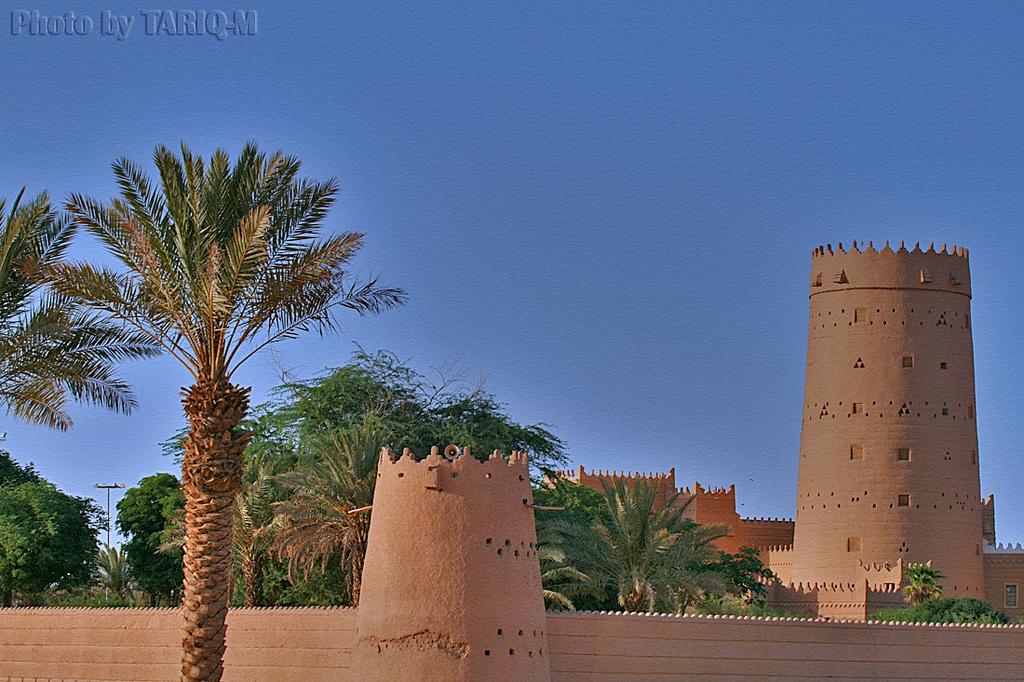
 jeddah by azizmishkhas, on Flickr
 DSCF1618_HDR by المصمماتي, on Flickr
 color building by Nasser Aldossary, on Flickr


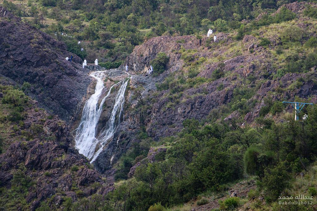


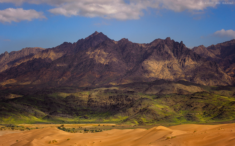 تضاريس by Abdulaziz Hajjaj, on Flickr