Tejas-MkII
FULL MEMBER

- Joined
- Sep 7, 2009
- Messages
- 410
- Reaction score
- 0
The Hindu Business Line : Global Indian Navigation system on cards
Global Indian Navigation system on cards
Statutory filing for frequency spectrum.
Madhumathi D.S.
Bangalore, May 13
The US rules the world with it, Russia has had it and Europe is firming up its own.
Now an ambitious Indian GPS' stretching all across the globe has been conjured up.
GINS or the Global Indian Navigation System, when it happens, will give India an entry into the commercially and militarily powerful world of positioning and timing of all things on earth, sea, air or space.
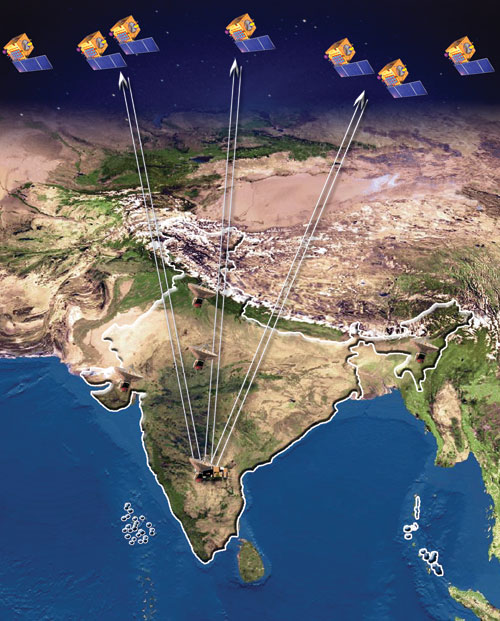
GINS, it is learnt, is meant to be a constellation of at least 24 satellites arching across the globe at a distance of 24,000 km.
These will offer an Indian brand of precise location advices to those who want it, much like the US Global Positioning System.
The statutory filing for frequency spectrum of GINS satellite orbits, which projects India's requirement in a specific international space, has been done.
The concept is still being studied in detail. But GINS will not be happening in the near future, said Dr Surendra Pal, till recently Associate Director at ISRO Satellite Centre, and who spearheaded the sat-nav programme from its start.
ISRO is currently concentrating on GAGAN (the three-satellite GPS augmentation scheme) and the Indian Regional Navigational Satellite System, he told Business Line.
The way it can impact everyday life is vast, he said. In the US and Europe, a GPS receiver is indispensable on cars and trucks.
Ships need them to find their way perfectly to their destination.
As do airlines' pilots who depend upon GPS for smooth navigating, landing and take-offs.
At times of disasters, rescue agencies have saved lives using the accurate time and location given by the GPS.
Yet, the GPS, created, owned by the US military and allowed for a few civilian services, cannot be taken for granted, Dr Pal said while speaking at an event organised recently by the Institution of Engineering and Technology of the UK.
For example, the time and position details can be adjusted to the detriment of adversaries of the US, as it happened during the second US-Iraq war. The disastrous consequences can only be imagined, he said.
According to Dr Pal, more global constellations meant better accuracy of information, reliability, as also availability of satellites over an area.
However, for civil aviation, GAGAN, once in use, would vastly improve readings for place and time for now.
Global system
A global system such as GINS would be a natural step for the country after it got the national-level GAGAN ready for operation in a couple of years and was preparing to put the GPS-independent Rs 1,600-crore, seven-satellite IRNSS in place between 2011 and 2014.
According to Dr Pal, more global constellations meant better accuracy of information, reliability, as also availability of satellites over an area.
However, for civil aviation, GAGAN, once in use, would vastly improve readings for place and time for now.
Considering that GPS, which came up in 1978, cost $20 billion and Europe's proposed Galileo estimated at $9 billion, GINS may cost at least in millions and take a long time before approvals and funds came, he said.
Russia's GLONASS with 24 satellites is crippled and being replenished with a role for ISRO. Dr Pal said accurate positioning will help all movements on land, sea or in air; it can be used in mining, fishing, aviation and to plan road, rail and infrastructure projects.
It can be used in forest survey, border mapping, synchronisation of power grids, monitoring the health of tall buildings, and even to mark out epidemic zones.
It can keep tabs on militancy, guide missiles to targets. Combined with remote sensing data, it can be used to make 3D maps.
Banks can now transfer money in real time since they started using the coordinated global navigation satellite systems times worldwide, he said.
Currently Dr Satish Dhawan Professor at ISAC, Dr Pal is in the UN panel of experts on GNSS, which will ensure seamless coordination and activities using the multiple systems.
Meanwhile, the next satellite carrying the GAGAN navigation payload will be in orbit by this year-end, followed by two others with this payload.
The full GAGAN system sponsored by ISRO and the Airports Authority of India mainly to benefit the civil aviation sector would be in place by 2013, Dr Pal said. GSAT-4, the first satellite carrying the navigation payload, was lost in a failed launch on April 15.
Global Indian Navigation system on cards
Statutory filing for frequency spectrum.
Madhumathi D.S.
Bangalore, May 13
The US rules the world with it, Russia has had it and Europe is firming up its own.
Now an ambitious Indian GPS' stretching all across the globe has been conjured up.
GINS or the Global Indian Navigation System, when it happens, will give India an entry into the commercially and militarily powerful world of positioning and timing of all things on earth, sea, air or space.
GINS, it is learnt, is meant to be a constellation of at least 24 satellites arching across the globe at a distance of 24,000 km.
These will offer an Indian brand of precise location advices to those who want it, much like the US Global Positioning System.
The statutory filing for frequency spectrum of GINS satellite orbits, which projects India's requirement in a specific international space, has been done.
The concept is still being studied in detail. But GINS will not be happening in the near future, said Dr Surendra Pal, till recently Associate Director at ISRO Satellite Centre, and who spearheaded the sat-nav programme from its start.
ISRO is currently concentrating on GAGAN (the three-satellite GPS augmentation scheme) and the Indian Regional Navigational Satellite System, he told Business Line.
The way it can impact everyday life is vast, he said. In the US and Europe, a GPS receiver is indispensable on cars and trucks.
Ships need them to find their way perfectly to their destination.
As do airlines' pilots who depend upon GPS for smooth navigating, landing and take-offs.
At times of disasters, rescue agencies have saved lives using the accurate time and location given by the GPS.
Yet, the GPS, created, owned by the US military and allowed for a few civilian services, cannot be taken for granted, Dr Pal said while speaking at an event organised recently by the Institution of Engineering and Technology of the UK.
For example, the time and position details can be adjusted to the detriment of adversaries of the US, as it happened during the second US-Iraq war. The disastrous consequences can only be imagined, he said.
According to Dr Pal, more global constellations meant better accuracy of information, reliability, as also availability of satellites over an area.
However, for civil aviation, GAGAN, once in use, would vastly improve readings for place and time for now.
Global system
A global system such as GINS would be a natural step for the country after it got the national-level GAGAN ready for operation in a couple of years and was preparing to put the GPS-independent Rs 1,600-crore, seven-satellite IRNSS in place between 2011 and 2014.
According to Dr Pal, more global constellations meant better accuracy of information, reliability, as also availability of satellites over an area.
However, for civil aviation, GAGAN, once in use, would vastly improve readings for place and time for now.
Considering that GPS, which came up in 1978, cost $20 billion and Europe's proposed Galileo estimated at $9 billion, GINS may cost at least in millions and take a long time before approvals and funds came, he said.
Russia's GLONASS with 24 satellites is crippled and being replenished with a role for ISRO. Dr Pal said accurate positioning will help all movements on land, sea or in air; it can be used in mining, fishing, aviation and to plan road, rail and infrastructure projects.
It can be used in forest survey, border mapping, synchronisation of power grids, monitoring the health of tall buildings, and even to mark out epidemic zones.
It can keep tabs on militancy, guide missiles to targets. Combined with remote sensing data, it can be used to make 3D maps.
Banks can now transfer money in real time since they started using the coordinated global navigation satellite systems times worldwide, he said.
Currently Dr Satish Dhawan Professor at ISAC, Dr Pal is in the UN panel of experts on GNSS, which will ensure seamless coordination and activities using the multiple systems.
Meanwhile, the next satellite carrying the GAGAN navigation payload will be in orbit by this year-end, followed by two others with this payload.
The full GAGAN system sponsored by ISRO and the Airports Authority of India mainly to benefit the civil aviation sector would be in place by 2013, Dr Pal said. GSAT-4, the first satellite carrying the navigation payload, was lost in a failed launch on April 15.