What's new

Featured Pakistan: The Archaeological Marvel

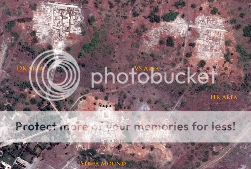
Sirkap is the name of an archaeological site on the bank opposite to the city of Taxila, Punjab.

The city of Sirkap was built by the Greco-Bactrian king Demetrius after he invaded ancient India around 180 BC. Demetrius founded in the northern and northwestern modern Pakistan an Indo-Greek kingdom that was to last until around 10 BC. Sirkap is also said to have been rebuilt by king Menander I.

The excavation of the old city was carried out under the supervision of Sir John Marshall by Her Grew from 1912–1930. In 1944 and 1945 further parts were excavated by Mortimer Wheeler and his colleagues.

The site of Sirkap was built according to the "Hippodamian" grid-plan characteristic of Greek cities. It is organized around one main avenue and fifteen perpendicular streets, covering a surface of around 1,200 by 400 meters (3,900 ft × 1,300 ft), with a surrounding wall 5–7 meters (16–23 ft) wide and 4.8 kilometers (3.0 mi) long. The ruins are Greek in character, similar to those of Olynthus in Macedonia.

A Nereid riding a Ketos sea-monster, stone palette, Sirkap, 2nd century BC.

Numerous Hellenistic artifacts have been found, in particular coins of Greco-Bactrian kings and stone palettes representing Greek mythological scenes. Some of them are purely Hellenistic, others indicate an evolution of the Greco-Bactrian styles found at Ai-Khanoum towards more indianized styles. For example, accessories such as Indian ankle bracelets can be found on some representations of Greek mythological figures such as Artemis.

Following its construction by the Greeks, the city was further rebuilt during the incursions of the Indo-Scythians, and later by the Indo-Parthians after an earthquake in 30 AD. Gondophares, the first king of the Indo-Parthian Kingdom, built parts of the city including the double headed eagle stupa and the temple of the sun god. The city was overtaken by the Kushan kings who abandoned it and built a new city at Sirsukh, about 1.5 km (0.93 mi) to the north-east.


1598752694407.png


1598752771463.png
 
Hari Singh Nalwa: Forgotten Voices From Hazara

June 22, 2019

Indus Heritage Club

0
legacy


Published in SikhNet on May 29, 2019 by Indus Heritage Club founder Jahandad Khan


legacy.JPG


The most enduring landmark of Sardar Hari Singh Nalwa’s legacy in Pakistan is the country’s western border with Afghanistan, which also once represented the furthest limits of the Sikh empire. However, it was in the Hazara region in today’s Khyber Pakhtunkhwa province that Nalwa spent the bulk of his time on the frontier. Although local history sources contain a wealth of information on Hari Singh Nalwa’s fifteen-year tenure as Governor of Hazara, they have not received adequate scholarly attention. Foremost among these is the remarkable Tawarikh-e-Hazara. This book was penned in Persian in 1846 by Lala Mehtab Singh, who hailed from Musanagar (Kanpur) and joined Nalwa’s service in Hazara in 1824. As my ancestor Painda Khan Tanoli, of Amb-Darband in Hazara, was a contemporary and prominent rival of Nalwa, our elders also passed down rich oral and written traditions that shed light on the towering figure of nineteenth century South Asian history whose legacy on the frontier is often misunderstood. It is my earnest desire to see these local narratives from Hazara added to existing knowledge of Nalwa in an objective manner, before they fade away from memory and relevance.

The Political Economy of Conflict in Hazara

Hazara occupied a strategically important position at the beginning of the early nineteenth century, as the Durrani Afghans crossed the Indus and used routes through Hazara to access the wealth of Kashmir. Therefore, control of Hazara became increasingly important to Maharaja Ranjit Singh’s Lahore Durbar as it attempted to take control of Kashmir away from the Durranis. This was bad news to the native tribes of the region who were used to maintaining their political autonomy. Both the Sikhs and Durranis experienced turbulence with the locals. In 1817, my ancestor Nawab Khan Tanoli was killed by Azim Khan Durrani, the Afghan Governor of Kashmir, for challenging Durrani authority in the region (1). Around the same time, Southern Hazara under the leadership of Muhammad Khan Tareen rebelled against growing Sikh control. Muhammad Khan Tareen was a distant ancestor of Pakistan’s first military dictator, General Ayub Khan, and a powerful chief who had formerly collected taxes from the region and paid them to the Sikh Empire’s agents at Attock Fort. The cause for the rebellion was an increase in annual tax demands from 5,000 to 25,000 Rupees.


To alleviate the resistance against the Lahore Durbar, Ranjit Singh’s crafty mother in law Mai Sada Kaur visited Hazara in 1818 with Sher Singh and a military contingent of 300 men from Lahore headed by Illahi Baksh. They built a fort at Tarbela in Hazara; Mai Sada Kaur adopted Muhammad Khan Tareen as her son and Maharaja Ranjit Singh later convinced him to accept a jagir of Rs. 20,000 to maintain peace in the region (4). Despite the efforts towards reconciliation with Hazarawal political elites, several notable Sikh officers like Makhan Singh, Diwan Ram Diyal and Amar Singh Majithia fell at the hands of local tribal chiefs who resented their decreasing autonomy.

The historian Hari Ram Gupta crudely assessed that conflict in Hazara was driven by “the religious zeal and bigotry” of the natives (who he incorrectly identifies as Yusufzai Pashtuns). However, the above chain of events identifies excessive taxation and loss of political autonomy to both Durranis and Sikhs as the realistic drivers of conflict.


Nalwa’s Military Campaign in Hazara


tanali-chief.JPG


Maharaja Ranjit Singh appointed Nalwa the Jagirdar-Governor of Hazara in 1822 following the latter’s decisive victory in an unplanned battle where the odds were heavily stacked against Nalwa. In 1821, Nalwa was rushing from Kashmir to Mankera when his forces were intercepted in Hazara. A large body of Jadun tribesmen had blocked the narrow pathway at Mangal, on the outskirts of modern-day Abbottabad, and demanded Pashmina shawls in return for right for passage. Hari Singh Nalwa sent Najeebullah Khan Swati and Lala Raj Kunwar to negotiate with the tribesmen on his behalf three times .

After three failed attempts through the local intermediaries, Nalwa took the fort at Mangal by storm. Local records mention that the Sikh forces that scaled the walls of the Mangal Fort at dawn were headed by an Iqbal Singh who displayed exemplary courage. The defeated tribesmen sent delegations of local Hindus and Sikhs from Nawanshehr and Dhamtor in Hazara to parley with Nalwa on their behalf. Nalwa permitted the Jaduns to resettle in their captured territory on the condition that each house in Nawanshehr, Dhamtor and Rajoyya pay five and a half rupees as fines for the inconvenience caused .


site.JPG


On becoming the Governor of Hazara in 1822, Nalwa built the Harkishangarh Fort a mile east of the city of Haripur, at a strategic location pointed out him by his local Muslim ally Muqaddam Musharraf who was from the Gujjar tribe . This would remain the Lahore Durbar’s largest fort in Hazara. However, it would take Nalwa two years to further cement his authority in the region. A series of toughly contested battles took place at Srikot, a mountain retreat of the Mashwani tribe that had become a seat of resistance for chiefs from around Hazara who fell out of favour with the Durbar. In 1824, Maharaja Ranjit Singh himself participated in the Hazara campaign when Nalwa was seriously wounded while attempting to take Srikot from a confederation of local tribes .

Control of Hazara was firmly established in 1824 when, on Nalwa’s local ally Muqaddam Musharraf’s advice, the following chiefs were apprehended and blown away from cannons following a battle at Srikot: Bostan Khan Tareen of Dervesh, Sher Muhammad Khan of Saraye Saleh, Saleh Muhammad Mashwani, Saleem Shah Mashwani, Jalal Khan Dilazak of Saraye Saleh and Sheikh Jadun of Rajoya. Srikot was garrisoned by the Sikh empire and the Mashwani tribe was driven out of their mountain range for two years. The Mashwanis were only allowed to return when elders of the tribe promised Nalwa that they would not cause further trouble to the Lahore Durbar .


After 1824, my ancestor Painda Khan Tanoli of Amb-Darband was the only chief left to continue the resistance in Hazara – a point to note is that he was at war not just with Nalwa but also simultaneously with the Afghan Durranis and Syed Ahmed Barelvi. This explains why Edward Conolly referred to Painda Khan as a “a sort of wild man, at war with all around him,” who would cross the river Indus with his tribal army on inflated goat skins to ambush garrisons built by the regional powers in his native lands. Nalwa was aware that Painda Khan’s father, who was put to death by the Afghan Governor of Kashmir, had as his dying wish made his son swear an oath never to trust an outside ruler. Perhaps sympathetic to his solitary condition, Nalwa made unsuccessful peace overtures to my ancestor no less than five times until his death in Jamrud in 1837 .


tawarikh.JPG


Nalwa was therefore surprised when he received a letter from the reclusive Painda Khan requesting his assistance against Syed Ahmed Barelvi, an angry preacher from UP who wanted to rally the frontier tribes in Jihad (Holy war) against the Sikh Empire. Barelvi and his men had captured my family’s seat of power at Amb-Darband after my elders’ refusal to become part of their war. Additionally, the strict version of Islam Barelvi preached was at odds with the flexible folk Islam traditionally practiced by local communities.


Hari Singh Nalwa agreed to provide military support against Barelvi in return for Painda Khan sending his eldest son, Jahandad Khan, to Nalwa as a guarantee of good will. Jahandad was a boy of eight years at the time. Interestingly, the exchange between the two rivals making common cause against Barelvi was preserved as poetry by local bards. Syed Murad Ali Aligharhi translated the folk poetry into Urdu in the 1870s . An excerpt from his translation is as follows:


pk2hsn.JPG


Barelvi’s forces were driven out of Amb-Darband with the help of the Sikh reinforcements. The alliance was short lived as the old differences between Nalwa’s lieutenant Mahan Singh and Painda Khan Tanoli soon resurfaced, and they were back to skirmishing (16). This also meant that the eight-year-old Jahandad Khan spent a few years in Nalwa’s custody before he was able to rejoin his family.


shergarh-fort.JPG


It’s important to clarify that despite his robust military presence, Nalwa’s control was never established in all of Hazara. Local sources and the Umdat Ut Tawarikh ascertain that Painda Khan Tanoli, based in the Trans-Indus Tanawal belt, continued to be a source of disturbance to Nalwa throughout the 1830s – launching prominent attacks on the Lahore Durbar’s forces in Mansehra, Kiriplian, Qadirabad, Shergarh, Parhena, Bhirkund, Nilore, Agror and Bharukot. As late as 1836, the Umdat ut Tawarikh mentions that Maharaja Ranjit Singh was annoyed with Nalwa “for in spite of that fact that there were 8,000 horse and foot with the Sardar, the affair of Painda Khan had not yet been over” . Our elders told us that control of the Shergarh Fort, which was built by Diwan Bhawani Das in 1819 and is currently in custody of my family, changed hands seventeen times between Painda Khan and the Sikh Empire between 1824 and 1844.
 
Administration

Nalwa managed Hazara through 4000 men from his personal Jagirdari forces, who were stationed in 80 forts and towers in Hazara at an annual cost of 200,000 rupees. Reinforcements were summoned from Lahore when the need arose. As Jagirdar-Governor, Nalwa’s primary responsibility was to collect taxes from the region and deposit a fixed amount into the state treasury, while ensuring that the pathways to Kashmir remained clear of the Durrani Afghans. In the early years, he did this by directly appointing the following officers as Thanedars in Hazara: Gulab Singh at Shinkiari, Dal Singh at Galli Badral, Hukam Singh at Mansehra, Diwan Bhawani Das for Tanawal, Syed Hassan Shah at Nilan, Fateh Singh at Tarbela and Mool Singh at Saraye Saleh.


Nalwa took several steps to develop Hazara’s economy. These were done not only to offset the high military expenses, but also to fund a number of key social, administrative and political projects in the region. These would come as a surprise to those accustomed to viewing Nalwa primarily as the fighting arm of the Sikh Empire. The table below provides a summary of the types and numbers of the grants given out by Jagirdar-Governor Nalwa in Hazara.


grants.JPG

To improve the revenue generating potential of the region, Nalwa developed critical irrigation infrastructure in the Haripur plains. Known as the Rangila Canal, the water distribution system introduced by Nalwa on the Dor River for the first time allowed modern agriculture as well as urban settlements to spring up in the Haripur plains. The Sikhs collected revenue on agricultural produce twice a year. Although official policy was to demand half of output, a third was usually collected. Additional sources of revenue in the region were taxes on grazing livestock and Jandars (water mills).


canalSystem.JPG

The water distribution system, gardens and groves laid down by Nalwa in Haripur and Khanpur laid down the foundations for citrus farming in the region, which is a key driver of the local economy even today . Security was provided to traders traveling between Hazara’s three commercial hubs (Haripur, Baffa and Nawanshehr), and Khatri traders migrated from northern Punjab moved to Hazara to set up shop in Hazara.

Nalwa’s legacy as a diplomat who tackled insurgency through political settlements is largely forgotten today. Of the 125 Jagirs that existed in Hazara under British rule in 1883, 102 were continuations of Jagirs granted under Sikh rule, primarily by Nalwa (26).

Muhammad Khan Tareen, Mir Zaman Khan Utmanzai, Habibullah Khan Swati, Hassan Khan Karlal, Sher Muhammad Tanoli, Muhammad Khan of Jalloh and Faiz Ali Shah of Kaghan were some of the leading chiefs from Hazara who were rewarded with Jagirs by Governor Hari Singh Nalwa in return for abandoning resistance. Alexander Burnes detailed reports also mention the settlements made with and tribute taken by Nalwa from the major Pashtun tribes west of the Indus.

As the urban regions were settled after 1824, Nalwa turned over day to day administration of Hazara to Mahan Singh Mirpuri. His loyal lieutenant had stood by Nalwa’s side at a time when others deserted him, when he was severely injured at the battle of Srikot in 1824. On assuming administration, however, Mahan Singh replaced Nalwa’s handpicked officers in Hazara with his own relatives. Two of Mahan Singh’s brothers were appointed Thanedars at Saraye Saleh and Mansehra, and a cousin was assigned the task of collecting revenues from Tanawal.

Mahan Singh was far less effective at managing relations with the local tribes than Nalwa, and frequently created headaches for the Lahore Durbar in the region. His decision to kidnap and humiliate Sher Muhammad Tanoli, a Jagirdar appointed by Nalwa, led to rebellion in the Tanoli country that would continue till the next two decades.

None of the Governors appointed by the Lahore Durbar after Nalwa’s death in Jamrud in 1837 could match his administrative and military abilities. Ten years after Nalwa’s death, the British sent in a survey team comprising Peter Van Agnew and Henry Lumsden to Hazara to negotiate ways to transfer the region to Dogra control without bloodshed. On 6th February 1847, the team reported that “the people are all willing to tender allegiance to Maharaja Golab Singh on his guaranteeing to them what they held in the time of Sirdar Hurree Singh”.

Was it a clash of religions?

As mentioned earlier, the root causes of the conflict lay in the challenging of the status quo by the expanding Sikh empire. Prior to Sikh rule, Haji Wahab, an agent of the Durrani rulers had also perished while attempting to collect taxes from Hazara in 1803.

A large number of Punjabi Muslims served in the Sikh army stationed in Hazara; similarly, there is evidence that the resistance in Hazara became a destination for Hindus and Sikhs escaping the Lahore Durbar’s reach. As early as May 1820, Nand Singh, the Thanedar of Rawalpindi who fell out of favour with the Maharaja escaped to Hazara and made common cause with the “mischief makers of Darband”. When my ancestor Painda Khan attacked the Sikh fort in Mansehra in 1832, he had to confront a local Muslim army headed by Saddam Khan Jahangiri, who was appointed Mayor of Mansehra city by Hari Singh Nalwa .

When the Muslim Mayor was slain by the tribal army, his young son Muhammad Zaman Khan was handsomely rewarded by Nalwa with 1000 kanals of land, and revenue rights to three villages and three water mills . It seems unlikely that any of the above could have happened if the conflict between Nalwa and local tribes in Hazara had strong religious undertones.

However, the ban on beef eating and Azan (call to prayer) imposed by Ranjit Singh on the 95 per cent Muslim majority population of Hazara was an extremely weak public policy move. Even if it was only implemented in the urban areas under direct Sikh control, it was widely seen as an action hostile to Islamic beliefs.


Which was the moral army?


seals.JPG


There is ample evidence that the Afghan, Sikh and Hazarawal political elites locked in realpolitik were pragmatic in their dealings with one another, and even became allies when it suited their interests. However, any decent and enlightened citizens of the twenty first century would be appalled by some of the acts committed by all sides:

  • Plundering and bullying non-combatants to induce fear in the general population was considered fair game by all parties. My own ancestor had the unsavory habit of throwing rich merchants into the Indus after chaining heavy rocks around their necks – sometimes even after collecting ransom payments from them. Syed Ahmed Barelvi, who had come from UP to unite the Muslim tribesmen in a holy war against Ranjit Singh, plundered and destroyed a rich trading hub bordering Hazara at Hazro in 1823 .

  • In 1824, William Moorcroft found Peshawar’s houses, gardens and orchards in ruins after the Sikhs took control of the city for the first time. Nalwa locked up in a well and starved to death Muhamad Khan Tareen, one of the most respected chiefs of Hazara, after he developed differences with the Sikh Empire. Following his death, each family under Sikh control in Hazara was forced to pay 2.5 Rupees to cover the 50,000 Rupees expense Nalwa incurred when he ‘purchased’ the release of Muhammad Khan Tareen from Maharaja Ranjit Singh’s captivity (37).
  • In 1821, the Swati tribe destroyed the Sikh garrison at Shinkiari and carried away around 300 Sikh and Hindu women residing therein. As retaliation, Nalwa conducted a lightening raid on peasants in the Konsh, Agror and Nindhar glens in northern Hazara and captured around 1000 Muslim women and children. All of the Sikh, Hindu and Muslim women were returned after negotiations between Nalwa and the Khan of Garhi Habibullah.
Had our historians encouraged a culture of introspection and critical thinking instead of chest thumping to half-truths, perhaps an exact repeat of the senseless murder, carnage and violence on women at the time of partition could have been avoided.

In February 2019, I experienced an emotional journey with a group of twenty Sikh guests visiting Pakistan from the United States and Singapore. We went to the sites in Hazara that witnessed the complex relationship between Nalwa and my elders in an unforgiving world six generations ago. We celebrated with a large group of locals the 200th anniversary of Shergarh, one of the few Sikh era forts in Pakistan that survives in its original form. A month earlier, a group of my friends in Haripur had taken a stand to prevent the demolition of the Harkishangarh Fort built by Nalwa, citing its importance to our once shared past. History remembers the mountains of the frontier for many things – but rarely for compassion. As the urban centers of South Asia increasingly appear captive to the petty posturings of identity politics, perhaps hope for the future thrives in the unlikeliest of places.
 
2000 year old relics of 'Rani Gut' in Buner district


Amjad Ali Sahab


Remains of a 2,000-year-old 'Rani Gut' on a hilltop near the village of Nogram, about 140km northwest of Peshawar and 20km northwest of Swabi District, are still a testament to the region's greatness. These monuments can be accessed after a journey of about 4 hours from Mingora, the capital of Swat.

The name of the queen gut is the large stone on which the queen used to sit and eat in the evening. Historical books state that the fresh water of the Indus River was the queen's favorite drink. Although the river is a long way from the Rani Gut monuments, fresh water still reached the Rani Gut in minutes. To carry out this process, the queen formed a chain of human hands. The first servant would fetch water from the river Indus in a special vessel and run and hand it over to the second servant standing at a certain distance, then the second would hand it over to the third and by this analogy and thus fresh water would be presented to the queen and she would drink it. She says

The stone still stands with the same splendor at a distance of one thousand to twelve hundred meters from the ruins of the palace. The stone and the queen had a loving relationship, on which the queen not only worshiped but also, in a way, took over the work of the Watch Tower.


Tourists are climbing the hill to see the relics of Rani Gut; Amjad Ali Sahab


Tourists are climbing the hill to see the relics of Rani Gut; Amjad Ali Sahab


Rani's palace, Rani Gut is clearly visible in the back; photo by Amjad Ali Sahab

Rani's palace, Rani Gut is clearly visible in the back; photo by Amjad Ali Sahab


The Queen Gut used by the Queen as the Watch Tower; Photo by Majid Ali Sahab

The Queen Gut used by the Queen as the Watch Tower; Photo by Majid Ali Sahab


The Rani Gut is considered to be one of the most famous and prominent monuments of the Gandhara civilization. There have been various attacks on this area in different periods, including Alexander the Great. The monuments are scattered over an area of 4 square kilometers, which has a long history. The place was known as the Fort of Ornus and the whole area represents Rani Gut.

In fact, in history, there has been a king named 'Aura' who was the ruler of Takht Bhai, his queen was known as 'Rani', Rani Gut was the capital of this queen.

According to Haider Ali Akhundkhel, who has carefully studied the monuments of Buner district, “After a careful examination of the monuments of Rani Gut, it can be said with confidence that they show signs of different periods and civilizations. In 327 BC, when Alexander the Great entered Odhiana and subdued various territories, he entered Buner via Elm. The conquest of this fort was a great adventure for Alexander the Great. He conquered this palace in Rani Gut, which was in a way the last fort of Odhiana. After that Alexander the Great reached Taxila via Hun. The king of Taxila welcomed him, after which Alexander the Great defeated Raja Porus and continued his adventures.

A tourist inspects artifacts inside the Queen's Palace; photo by Amjad Ali Sahab

A tourist inspects artifacts inside the Queen's Palace; photo by Amjad Ali Sahab


Traces of the anchor in the Queen's Palace - Photo by Amjad Ali Sahab

Traces of the anchor in the Queen's Palace - Photo by Amjad Ali Sahab


Haider Ali adds that if we look at the Rani Gut from a historical point of view, the whole area is called Nogram. In fact, there were three princes at that time, one Nogram, the other Sita Ram and the third Bagram. There is money in history that the old name of Peshawar was Bagram. The area was inhabited under the name of Topai Sita Ram and the area of Khudukhel in Buner where traces of Rani Gut are found today, was once inhabited in the form of a state called Nogram and Rani Gut was its largest fort. Was

Fahyan has also mentioned the area of Nogram in his travelogue. The travelogue was translated into English at some point which was translated into Urdu by Yasir Jawad with footnotes. A study of the book reveals that Fahian portrayed the kingdom of Ochong and its surroundings. The places thus marked clearly show that the kingdom of Ochang in the far north of India and the stone house, the stupa, the cupboard of the King's Square, etc., which are widely spread in Khudukhel The present ruins and standing places are here. Because such a large number of archeological sites and places are not found anywhere else.
 
In this regard, see the paragraph of a research paper by Haider Ali Akhundkhel, 'To the southeast of this mountain is a stone house with two rooms. In front of it (the king's house) is a square stone ten steps away, on which the 'king' used to sit. King Ashoka built a stupa here in honor of the place. To the south of the stupa is the king's house, one li (li, equal to one-fifth of a mile). Descending from the mountain, at a distance of 50 feet to the north, comes the place where the prince and the princess walked around the tree without separating from each other and where the Brahmins beat them so much that their blood started dripping on the ground. The tree still exists and the drops of blood given to it are safe. There is a spring there. '

Main Stupa of Rani Gut; Photo by Amjad Ali Sahab


Main Stupa of Rani Gut; Photo by Amjad Ali Sahab


Three years ago, the stupa existed in its original form, but its current condition can be seen at the hands of smugglers. Photo by Amjad Ali Sahab


Three years ago, the stupa existed in its original form, but its current condition can be seen at the hands of smugglers. Photo by Amjad Ali Sahab


The places identified in the light of the text above are, of course, Nogram. Ochang (Adhyana), which Hyun Sang did not write Ochang in his travelogue. And this is the place that comes after crossing the Sun Theo. The name means 'garden'. In Sanskrit, the region of Ujjain (udyana) got its name because the garden of the first Chakravarti king used to be here. Fahyan is the first Chinese to mention this. Hyun Sang has written Ochang Na which is considered to be the most accurate.

There is also a large room-like stone in the ruins of Rani Gut where a stonemason used to sit. According to Haider Ali Akhundkhel's book, 'He used to sit here and make stone idols and for this purpose stones were brought from Takht Bhai by camels and from here these idols of Gautama Buddha were sent to other areas for preaching purposes. That is why the area was in a way a center for Buddhists.

Here he used to make sculptures by sitting on carvings. Photo by Amjad Ali Sahab


Here he used to make sculptures by sitting on carvings. Photo by Amjad Ali Sahab


Buddhists used to sit on this pulpit and give Buddhist teachings. Photo by Amjad Ali Sahab

Buddhists used to sit on this pulpit and give Buddhist teachings. Photo by Amjad Ali Sahab
 
.


The board on which information about Rani Gut is listed; photo by Amjad Ali Sahab


The board on which information about Rani Gut is listed; photo by Amjad Ali Sahab


Highlighting the Rani Gut, he says, “The Rani Gut is the largest civilization in the world in the Gandhara civilization. There are innumerable small stupas with big stupas. To the east are small, roofless rooms, carved out of stone. There is a separate seating area for religious leaders and a separate seating area for students.

The first excavations were carried out in 1883 under the supervision of HH Cole, according to a board at the site, followed by A. Stein & MA Foucher. Also visited these monuments. In 1920, a team from the Archaeological Survey of India also inspected the monuments. Finally, the Archaeological Mission of Kyoto University in Japan carried out a massive excavation and set out to preserve the remains. This work continued from 1959 to 2005. The mission has not only excavated but also built about 500 steps and an iron fence up to the ruins on the hill.


According to the said board, the present relics of Rani Gut date from the first century AD to the sixth century AD.

1864.jpg


Amjad Ali Sahab is the editor of Azadi Islamabad and Bakhbar Swat.com. Teach Urdu as a subject. There are also freelance journalists. As well as discovering new worlds, they are also interested in history and historical places.
 
Archeology Departments Proposed Site For Multan Museum

1599463865800.png


Archeology department has sent a proposal to Punjab government to use an 8-kanal piece of land owned by Auqaf department along water works road near historical Qasim fort to build a museum for a longstanding demand of Multanites

MULTAN, (UrduPoint / Pakistan Point News - 3rd Sep, 2020 ) :Archeology department has sent a proposal to Punjab government to use an 8-kanal piece of land owned by Auqaf department along water works road near historical Qasim fort to build a museum for a longstanding demand of Multanites.

After having witnessed many troubles and objections spanned over last two decades, Multan museum project has again re-surged on the official radar raising hopes this time it might finally see the light of the day.

Deputy director archeology (south) Muhammad Hassan told APP that site selection was the main problem that archeology department had been facing since 1994 when he was Incharge in Multan. He recalled that a site near a park in the vicinity of Daulat gate was initially selected for museum but was later dropped.

Many other sites were proposed in the following years but none of these could see the project materialize into reality.

Practical step was taken in 2008 when provincial government approved Rs 40.472 million museum project for Multan in 2008-9 and funds start pouring in in 2009-10. At that time then Prime Minister Syed Yousuf Raza Gilani also announced to build a museum in Multan, making it the focus of attention of both provincial and Federal governments.

Over 125-year old victorian style clock tower building was selected for conversion into museum. A sum of Rs 22.9 million was released till 2011, however, no funds released in 2012.

A sum of Rs 8 million was released in 2012-13, however, Rs 7.6 million of it had to be surrendered.

During late 2012 or early 2013, the parking space in front of the clock tower building was demolished to include its 120x40 square feet area in expansion of clock tower Chowk when Naseem Sadiq was deputy commissioner. It happened at a time when Archaeology department had already spent around Rs 23 million on modifying the building into museum and acquisition of antiquities.

The department then sent a report to provincial secretary raising security related concerns as the clock tower building was then exposed with no parking space in between building and road.

It was then rejected as site for museum and the antiquities acquired for Multan museum were sent to Lahore.

No head way was made since then. However, incumbent government took up the matter and a senior official, who was assigned to submit report, suggested an 8-Kanal piece of land as a suitable site for museum.

Officials said that the antiquities worth Rs 1.5 million would be shifted back to Multan once the museum project is completed.

The clock tower building that operated for decades as main office of municipal corporation was later given to Walled City Project staff in 2016 and another portion to a provincialgovernment department recently and shifting was under way.

 
PAKISTAN PLANS TO PROTECT ANCIENT ROCK CARVINGS FROM BEING SUBMERGED BY DAM

1600163420099.png


Cliffs and boulders in the mountainous area of Gilgit-Baltistan in northern Pakistan feature thousands of ancient carvings etched into rocks. The Chilas valley, 244 miles north of Islamabad, has one of the largest known collections of rock carvings. Many of these are on the banks of the Indus River.

When the Daimer Bhasha dam is constructed, it will, on one hand, address the paucity of energy and water in the country. But the structure — spread over 8 million acre-feet with a height of 272 feet — will also submerge rock carvings that are thousands of years old.

“These Pakistani petroglyphs are simply unobtainable anywhere else along the famed Silk Road,” Burzine Waghmar, a research fellow at the Centre for Iranian Studies at the School of Oriental and African Studies in London, wrote in an email to Zenger News.


Etched on the rocky slopes and boulders of the Indus gorge, stretching for approximately 100 kilometers (62 miles) along both banks of the river, is the largest collection of images and inscriptions on rocks from the eighth millennium B.C. to the Golden Age of Buddhism (fifth to eighth centuries A.D.), he wrote.

Almost 37,116 petroglyphs, including 3,618 inscriptions on 5,928 boulders (95 archaeological sites), will be forever submerged once the dam is finished, said Waghmar.

“Some will be submerged for eternity while others are expected to be partly visible seasonally when the shoreline dips,” he said. “Still others etched on higher elevations will be observable from the newer shoreline.”

After the construction of Karakoram Highway in the 1980s, academics studied the carvings and inscriptions.

Pakistan’s Water and Power Development Authority, which is building the dam, said it will implement the Cultural Heritage Management Plan to preserve the prehistoric rock carvings and inscriptions.

The plan for the Daimer Bhasha Dam has been put together by a team of international experts led by Professor Harald Hauptman from the Institute for Rock Carvings and Inscriptions at the University of Heidelberg, Germany.

“About 5,000 most important rock carvings and inscriptions ranging from seventh millennium B.C. to the 16th century A.D. would be 3-D scanned, documented, replicated and relocated,” according to the plan.

Protective treatment is also planned to be applied for important carved rock surfaces in the water reservoir drawdown band in addition to on-site mitigation through barriers, screens, signage, and bracing.

1600163448810.png


Waghmar, for his part, is skeptical of the Water and Power Development Authority’s plan.

“How committed Wapda remains in fulfilling this following Hauptmann’s demise and whether Wapda even has sufficient resources and know-how to apply protective treatment to those etchings which will eventually lie below the water surface remains to be seen,” said Waghmar.

The lead consultant for the Cultural Heritage Management Plan of Wapda, Feryal Ali-Gauhar, said in an interview that 35,000 rock carvings would be affected by the construction of the Diamer Basha dam.

“Since a Chinese company has been contracted for the building of the dam, it is possible to seek assistance from the Chinese government to help us to build a dome-like structure above the most important carvings,” she said.

“China would fund construction of an open-air museum in Chilas,” Mahmood ul Hassan, assistant director of National Heritage and Culture, told Zenger News.

“Rock carvings to be affected by the construction of the dam will be moved to the museum,” he added.

“As far as small rock carvings are concerned these can be moved using machinery. But when it comes to boulders, these will be cut in such a way that only carvings will remain, and then moved to the museum,” said ul Hassan.

But there are some rock carvings that can neither be lifted nor cut.

“In such cases, 3-D pictures will be taken and later put on fiberglass,” he said. “There will be displaced in the museum.”

Land for the museum will be provided by Gilgit-Baltistan, said Mubashir Ayub, assistant director of the archaeology department of Gilgit-Baltistan.

“We have to be very careful during this shifting so as not to damage the ancient rock carvings,” he said.

Not everyone is happy with the plan though.

“I am sure provisions are being made to move the boulders and to preserve them underwater,” said Muhammad Shah Bokhari, former director of the archaeology department. “But I think it is immaterial if the carvings are submerged. Our past glory should not be compromised for our future.”

Several rock carvings have also been defaced by Muslim iconoclasts, said Waghmar.

In July, four people were detained for allegedly destroying the centuries-old Buddha statue in the region. The 1,700-year-old idol was discovered during construction in a village near Takht-i-Bahi, known for being the cradle of the Buddhist civilization where a large number of people from Sri Lanka, Japan, and Korea come every year.

The suspects were arrested after their video of hammering a statue to pieces went viral on social media.

 
On the trail of Balochitherium

Pakistan has a rich culture, history and heritage. It starts from pre-historic time and encompasses Mehrgarh, Indus and Gandhara Civilisations. The remarkable marks of civilisation are found in all provinces of the country; both in tangible and intangible shapes.

The province of Balochistan is not only considered as one of the earliest seats of civilisations but homes to prehistoric mammals as discovery from time to time revealed. In the words of renowned French palaeontologist, Mr Jean Loup Welcome, Balochistan has been the best bed and an evolutionary highway for ancient mammals. Nearly 30 million years ago, a very large and giant mammal roamed the province of Balochistan. Called Baluchitherium, it was estimated to be five meters high, nine meters long and weighed 20 tonnes. It was the largest mammal that ever lived on earth and belonged to the Paraceratherium family. The fossils of this strange and enigmatic creature were found from the hilly mountains of Dera Bugti district in Lund Chur area.

Sir Clive Foster Cooper, Director of Natural History Museum, London, and an eminent palaeontologist, discovered for the first time in 1910 the bones of the mammal having a very huge size. He named it Baluchithirium, which means the beast of Balochistan. This name was given in honour of the region where he found the bones. After his interesting discovery, there was no further research and investigation on this unique creature belonging to the Mammalia class till the 1990s.

After such a long pause of 80 years, a renowned Fench palaeontologist, Jean-Loup Welocmme, followed the path of Mr Clive. He embarked upon a journey that brought him to the hilly mountains in Balochistan to find more about this creature. The initiative of Welcomme was in collaboration with the Pakistan Museum of Natural History. This activity was carried out under a project “Mission Paleontologique Francaise au Balochistan.”

1600263824371.png


Professor Welcomme, along with his team members, started work in the early 1990s on this fossil bed. The task was immensely tough and challenging. While working in the area, they found many varieties of fossils. They finally succeeded in discovering certain fragmentary remains of this elephantine animal. The initial discovery was a finger of Baluchitherim. The excavation continued in search of remaining fossils and they were immensely successful in finding remains of this giant creature.

Besides, they discovered innumerable fossils scattered in that area. Fossils of a variety of other animals, such as crocodiles, turtles, fish, lemur and other mammals, were also found. More interestingly, the fossils of the 47-million-years-old walking whale were also discovered from that area. This was just a beginning and there was a lot more to be done. A thorough and meticulous examination was required to get an insight about this largest land mammal as yet known.

It was not an easy task to define features of any mammal that lived millions of years ago. Welcomme tasked his team to work on properly placing the discovered fragmentary remains and skeleton in an accurate shape. He took the lead role in the accumulation of bones; placing them in the right order and formation and fitting them in the form what originality required. Baluchitherim structure revealed astonishing features of this creature. They used a variety of techniques to assess each and every remains.

The team of scientists examined each and every part. It was very hard to decipher a correlation of different body parts, such as the skull, teeth and feet, as well as upper and lower tusks and the presence or absence of horns. The bone-mass relationship technique was applied to find the unique characteristics of this mammal. The fragments, along with the associated balance of evidence, revealed that Baluchitherium had a very heavy body supported by pillar-like limbs and with the long neck. Some remains of Baluchitherium are on display in vertebrate palaeontology gallery in the museum of the Geological Survey of Pakistan in Quetta. The reconstruction of this superlative mammal can be viewed at the Pakistan Museum of Natural History, Islamabad.

The province once used to be very green with dense forests comparable with present-day amazon. This was considered a very ideal place for mammals, such as Baluchitherium, to survive and flourish. However, due to unprecedented climatic and geological changes, Balochistan turned into the rocky deserted area from a green and verdant valley. There was no vegetation. It resulted in the extinction of this mammal and other species of impressive stature in the fight of survival. This is only known mammal whose line of ancestry is yet unknown.

This discovery reveals that the province of Balochistan was the homeland of all animal groups. More research and fieldwork is needed to unearth the palaeontological scenario of Pakistan and to determine true generic position as well as an increased understanding of this rhinoceros as a whole. This is the time to pay more serious attention. The fossil beds of this country are ready to disclose the immense wealth of ancient treasure-troves.

 
ancient India
Correction please -

"Ancient Pakistan".

*Identities, regions and names that convey them are merely human constructs and reify what is abstract. If we do not reify "Pakistan" as a identity, it will never be constructed in a million years. If such places as a defence forum which putatively attracts patriots and nationalists fail to do so, please tell me who is going to do it. Indians?
 
Last edited:
Pattan Manara , Rahim Yar Khan. 326 BC :-


Pattan Manara is located 8 km south of Rahim Yar Khan. Pattan Manara was known as Patanpur in history. According to some researchers, Patanpur was constructed by Sikandra Azam and a huge school was built here.

While the city was inhabited before the era of Sikandra Azam, and an ancient river passing through the Cholistan desert flows near Hakra or Ghaghara Patanpur. After the Sikandra Azam conquered the city, his army for some time. Stayed here , During that time, Alexander Azam built a tower here, whose name was Patan Manara.

As stated above, this tower might be built by Alexander Azam or already existed. So with the title above, written in the year 326 BC.

Patanpur Mohan has been a trustworthy of the cultures of Judaro and Taxila.
Hinduism has been a special center of Buddhism. The river that flows on its bank has dried up due to climate change.

The greatness of Patanpur is gradually faded, because of drying up of the river and there came a time when the whole area was deserted.


1602006823087.png


According to some traditions, Pattan Manara Treasury is buried. During the British reign, Colonel Manchin tried to find this treasury in 1849 but failed.

In Rahim Yar Khan, Pattanpur, who was once a mirror of civilization and civilization, today these ruins are unable to tell its story. When the Hakra river changed its way, people started craving for a drop of water. This is the only brick tower left today. Which is going to be landed anytime.

Entering the premises are the old staircase in front. That go up to the top of the tower. A lot of the tower has been swallowed into the ground. The last sign of Patanpur civilization. A letter has been issued by the Department of Archaeology for the restoration of Patan Manara.
 
.....................
worlds first toilet system were started in Mohenjo Daro

107461251_zps24f6659b.png


Areal view of city Mohenjo Daro

10001097_10152316872149846_1627079233_o_zps61b4f4e2.jpg


Takht-i-Bahi

1498996_567330346675128_110251141_o.jpg


1502714_567335083341321_288146604_o.jpg


.........
Wow, IVC made world's first toilet system 5000 years ago and those people who can't make toilets even in 21st century are now claiming IVC's legacy.
 
And when it is said to them, "Come to what Allah has revealed and to the Messenger," they say, "Sufficient for us is that upon which we found our fathers." Even though their fathers knew nothing, nor were they guided?

Surah e Maida 104

And be not like those who forgot Allah, so He made them forget themselves. Those are the defiantly disobedient.

Surah e Hashr 19

Say, "O People of the Scripture, do not exceed limits in your religion beyond the truth and do not follow the inclinations of a people who had gone astray before and misled many and have strayed from the soundness of the way."

Surah e Maida 77
 
Back
Top Bottom