[/QUOTE]
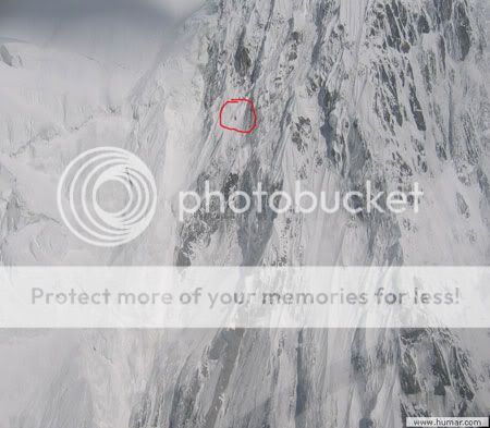
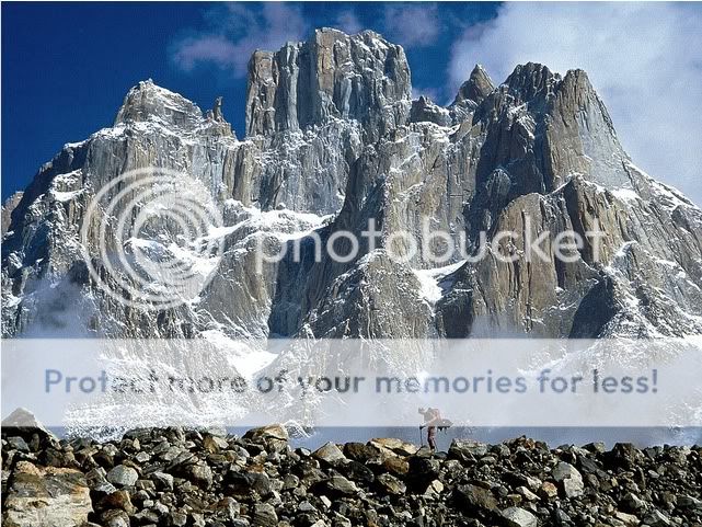
This is the famous Trango Tower, a group of dramatic granite spires located on the north side of the Baltoro Glacier, in Baltistan, a district of the Gilgit-Baltistan region of Pakistan (formerly Northern Areas). They are part of the Baltoro Muztagh, a subrange of the Karakoram range. The Towers offer some of the largest cliffs and most challenging rock climbing in the world. The highest point in the group is the summit of Great Trango Tower, 6,286 m (20,608 ft). The east face of the Great Trango Tower features the world's greatest nearly vertical drop.
[url=http://www.youtube.com/watch?feature=player_embedded&v=-M99QbbJMYI]Basejump Great Trango Pakistan - YouTube[/url]


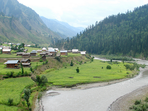


 Been a little mad for these places! But one thing I have to clarify is that the KKH passes through ever changing landscapes and scenery as you drive along. The only thing that remains a constant are the monstrous mountains and the feeling of all your senses being knocked out of you after every 15 min. The question 'has one been on the KKH' is incomplete and too vague. Its a long LONG road. It starts from the hills of Abbotabad to Khunjrab pass (Pak-China border) and then on to Kashgar. Iv traveled from Abottabad till Khhunjrab and everywhere else in between. One more thing: The Gilgit-Skardu road which shoots off from the KKH at Alam chowk, which is approximately a 2-3 hour drivefrom Jaghlot, is never given its dew credit. Its almost always told and known as a section of the KKH which it actually isnt. Up till Skardu its been built on terrain more dangerous and hazardous than the KKH itself. Through out its length is passes through very very narrow gullies and valleys with seriously tall, black mountains of the Karakorum shooting straight up, and I do mean straight up, right besides you. You are always traveling right at the edge of at least a 100 meter drop. Its a beautiful beautiful road passing through even more beautiful places. At least for me that road has always been a more exciting and terrifying experience than the KKH itself. Many people see pictures of those places and they are dumbfounded by the beauty but I promise you that the pictures dont come close to doing justice to those places. One cant even explain the feeling one gets when standing in the middle of it all and taking it all in through sight, smell and sound. Its an overwhelming feeling which starts from the pit of your stomach and overtakes the whole body. Theres no other feeling that comes close to standing right at the feet of the tallest and most precipitous mountains in the world. Iv seen people fall down on their knees and burst out in tears with my own eyes (i promise you that this is not even a little exaggerated). Your life and the world around you suddenly starts looking more beautiful than ever. One always come's back from there brand new with an undying hunger to go back. Id better stop myself now or ill keep on blabbering about the north all night.
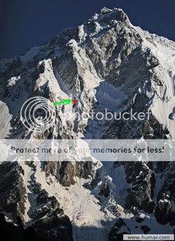


")