zebra7
BANNED

- Joined
- Sep 18, 2015
- Messages
- 2,135
- Reaction score
- 10
- Country

- Location
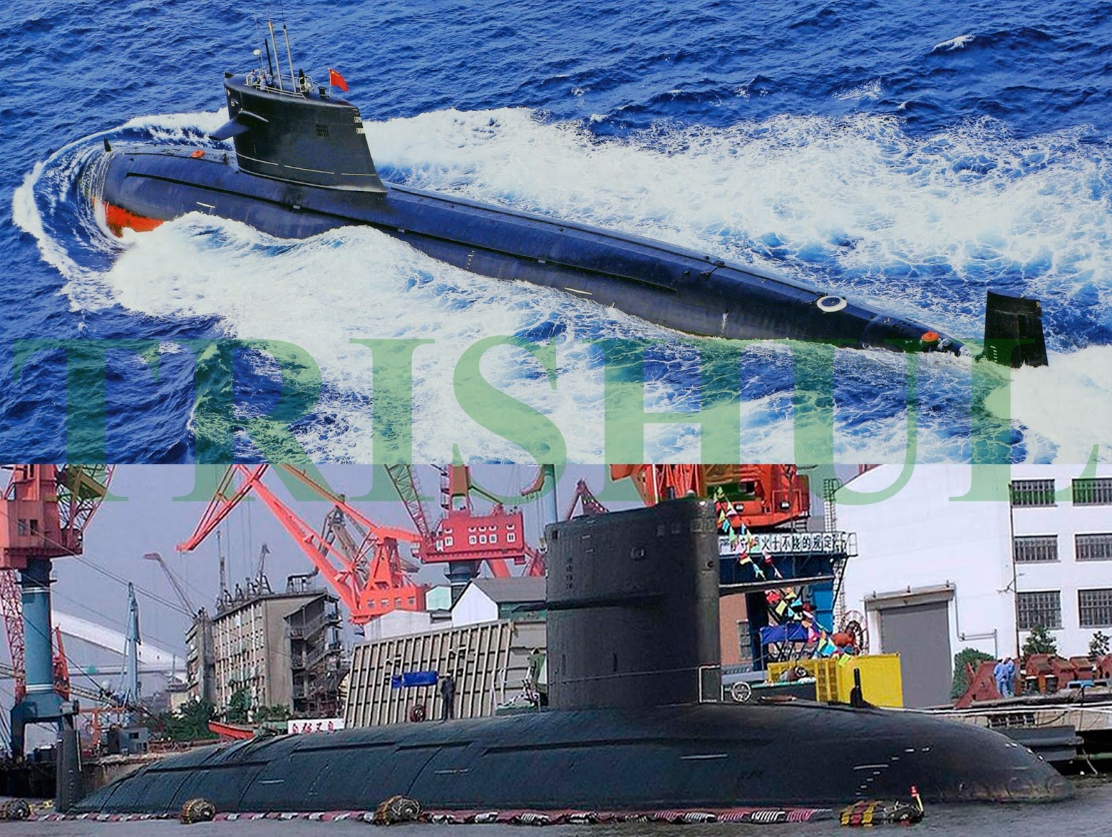
Ok I am starting a thread on the claimed SOSUS network been worked between India, Japan and U.S jointly to increase the survellance and lower down the SUB threads in the India ocean and the South China Sea specially to curtain PLAN sub capabilities.

In the near future, therefore, under the auspices of the US–India Defence Framework Agreement, foundational pacts like the Logistics Exchange Memorandum of Agreement (LEMOA), Communication Interoperability and Security Memorandum Agreement (CISMOA), and Basic Exchange and Cooperation Agreement for Geo-Spatial Cooperation (BECA), are likely to be inked by the two countries later this year. Concurrently, Japan can be expected to extend funding from the Japan International Cooperation Agency for the upgradation of naval air bases and construction of new ELINT/SIGINT stations along the Andaman and Nicobar chain of islands, which is made up of 572 islands (of which only 34 are presently inhabited), stretching around 470 miles north to south. But most importantly, preliminary planning has commenced on a Japan-financed project that calls for 1) laying of an undersea optical fibre cable from Chennai to Port Blair; and 2) the construction of an undersea network of seabed-based surveillance sensors stretching from the tip of Sumatra right up to Indira Point. Once completed, this network will be an integral part of the existing US-Japan ‘Fish Hook’ sound surveillance (SOSUS) network that will play a pivotal role in constantly monitoring all submarine patrols mounted by China’s PLA Navy (PLAN) in both the South China Sea and the IOR. This network will in turn be networked with the Indian Navy’s (IN) high-bandwidth National Command Control and Communications Intelligence network (NC3I), which has been set up under the IN’s National Maritime Domain Awareness (NMDA) project at a cost of Rs.1,003 crores. At the heart of the NC3I is the Gurgaon-based, Rs.453 crore Information Management and Analysis Centre (IMAC), whose systems integration software packages were supplied by Raytheon and CISCO.

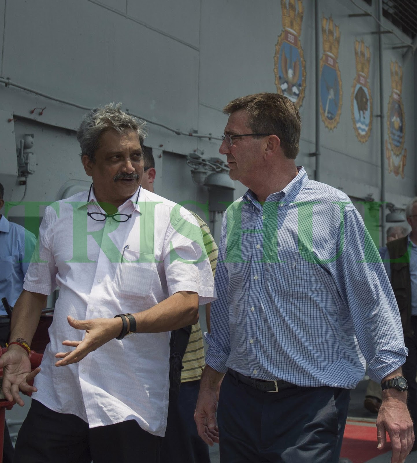
Oblique references to all these developments were made in the joint statement that was issued last month after the visiting US Secretary of Defense Ashton Carter held delegation-level talks with his Indian counterpart Manohar Parrikar. The joint statement spoke about:
A) new opportunities to deepen cooperation in maritime security and maritime domain awareness;
B) commencement of navy-to-navy discussions on submarine safety and anti-submarine warfare; and
C) enhancing on-going navy-to-navy discussions to cover submarine-related issues.

The US was always interested in Japanese and Indian locations for its SOSUS stations. Initially called Project Caesar, this involved running cables out on continental shelves and connecting them to hydrophones suspended above the sea bottom at optimum signal depths. An ‘experimental station’ was established at the north-western tip of Hokkaido in 1957, with the cable extending into the Soya (La Perouse) Strait. It monitored all Soviet submarine traffic going in and out of Vladivostok and Nakhodka in the Sea of Japan. Undersea surveillance systems and associated shore-based data collection stations code-named Barrier and Bronco were installed in Japan in the 1960s. Acoustic data collected at these sites was transmitted by US defence communications satellites to US Navy (USN) processing and analysis centres in the US. In the 1970s, a network between between Japan and the Korean Peninsula was commissioned. By 1980, three stations at Wakkanai (designated JAP-4), Tsushima (JAP-108) and the Ryukyu Islands (RYU-80) were operational in Japan, along with earlier stations built in the Tsushima Straits and the Okinawa area. The existence of old cables at Horonai Point in north-west Honshu, which during the Cold War led out to SOSUS arrays in the Sea of Japan, has been widely described by scuba divers. By the mid-1980s the SOSUS hydrophone arrays stretched from southern Japan to The Philippines, covering the approaches to China. After the collapse of the USSR and the decline of the submarine threat to the US in the early 1990s, the USN allowed its SOSUS systems in the north-west Pacific to atrophy, although some arrays were retained in working order so as to support civilian scientific research (such as tracking whales and monitoring undersea volcanic activity). According to a USN directive issued in August 1994, all seabed-based fixed-arrays in the Pacific were placed on ‘hot standby’; personnel would ‘not be routinely assigned to monitor fixed-array data’ unless that data was required for operational purposes, but in practice the probability of being able to reconstitute them to full operational status was ‘extremely low’.

However, in the early 2000s, facing an increasing PLAN submarine force and more aggressive PLAN submarine patrols, the USN decided that it needed a new chain of fixed arrays designed primarily to monitor the movement of PLAN submarines between the East China Sea and South China Sea on the one hand, and between the Pacific Ocean and the Indian Ocean on the other. Thus was born the US-Japan ‘Fish Hook Undersea Defense Line’ in early 2005, stretching from Japan southwards to Southeast Asia, with key nodes at Okinawa, Guam and Taiwan. Beginning from near Kagoshima in the southwest part of Kyushu, it runs down the Osumi archipelago to Okinawa, then to Miyako-jima and Yonaguni in the southern part of the Ryukyu Islands, past Taiwan to the Balabac Islands in The Philippines, to Lomkok in the eastern part of the Indonesian archipelago, across the Sunda Strait between Java and Sumatra, and from northern Sumatra to the Andaman and Nicobar Islands. Three major gaps—between Yonaguni and Suao in north-east Taiwan (120km), between Kaohsiung in south-western Taiwan and the Dongsha (Pratas) Islands (450km) where the East China Sea meets the South China Sea, and across the Bashi Channel (220km) between Hengchun at Taiwan’s southernmost tip and Luzon Island in The Philippines—were plugged. In addition, the USN installed a new SOSUS network, stretching from Sasebo down to Okinawa, in 2006, when the US cable-laying ship USNS Zeus operated together with oceanographic survey vessels and nuclear submarines in this area. In July 2013, Beijing claimed that the US and Japan had jointly established ‘very large underwater monitoring systems’ at the northern and southern ends of Taiwan. One of these stretched from Yonaguni to the Senkaku Islands (about 150km), while the other covered the Bashi Channel down to The Philippines. Thus, this US-Japan undersea trip-wire around the PLAN presently extends across the Tsushima Strait between Japan and the Korean Peninsula, and from Japan’s southern main island of Kyushu down past Taiwan to The Philippines. The curve of the hook stretches across the Java Sea from Kalimantan to Java, across the Sunda Strait between Java and Sumatra, and from the northern tip of Sumatra along the eastern side of India’s Andaman and Nicobar island chain. Real-time information-sharing between the US and Japan joins the undersea defence line-up, effectively drawing a tight arc around Southeast Asia, from the Andaman Sea to Japan.
Edited to add picture
Undersea Webs
A web of strategic projects is now taking firm shape as India enters into closer multilateral military cooperation relationships with Japan, Australia and the United States, as well as regional powers like Indonesia, Malaysia, Singapore and Vietnam. Matters began taking on urgency in late September 2014, after US President Barack Obama and PM Modi have pledged to intensify cooperation in maritime security. Following this, on March 16, 2015 the defence ministers of the 10-member Association of Southeast Asian Nations (ASEAN) at the end of the two-day 9th ASEAN Defence Ministers’ Meeting in Langkawi, Malaysia, collectively stated that they wanted India to play a far bigger role in both the Indian Ocean Region (IOR) and the South China Sea.
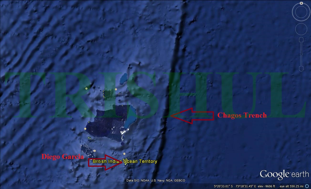
In the near future, therefore, under the auspices of the US–India Defence Framework Agreement, foundational pacts like the Logistics Exchange Memorandum of Agreement (LEMOA), Communication Interoperability and Security Memorandum Agreement (CISMOA), and Basic Exchange and Cooperation Agreement for Geo-Spatial Cooperation (BECA), are likely to be inked by the two countries later this year. Concurrently, Japan can be expected to extend funding from the Japan International Cooperation Agency for the upgradation of naval air bases and construction of new ELINT/SIGINT stations along the Andaman and Nicobar chain of islands, which is made up of 572 islands (of which only 34 are presently inhabited), stretching around 470 miles north to south. But most importantly, preliminary planning has commenced on a Japan-financed project that calls for 1) laying of an undersea optical fibre cable from Chennai to Port Blair; and 2) the construction of an undersea network of seabed-based surveillance sensors stretching from the tip of Sumatra right up to Indira Point. Once completed, this network will be an integral part of the existing US-Japan ‘Fish Hook’ sound surveillance (SOSUS) network that will play a pivotal role in constantly monitoring all submarine patrols mounted by China’s PLA Navy (PLAN) in both the South China Sea and the IOR. This network will in turn be networked with the Indian Navy’s (IN) high-bandwidth National Command Control and Communications Intelligence network (NC3I), which has been set up under the IN’s National Maritime Domain Awareness (NMDA) project at a cost of Rs.1,003 crores. At the heart of the NC3I is the Gurgaon-based, Rs.453 crore Information Management and Analysis Centre (IMAC), whose systems integration software packages were supplied by Raytheon and CISCO.

Oblique references to all these developments were made in the joint statement that was issued last month after the visiting US Secretary of Defense Ashton Carter held delegation-level talks with his Indian counterpart Manohar Parrikar. The joint statement spoke about:
A) new opportunities to deepen cooperation in maritime security and maritime domain awareness;
B) commencement of navy-to-navy discussions on submarine safety and anti-submarine warfare; and
C) enhancing on-going navy-to-navy discussions to cover submarine-related issues.
The US was always interested in Japanese and Indian locations for its SOSUS stations. Initially called Project Caesar, this involved running cables out on continental shelves and connecting them to hydrophones suspended above the sea bottom at optimum signal depths. An ‘experimental station’ was established at the north-western tip of Hokkaido in 1957, with the cable extending into the Soya (La Perouse) Strait. It monitored all Soviet submarine traffic going in and out of Vladivostok and Nakhodka in the Sea of Japan. Undersea surveillance systems and associated shore-based data collection stations code-named Barrier and Bronco were installed in Japan in the 1960s. Acoustic data collected at these sites was transmitted by US defence communications satellites to US Navy (USN) processing and analysis centres in the US. In the 1970s, a network between between Japan and the Korean Peninsula was commissioned. By 1980, three stations at Wakkanai (designated JAP-4), Tsushima (JAP-108) and the Ryukyu Islands (RYU-80) were operational in Japan, along with earlier stations built in the Tsushima Straits and the Okinawa area. The existence of old cables at Horonai Point in north-west Honshu, which during the Cold War led out to SOSUS arrays in the Sea of Japan, has been widely described by scuba divers. By the mid-1980s the SOSUS hydrophone arrays stretched from southern Japan to The Philippines, covering the approaches to China. After the collapse of the USSR and the decline of the submarine threat to the US in the early 1990s, the USN allowed its SOSUS systems in the north-west Pacific to atrophy, although some arrays were retained in working order so as to support civilian scientific research (such as tracking whales and monitoring undersea volcanic activity). According to a USN directive issued in August 1994, all seabed-based fixed-arrays in the Pacific were placed on ‘hot standby’; personnel would ‘not be routinely assigned to monitor fixed-array data’ unless that data was required for operational purposes, but in practice the probability of being able to reconstitute them to full operational status was ‘extremely low’.
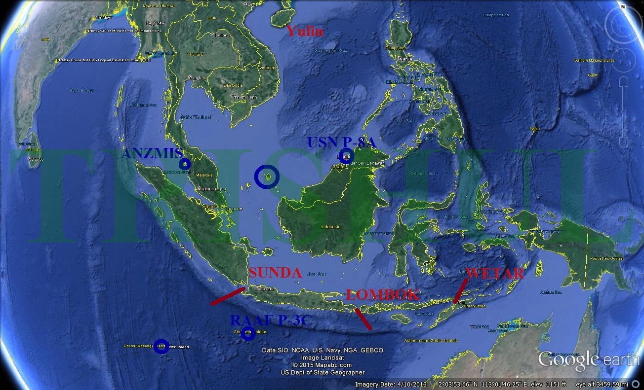
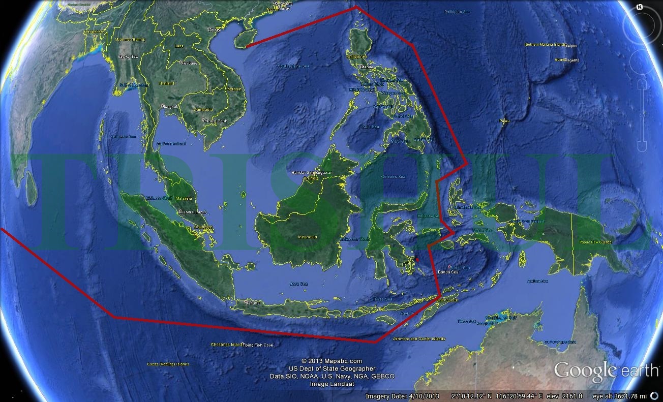
However, in the early 2000s, facing an increasing PLAN submarine force and more aggressive PLAN submarine patrols, the USN decided that it needed a new chain of fixed arrays designed primarily to monitor the movement of PLAN submarines between the East China Sea and South China Sea on the one hand, and between the Pacific Ocean and the Indian Ocean on the other. Thus was born the US-Japan ‘Fish Hook Undersea Defense Line’ in early 2005, stretching from Japan southwards to Southeast Asia, with key nodes at Okinawa, Guam and Taiwan. Beginning from near Kagoshima in the southwest part of Kyushu, it runs down the Osumi archipelago to Okinawa, then to Miyako-jima and Yonaguni in the southern part of the Ryukyu Islands, past Taiwan to the Balabac Islands in The Philippines, to Lomkok in the eastern part of the Indonesian archipelago, across the Sunda Strait between Java and Sumatra, and from northern Sumatra to the Andaman and Nicobar Islands. Three major gaps—between Yonaguni and Suao in north-east Taiwan (120km), between Kaohsiung in south-western Taiwan and the Dongsha (Pratas) Islands (450km) where the East China Sea meets the South China Sea, and across the Bashi Channel (220km) between Hengchun at Taiwan’s southernmost tip and Luzon Island in The Philippines—were plugged. In addition, the USN installed a new SOSUS network, stretching from Sasebo down to Okinawa, in 2006, when the US cable-laying ship USNS Zeus operated together with oceanographic survey vessels and nuclear submarines in this area. In July 2013, Beijing claimed that the US and Japan had jointly established ‘very large underwater monitoring systems’ at the northern and southern ends of Taiwan. One of these stretched from Yonaguni to the Senkaku Islands (about 150km), while the other covered the Bashi Channel down to The Philippines. Thus, this US-Japan undersea trip-wire around the PLAN presently extends across the Tsushima Strait between Japan and the Korean Peninsula, and from Japan’s southern main island of Kyushu down past Taiwan to The Philippines. The curve of the hook stretches across the Java Sea from Kalimantan to Java, across the Sunda Strait between Java and Sumatra, and from the northern tip of Sumatra along the eastern side of India’s Andaman and Nicobar island chain. Real-time information-sharing between the US and Japan joins the undersea defence line-up, effectively drawing a tight arc around Southeast Asia, from the Andaman Sea to Japan.
Edited to add picture
Last edited: