View attachment 914988
Can you show me scientific articles which state the flow you posted about? Wikipedia has many Indian 'contributors' changing things as they go along.
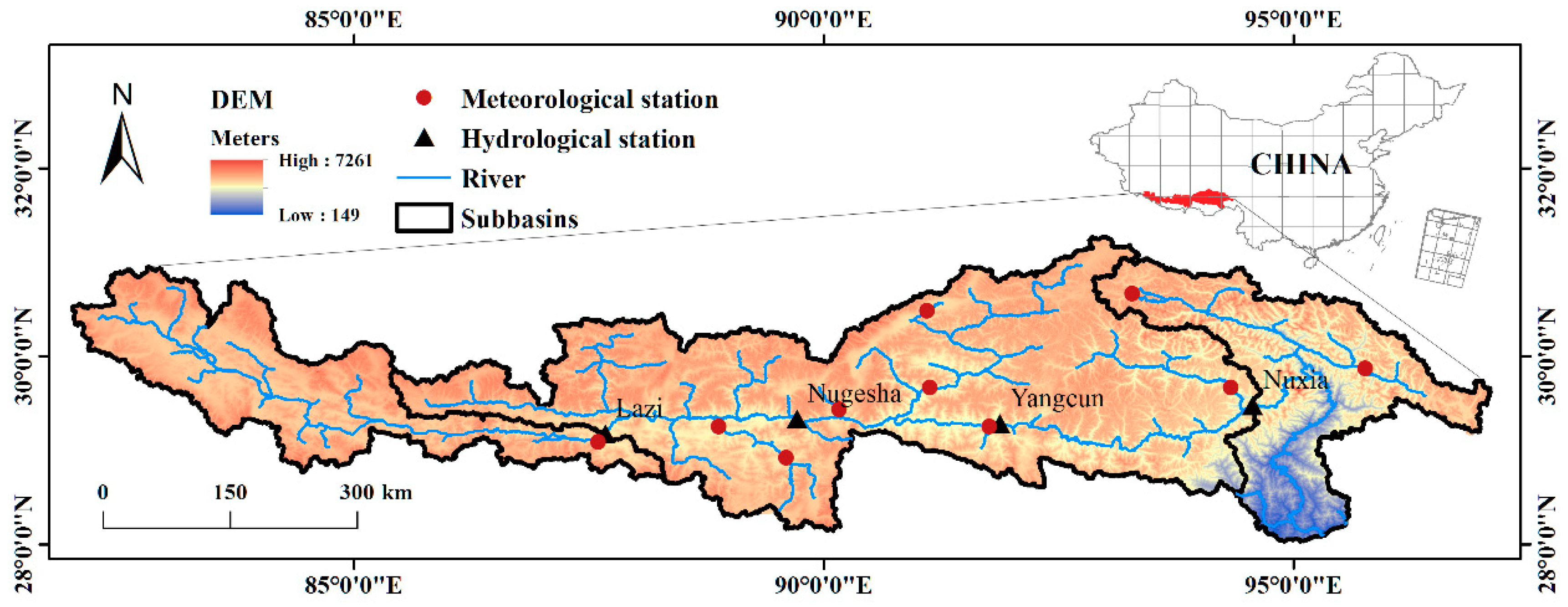
Yes I know what discharge is and one of the main factors that give a high discharge rate are drainage basin, and the Yarlung Zangbo has a large drainage basin giving it a higher discharge rate;
Large drainage basins catch more precipitation so have a higher peak discharge compared to smaller basins.
The river flows through Tibet which again makes discharge high as drainage basins with steep sides tend to have shorter lag times than shallower basins. This is because water flows more quickly on the steep slopes down to the river.
It also has numerous streams contributing to velocity and high density drainage i.e. drains quicker.
The river also has a natural clear path, little vegetation and the rock type is also impermeable which means lag time is low and discharge higher.
For reference;
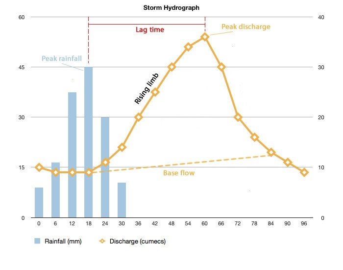
River discharge is the volume of water flowing through a river channel. This is the total volume of water flowing through a channel at any given point and is measured in cubic metres per second (cumecs).

www.internetgeography.net
You still didn't answer how such a long river can have a low discharge. Look at the list of rivers with the highest discharge, their length is
always longer.

en.wikipedia.org
Now here is the big contradiction in what you posted. In your source
you said the Yarlung only has a flow of 1800 m³/s.
But the above link shows this from wikipedia;
Screenshot;
View attachment 914989
View attachment 914990
en.wikipedia.org
So the average discharge is 7,529 which makes it 30% out of the 25000 m3/s.......
This is lake Rakshastal before it becomes the Sultaj;
China has massive control over the Sultaj;
More than 50% of the annual flow of Satluj river comes from snow and ice melt from China!
https://www.indiawaterportal.org/articles/glacier-melt-threatens-water-reserves-satluj-basin
According to experts such as Veen, Feddema,J eelani, and Stearns it is even as high as
59%.
The contributions of rain and smaller streams within India are small.
The total glacier stored water for
2026 glaciers in Satluj basin was 69 cubic kilometres.
About 56% of the total volume (37 cubic kilometres) was stored in large glaciers (with an area of above 5 sq. km) covering an area of 517 sq km.
The largest glacier found in the study area was from the Tibetan region (CHINA), which was found to occupy an area of 66.8 sq. km and contained 6.5 gigatonne (Gt) of ice. Most of the glaciers contained less than 0.1 Gt of ice.
https://www.indiawaterportal.org/articles/glacier-melt-threatens-water-reserves-satluj-basin
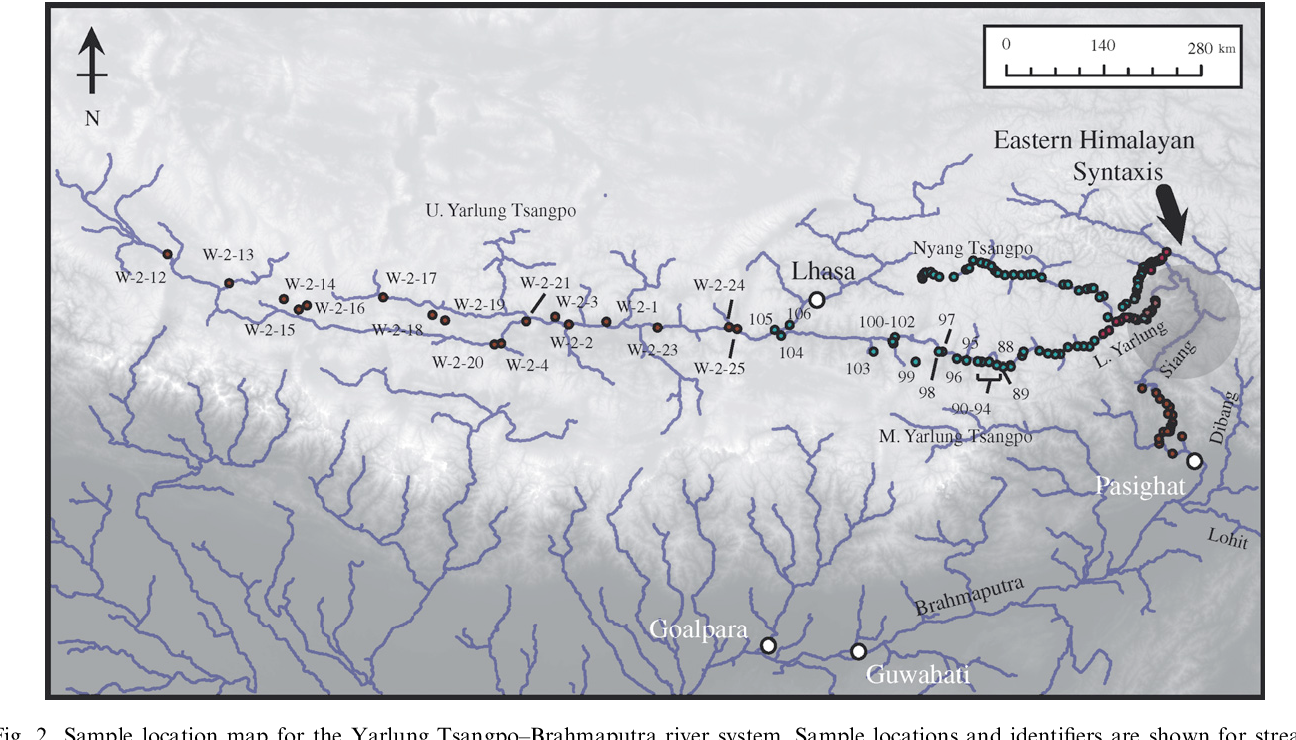
The Brahmaputra is just as reliant.
Tibetan glaciers contribute to Indian river systems, and it is very substantial. Thank you to the academics (UK) for showing me this.
Here's one such research paper on the Brahmaputra;
https://tc.copernicus.org/preprints/tc-2019-211/tc-2019-211.pdf
the sustainable supply
of GS melt, which is susceptible to climate change, is the key to the local freshwater security, flood prevention and control, and hydroelectric development
The GS melt serves as an essential water supplier for the Brahmaputra river system
results of Lutz et al. (2014), which showed that GS melt
constitutes 33% of the total discharge in the Brahmaputra and that 50% of the annual melt occurs in the summer
This is why your government is scared of Chinese water control. They are wise and pay lots of money to save them from a disaster. You're wasting your time discussing with me on here. You should be talking to Modi and his clan.