What's new

China Outer Space Science, Technology and Explorations: News & Updates

China's in-orbit cargo spacecraft releases CubeSat
Source: Xinhua| 2017-08-02 15:13:03|Editor: An


BEIJING, Aug. 2 (Xinhua) -- China's Tianzhou-1 cargo spacecraft on Tuesday successfully released a cube satellite (CubeSat) while in orbit, according to China Aerospace Science and Technology Corporation (CASTC).

Signals from the CubeSat were received by ground technicians right after the release, said the CASTC.

The CubeSat was launched inside the Tianzhou-1 from the Wenchang Space Launch Center in south China's Hainan Province on April 20.

After 104 days, the CubeSat was released by the cargo spacecraft.

It was the first time China has released a CubeSat by an in-orbit spacecraft. Traditionally, the CubeSat is released during the launch.

The test release has laid a technical foundation for China's future space station to launch more micro/nano-satellites and provide other in-orbit services.

Like a Rubik's cube, a CubeSat is a satellite composed of smaller cubic units. Depending on its different uses, a CubeSat may contain two, three or more such units.

Compared with other integral satellites, cube spacecraft are generally smaller, lighter and much more economical in development and production costs.
 
upload_2017-8-4_15-50-25.jpeg
 
Satellite Grid System Zeros In on Rogue Polluters
By Zhou Tailai, Chen Xinyue and Teng Jing Xuan

1502023974883834.jpg
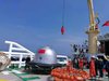
The Ministry of Environmental Protection’s Bureau of Environmental Supervision created more than 36,000 9-square-kilometer squares in the 28 cities in the Beijing-Tianjin-Hebei area. Using satellite remote sensing technology, the ministry identified over 3,600 hot spots that have high concentrations of PM2.5 pollution. Photo: Ministry of Environmental Protection’s Bureau of Environmental Supervision.

Every winter, Beijing, Tianjin and Hebei province battle choking pollution from vehicles, factories and household heating.

Local governments in the area, known as “Jing-Jin-Ji,” have long known that small, hard-to-spot polluters like workshops and illegal boilers contribute significantly to poor air quality. Environmental inspectors are hoping to change that through a new satellite grid system, which can locate those small polluters with greater precision.

The grid system was first used the previous winter, from Dec. 30 to Jan. 7, when heavy pollution caused 60 cities in the region and its surrounding provinces to activate pollution alerts. Half of the cities activated the red alert — the highest warning level.

During this period, the national Ministry for Environmental Protection sent inspection teams to Jing-Jin-Ji as well as neighboring provinces Henan and Shanxi. Every evening, each team would receive the coordinates of the day’s five most-polluted hot spots in their coverage area. Each hot spot had an area of 100 square kilometers (38.6 square miles), and appeared as a red rectangle on a mobile map app. Inspectors would focus on the highlighted hot spots for the next day’s inspections.

Liu Xiangmei, who led one of the teams sent to the city of Xintai in Hebei province, described a typical grid-assisted inspection: “After confirming the coordinates of the area we needed to inspect, we could see from the map image that a particular hot spot covered industrial parks.” In this hot spot, Liu’s team found a small coal yard in a glass factory where coal was improperly stored. Every time a vehicle passed the coal yard, it would cause a large dust cloud to rise up. After the coal yard was discovered, the local environmental agency was able to penalize its owners and demand a cleanup.

Three weeks into the new year, a new wave of heavy pollution engulfed the Jing-Jin-Ji area. This time, the Ministry for Environmental Protection further refined the grid system. It divided the area’s 26 prefecture-level cities, as well as the provincial-level municipalities of Beijing and Tianjin, into a total of 36,000 squares, each covering 9 square kilometers.

In April, the ministry announced the largest-ever, national-level environmental protection operation in Jing-Jin-Ji, deploying 5,600 environmental law enforcement officers to inspect the air quality in the 28 cities over the course of a year. The satellite grid system will play a central role in this operation.

Blind spots

Pollution hot spots identified by the satellite grid system usually fall into one of three categories, Lei Ming, one of the inspectors sent to Jing-Jin-Ji, told Caixin. Some hot spots are in areas where large-scale, heavily-polluting industry — like steel factories, thermal power plants and coal mines — is located. Other hot spots are in city centers, where pollution comes primarily from car exhaust and central heating systems. The last category of hot spots includes areas with a high concentration of small-scale, pollutant-emitting businesses, and from delivery vehicles.

For many years, the small, scattered polluters were a blind spot in the Ministry for Environmental Protection’s data collection system, Chinese Academy of Engineering member He Kebin wrote in a recent essay.

These small polluters, usually factories or workshops, are often very well-hidden. “When we went to Shanxi province, we realized that some of these small polluters were hidden inside fruit orchards. There would be a small clearing inside the orchard, the site of a small oil refinery. From the outside, it looked like just trees, and you could enter only down a small winding path,” a ministry official told Caixin.

Before the satellite grid system was implemented, the ministry’s standard inspection methods were limited. Drones can travel for only short distances and are expensive to operate. Air-quality monitoring stations are good for measuring the overall air quality in a city, but aren’t precise enough for pinpointing specific rogue businesses, since even the best-equipped cities are home to only a few dozen such stations. Teams of inspectors can “carpet” an entire city and spot its biggest pollution offenders, but often miss harder-to-spot but more-numerous small polluters.

“So we considered trying out satellites, to see what the effect was. We later realized it was viable, and added the hot spot grid system to our methods,” the ministry official said.

Satellites’ benefits are twofold, the official added. They cover large areas and they are relatively immune to human interference, which doesn’t always involve deliberately falsified data, but can also be caused by inexperienced maintenance staff, he said.

The grid system relies primarily on satellite remote sensing technology, which measures the sunlight reflected by the earth. Light is scattered and absorbed by pollutants in the air, so the difference in brightness between the light reaching the Earth and the light reflected back into space can be used to calculate pollutant concentration.

Human input

Once the satellite-generated figures are received by the Ministry of Environmental Protection, its environmental supervision bureau uses big data analysis and artificial intelligence to identify hot spots. But human experts haven’t been taken out of the equation.

“Looking from above, if a grid square’s pollutant concentration is very high, does it necessarily mean it contains pollutant-emitting factories? There are lots of other explanations that affect the pollutant concentration,” including the topology of the area, a ministry official told Caixin. Ultimately, an experienced environmental supervision official needs to step in to interpret the data.

“When you get a satellite image, if you rely entirely on machine identification, the process starts from zero, with no knowledge of what factors may be affecting the results. But if an environment specialist looks at the image, they can use their experience to judge that pollution from a particular direction may have been a cause,” the official said.

So far, the ministry has identified more than 3,600 hot spots from 36,000 squares on the grid. These hot spots make up approximately 10% of these cities’ land area but contribute to nearly 80% of the pollution they experience, the official said.

This year, local governments in Jing-Jin-Ji’s 28 cities will spend a year strengthening supervision of these 3,600 squares, lowering their concentration of the cancer-causing PM2.5 particulates. At the end of the year, the Environmental Supervision Bureau will grade 2017’s situation, find the year’s 3,600 worst offending squares to set as targets for next year, gradually lowering the entire region’s PM2.5 concentrations over the course of the next few years, the official added.

Cangzhou City

The Ministry for Environmental Protection’s satellite grid system isn’t just intended to simply provide inspectors with a new method for spotting polluters, but also to act as the basis of a new environmental regulation system. In February, the ministry began a pilot of this new regulation system in Cangzhou, Hebei.

Cangzhou has a population of around 740,000, distributed across 14,000 square kilometers, and is one hour away from Beijing by high-speed train. As of mid-July, Cangzhou had 6,000 small-business polluters, including plastic waste processors, and small foundries. In 2016, Cangzhou’s average concentration of PM2.5 air pollutants was 69 micrograms/cubic meter. It hopes to bring this year’s average down to 62.

Under the pilot program, the Cangzhou government matches hot spots with enforcement staff who are responsible for reducing pollution in their assigned areas. The ministry has identified 126 hot spots in Cangzhou, scattered across the city’s 19 districts.

This isn’t the first time supervision of pollution in Cangzhou is being staffed according to a grid layout. In 2014, China’s State Council issued a notice requiring municipal and county governments to split their jurisdictions according to a grid system, and assign three tiers of supervisors to each square.

But at the time, most cities’ implementation of this supervision system was superficial. Environmental grid regulation of a major difficulty is to fully roll out no focus. "A county environmental protection bureau may have up to 20 enforcement staff, but each county has an area of over 1,000 square kilometers,” meaning there was no way staff could thoroughly carry out inspections, a ministry official told Caixin.

But the satellite grid system marks a breakthrough for grid-based supervision. Hot spots of 3 kilometers by 3 kilometers are far easier to police, a Cangzhou city official said.

“This coming winter will be the real test of the new system’s effectiveness,” Wu Rongsheng, a senior official at Cangzhou’s environment protection agency, told Caixin.


Satellite Grid System Zeros In on Rogue Polluters - Caixin Global
 
Beidou-3M's carrier rocket CZ-3B to reenter on 17 August 2017


Not to be confused with the Perseid meteor shower!:bounce::lol::partay::flame:


fire-ball-of-perseid-20170813114746_1502645046-gif.418346

▲ Fireball of perseid on August 12, 2017 Taken by: @ alxa,china
Details:
Can you find the color of the Perseid meteor? Can you tell the path, the variation in brightness and hue of the 1 second meteor? When we use our newly designed wide-angle-ultra-large-aperature-optics video camera, we recorded a very long fireball on 12th August 2017 which can be easily traced to be a Perseid. As the camera records the brightness variation during it descent along the Milky Way from Perseus toward Sagitarii, a powerfull bright green flash can be seen. This is very funny as we used a laser pointer to show the Cygnus in the center of the Milky Way to observers, this great fireball appeared in the field of our green laser pointer, with the same beautifull green wavelenght.
credit: CNA, NAOC, Tencent


Code:
Name:          Beidou M3 Rocket
Decays:        17 Aug 2017 17:58 UTC (predicted)
Brightness:     3.4 mag (at 1000 km, 50% illuminated)
               -2.1 mag (at perigee, full illumination)
RCS:           29m2 (Radar cross section)
USSPACECOM Nr: 38253  Internat. Designator: 2012-018D
Orbit:         110.8 x 167.9 km, 87.3min  Inclination: 54.7°
Age Elements:   0 days (based on 4 days old data; SatEvo)

According to our calculations this object will either land, decay or dock on 17 August 2017 at 18 UTC. It cannot be observed after this time.

https://www.calsky.com/observer/csr...00422&tdt=2457983.24963776&sat=38253&tracker=

Object Description
Code:
Type:              Rocket Body
Int’l Designation: 2012-018D
NORAD Number:      38253
Launched:          29 April 2012 @ 20:50 UTC
Site:              Xichang Satellite Launch Center, China
Mission:           Beidou M3 Navigation Satellite


Reentry Prediction
Code:
Predicted Reentry Time: 18 Aug 2017 02:30 UTC ± 35 hours
Prediction Epoch:       12 Aug 2017 04:16:39.700 UTC

Prediction Ground Track:

2012-018d_224l-png.418341

▲ CZ-3B Rocket Body Reentry Prediction


http://www.aerospace.org/cords/reentry-predictions/upcoming-reentries-2-2/cz-3b-rocket-body-2/
 

Attachments

  • 2012-018D_224L.png
    2012-018D_224L.png
    1.7 MB · Views: 596
  • fire-ball-of-perseid-20170813114746_1502645046.gif
    fire-ball-of-perseid-20170813114746_1502645046.gif
    1.3 MB · Views: 595
New thruster design increases efficiency for future spaceflight
August 15, 2017

The vortex exhaust mode on low-power cylindrical Hall thruster. Credit: Wei Liqiu, Harbin Institute of Technology, China

Hall thrusters (HTs) are used in earth-orbiting satellites, and also show promise to propel robotic spacecraft long distances, such as from Earth to Mars. The propellant in a HT, usually xenon, is accelerated by an electric field which strips electrons from neutral xenon atoms, creating a plasma. Plasma ejected from the exhaust end of the thruster can deliver great speeds, typically around 70,000 mph.

Cylindrical shaped Hall thrusters (CHTs) lend themselves to miniaturization and have a smaller surface-to-volume ratio that prevents erosion of the thruster channel. Investigators at the Harbin Institute of Technology in China have developed a new inlet design for CHTs that significantly increases thrust. Simulations and experimental tests of the new design are reported this week in the journal Physics of Plasmas.

CHTs are designed for low-power operations. However, low propellant flow density can cause inadequate ionization, a key step in the creation of the plasma and the generation of thrust. In general, increasing the gas density in the discharge channel while lowering its axial velocity, i.e., the speed perpendicular to the thrust direction, will improve the thruster's performance.

"The most practical way to alter the neutral flow dynamics in the discharge channel is by changing the gas injection method or the geometric morphology of the discharge channel," said Liqiu Wei, one of the lead authors of the paper.

The investigators tested a simple design change. The propellant is injected into the cylindrical chamber of the thruster by a number of nozzles that usually point straight in, toward the center of the cylinder. When the angle of the inlet nozzles is changed slightly, the propellant is sent into a rapid circular motion, creating a vortex in the channel.

Wei and his coworkers simulated the motion of the plasma in the channel for both nozzle angles using modeling and analysis software (COMSOL) that uses a finite element approach to modeling molecular flow. The results showed that the gas density near the periphery of the channel is higher when the nozzles are tilted and the thruster is run in vortex mode. In this mode, gas density is significantly higher and more uniform, which also helps improve thruster performance.

The investigators verified their simulation's predictions experimentally, and the vortex inlet mode successfully produced higher thrust values, especially when a low discharge voltage was used. In particular, the specific impulse of the thruster increased by 1.1 to 53.5 percent when the discharge voltage was in the range of 100 to 200 Volts.

"The work we report here only verified the practicability of this gas inlet design. We still need to study the effect of nozzle angle, diameter, the ratio of depth to diameter and the length of the discharge channel," Wei said. He went on to predict that the vortex design will be tested in flight-type HTs soon and may eventually be used in spaceflight.

More information: "Effect of vortex inlet mode on low-power cylindrical Hall thruster," Physics of Plasmas (2017). DOI: 10.1063/1.4986007


https://phys.org/news/2017-08-thruster-efficiency-future-spaceflight.html
 
China Astronaut Sea Survival Training Base


dhvszk2wsaakspy-jpg.418802

https://pbs.twimg.com/media/DHVSZK2WsAAKspY.jpg
https://twitter.com/Explornaut/status/897714301280112640
▲ 16 August2017, Sea Survival training starting in Yantai


dgharf0uaaae25n-jpg.418803

https://pbs.twimg.com/media/DGhArF0UAAAe25N.jpg
https://twitter.com/cnspaceflight/status/894035699078356992
▲ Aug 5, 2017: 第一天海上救生与生存试训训练


dghatjduaau4v2y-jpg.418804

https://pbs.twimg.com/media/DGhAtJdUAAU4V2y.jpg
https://twitter.com/cnspaceflight/status/894035699078356992
▲ Aug 5, 2017: 第一天海上救生与生存试训训练


dghaogku0aaaex6-jpg.418806

https://pbs.twimg.com/media/DGhaOgKU0AAAex6.jpg
https://twitter.com/cnspaceflight/status/894063896075489280
▲ Aug 5, 2017: 8月6日,宇航员费俊龙,翟志刚,刘洋参加海上生存训练。


dghatrbuaaezyfp-jpg.418807

https://pbs.twimg.com/media/DGhaTRBUAAEzYFP.jpg
https://twitter.com/cnspaceflight/status/894063896075489280
▲ Aug 5, 2017: 8月6日,宇航员费俊龙,翟志刚,刘洋参加海上生存训练。

dghaugtumaami2h-jpg.418808

https://pbs.twimg.com/media/DGhaUgtUMAAMI2h.jpg
https://twitter.com/cnspaceflight/status/894063896075489280
▲ Aug 5, 2017: 8月6日,宇航员费俊龙,翟志刚,刘洋参加海上生存训练。

dghavqpuiaasgcr-jpg.418809

https://pbs.twimg.com/media/DGhaVQpUIAASGcr.jpg
https://twitter.com/cnspaceflight/status/894063896075489280
▲ Aug 5, 2017: 8月6日,宇航员费俊龙,翟志刚,刘洋参加海上生存训练。

:lol:
 

Attachments

  • DHVSZK2WsAAKspY.jpg
    DHVSZK2WsAAKspY.jpg
    110.5 KB · Views: 459
  • DGhArF0UAAAe25N.jpg
    DGhArF0UAAAe25N.jpg
    116.9 KB · Views: 460
  • DGhAtJdUAAU4V2y.jpg
    DGhAtJdUAAU4V2y.jpg
    151.2 KB · Views: 460
  • DGhaOgKU0AAAex6.jpg
    DGhaOgKU0AAAex6.jpg
    148.2 KB · Views: 465
  • DGhaTRBUAAEzYFP.jpg
    DGhaTRBUAAEzYFP.jpg
    61.5 KB · Views: 453
  • DGhaUgtUMAAMI2h.jpg
    DGhaUgtUMAAMI2h.jpg
    44 KB · Views: 463
  • DGhaVQpUIAASGcr.jpg
    DGhaVQpUIAASGcr.jpg
    55.9 KB · Views: 459
时间: 2017-08-14

实践十八号技术试验卫星(SJ-18):2017年7月2日19:23:23由长征五号遥2火箭发射升空。任务失败,主要故障是一级部分发动机泄压失效

https://www.chinaspaceflight.com/satellite/Shijian/Shijian18-launch.html

[新闻资讯] 长征五号遥2火箭发射任务失败,主要故障是一级部分发动机泄压失效

2017-8-15 00:01

南京航空航天大学航天学院社会实践“追飞机的人”团队走访了中科院微小卫星研究所

陈总师在办公室与我们聊了许多,包括7月2日发射失败的长征五号,他表示,主要故障是一级部分发动机泄压失效,没有达到预定高度和速度,最终未能进入轨道坠毁。小卫星所一些型号今年可能就要推迟发射。他告诉我们,航天不是一件容易的事情,航天很难,要保证万无一失,一点点小小的失误都会导致任务的失败,航天路遥艰辛,我们还要继续努力。——中科院微小卫星创新研究院上海微纳卫星研究所所长陈宏宇

https://lt.cjdby.net/thread-2407181-1-1.html

Cause of 2 July 2017, CZ-5 Y2 launch failure is due to first stage engine loss of pressure.

Some launches scheduled for this year might be postponed.
 
China's spacecraft orbit determination accuracy reaches centimeter level
Source: Xinhua| 2017-08-16 22:00:49|Editor: Mengjie


XI'AN, August 16 (Xinhua) -- The orbit determination accuracy of China's spacecraft in low-Earth orbit, now at the centimeter level, reaches the most advanced level in the world, an official at the satellite control center in northwest China's city of Xi'an said Wednesday.

The determination of geosynchronous orbit is limited to just tens of meters, while the accuracy lunar orbits has reached the kilometer level, according to Qi Yahu, secretary of the Party committee of the center.

For 50 years, the center has been working on accurate orbit determination, on which efficient control of spacecraft is based, he continued.

The technology has already contributed to the return and landing of recoverable satellites. In 2003, Shenzhou-5, the country's first manned spacecraft, landed only 50 meters away from its search-and-rescue helicopter on its return.

Established in 1967, the Xi'an satellite control center is the only modern satellite control center in China that multi-tasks in regular satellite measurement and control, the long-term management of in-orbit spacecrafts and others.
 
Air routes adjusted to leave world's largest radio telescope in peace
Source: Xinhua| 2017-08-17 21:04:12|Editor: Mengjie


GUIYANG, Aug. 17 (Xinhua) -- The Civil Aviation Administration of China has adjusted air routes around the world's largest radio telescope in southwestern province of Guizhou to protect the electromagnetic environment.

The Five-hundred-meter Aperture Spherical Telescope (FAST), which was put into use in September 2016 to probe space for the faintest signs of life, is sensitive to any electromagnetic interference.

The aviation authority has set up two restricted flight zones in the area, canceled two routes, and added or adjusted three other routes.

The single-dish telescope, with a diameter of half a kilometer, is located in Dawodang depression, a natural karst basin in Pingtang, once an impoverished area in mountainous Guizhou.

Nearly 10,000 residents within five kilometers of the telescope have been relocated. Visitors should also hand in their digital devices before sightseeing.
 
Cause of 2 July 2017, CZ-5 Y2 launch failure is due to first stage engine loss of pressure.

Some launches scheduled for this year might be postponed.

Better late than failure.
I wish that is the problem and we're onway to solve it.
Keep going China!
Thank you for the hardworks!
:china:

images


Control center resolves over 10 major satellite faults in 50 years
Source: Xinhua| 2017-08-09 22:29:56|Editor: ZD


XI'AN, Aug. 9 (Xinhua) -- Over the 50 years since its founding, the Xi'an Satellite Control Center has successfully resolved major faults in over 10 satellites, saving the country billions yuan in possible losses, the center said Wednesday.

Founded in 1967, the center is tasked with routine telemetry, orbit control and breakdown diagnosis and maintenance of satellites.

In one case, the center successfully sent the communications satellite Zhongxing-9A into correct orbit, after it had failed to enter its preset orbit after launch.

The satellite was launched on June 19, 2017. Abnormal performance during the launch stage had caused the satellite to orbit about 16,420 km above the Earth's surface while its preset orbit was at 41,991 km above the Earth, according to Yang Yong'an, senior engineer at the center.

Over the following 16 days, staff members at the center carried out consultations with the satellite's designer and manufacturer and formulated a solution.

After 10 orbit adjustments, the satellite finally entered the preset orbit.@ In another case, the maritime satellite Haiyang-2, launched in August, 2011, began to fail soon after entering orbit and was at risk of disintegrating.

Fan Henghai, chief technician at the time, worked with other staff members for 45 days to successfully fix the problem.

The center currently monitors and manages over 100 Chinese spacecraft in orbit.

Over the last three years, the center has debugged hundreds of satellite glitches, according to Li Weiping, senior engineer at the center.
 
Tuesday, August 22, 2017, 10:27
Europeans first to train here for space
By Zhao Lei

50023_47803_793_446_jpg.jpg
Chinese and European astronauts take part in a survival course off Yantai, Shandong province, earlier this month. (PROVIDED TO CHINA DAILY)

Two Europeans became the first foreign astronauts to take part in space-related training in China by completing a 17-day sea survival course.

Samantha Cristoforetti of Italy and Matthias Maurer of Germany, both from the European Space Agency, joined 16 Chinese astronauts in waters off the coastal city of Yantai, Shandong province. The training concluded on Monday.

The course was organized by the China Manned Space Agency in cooperation with the Ministry of Transport's Beihai Rescue Bureau. An astronaut sea survival training base in a suburb of Yantai was put into use shortly before the session.

The Chinese astronauts included Yang Liwei, the first Chinese in the space, and Jing Haipeng, a three-time flyer. The group was divided into six teams during the training, which was designed to improve astronauts' sea survival, decision-making and emergency response capabilities, and to boost their team spirit and collaboration capacity, according to the Chinese agency.

Each team had three members - one commander and two operators. At the beginning of the training, members of a team would put on their space suits and enter into a mock re-entry capsule of a Shenzhou spacecraft, which was carried by a ship and placed on the sea's surface by a crane.

Once in the water, the astronauts would take off their space suits and put on a rubber suit capable of resisting cold and providing extra buoyancy. Then they would get out of the re-entry capsule to board inflatable boats. Next, they would practice rescue procedures with a rescue ship and later repeat the process with a helicopter.

Through the training, the astronauts learned methods and procedures of exiting the re-entry capsule as it floated in the sea; familiarized themselves with sea survival skills and rescue preparations; and strengthened their ability to cooperate with each other and with rescuers, the agency said.

50024_47804_800_450_jpg.jpg
Astronauts Matthias Maurer (left), Liu Boming and Ye Guangfu signal for "help" in the training on Aug 21, 2017. (PROVIDED TO CHINA DAILY)

Huang Weifen, deputy research director for the Astronaut Center of China, said the European astronauts' participation helps to explore methods and gain experience for international cooperation in manned space activities. She said the training program tested the overall design and feasibility of the sea survival plan and related training procedures.

She said such training is aimed at preparing the astronauts to survive an emergency landing in the water during a carrier rocket's liftoff process and a re-entry capsule's return to Earth.

"In the past, we organized survival training in pools or reservoirs. This was the first time for us to conduct such training at sea and also the first time for rescue forces to be involved in a survival training session," Huang said.

Maurer said this was the first time for European astronauts to come to China to train with Chinese colleagues, and also the first time for him to attend a realistic sea survival training course involving a ship and helicopter.

"The training was well organized with a high level of quality and safety and we are well protected. It is important to nurture mutual trust so that in the future we can work together in space," Maurer said.

"We feel that we are like a family. We share our experience and other information. Samantha and I have learned how the Chinese perform their training. ... Through this training, we understand that China's training standards are very high and such occasions would be foundation for our future cooperation."

He added, "This has been a big step forward toward our future cooperation in space. In the future, we want to fly and explore together."

The space agencies in China and Europe signed an agreement in May 2015 to boost collaboration.

Pal Hvistendahl of the European agency has said the objective of the cooperation is "to fly a European astronaut on the Chinese space station" that is scheduled to enter operation in 2022.

upload_2017-8-22_13-12-42.jpeg

upload_2017-8-22_13-14-36.jpeg


#####​

Sea survival training / Highlights / Human Spaceflight / Our Activities / ESA

SEA Survival Training

ESA astronauts Matthias Maurer and Samantha Cristoforetti joined 16 Chinese astronauts in August 2017 for nine days of sea survival training off China’s coastal city of Yantai. The course was organised by the Astronaut Center of China in cooperation with the Ministry of Transport’s Beihai Rescue Bureau.

Returning from space, astronauts need to be prepared for any eventuality – including landing in water. Sea survival is a staple of all astronaut training but this is the first time with non-Chinese participants.

The group donned pressure suits and entered a mock capsule of a Shenzhou spacecraft that was then released into the sea. The astronauts had to swap their flightwear for insulation and buoyancy suits before jumping from the capsule into inflatable boats. They then practised rescue procedures with both a ship and a helicopter.

ESA signed an agreement in 2015 to boost collaboration with the China National Space Administration, with the goal of flying a European astronaut on the Chinese space station in the future.
 
Last edited:
Nation glad to train foreign astronauts
By Zhao Lei in Yantai, Shandong | China Daily | Updated: 2017-08-23 08:01

Program invites other countries to take part in, benefit from peaceful use of space

China is willing to help other nations select and train astronauts and will gladly cooperate with them in its space station program, a senior official of the China Manned Space Agency said on Tuesday.

Yang Liwei, deputy head of the agency and the first Chinese in the space, said more than 10 countries, mostly developing have asked for China's assistance in selecting and training astronauts.

They hope to prepare astronauts for prospective joint missions to China's future space station, he said.

"It normally takes about four years to train a Chinese astronaut. The time needed to train a qualified foreign astronaut will vary based on each candidate's individual situation," Yang said. "Considering that we will have our own space station in about four years, now is the time to begin such training for nations interested in joining our space station program."

China welcomes other parties to join the program for mutual benefit and the peaceful use of outer space, he said.

His agency will begin making policies and standards for the selection and training of foreign astronauts, but the final decision will be made by top authorities, he said.

"Our scientists and designers have allocated a considerable amount of resources to the station for international collaboration. Foreign countries can work with us on the development of some equipment in the station or place their own devices in it. Our scientists also designed adapters that will enable the station to dock with foreign spacecraft," he said.

Yang was speaking after a news conference to announce the completion of a sea survival training session in Yantai, Shandong province, for 16 Chinese and two European astronauts. It was the first time foreign astronauts participated in spaceflight-related training in China, according to the space agency.

China will start building its first manned space station in 2019. First, a Long March 5B heavy-lift rocket will put the core module into orbit.

The space station will have three parts - the core module attached to two space labs, each weighing about 20 metric tons. It is expected to be put into operation around 2022 and to serve for at least 10 years, according to the manned space agency.

In 2024, it will become the world's only space station, if the International Space Station is retired that year as planned.

Huang Weifen, deputy research chief of the Astronaut Center of China, previously said that recruitment and training of China's third generation of astronauts will start this year.

The field of candidates will expand from Chinese Air Force pilots to include space industry engineers. All 21 of China's first and second generation astronauts were Air Force pilots.
 
Monitoring Carbon Dioxide from Space
Aug 23, 2017

Atmospheric carbon dioxide (CO2) is the most important anthropogenic greenhouse gas and is considered to be the primary cause of global warming. A lack of knowledge regarding global CO2 emissions has introduced significant uncertainties into studies of climate change. A state-of-the-art space-borne hyperspectral instrument provides will provide an opportunity to achieve accurate CO2 measurement with global coverage to improve estimations of the global carbon budget and investigate climate change.

The first greenhouse gas satellite, GOSAT, was launched successfully in 2009, followed five years later in 2014 by NASA’s Orbiting Carbon Observatory 2 (OCO-2). The Chinese Global Carbon Dioxide Monitoring Scientific Experimental Satellite (TanSat) then became the third inflight greenhouse gas satellite in December 2016.

There will be more satellites, such as GOSAT-2 and OCO-3, joining the space-borne greenhouse measurement family. Advances in retrieval and inversion systems are continually required for the successful analysis and application of satellite-measured data.

A paper recently published in Advances in Atmospheric Sciences by scientists from Institute of Atmospheric Physics (IAP) of the Chinese Academy of Sciences introduced a carbon flux inversion system for estimating the carbon flux with satellite measurements under the support of “The Strategic Priority Research Program of the Chinese Academy of Sciences—Climate Change: Carbon Budget and Relevant Issues”.

The carbon flux inversion system is developed at the Chinese Academy of Sciences. It composed of two separate parts: the Institute of Atmospheric Physics Carbon Dioxide Retrieval Algorithm for Satellite Remote Sensing (IAPCAS), and CarbonTracker-China (CT-China).

W020170823550210931552.jpg
The global carbon flux measured from space. The study is selected as the cover article of the Special Issue on "the Program of Carbon Budget and Relevant Issues". (Image by Advances in Atmospheric Sciences)

GOSAT L1B spectrum measurements are used in the study. The CO2 concentration is retrieved from IAPCAS and, to improve upon the quality of the IAPCAS-GOSAT retrieval, a post-screening and bias correction method has been developed, resulting in 25%–30% of the data remaining after quality control. The CO2 flux is then obtained by CT-China, in which a large error reduction of 84% is found, indicating a significant improvement on the CO2 flux estimated after assimilating IAPCAS-GOSAT data compared with in-situ–only inversion.


Monitoring Carbon Dioxide from Space---Chinese Academy of Sciences
 
Chinese Team has Obtained Scientific Data from 2017 Grand American Total Solar Eclipse
Aug 23, 2017

"We have just succeeded in acquiring worthy scientific data during 2017 Grand American Total Solar Eclipse on Aug.21", said Prof. QU Zhongquan, the leader of a Chinese team, from their observation site in a suburb of Dallas, Oregon.

This team, among one of the hundreds of observation teams pouring into the little town in Oregon for the Grand Solar Eclipse, is formed by three institutes of China. They are respectively Yunnan Observatories of the Chinese Academy of Sciences, Peking University and Sichuan University of Science and Engineering. Yunnan Observatories organized this observation.

They brought five telescopes to the observation site. Four telescopes are aimed at measurement of magnetic field of solar corona via spectro-polarimetry and imaging polarimetry or both while the other one targets the accurate measurement of solar radius.

Especially, Fiber Arrayed Solar Optical Telescope of the first generation(FASOT-1A) is dedicated to measuring the magnetic field via spectro-imaging polarimetry.

This time they have acquired quantitative data to get the exact specific intensity and linear polarization intensities of the famous green line, the strongest coronal line with wavelength of 530.3nm. The magnetic field alignment can be deduced via analyzing the data.

They also obtained precious imaging polarimetry data from other three telescopes. All these data with different filter bandpasses and wavelength bands form an almost complete assembly to reveal the distribution of coronal magnetic field in different scales and field of view.

W020170824414490794103.jpg
FASOT-1A telescope (Image by QU Zhongquan)

W020170824414490804760.png
Sample modulated image acquired during the totality. The green line is the emission line (bright horizontal wide line in the middle), and the wavelength increases from the bottom to top. (Image by QU Zhongquan)


Chinese Team has Obtained Scientific Data from 2017 Grand American Total Solar Eclipse---Chinese Academy of Sciences
 

Pakistan Affairs Latest Posts

Country Latest Posts

Back
Top Bottom