What's new

Saudi Arabia (KACTS) has developed SAR (Synthetic Aperture Radar) satellites

Corruptistan

FULL MEMBER
Joined
May 28, 2022
Messages
1,475
Reaction score
0
Country
Pakistan
Location
Denmark

Translation:

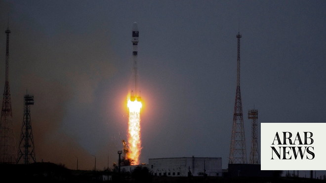
Space publication entitled: Radar imaging and dual-frequency SAR satellites and the global priority struggle between King Abdulaziz City for Science and Technology (KACST) in front of a consortium that brings together NASA & ISRO


Translation:

A quick look at the beginning at the meaning of SAR or Synthetic Aperture Radar, which means synthetic aperture radar, or according to its common meaning, radar imaging. Radar imaging techniques are used in many atmospheric applications, as they send their waves to the surface of the earth and are reflected in accurate two-dimensional images.


Translation:

Then reprocessing the images to obtain high-resolution 3D images. SAR imaging techniques are used in combat aircraft, reconnaissance aircraft, drones, and airships, as well as satellites to create accurate images. Some Saudi projects dedicated to aircraft, radar detectors and sighting radars


Translation:

Advantages of radio imaging SAR The main advantage of SAR imaging devices is that monitoring is carried out regardless of weather or day or night lighting conditions that are not affected. In other words, SAR satellites can be used at night or with thick cloud cover over the area of interest and very accurate images can be drawn.


Translation:

SAR satellites are well suited for monitoring change such as landslides or rising water levels. - It can also estimate the number of cars that appeared in a parking lot during the night, or the number of containers that disappeared from the port.


Translation:

It can also be used successfully to monitor the condition of infrastructure, such as gas or oil pipelines, etc. The SAR satellite is well suited for maritime traffic monitoring as well. This is because ships or warships can easily be captured on the water.
 
Last edited:
Part 2:


Translation:

The SAR provides the ability to monitor large areas over short periods of time. For example, it takes about 30 seconds to collect images of an area of 100 x 50 km across a SAR, while it may take a few days to capture optical images of this small piece of land, with a suitable resolution.


Translation:

Dual frequency SAR satellite: Currently, all the SAR satellites in space are single-frequency satellites, meaning that they operate with only one wavelength. The competition for the priority of launching the first dual-frequency SAR satellite is between KACST and a consortium that brings together the US and Indian space agencies, NASA & ISRO, on their NISAR satellite.


Translation:

Introduction to the KACST project On 10/2015, the Space and Aviation Research Institute of King Abdulaziz City for Science and Technology began the last steps to reach their dream of international competition, which they set 25 years ago and worked hard to achieve. That date marks the beginning of the world's first dual-frequency SAR satellite project.


Translation:

Beginning of the project On 2015-10, KACST announced the beginning of the development of the dual-frequency SAR satellite as a highly advanced and unique satellite. An overview of the Saudi moon and some of its features in the upcoming tweets:


Translation:

The SAR payload is the first in the world to support Band L& X) satellite radar. - Supports StripMap mode and StripSAR mode to meet different needs and serve a lot of applications, such as high-resolution imaging and wide-area photography, coastal monitoring, monitoring changes specifically at points on the ground.


Translation:

The project includes 5 main phases: 1- Determining the main requirements of specifications, concepts and analyses. 2- Design and development. 3- Preliminary tests and development of prototypes. 4- Develop and test the engineering models that have been made. 5- Assembly and final exams.
 
Part 3:


Translation:

- The project has reached 85% of completion, according to the city’s announcement in its annual report for 2018 issued at the beginning of 2019. What has been accomplished up to the date of the report: - Manufacture and test the first version of the space computing system and start manufacturing the engineering model.


Translation:

Fabrication and testing of the first version of the high-speed transmission system and the start of engineering model manufacturing. - Manufacture and start testing different engineering models for SAR. The development and testing of ground treatments is completed. - Construction and testing of the ground-based telescope.


About the NISAR joint project between NASA & ISRO - NISAR will use Band L and Band S frequencies NASA will develop the Band L, while ISRO will develop the Band S - NISAR's budget is estimated at 1.5 billion dollars, as one of the most expensive projects if not the most expensive in the world of satellites.


Translation:

- The idea of developing in India started from 2012, and the official signing was signed with NASA on 9/30/2014 - It will be launched into space as scheduled on the 9th of 2022.


Translation:

- The NISAR program and the KACST program are both in the final stages and close to launch, but KACST has not set a launch date yet, while NISAR has set September 2022 - The achievement of KACST and their dream, which began 25 years ago, to transfer our country to the ranks of developed countries in a great field such as space is a matter of thanks and pride for all.


Translation:

The end of the post.. My wish is that they can launch the moon as soon as possible, in honor of the efforts of the heroes who transferred the name of their homeland to space with force and at the speed of light. Thanks for reading..


Last edited:
Part 3:


Translation:

- The project has reached 85% of completion, according to the city’s announcement in its annual report for 2018 issued at the beginning of 2019. What has been accomplished up to the date of the report: - Manufacture and test the first version of the space computing system and start manufacturing the engineering model.


Translation:

Fabrication and testing of the first version of the high-speed transmission system and the start of engineering model manufacturing. - Manufacture and start testing different engineering models for SAR. The development and testing of ground treatments is completed. - Construction and testing of the ground-based telescope.


About the NISAR joint project between NASA & ISRO - NISAR will use Band L and Band S frequencies NASA will develop the Band L, while ISRO will develop the Band S - NISAR's budget is estimated at 1.5 billion dollars, as one of the most expensive projects if not the most expensive in the world of satellites.


Translation:

- The idea of developing in India started from 2012, and the official signing was signed with NASA on 9/30/2014 - It will be launched into space as scheduled on the 9th of 2022.


Translation:

- The NISAR program and the KACST program are both in the final stages and close to launch, but KACST has not set a launch date yet, while NISAR has set September 2022 - The achievement of KACST and their dream, which began 25 years ago, to transfer our country to the ranks of developed countries in a great field such as space is a matter of thanks and pride for all.


Translation:

The end of the post.. My wish is that they can launch the moon as soon as possible, in honor of the efforts of the heroes who transferred the name of their homeland to space with force and at the speed of light. Thanks for reading..


I have question, does it help in detecting BM firing location?

Very good effort from you khan2727,thank you
 
I have question, does it help in detecting BM firing location?

Very good effort from you khan2727,thank you

You are welcome, Hamza. Good to have an Arab and Omani brother around.

Yes very much so, is the short answer.

“The primary advantage the radar sensors have, within the scope of carrying out observation, is the fact that the process may be carried out in a continuous manner. As opposed to the optical instruments, Synthetic Aperture Radar may carry out remote sensing activities regardless of the weather or lighting conditions.

In other words, SAR satellites may be used at night or with a thick cloud cover over the area of interest. The continuous nature of the observation provided by the ability to carry out this effort, regardless of the circumstances listed above, is of key importance, during each and every subsequent visit the satellite makes over the given area. Due to the reason above, SAR satellites are perfectly suited for monitoring change. Here one may refer to landslides or growth of water level in the flooded area. One may also estimate how many more cars appeared at a car park overnight, or how many containers disappeared from the given harbour. Satellite tools as such may also be successfully used to monitor the status of linear infrastructure, such as gas or oil pipelines.

SAR offers an ability to monitor vast areas over short periods of time. This is another of its major advantages. For instance, gathering imagery of an area which has dimensions of 100x50 kilometers takes around 30 seconds. Capturing optical imagery of such small piece of the Earth, with a proper resolution, may take up a few days.

SAR radar is well suited to monitor marine traffic too. This is because ships or warships can be easily picked up on the water, on the imagery as such.”​

For better overview, you can read this article which does a good job of explaining the concept of SAR satellites.


1658531159525.png


We can expect the launch some time in the autumn, Insha'Allah.
 
You are welcome, Hamza. Good to have an Arab and Omani brother around.

Yes very much so, is the short answer.

“The primary advantage the radar sensors have, within the scope of carrying out observation, is the fact that the process may be carried out in a continuous manner. As opposed to the optical instruments, Synthetic Aperture Radar may carry out remote sensing activities regardless of the weather or lighting conditions.

In other words, SAR satellites may be used at night or with a thick cloud cover over the area of interest. The continuous nature of the observation provided by the ability to carry out this effort, regardless of the circumstances listed above, is of key importance, during each and every subsequent visit the satellite makes over the given area. Due to the reason above, SAR satellites are perfectly suited for monitoring change. Here one may refer to landslides or growth of water level in the flooded area. One may also estimate how many more cars appeared at a car park overnight, or how many containers disappeared from the given harbour. Satellite tools as such may also be successfully used to monitor the status of linear infrastructure, such as gas or oil pipelines.

SAR offers an ability to monitor vast areas over short periods of time. This is another of its major advantages. For instance, gathering imagery of an area which has dimensions of 100x50 kilometers takes around 30 seconds. Capturing optical imagery of such small piece of the Earth, with a proper resolution, may take up a few days.

SAR radar is well suited to monitor marine traffic too. This is because ships or warships can be easily picked up on the water, on the imagery as such.”​

For better overview, you can read this article which does a good job of explaining the concept of SAR satellites.


View attachment 864300

We can expect the launch some time in the autumn, Insha'Allah.
thank you very much Mr. khan2727 your replay was helpful for me I wish KSA success on lunching this great SAR satellite it well be useful in civilian and military uses.
 
thank you very much Mr. khan2727 your replay was helpful for me I wish KSA success on lunching this great SAR satellite it well be useful in civilian and military uses.

Insha'Allah this is just the beginning of the long journey ahead.

Anyway I was not aware of how many promising projects the KACTS is involved in.

 
Great website and blog.


Very impressive.
 
I have a question.

How does this development compare to regional ones in this regard? I imagine that only Israel is comparable if they have pursued this technology publicly.

Looks like this technology is purely the domain of very technologically advanced countries.
 
Part 3:


Translation:

- The project has reached 85% of completion, according to the city’s announcement in its annual report for 2018 issued at the beginning of 2019. What has been accomplished up to the date of the report: - Manufacture and test the first version of the space computing system and start manufacturing the engineering model.


Translation:

Fabrication and testing of the first version of the high-speed transmission system and the start of engineering model manufacturing. - Manufacture and start testing different engineering models for SAR. The development and testing of ground treatments is completed. - Construction and testing of the ground-based telescope.


About the NISAR joint project between NASA & ISRO - NISAR will use Band L and Band S frequencies NASA will develop the Band L, while ISRO will develop the Band S - NISAR's budget is estimated at 1.5 billion dollars, as one of the most expensive projects if not the most expensive in the world of satellites.


Translation:

- The idea of developing in India started from 2012, and the official signing was signed with NASA on 9/30/2014 - It will be launched into space as scheduled on the 9th of 2022.


Translation:

- The NISAR program and the KACST program are both in the final stages and close to launch, but KACST has not set a launch date yet, while NISAR has set September 2022 - The achievement of KACST and their dream, which began 25 years ago, to transfer our country to the ranks of developed countries in a great field such as space is a matter of thanks and pride for all.


Translation:

The end of the post.. My wish is that they can launch the moon as soon as possible, in honor of the efforts of the heroes who transferred the name of their homeland to space with force and at the speed of light. Thanks for reading..


I don't understand your posts are you saying it's a collaboration between isro nasa and saudi arabia
Or did saudi build the entire satellite and india and us Collab is just launching it ?
@Khan2727
 
I don't understand your posts are you saying it's a collaboration between isro nasa and saudi arabia
Or did saudi build the entire satellite and india and us Collab is just launching it ?
@Khan2727

KSA is building their own.

NASA and ISRO have their own collaboration.

Translations are below every tweet in Arabic.

From what I recall, when posted it, there is a healthy race going on between them. It is for local Saudi Arabian/Arab consumption to see who they are up against.

Impressive nevertheless.
Ok thanks now i understand by reading up more arabia is launching KACST
And nasa isro collab is NISAR i had heard of nisar
So who will launch this KACST ?
 
Ok thanks now i understand by reading up more arabia is launching KACST
And nasa isro collab is NISAR i had heard of nisar
So who will launch this KACST ?

I have to admit that I don't know from where it will be launched once finished. I know that KSA has sent its own satellites into space from Kazakhstan (Baikonur Cosmodrome) on board Russia’s Soyuz-2 carrier rocket. As late as last year.


Earlier from France (French Guyana) and the US too if I recall. Projects with China too.


I think that it will be published once the launch takes place.
 

Back
Top Bottom