Kineco Kaman's antenna put into orbit via ISRO satellite
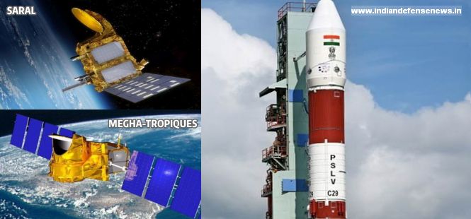
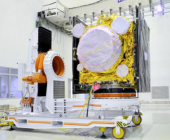
DHAA was manufactured by Kineco Kaman for ISRO's Vikram Sarabhai Space Centre (VSSC) in Trivandrum and was integrated into IRNSS-1E. (Representative Image)
PANAJI:
Kineco Kaman Composites India (KKCI) has become the first private company in India to manufacture a Dual Helix Antenna Array (DHAA) assembly, which was launched into the space aboard ISRO's fifth
Indian Regional Navigation Satellite (IRNSS-1E) this month.
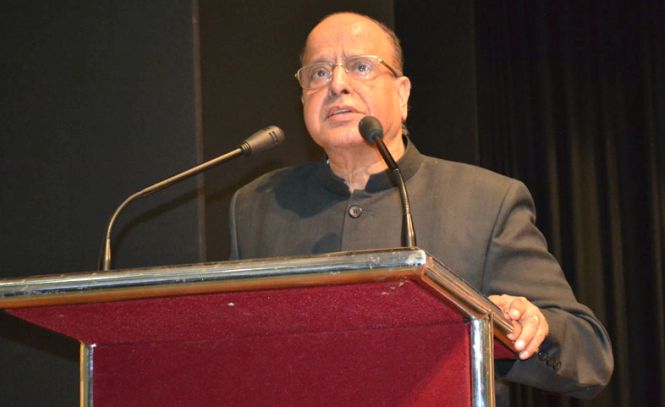
"The DHAA assembly is a very complex and high precision structure made using a combination of Carbon and Aramid Composites. The manufacturing of this DHAA requires hi-tech engineering and manufacturing competence, benchmarked with the best in the world," said Shekhar Sardessai, Chairman and MD, Kineco Kaman Composites-India Private Limited.
IRNSS is a cluster of seven satellites comprising three geo-stationary and four geo-synchronous satellites.
DHAA was manufactured by Kineco Kaman for ISRO's
Vikram Sarabhai Space Centre (VSSC) in Trivandrum and was integrated into IRNSS-1E, which was successfully put into the orbit by PSLV-C31 on January 2, he said.
"The IRNSS will be the Indian version of the global positioning system (GPS) and will be called Standard Positioning Service (SPS). Once all the satellites are placed in orbit, which is expected to be by March 2016, free SPS services will be available to all civilians," Sardessai said.
Kineco Kaman -- a joint venture of Kineco Group Goa, India and Kaman Aerospace Group-USA -- had earlier received a contract for the manufacture and supply of 10 sets of DHAA assemblies for VSSC Trivandrum in 2015.
Indian Regional Satellite Navigation System Update
IRNSS 1F will be launched on 10th March 2016
IRNSS 1G will be launched on 31st March 2016
Source:
<img src="/images/favicon_ps.ico" >ప్రజాశక్తి
One launch at every month- Frequency "12" dream is realizing.
NASA, India Join Hands for Astrobiology Mission
For the first time India is part of Spaceward Bound program, which funds expeditions to places with extreme climate conditions
Even as India prepares for a second mission to Mars, a team of scientists from the National Aeronautics and Space Administration (NASA), the Mars Society Australia and the Birbal Sahni Institute of Palaeobotany, Lucknow, will mount an expedition to Ladakh this August to study the similarities of certain parts of the region’s topography and microbial life to Martian surroundings.
India’s second mission to Mars — scheduled to be in 2020 — will involve collaboration with France and may include a lander or rover — remote controlled vehicles — which can ostensibly better analyse a planet’s surface.
“This is the first time that India is part of the Spaceward Bound programme,” said Siddharth Pandey, who is among the coordinators of the expedition “and we hope to have the Indian Space Research Organisation (ISRO) closely involved.”
The Spaceward Bound is a NASA project that educates future space explorers and funds expeditions to places with extreme climate conditions.
Before Ladakh, there have been expeditions to the deserts such in Atacama, Chile; Mojave, California; Arkaroola, Australia as well as the Arctic and Antarctica, organised since 2006.
Low-Cost Mars Mission
The success of India’s low-cost mission to Mars, in 2014, has led to heightened international interest in collaborating with India’s upcoming space missions. India now has an orbiter that's still circling Mars and taking pictures — with five instruments on board — in hopes of finding methane, carbon dioxide and the effect of solar winds on its surface. “Ladakh has been studied before but this time we’re going to be looking at some very specific experiments,” said Mr. Pandey — an engineer from India and who’s previously worked at the NA
SA. “We will be testing a rover that will collect samples and analyse some of the high altitude springs etc.”
According to the program’s website, Ladakh offers a “high UV (ultra-violet) exposed, dry ecosystem with Mars analogue topological features that tell us heaps about the origin and evolution of our planet’s topological features…”
Before its Mars Mission, the ISRO has Chandrayaan 2 planned to the moon, in 2017, that too hopes to set a lander on the surface of the moon.
The Birbal Sahni Institute of Palaeobotany, which has expertise in studying ancient climate and life, will be coordinating the travel of scientists and researchers from several countries who will be part of the 10-day expedition.
Along with research experiments, the group would also meet school students and organise sessions on how astrobiology missions work, the evolution of life on earth as well as on how space missions work, Mr. Pandey added.
Source>>
ISRO conducts 1st satellite based warning system trial for railways
The first trial run for developing a satellite-based system to warn train drivers of unmanned railway crossings was conducted by ISRO scientists in Ahmedabad recently. Scientists at the city-based Space Applications Centre (SAC) are now in the process of commercially developing this system that will be fitted on 50 different trains across the country as a second part of the demonstration project.
Of around 30,000 level crossings of the Railways, as many as 11,000 are unmanned. “An estimated 7,000 people die every year at these unmanned crossings in the country. We have successfully conducted the first test-drive in Ahmedabad for developing a satellite-controlled warning system for the Indian Railways that will alert the train driver well in advance about an approaching unmanned level crossing. Simultaneously, it will also alert the road-users about the approaching train,” Tapan Misra, director of ISRO’s Space Applications Centre, said..
The demonstration project was carried out by a team of ISRO scientists and Western Railway officials in the first week of January. Under this project, a transmitter connected to GSAT-6 (a communication satellite) was mounted at Vastrapur and Sarkhej level crossings. Thereafter, the team boarded a train — fitted with a hooter that was in turn connected with a similar transmitter and a receiver — running between Gandhigram and Moraiya, near Changodar. All the trial runs were conducted in Ahmedabad.
“About 500 m before the level crossings, this hooter went on, warning the train driver about the approaching level crossing. The hooter got louder as the level crossing neared, and finally fell silent after the train passed it by. Similarly, the hooter attached to the transmitter mounted on the railway crossings alerted the road users about the approaching train. We had also used global positioning system and Indian Regional Navigational Satellite System (IRNSS) during this demonstration. After its success, we will soon implement the second phase,” Misra said.
In the next phase of the demonstration project, SAC has selected six private companies for commercially developing the satellite-based transmitting and receiving system. “One of the six models/designs developed by these companies will be selected and will be demonstrated on 50 different trains running across the country. This demonstration will be done for a month,” he said, adding that the system will be integrated with IRNSS
According to scientists at SAC, the project to build warning systems will be taken forward to cover the entire railway network at a later stage. A GIS (Geographical Information Systems) mapping will be done of the entire route and a GIS map will be created. “This will help Indian Railways track each train on its network and also get timely alerts about derailment and accidents,” Misra added.
IIST: Capacity Building for Indian Space Programme
The Indian Institute of Space Science and Technology (IIST) is an autonomous body under DOS formed with the primary objective of creating world class academic Institution in the area of advanced Space Science and Technology education by seamlessly integrating education with research and generating high quality human resources to meet the quality human resource requirements of DOS/ISRO. IIST, a ‘Deemed to be University’ under Section 3 of the UGC Act 1956 was established in 2007 at Thiruvananthapuram.
View of IIST student hostels at the Valiamala campus
The Institute is the first of its kind in the country, to offer high quality and specialized academic programmes at the undergraduate, graduate, doctoral levels in the emerging areas with special focus to space sciences, space technology and space applications and it also offers post doctoral positions to undertake research.. The Institute started functioning in an alternate campus adjacent to VSSC, Thiruvananthapuram and later moved over to its own new campus at Valiamala from August 15, 2010. The annual intake of the Institute is around 250 students.
The old IIST Campus at ATF Area
Undergraduate Programmes
IIST offers various undergraduate and postgraduate programmes in areas that are relevant to space studies. The institute was offering B.Tech in three branches – Aerospace Engineering, Avionics and Physical Sciences. From academic year 2015 onwards, a Dual Degree (B. Tech + M.S / M. Tech) has been replaced the B. Tech (Physical Sciences). This five year Dual Degree Programme will lead to a B.Tech degree in Engineering Physics and Post Graduate Degree in any of the following specialisations - (i) M.S. (Astronomy & Astrophysics) (ii) M.S. (Earth System Science) (iii) M.S. (Solid State Physics) and (iv) M.Tech (Optical Engineering). There is no option to exit the dual degree after four years. The dual degree students will give their preference for the M.S./M.Tech. specialisations at the end of sixth semester. They will pursue one of the four specialisations based on their academic performance (CGPA) up to the sixth semester.
Admissions to all undergraduate programmes are based on the performance of the students in their class XII Board exams as well as on the Joint Entrance Examination (JEE–Main) conducted by Central Board of Secondary Education (CBSE), New Delhi as well as the Joint Entrance Examination (Advanced) conducted by IITs, as per the guidelines set by IIST.
The Observatory at IIST with an 8-inch Celestron telescope.
The major feature of the undergraduate program is the complete absence of any form of fees payable to the institute, rendering the education “fully assisted”, subject to the students securing a stipulated minimum academic requirement. As performance based financial assistance is provided by DOS to the B.Tech students of IIST, ISRO/DOS will have the first right to absorb them, subject to the human resource requirements of ISRO/DOS. Summary of the undergraduate programmes :
Programme
No. of Seats
Duration
B.Tech. in Aerospace Engineering
60
4 years
B.Tech. in Avionics
60
4 years
Dual Degree (B.Tech. and M.S./M.Tech.)*
20
5 years
* On successful completion of the 5-year (10 semesters) students receive, a
B.Tech. degree in
Engineering Physics and a
M.S./M.Tech. degree in one of the following four streams :
• M.S. in Astronomy and Astrophysics
• M.S. in Earth System Science
• M.S. in Solid State Physics
•M.Tech. in Optical Engineering
138 undergraduate students were admitted for the academic year 2015-2016 in the above-mentioned three branches.
M.Tech./MS Programme
IIST offers postgraduate programmes in fourteen areas of space science and engineering. These M.Tech and M.S programmes are open to public as well as scientists / engineers of DOS / ISRO. The academic programmes have been formulated to strengthen the fundamentals, experience the realities through practical work, and enhance the knowledge and understanding in the areas of interest. Also, the programmes so envisaged ensures adequate exposure in the emerging fields which will lead to experience knowledge synthesis.
Applications for M.Tech./MS programmes are screened based on GATE score and the admission is through test and interview. The total number of seats in each programme is ten, out of which six seats are reserved for open merit candidates and the remaining four for DOS/ISRO employees.
90 postgraduate students were admitted for the academic year 2015-2016.
ESTABLISHMENT OF DR. SATISH DHAWAN ENDOWED FELLOWSHIP AT GRADUATE AEROSPACE LABORATORIES OF THE CALIFORNIA INSTITUTE OF TECHNOLOGY (GALCIT)
The Department of Space / Indian Space Research Organisation has established an endowed fellowship at the Graduate Aerospace Laboratories of the California Institute of Technology (GALCIT), California, USA. This fellowship is established in the honor of Dr. Satish Dhawan, who was the former Chairman of Indian Space Research Organization (ISRO) during its formative period 1972-1984.
The fellowship provides an excellent opportunity to the top ranking graduating student from Aerospace Department of IIST, to be sponsored by the Department of Space, to pursue Masters in Space Engineering at California Institute of Technology (Caltech). On completion of the course and award of degree by Caltech, the student will pursue career in Space at ISRO.
Doctoral Programmes
The institute recognizes the relevance of research. IIST encourages all its faculty members to guide and supervise young scholars for the PhD programme as well as for Post-Doctoral programmes. It also supports the research needs of faculty members by funding research projects directly. The institute provides for the publication charges of peer reviewed journal papers that are published by faculty, research scholars and students of the institute.
Admission for Ph.D. programme is based on test and interview and is restricted to those candidates who qualified JRF-NET/GATE or equivalent exams. The Institute has the provision to allow ISRO/DOS Scientists/Engineers to join the Ph.D. Programme.
26 Research Scholars were admitted for the academic year 2015-2016.
Research in Departments
Presently, the Institute has the faculty strength of 93 spread over seven departments. Faculty members from various departments have initiated various research projects. Collaborative research works with various ISRO centres are also undertaken by faculty. The faculty members have to their credit publications in books and journals of both national and international repute; they have also presented papers and lectures in outside universities/academic institutions.
One of the major recent developments in the institute is setting up of an “Advanced Space Technology Development Cell” (ASTDC). ASTDC was created in September 2015 as a new technology cell in IIST to develop advanced technologies required by the various centres in ISRO for their current and future projects. In addition, ASTDC is also responsible for interacting with Indian and foreign universities for the design and development of experimental payloads and nano-satellites.
Campus
The campus is located at Valiamala, about 25 kms from Thiruvananthapuram city, on the way to the famous hill resort of Ponmudi. The institute provides full-fledged infrastructure of international standards to develop an excellent academic and research atmosphere. Modern environment friendly buildings of unique architecture merge well with the flora and fauna of the surroundings. The academic activities spread across four blocks – Aerospace, Physical Sciences, Avionics and Interdisciplinary. Of these the first two are fully functional and host all the seven departments. The Academic blocks are equipped with spacious lecture halls and well-designed research and curriculum laboratories. The Academic blocks also house the offices of the faculty members and research scholars. An imposing Library building is centrally located. IIST also has an Astronomical Observatory situated on the rooftop of the Physical Sciences building.
IIST is planned to be a fully residential campus with all facilities. Presently, the residential wing for the students is complete. The faculty and staff residential campus along with the stadium and sports complexes are in the pipeline. The campus has 11 hostels and two mess halls for the students. There is a Medical Centre with qualified doctors and nurses which operates 24 x 7. An ambulance is available in the campus for emergencies. Tie up with premier hospitals in Thiruvananthapuram ensures that all students are provided excellent medical attention when required.
The institute is committed to excellence in teaching, learning and research. IIST fosters state-of-the-art research and development in space studies and provides a think-tank to explore new directions for the Indian space programme.
For further information please visit: www.iist.ac.in
Story of the Week - Archive
Feb 02, 2016 : IIST: Capacity Building for Indian Space Programme
Jan 26, 2016 : Aditya - L1 First Indian mission to study the Sun
Jan 18, 2016 : ASTROSAT Completes 100 days in Orbit
Jan 11, 2016 : Geo-spatial Technology for Swachh Bharat Abhiyaan
Jan 05, 2016 : ISRO Completes 50 Launches from Sriharikota
Dec 29, 2015 : Mount Abu InfraRed Observatory (MIRO) : Unveiling the Universe
Dec 21, 2015 : National Database for Emergency Management (NDEM) services in tackling Disasters
House Panel for 50% Hike in ISRO’s Budget
The Parliamentary Standing Committee on Science and Technology, Environment and Forests plans to recommend to the Centre a 50 per cent raise in the Indian Space Research Organisation’s (ISRO) annual budget.
Ashwani Kumar, Chairman of the committee, addressing reporters said ISRO’s current budget is ₹5,800 crore and non-Plan allocation is ₹1,400 crore. Justifying the hike, Ashwani Kumar said
it will help ISRO enhance its manpower, especially high-tech scientific manpower which help in launching more satellites. “An organisation like ISRO should not be starved of funds,” he added. “We have been informed about the need for enhancing manpower, particularly the scientific manpower of ISRO, the lack of which was disabling the organisation to optimise its potential.”
Geosynchronous Satellite Launch Vehicle MK III at the Launch Pad

AS Kiran Kumar, ISRO Chairman said the process of hiring more scientists was being initiated. This depends on the Centre’s approval. “We need manpower for producing various satellites and also bolster our R&D set up to develop new generation satellite and launch vehicles,” he said.
Ashwani Kumar said, “The country needs to give a lot more attention to R&D and develop more satellites and launch them. There is no dearth of funds for supporting scientific establishments like ISRO which has made the country proud by putting it on the global map and among the exclusive club of nations through its huge achievements in space technology.”
He further said the sixth and seventh satellites of the Indian Navigational Satellite System would be launched by March end and that completes the constellation of seven satellites.
Source>>
New ISRO Satellite to Predict Cyclones Being Built at 60% the Actual Cost, in One Third of the Time
The Indian Space Research Organization (ISRO) is developing a new weather-forecasting satellite to predict the beginning of cyclones in oceans. About 300 scientists are working on the satellite named ScatSat-1, at the Space Applications Centre (SAC) in Ahmedabad.
The best thing about this 301 kg satellite is that it is being built at 60% of the actual cost, and in one-third of the estimated time.
About 40% of satellite is made by recycling the leftover equipment from previous satellite missions. It will be launched in July 2016 and has a mission life of five years.
Picture for representation only. Source: ISRO
ScatSat-1 will replace OceanSat-2, which was launched in 2009 and was known for its accurate predictions of cyclones like Hudhud and Phailin. OceanSat-2 stopped functioning in Feb 2014. Currently, ISRO is getting most of the weather information from INSAT-3D satellite.
“Normally, it takes about three years to
build a satellite of this class from
scratch. However, as we have sourced
40% of the parts used in ScatSat-1 from
spares of previous missions, we will
complete it in a year’s time,” Tapan
Misra, director of the SAC, told
The Indian Express
He added that at the time of launch, ScatSat-1 will be a piggy ride with another satellite, and this will help save costs even further.
A scatterometer in the satellite will help predict formation of cyclones in the seas. Such predictions help in timely evacuation and minimise human casualties. A scatterometer is a microwave radar sensor. It measures the scattering effect produced while scanning the surface of the Earth from an aircraft or a satellite. It will measure the direction and speed of winds over the seas and oceans. The satellite has been designed to withstand multiple system failures, unlike the last one.
It is a polar orbiting satellite that will take two days to cover the globe. The data will be used by NASA, European Organisation for the Exploitation of Meteorological Satellites, and National Oceanic and Atmospheric Administration as well.
SAC is one of the major centres of ISRO and it deals with disciplines like design and development of payloads, societal applications, capacity building and space sciences, etc.


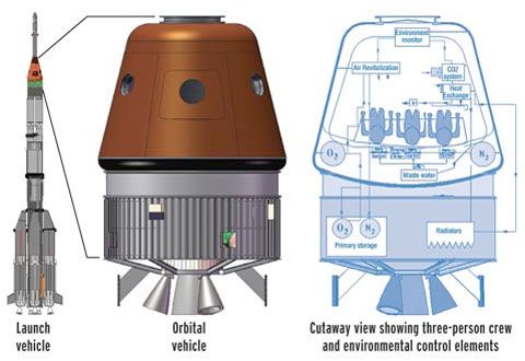
 Space suits for Vyomanauts (Yes) have already been developed. Google for images. Visit Space Museum in Thumba to see a model.


 :paraty:


