What's new

Pictures of HongKong

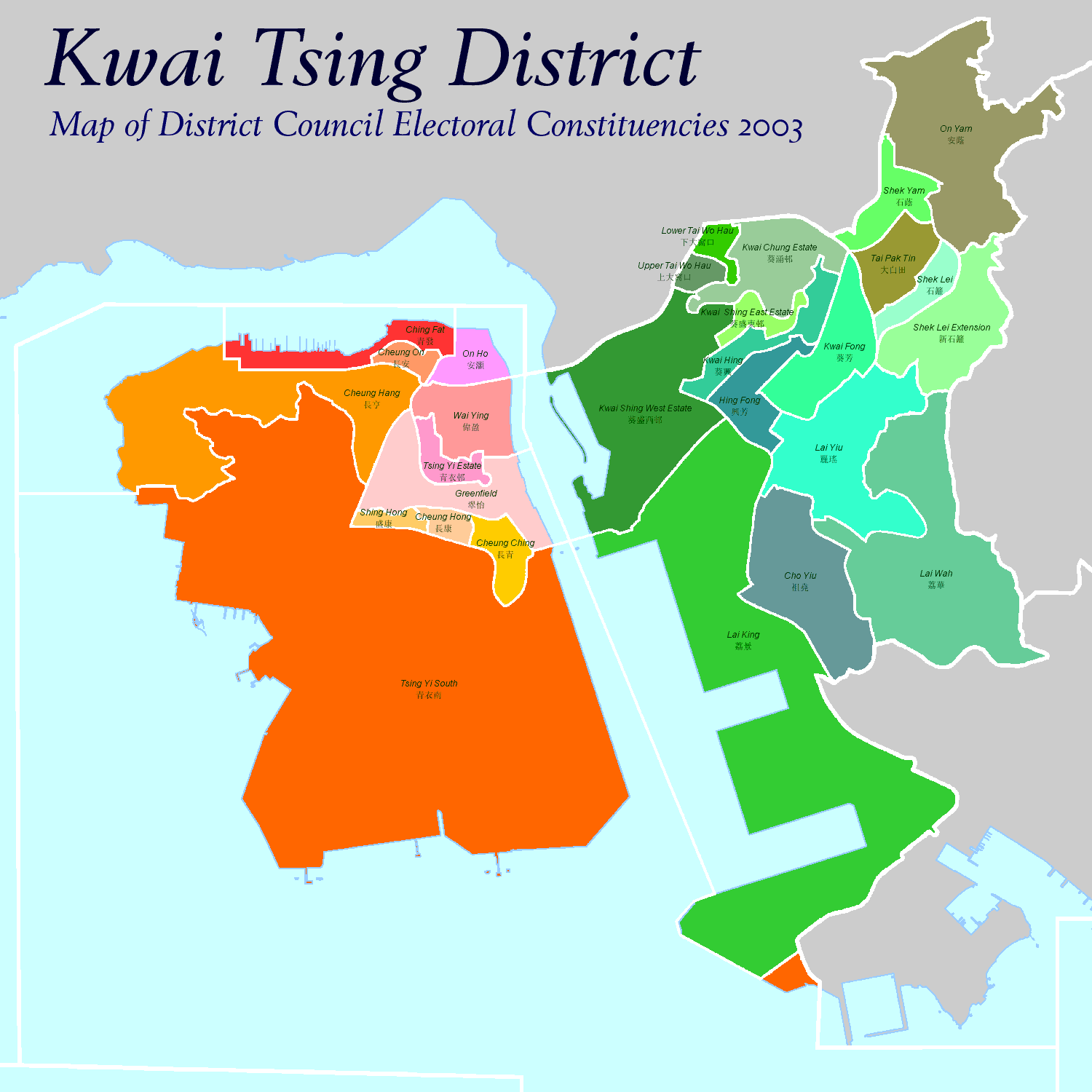
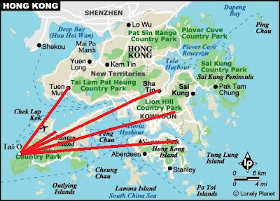
Tsing Yi Island 青衣島 is administered by Tsuen Wan and separates from the mainland by the Rambler Channel. It's east of Ma Wan Island and the island itself absorbed 2 smaller islands due to land reclamation. The island consists residential areas, heavy industries and ship buildings. Its area is almost 11 km sq and the population is about 200,000 live mostly in Tsing Yi Town


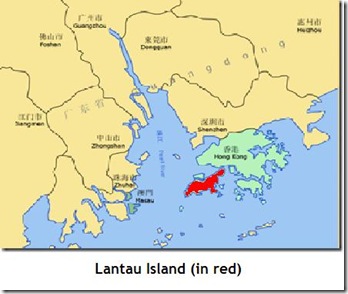
Tsing Yi Island in red
Kwai_Tsing_District_Council_Election_2003.png


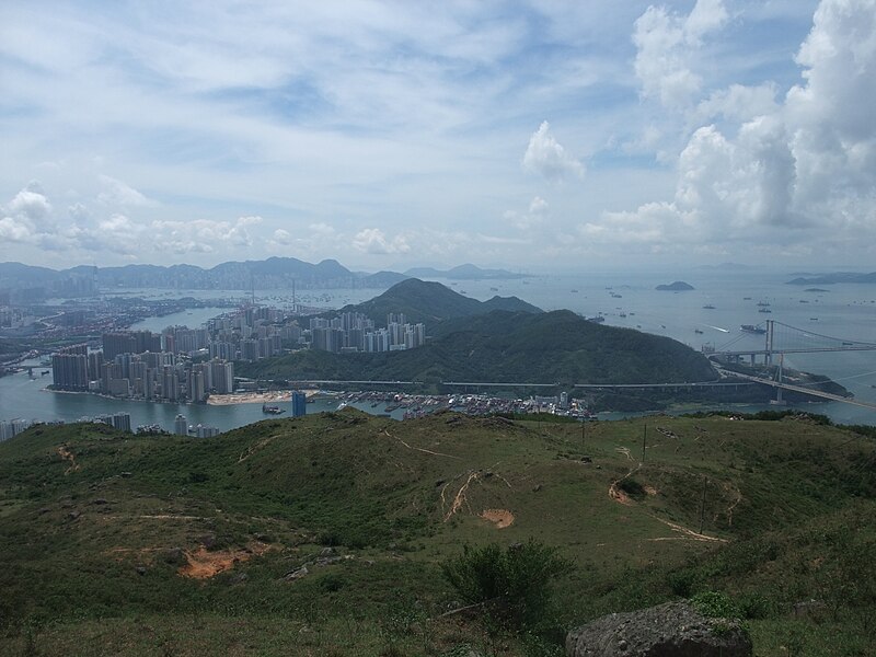
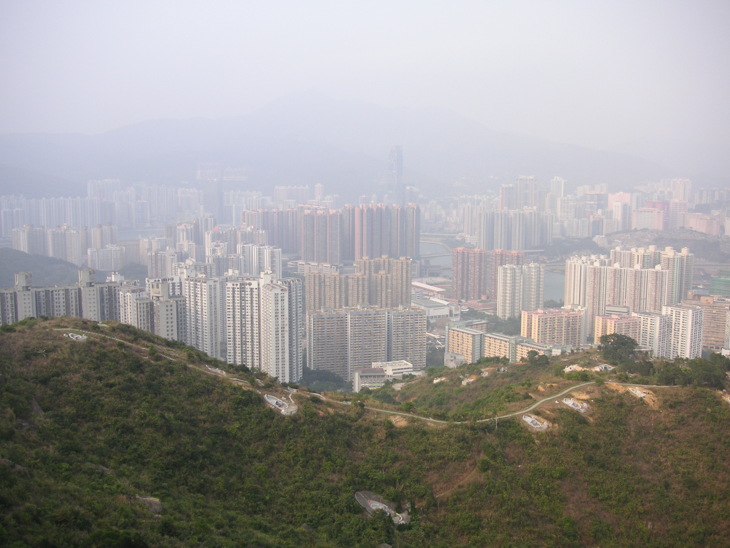
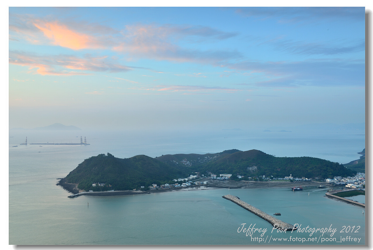
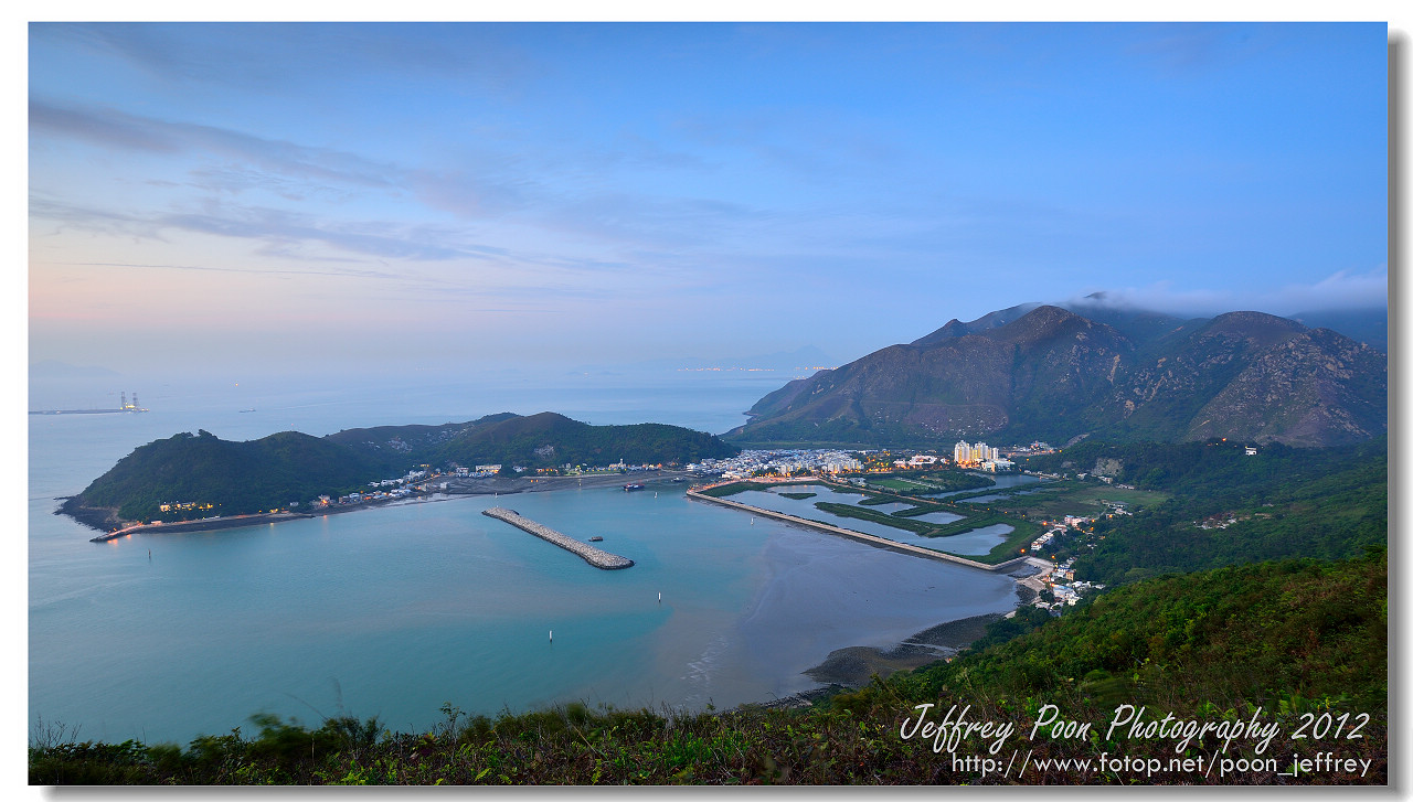
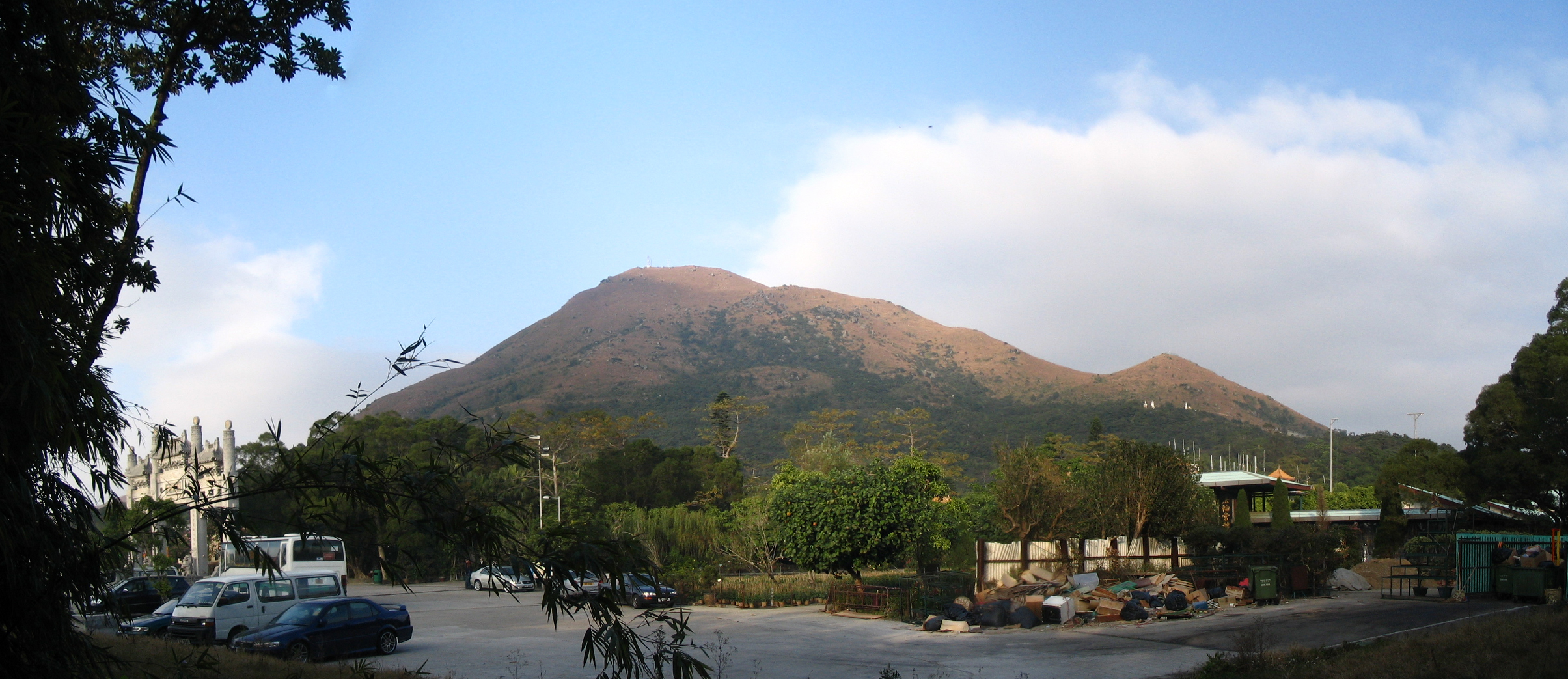
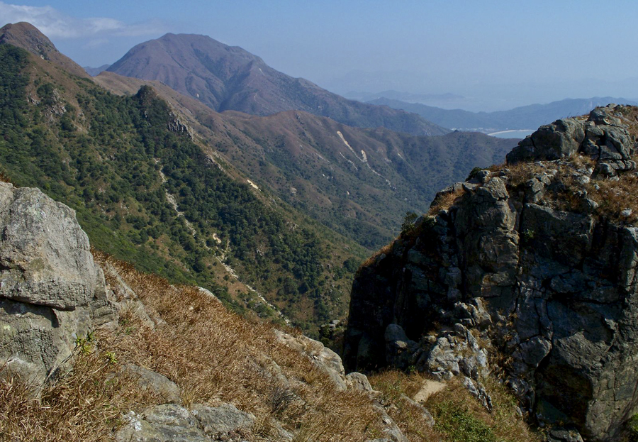
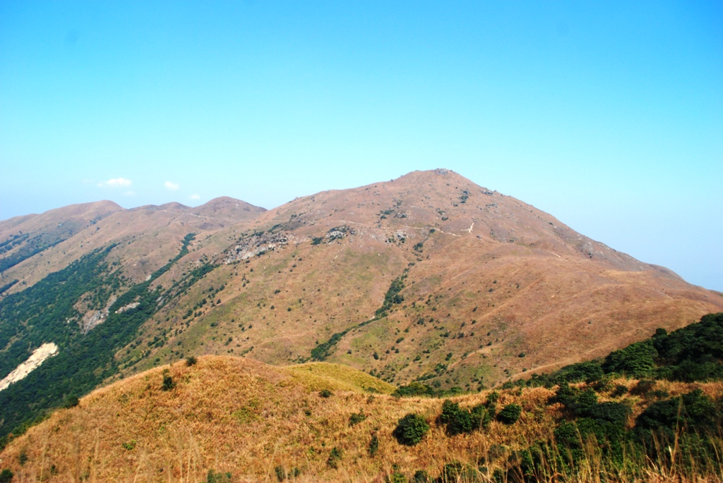
Tsing Yi, viewed from Shek Lung Kung
800px-Tsing_Yi_1.jpg


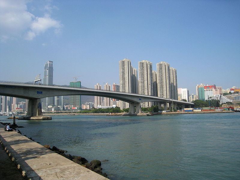
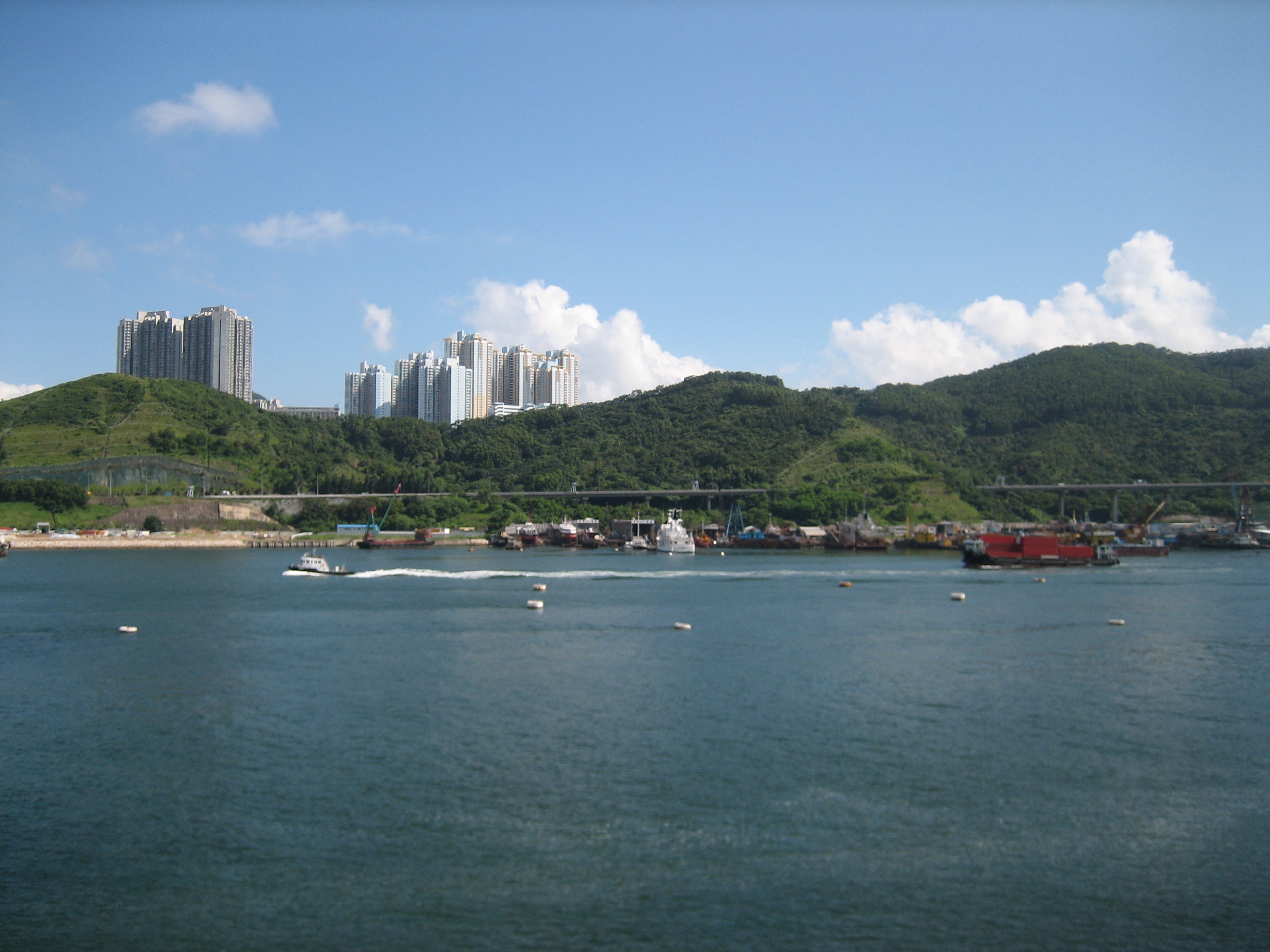
Tsing Yi Bridge across the Ramble Channel
800px-HK_Tsing_Yi_Bridge_North.jpg


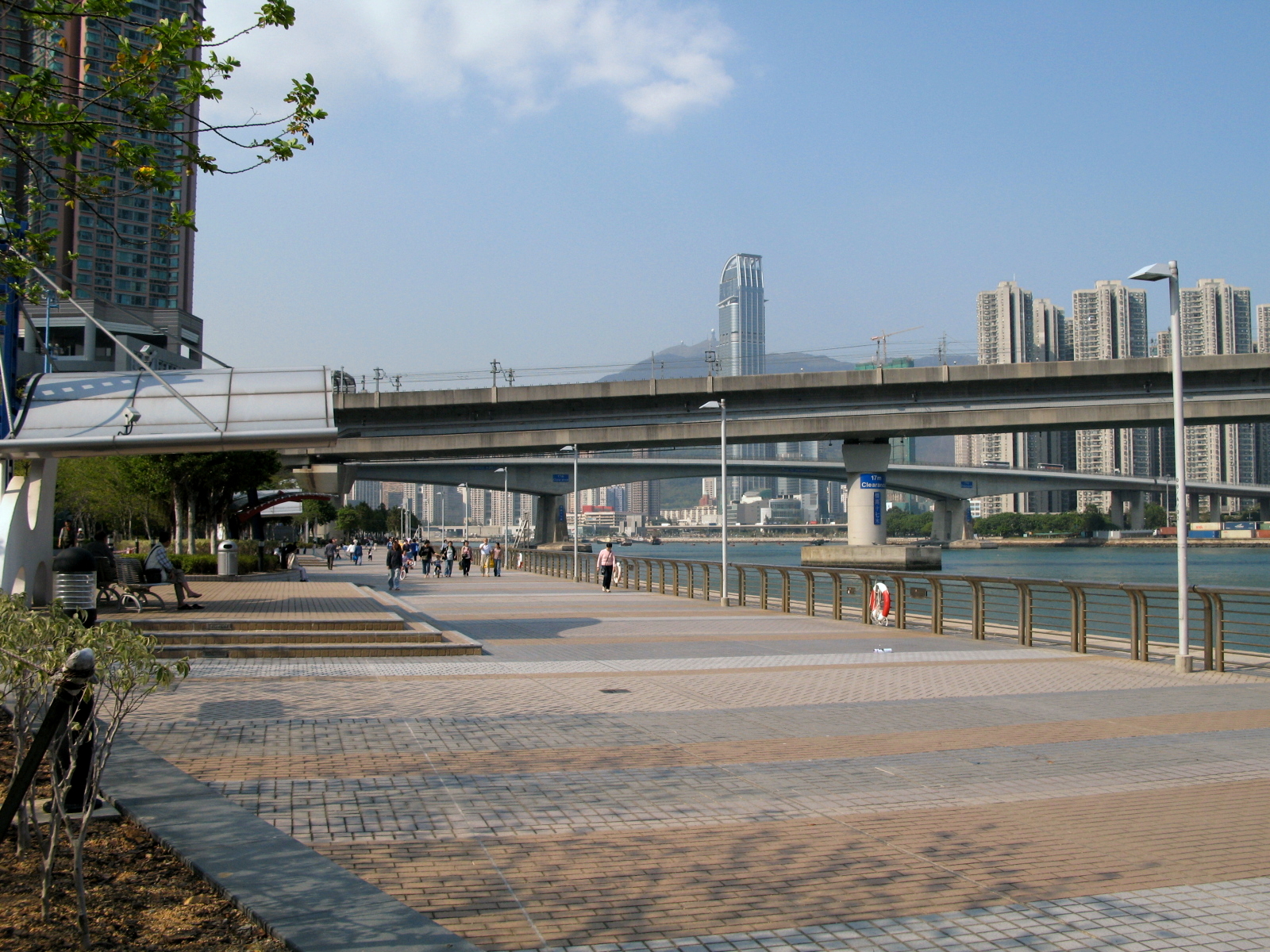
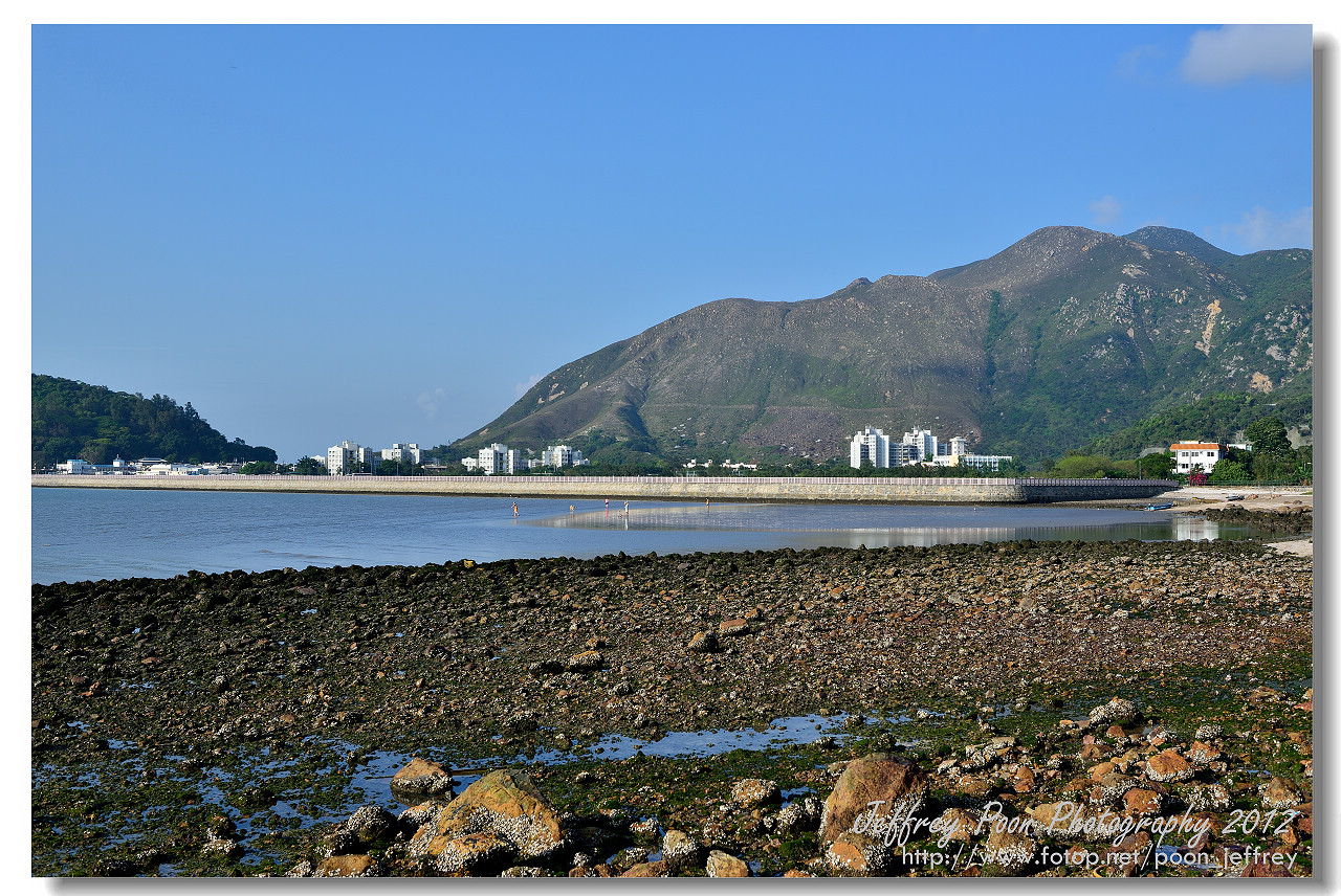
Tsing Yi Promenade in Tsing Yi Town along Rambler Channel
HK_Tsing_Yi_Promenade_view1.jpg


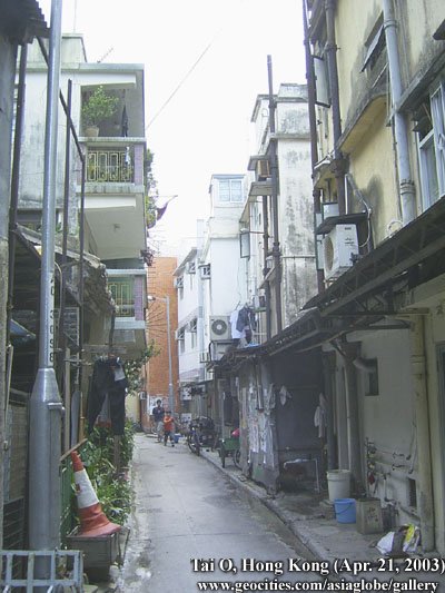
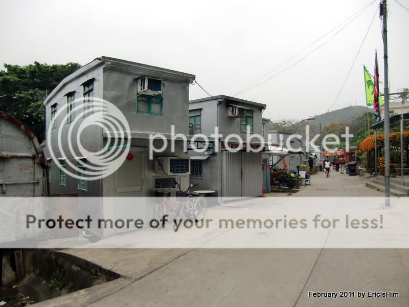
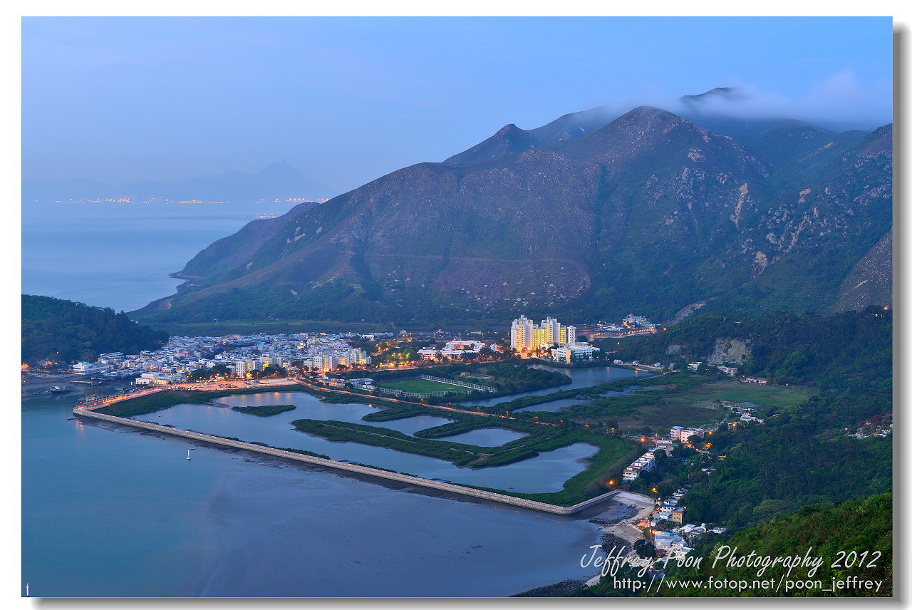
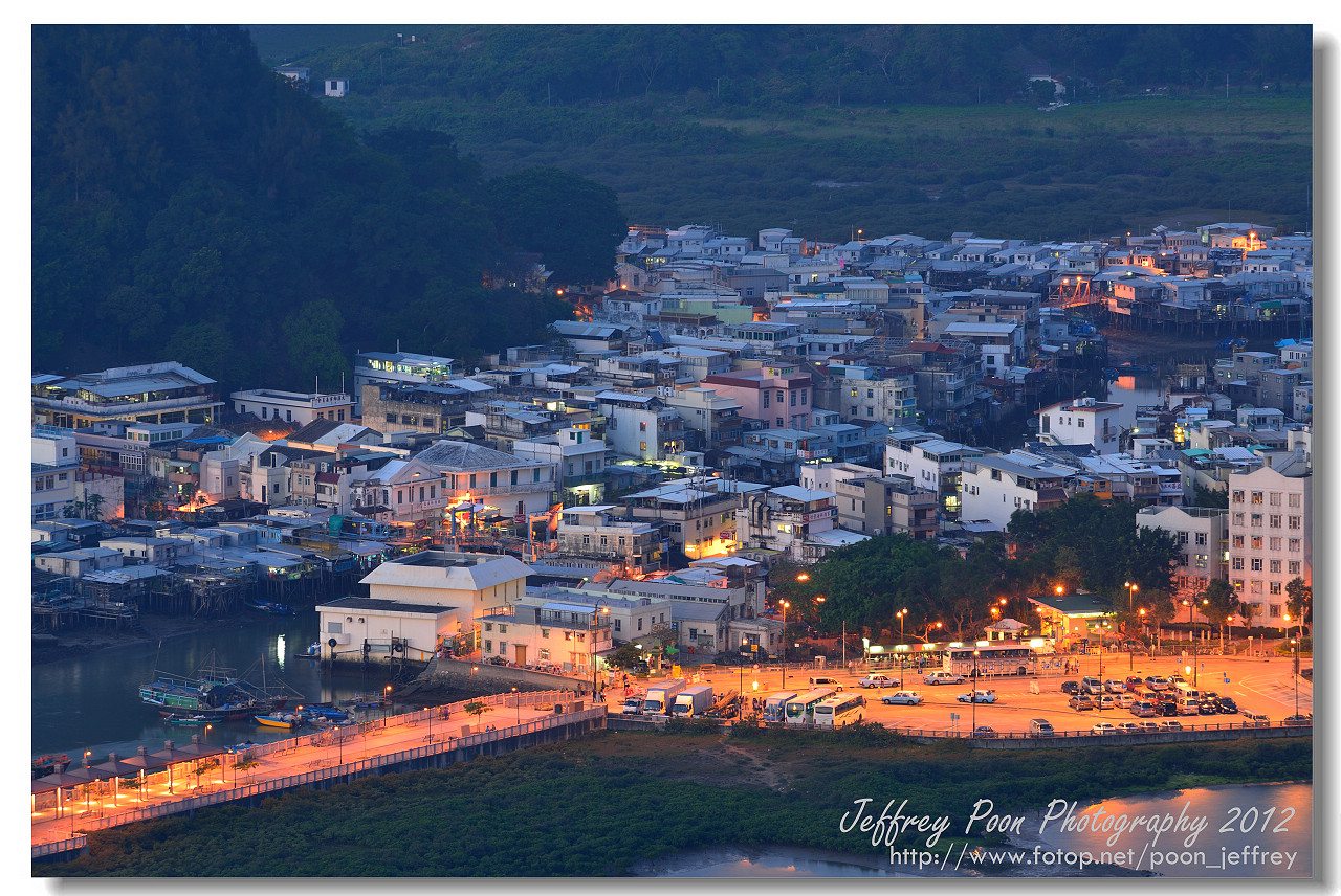
Residentional in Tsing Yi
HK_Tsing_Yi_view1.jpg


Tsing Yi Northern Coastal Road
%E9%9D%92%E8%A1%A3%E5%8C%97%E5%B2%B8%E5%85%AC%E8%B7%AFTsing_Yi_North_Coastal_Road.jpg


Clusters of highrise residential blocks in Tsing Yi Town. Notice some traditional grave sites on top of the hill
Northern_part_of_new_town_on_Tsing_Yi_Island.jpg


Cheung Tsing Bridge or Rambler Channel Bridge 長青橋 or 藍巴勒海峽大橋 connects to the mainland
Rambler_Channel_with_three_bridges.jpg


Notice there aren't any old buildings around
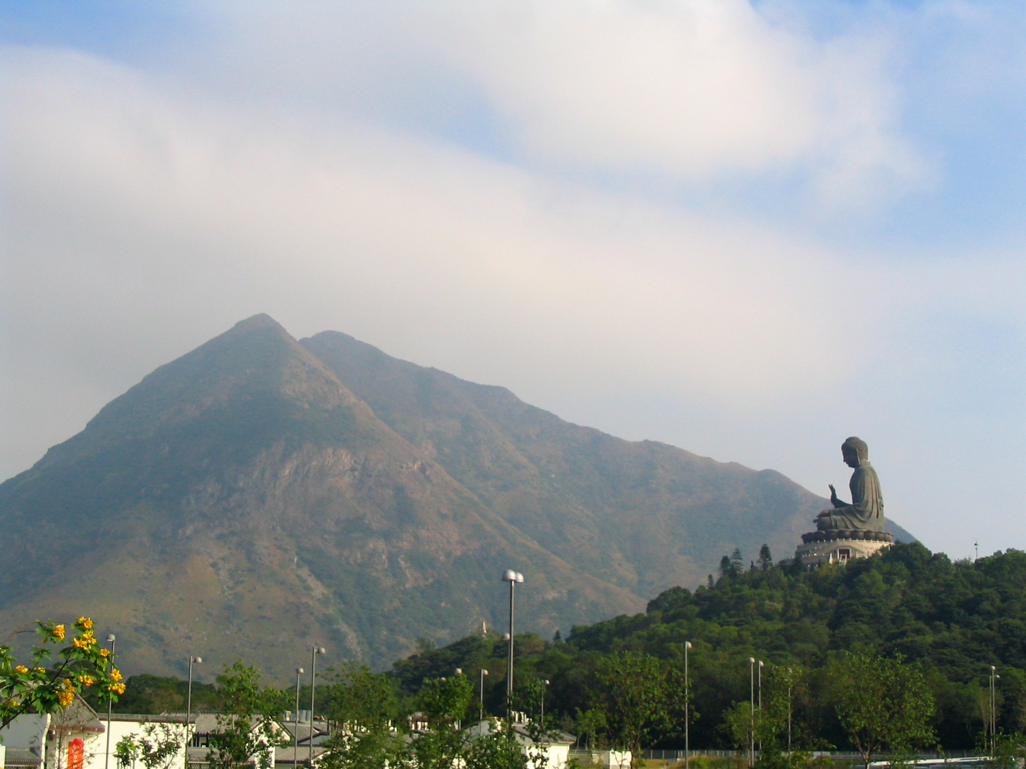
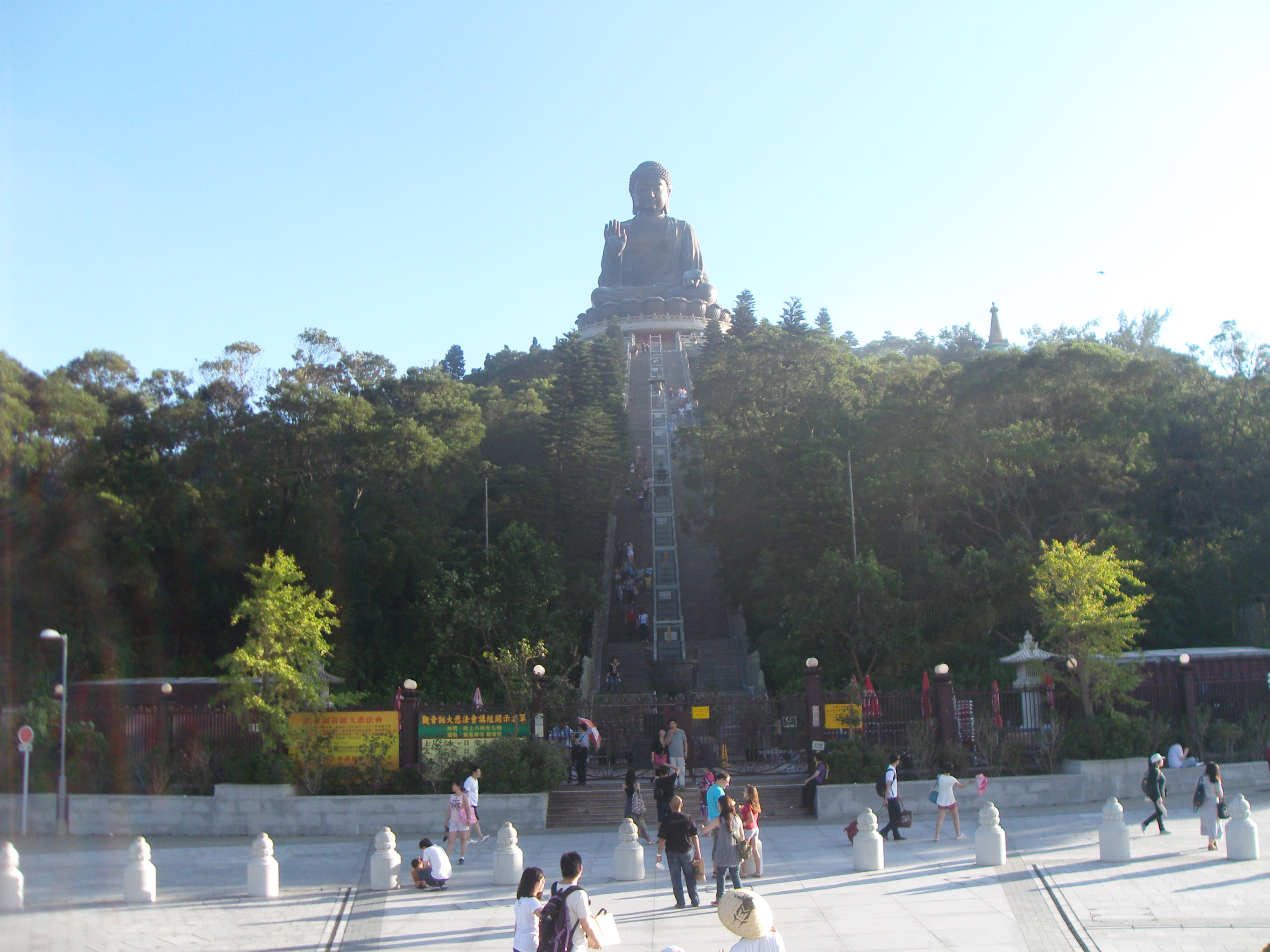
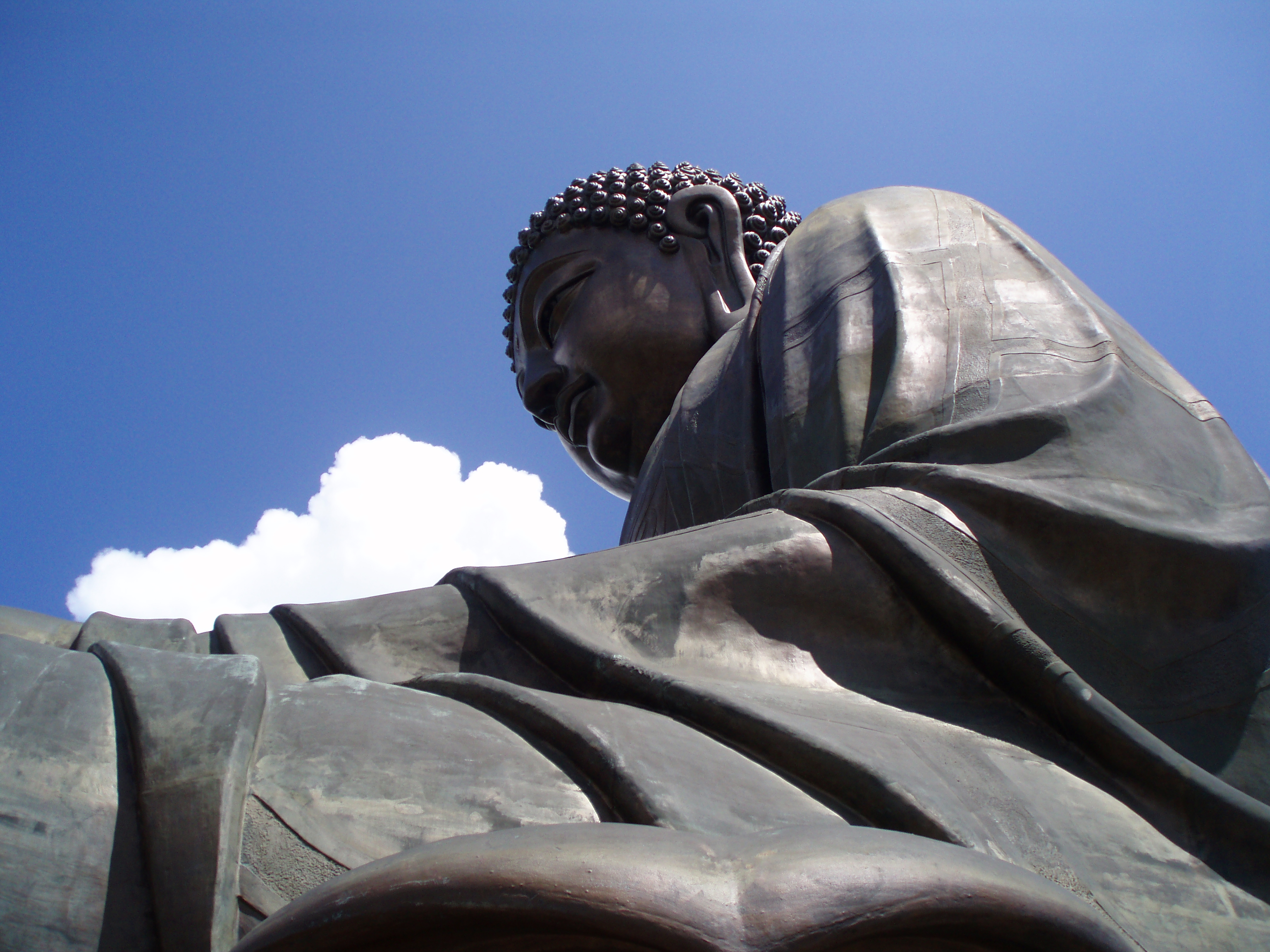
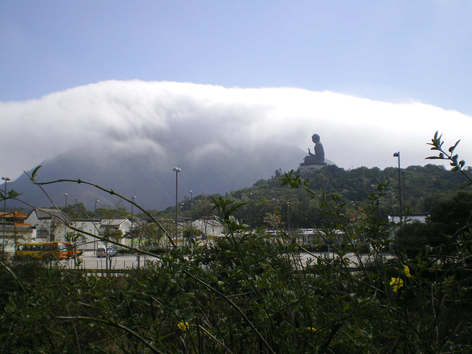
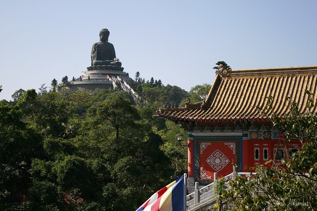
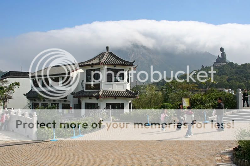
 
Tai O 大澳 is a fishing town located on the western side of Lantau Island 大嶼山 is known as "Venice of Hong Kong''. It's a must visit for locals and foreign tourists. It's not too far from HK International Airport in 赤鱲角 and visitors from Kowloon, HK or other locations can use ferries or road links to reach the relaxation heaven - with no modern facilities and traffics.


Location of Tai o
LCOM+hk+map+(1).bmp


A bridge from Tai O San Ki to the island between the stilt houses. Notice the bridge can be raised when tall sails come by
Tai_O_San_Ki_Bridge.jpg


Waterside views of the town
Tai-O-stilthouses.jpg


tai_o4578.jpg


060222_Tai-O_1.jpg


tai_o4648.jpg


TaiO720p.jpg


Wooden_bridge_in_Tai_O.jpg
 
@ Monk:香港的华丽转身 Beautiful metamorphsis of Hong Kong !

and the places are well kept, fairly clean and tidy! Good job!

CC%2BNZ-Melbourne-Sydney-HongKong%2B%2528Tai%2BO%2529%2B565.JPG


RIMG8490.jpg


HK_Tsing_Yi_Promenade_view1.jpg
 
Lantau Island 大嶼山


Lantau Island 大嶼山 belongs to the island district and is the biggest island in HK. It's almost twice the size of HK Island, which lies on the east. The island is mostly mountainous and dominates by lantau Peak 爛頭 934m, 2nd high in HK after Tai Mo Shan 大帽山 957m and twice the height of Victoria Peak. The other peaks are Sunset Peak 大東山 869m, Lin Fa Shan 蓮花山 766m and Nei Lak Shan 彌勒山 751m. The Island is sparsely populate with only 45,000 and is called the lung of HK because of that and the greenery. We already visited Tai O, which lies on the west end of the island, so let's check out other notable places in the island.


A map of HK in relative to China with Lantau Island in red
Lantau%20Island%5B4%5D.jpg


Here a map of Lantau with HK International Airport in Chep Lap Kok (on partial reclaimed land) on the northern shore and Lantau Link (roads and bridges link for trains and cars) from other areas in HK/Kowloon/New Territory to the airport and the island. Of course there are many 2-way ferry services as well.
742px-Concept_Plan_for_Lantau.jpg


Lantau Peak with Tian Tan Buddha 天壇大佛 on the foreground
Lantau_Peak%2C_Hongkong.jpg


View from the top of Lantau Peak with Tung Chung new Village on the right, HK Internatinal Airport in the middle and Castle Peak 青山 (sharp pointed peak) across the channel. A little further north would be Shenzhen, China
HK-Lantau-Lantau_Peak.jpg


Sunset Peak 大東山 869m, Yat tung Estate in the foregroung and Ngong Ping 360 昂坪360 skyrail above
Yat_Tung_Estate_1.jpg


View of Nei Lak Shan 彌勒山 751m from Po Lin Monastery parking lot
Nei_Lak_Shan_2.jpg


Lantau mountain scene
Lantau_Trail-02b.jpg


a mountain trail
lantau-trail.jpg
 
Lantau Island 大嶼山


Tian Tan Buddha 天壇大佛 s a large bronze statue of a Buddha Amoghasiddhi, completed in 1993, and located at Ngong Ping, Lantau Island, in Hong Kong. The statue is located near Po Lin Monastery and symbolises the harmonious relationship between man and nature, people and religion. It is a major centre of Buddhism in Hong Kong, and is also a popular tourist attraction. The statue is 34m tall and was the world tallest bronze seated Buddha until 2007. Visitors have to climb 240 steps of the three-platform altar in order to reach the Buddha.


Frontal view of Tian Tan
Tian_Tan_Buddha.jpg


View from the upper platform
Tian_Tan_Buddha_Face.jpg


Lantau-Giant-Buddha-a18411744.jpg


4269649-profile-tall-budda-statue-on-top-of-a-hill-on-lantau-island-hongkong.jpg


View of Buddha from near the Ngong Ping 360 station.
Buddha_from_first_platform.jpg


Buddhistic statues praising and making offerings to the Tian Tan Buddha
BuddhisticStatuesHKe1.jpg


1.6.1.4.2-New-Lantau-Island-Tour_03.jpg


LantauIslandStatueView.jpg
 
Lantau Island 大嶼山


The Ngong Ping 360 昂坪360 is a tourism project on Lantau Island. It consists of Ngong Ping Cable Car, Ngong Ping 360 Skyrail and Ngong Ping Village, a highland village. Ngong Ping 360 serves to connect Tung Chung, on the north coast of Lantau and itself linked to central Hong Kong by the Tung Chung rail line, with the Ngong Ping area in the hills above. This is home to the Po Lin Monastery and the Tian Tan Buddha.


A map of Ngong Ping 360
Ngongping360_sameboat.png


Ngong Ping 360 begins in Ngong Ping village's Po Lin Monastery with Tian Tan Buddha off the picture. Lantau Peak in the background
Ngong_Ping_2009.jpg


Tung Chung Station
Ngong_Ping_360-_Returning_to_Tung_Chung.JPG


HK International Airport angle Station
Airport_angle_station.jpg


Passing through the Tian Tan Buddha
Ngong%20Ping%20Cable%20Car_3.jpg


My knees are buckling, Man!
20100823173700__dsc03634_ngong_ping_360.jpg


Hold on to me please!
Ngong_Ping_360.JPG


See through interior floor. Where's the seat belt?
NG360_transparent.jpg
 
Great work Fanling Monk, keep it up! :woot:

Regarding the Cable cars, I remember when I was very young, we once went to Ocean Park and got stuck on the Cable cars!!

We were in the Cable car when the entire line stopped working. We were stuck halfway across, hovering in the air for about an hour and a half, lol. :lol:
 
Lantau Island 大嶼山


Po Lin Monastery 寶蓮禪寺 is a Buddhist monastery located in Ngong Ping Plateau, as well as Tian Tan Buddha, Ngong Village and Ngong Ping 360. The monastery was found by three monks and was known simply 大茅蓬 and was renamed to its present name in 1924. In 1918, three nuns ordained at this monastery established a private nunnery called Chi Chuk Lam (紫竹林) on Lantau's Lower Keung Hill (下羌山). The nunnery, dedicated to Guanyin.


A map of Ngong Ping Plateau
4052506793_393f31ec08.jpg


A 15 minutes walk from Ngong Ping Piazza through the forest's Wisdom Path
WisdomPath.jpg


The Paifang 牌坊, entrance gate of Po Lin Monastery
PoLin-1.jpg


A view of the Paifang from the steps of Tian Tan
PoLin-4.jpg


Frontal view of Po Lin
Po-Lin-Monastery.jpg


Front court incense pot
Incense_pot_at_Po_Lin_Monastery.jpg


The Buddhas
po-lin-monastery-photo_1164080-770tall.JPG


The Buddhas and the believers
Po_Lin_Monastery_3.jpg
 
Lantau Island 大嶼山


The monastery and the Tian Tan Buddha
4148066366_3c1810a59b_z.jpg


Vegetarian restaurant inside Po Lin
IMG_7473+(Edit).jpg


More incense burning
Sweet_Lemon_tree_in_Po_Lin_Monastery.jpg


Another section of the courtyard
Po_Lin_Monastery_9.jpg


A golden Buddha
Sakyamuni+Buddha,+Hall+of+the+Great+Herot,+Po+Lin+Monastery,+Lantau+Island,+2+April+07.jpg


Interior roof
6+The+Interiors+of+Po+Lin+Monastery%252C+Lantau+Island+Hong+Kong.jpg


Overhead view
Po%20Lin%20Monastery%203082.jpg


Another interior look
Po+LIn+Buddish+Monastery+Interior+11.jpg
 
Lantau Island 大嶼山


Ngong Ping Village, besides having all the attractions we mentioned above, also is the starting gate for hiking to the Lantau Peak
Ngong_Ping_Village01.jpg


Close proximity of Tian Tan Buddha
Ngong-Ping-Village-Copy.jpg


As well as the Po Lin Monastery
Ngong_Ping_Village.JPG


Easy access
NP360_1-TR.jpg


Ngong%20Ping%20Cable%20Car_3.jpg


Many sidewalk cafes with NO CARS or bicycles
6868536181_fc4c475daa_z.jpg


6868536999_8dc2af0924_z.jpg


Thousand year old trees
6868549109_635c0cc1da_z.jpg
 
Lantau Island 大嶼山


Ngong Ping Village
PoLin-8.jpg


PoLin-6.jpg


A roof top view on foggy mountain
ngong-ping-lantau-peak-clouds.jpg


Street scene
208891_4315038914589_1701761687_n.jpg


Photo secession
524081_4315040434627_1159491529_n.jpg


hk_12.JPG


Classy hotel (not much commercial signs anywhere)
IMG_1148-1024x768.jpg


Expanding.......
20051204-NgongPing17-600.jpg
 
Lantau Island 大嶼山


Hong Kong Disneyland in Lantau 香港迪士尼樂園 is located on reclaimed land in Penny Bay, eastern Lantau, easy access from the Lantau Link (cars and trains) from Ma Wan Island. The property is owned and operated by HK International Theme Park and open on Sept 12, 2005.

The park consists of six themed areas: Main Street, U.S.A., Fantasyland, Adventureland, Tomorrowland, Grizzly Gulch and Toy Story Land.


Subway map to Disneyland
mtr-map.jpg


Easy access again- the trick of Walt
there-are-no-proper-hiking-trails-on-the-right-mountain-big-compressed.jpg


View of Disneyland with Kowloon (left) and HK Island (right) on the background.
hong-kong-disneyland-with-both-kowloon-and-hong-kong-in-the-background-big.jpg


HK Disneyland entrance
hong-kong-disneyland-entrance-big-compressed.jpg


Main Street
main-street-big-compressed.jpg


Sleeping Beauty Castle with fireworks on the background
Disney_in_star.jpg


International Parade Day
HK_Disneyland_parade_4_by_Dave_Q.jpg


More coming...... by the Hotel
hong-kong-disneyland-expansion-june-2011-big-compressed.jpg
 

Back
Top Bottom