How to install the app on iOS
Follow along with the video below to see how to install our site as a web app on your home screen.
Note: This feature may not be available in some browsers.
You are using an out of date browser. It may not display this or other websites correctly.
You should upgrade or use an alternative browser.
You should upgrade or use an alternative browser.
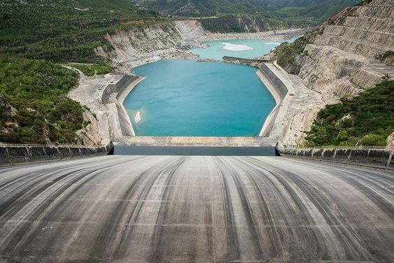
Pictures from Hazara. KPK
- Thread starter ghazi52
- Start date


ghazi52
PDF THINK TANK: ANALYST

- Joined
- Mar 21, 2007
- Messages
- 101,794
- Reaction score
- 106
- Country

- Location


ghazi52
PDF THINK TANK: ANALYST
- Joined
- Mar 21, 2007
- Messages
- 101,794
- Reaction score
- 106
- Country
- Location


ghazi52
PDF THINK TANK: ANALYST
- Joined
- Mar 21, 2007
- Messages
- 101,794
- Reaction score
- 106
- Country
- Location
amazing place haripur, lush and green
My district Headquarter.
[Bregs]
SENIOR MEMBER

- Joined
- Aug 11, 2013
- Messages
- 6,156
- Reaction score
- 2
- Country

- Location
My district Headquarter.
wow dream place to be born in
ghazi52
PDF THINK TANK: ANALYST
- Joined
- Mar 21, 2007
- Messages
- 101,794
- Reaction score
- 106
- Country
- Location

ejazmamuok
FULL MEMBER
New Recruit
- Joined
- May 20, 2017
- Messages
- 1
- Reaction score
- 0
- Country
- Location
Amazing photography. I think this subcontinent is best portion in the earth with full natural beauty. Explore the various part of Indo Pakistan I think many natural places are real dreamland. These are best place to bring our youth in these type of areas & make the true and full of amusement educational trips.

ghazi52
PDF THINK TANK: ANALYST
- Joined
- Mar 21, 2007
- Messages
- 101,794
- Reaction score
- 106
- Country
- Location


ghazi52
PDF THINK TANK: ANALYST
- Joined
- Mar 21, 2007
- Messages
- 101,794
- Reaction score
- 106
- Country
- Location
Hazara ہزارہ
Hazara (Hindko: هزاره, Urdu: ہزارہ) is a region of the Khyber Pakhtunkhwa province of Pakistan. It comprises six districts: Abbottabad District, Battagram District, Haripur District, Kohistan District, Mansehra District and now, since 28 January 2011, the new Tor Ghar District. It is a region that has many languages and ethnicities.
History
"The origin of the name Hazāra is obscure." This respected source continues: "It has been identified with Abisāra, the country of Abisares, the chief of the Indian mountaineers at the time of Alexander's invasion.
The name Hazara has also been derived from Urasā, or 'Urasha', an ancient Sanskrit name for this region, according to Prof. Aurel Stein. Some distinguished Indologists including Dr H. C. Raychaudhury, Dr B. N. Mukerjee, Dr B. C. Law, Dr J. C. Vidyalankar, Dr M. Witzel, Dr M. R. Singh and Prof K. N. Dhar concur with Prof. Stein's identification of modern Hazara with ancient Urasa.
Evidence from the seventh century Chinese traveller Hiuen Tsang, in combination with much earlier evidence from the celebrated Indian epic, the Mahabharata, attests that Poonch and Hazara District of Kashmir had formed parts of ancient state of Kamboja, whose rulers followed a republican form of government.
Although the region was called Hazara earlier, it was only made a district of that name, when under the British.
History since Alexander
Alexander the Great and Ashoka
Alexander the Great, after conquering parts of the Northern Punjab, established his rule over a large part of Hazara. In 327 B.C., Alexander handed this area over to Abisaras (Αβισαρης), the Raja of Poonch state.
Hazara remained a part of the Taxila administration during the rule of the Maurya dynasty. Ashoka the Great was the Governor of this area when he was a prince. After the death of his father Bindusara around 272 B.C., Ashoka inherited the throne and ruled this area as well as Gandhara. Today, the Edicts of Ashoka inscribed on three large boulders near Bareri Hill serve as evidence of his rule here. The Mansehra rocks record fourteen of Ashoka's edicts, presenting aspects of the emperor's dharma or righteous law, and represent the earliest irrefutable evidence of writing in South Asia. Dating to middle of the third century BC, they are written from right to left in the Kharosthi script.
Hazara has several places of significance for the Hindus related to the Pandavas.
“ 'There are the five Pandavas, the heroes of the Mahabharat favourite objects of worship in the east and sometimes addressed as the Panj Pir. Many are the legends current about these heroes and they are localised at quite a number of places. The Hill of Mokshpuri, just above Dunga Gali has an elevation of 9232 feet. Its name means 'the hill of salvation' and on its summit is a Panduan da Sthan, or place of the Pandavas, where it is said they were visited and tempted by Apsaras who still frequent the place ."
In the 2nd century CE, a mythical king Raja Risalu, son of Raja Salbahan of Sialkot, supposedly brought the area under his control. The local people consider him as a popular folk hero. When a Chinese pilgrim, Hiun-Tsang, visited this area, it was under the control of Raja Durlabhavardhana, the ruler of Kashmir.
The Shahi Dynasties ruled Hazara one after another. Among the Hindu Shahi dynasty rulers, Raja Jayapala is the best known. Mehmood of Ghazni defeated Raja Jayapala during his first campaign. However, there is no historical evidence that Mehmood of Ghazni ever visited or passed through Mansehra. After the fall of the Shahi dynasty, in the 11th century, the Kashmiris took control of this area under the leadership of Kalashan (1063 to 1089). From 1112 to 1120, King Susala ruled this area. In the 12th century, Asalat Khan captured this area but soon after Mohammad of Ghor's death the Kashmiris once again regained control of Hazara.
Amb and its surrounding areas of Hazara have a long history which can be traced to Alexander the Great's invasion of India. Arrian, Alexander's historian, did not indicate the exact location of Embolina, but since it is known that Aoronos was on the right bank of the River Indus, the town chosen to serve as Alexander's base of supplies may with good reason be also looked for there. The mention in Ptolemy's Geography of Embolima as a town of Indo-Scythia situated on the Indus supports this theory.
In 1854 Major James Abbott, the British frontier officer from whom Abbottabad, administrative centre of Hazara, takes its name, discussed his location of Aornos on the Mahaban range south of Buner. He proposed, as M. Court, one of Ranjit Singh's French generals had done before him in 1839, to recognize Embolima in the present village of Amb situated on the right bank of the Indus. It lies about eight miles to the east of Mahaban and is the place from which the later Nawabs of Amb take their title.[8]
Turk rule
Akbar as a boy around 1557
In 1399, the Muslim warrior Timur, on his return to Kabul, stationed his Turk soldiers,( who belonged to a sub-tribe of Turks, called Karlugh Turks) in Hazara to protect the important route between Kabul and Kashmir. By 1472, Prince Shahab-ud-Din came from Kabul and established his rule over the region. Prince Shahab-ud-Din, a Turk of central Asian origin and a descendant of Amir Taimur, founded the state and named it Pakhli Sarkar and chose the village of Guli bagh as his capital.
During the period of Mughal rule, local Turkish chiefs acknowledged Mughal authority. In fact, Mansehra (Pakhli) provided the main route to Kashmir and was the most commonly used route for Emperor Akbar to travel to Kashmir.
In the 18th century, Turkish rule came to an end due to the increased aggression of the Swathis and their allied forces. The most crucial attack was that of the Swatis in collusion with Syed Jalal Baba in 1703. Syed Jalal Shah was the son in law of the last ruler of Turkic dynasty, Sultan Mehmud Khurd. During the absence of the Sultan Mehmood Khurd, Syed Jalal Shah (Jalal Baba) took advantage of the his father in law's absence, conspired with Swatis and invited them to invade (Pakhli Sarkar).They succeeded to overthrow the Turkish rulers from the Sarkar. Thus Swatis ousted the Turks and captured this area. The descendants of this Turkic dynasty still live in vRevolt of Sultan Maqarrab
Sultan Maqarrab revolted against his own brother Sultan Mehmud Khurd, but was defeated by the Sultan due to intervention from the Delhi Sultanate. But this incident weakened the Turks permanently and they could never restore their previous strength. Karlal tribe gained strength and Jadun tribe came from across the river Indus to hasten the overthrow of the Turks. Ultimately, Jadoons from Swabi subjugated the Rush areas.
Durrani rule
Hazara remained part of the Durrani Afghan kingdom, from the mid-18th to the early 19th centuries. The lower Hazara plain was a separate administrative region attached to the Chacch and Attock areas of Northern Punjab whereas most of upper Hazara was attached to the Durrani 'Subah' or governorship of Kashmir, with the exception of the Tanawal 'Ilaqa' or area, which enjoyed independent status. The most important Tanoli chief then, Mir Navab Khan, fought the Durranis in a number of small battles and ultimately met his death at the hands of Sardar Azim Khan Durrani in 1818.
Sikh rule
Durrani rule had weakened considerably at the beginning of the 19th century. The Sikhs annexed Hazara in two stages. Lower Hazara except Karlal country became tributary to the Sikhs, with the exception of the ongoing struggle against the Sikhs led by the likes of Sardar Muhammad Khan Tarin, Shaheed, Bostan Khan Tarin and others of this tribe .Eventually, Ranjit Singh himself then attacked Hazara and reduced the warring tribes into submission, carrying the Tarin chief Muhammad Khan with him, as a prisoner, while the Karlals fled to the higher mountains for refuge; and the Sikhs were thus able to subdue the entire Lower Hazara . The Upper Hazara suffered a similar fate when the Sikhs took Kashmir from the Barakzai Durranis in 1819, with the exception of the Tanawal area, under the leadership of Mir Painda Khan, who was the tribal chief of the Hindwal section of Tanolis at the time and kept up a staunch rebellion against Maharaja Ranjit Singh's Governors of Hazara, which he continued after most of the resistance had gradually ceased in other parts from about 1819,and his son Mir Jehandad Khan later followed in his footsteps, and when Sikh power was on the decline in 1845 Jehandad Khan blockaded the garrisons of no less than 22 Sikh posts in Upper Tanawal ; and when they surrendered, he spared their lives, as the servants of a fallen Empire. These Tanoli chiefs were the actual founders of Amb (princely state).
British rule
After the First Sikh War, under the terms of the Treaty of Lahore, the area was governed by Major James Abbott. Abbott managed to secure and pacify the area within a year. During the Second Sikh War Abbott and his men were cut off by the Sikh army from supplies and reinforcements from the rest of the British Army, but were able to maintain their position.[9] James abbott was helped by few well known personalities of that time most prominently Qazi Abdul Ghafar, a man of immense energy, who rendered valuable service to Major Abbott in the critical years of 1847-49. He was made Tahsildar in Hazara.
By 1849, the British had gained control of all of Hazara. However, the western Pashtun tribes were occasionally rebellious. These tribes included the clans of Allai, Batagram in the Nandhiar valley, and the The Black Mountain (Tor Ghar) Tribes.The British sent many expeditions against these tribes to crush several uprisings between 1852 and the 1920s.
The British divided Hazara District into three Tehsils (administrative subdivisions) : Mansehra, Abbottabad, and Haripur and annexed it to the Punjab. In 1901, when the North-West Frontier Province (now Khyber Pakhtunkhwa) was formed, Hazara was separated from Punjab and made a part of NWFP. Throughout their rule in Mansehra, the British met fierce resistance from the local tribes and declared martial law. Meanwhile, the people of Mansehra's many villages largely governed themselves. Many of Mansehra's citizens joined the Khilafat movement and several were imprisoned for this.
ghazi52
PDF THINK TANK: ANALYST
- Joined
- Mar 21, 2007
- Messages
- 101,794
- Reaction score
- 106
- Country
- Location
From the 1930s on wards, the people of Hazara gradually became active in the freedom movement for an independent Pakistan under the active leadership of renowned All India Muslim League leaders such as Khan Bahadur Jalal-ud-din Khan a.k.a. Jalal Baba, Khan Sb Abdul Majid Khan Tarin, OBE, of Talokar (1877–1939), who remained a close friend and associate of Sahibzada Sir Abdul Qayyum Khan, and an early member of the (then) Frontier Legislative Assembly, and others. Even before the All-India Muslim League started its movement for Pakistan in 1937, after the historic Lucknow Session of October that year, the Hazara Muslim League was properly formed and convened at the residence of Noor-Ud-Din Qureshi in Abbottabad in 1936. In this meeting the leaders of the All-India Muslim League, Nawab Bhadur Yar Jang, Mulana Shoukat Ali, Hamid Badayuni and others, came from India. The local people joined the movement in large numbers. In Mansehra in the same year the Muslim League was organised by Ali Gohar Khan and Hakim Abdul Karim, who were elected the first president and general secretary of the tehsil Mansehra Muslim League. During the final phase of the movement for the creation of Pakistan, Capt Sardar Zain Muhammad Khan, OBI, and Khan Bahadur Jalal-ud-din Jalal Baba defeated their Congress rivals in the elections of 1946 from their respective rural and urban Constituencies, and politically routed the All India Congress from the region. Due to active involvement of Jalal Baba. the Muslim League captured all the Hazara District assembly seats except one in the crucial elections of 1946 against the than ANP who wanted to accede with India. In the Delhi Convention of Muslim League parliamentarians chaired by Quaid-e-Azam Muhammad Ali Jinnah, which finally voted for the division of India and the creation of Pakistan, Capt Sardar Zain Muhammad Khan(Chief of Karlal Tribe and father of Late Sardar M-Aslam Senetor of PPP and its founding member) represented Hazara. These Muslim League Leaders were also able to mobilize the people of this area in favour of the referendum for the creation of Pakistan.
Sometime before the time of Partition/Independence, Nawab Sir Muhammad Farid Khan (KBE) of Amb State developed good relations with Jinnah and Nawabzada Liaqat Ali Khan. His contributions to the Pakistan movement have been acknowledged in letters from Jinnah.
Independence
During British rule, the region of Hazara had formed part of Punjab province, until the western parts of that province were separated to form the new NWFP. The areas around Abbottabad and Mansehra became the Hazara District of Peshawar Division, whilst areas to the north of this became the Hazara Tribal Agency and the Kohistan Tribal Agency. Sandwiched between Hazara Tribal Agency and Hazara District were the small princely states of Amb and Phulra. This system of administration continued until 1950, when these two small states were incorporated into the Hazara district.
arious parts of Hazara, such as (Behali), Manakrai, Girwal, Mohar etc.
Decline and fall of Karlugh Turks
The last Karlugh Turks ruler of Pakhli Sarkar was Sultan Mehmud Khurd. One of his brothers, Sultan Qyas-ud-din, was Wali-e-Tanawal (Lower), and the Wali-e-Tanawal (Upper) was Sultan Sahwaj. His brother Sultan Muqarrab was Wali-e-Dhamtor, i.e. Rush areas of present Abbottabad. Pakhli Sarkar had two other important governorships. One in the areas between Battagram and Thakot ruled by Shamsher Khan and other of Kashmir governed by Sultan Kamal. Both of these governors were close relatives of Turk rulers of Pakhli Sarkar. At that time Kashmir was part of Hazara PakhliSarkar.
The introduction of Sikh rule into Hazara, commenced after 1818. In this year Kamal Khan, Turk, of Manakrai, murdered his fellow-chieftain, Hashim Khan (Karlugh)who was also known as Hashim Khan lakhay in order to grab throne. Hashim Khan was the son of the ruler Malook khan and grandson of Sultan Mehmood Khurd. Hashim Khan was ruler of appx. 84 villages which were later snatched by the Britishers. The latter's cause was espoused by the Tarin chief, Muhammad Khan, Mohammed Khan Tareen helped Kamal Khan to over threw Hashim khan who was the son of Ruler. Then Hashim Khan took help of one of his sikh friend general and conquered mankray again and took back his throne and killed Kamal Khan. At his invitation Makhan Singh, the Sikh Governor of Rawalpindi, invaded Hazara with 500 sowars, built a fort at Serai Saleh, and levied tribute from the Haripur plain. Note that Hashim Khan later died in British custody, all of his jahgeer ws snatched and his son Hayat Khan was given 1000 rupees at that time as expense by the British. From 1955 to 1970, NWFP province became part of West Pakistan under the One Unit policy, with the Hazara district forming part of the Peshawar division of West Pakistan.
Kashmir conflict
Kashmir was the first biggest challenge for Pakistan, right after Pakistan's creation; the Maharaja of Kashmir, signed the Instruement of Accession of his state 'Jammu and Kashmir' in favor of India. This was not acceptable to the Muslim majority Pakistan. Thus Pakistan Army infiltrates it's soldiers to Kashmir. From Hazara Nawab Muhammad Farid Khan sent an army of 1500 Amb State soldiers under the leadership of Subedar Major Shah Zaman Khan to take part in the Kashmir Liberation Movement from 1947 to 1948 (Kashmir Conflict). The Amb State force carried its own artillery to the battle. They fought bravely alongside other frontier tribesmen and came under fire by the Indian airforce just three kilometers from Baramulla sector. Around 200 Amb State soldiers lost their lives in the battle. Kashmir Conflict is still under dispute.
Hazara Division.... 1970-2000
On the dissolution of West Pakistan in 1970, Hazara District and the two tribal agencies were merged to form the new Hazara Division with its capital at Abbottabad. The division was initially composed of three districts (Abbottabad, Kohistan and Mansehra) but within a few years, Haripur district was spun off from Abbottabad District and Batagram District was spun off from Mansehra District.
Hazara remained a District right up to its conversion into a Division in 1976. In October 1976, Mansehra was given the status of a full fledged District, which consisted of Mansehra and Batagram Tehsils. Subsequently in July 1991, Haripur Tehsil was separated from Abbottabad and made into a District. Thus only the old Tehsil of Abbottabad remained, which was declared as Abbottabad District.
In 2000, administrative divisions were abolished and the fourth tier districts were raised to become the new third tier of government in Pakistan.
Geography and climate
Hazara is bounded on the north and east by the Northern Areas and Azad Kashmir. To the south are the Islamabad Capital Territory and the province of Punjab, whilst to the west lies the rest of Khyber Pakhtunkhwa. The river Indus runs through the division in a north-south line, forming much of the western border of the division. The total area of Hazara is 18,013 km².
Because it lies immediately south of the main Himalaya Range, and is exposed to moist winds from the Arabian Sea, Hazara is the wettest part of Pakistan. At Abbottabad, annual rainfall averages around 1,200 millimetres (47 in) but has been as high as 1,800 millimetres (71 in), whilst in parts of Mansehra District such as Balakot the mean annual rainfall is as high as 1,750 millimetres (69 in) . Due to its location on the boundary between the monsoonal summer rainfall regime of East Asia and the winter-dominant Mediterranean climate of West Asia, Hazara has an unusual bimodal rainfall regime, with one peak in February or March associated with frontal southwest cloudbands and another monsoonal peak in July and August. The driest months are October to December, though in the wettest parts even these months average around 40 millimetres (1.6 in) .
Due to the high altitude, temperatures in Hazara are cooler than on the plains, though Abbottabad at 1,200 metres (3,900 ft) still has maxima around 32°C (90°F) with high humidity in June and July. Further up, temperatures are cooler, often cooler than the Northern Areas valleys due to the cloudiness. In winter, temperatures are cold, with minima in January around 0°C (32°F) and much lower in the high mountains. Snowfalls are not uncommon even at lower levels.
Hazara lies close to the crossroads formed by the river Indus and the Grand Trunk Road. The Karakoram Highway begins at the town of Havelian and goes north through the division towards China via the Northern Areas.
ghazi52
PDF THINK TANK: ANALYST
- Joined
- Mar 21, 2007
- Messages
- 101,794
- Reaction score
- 106
- Country
- Location
Similar threads
- Replies
- 33
- Views
- 3K
- Replies
- 0
- Views
- 217