Đảo Bạch Long Vỹ;3244823 said:
Yeah yeah yeah finally you mean that Vietnamese Paracels is different with real Paracels

Before you start saying something that really hard to understand, list down your answer for all 6 of my points:
1) There is no near-coast archipelago which is big and far enough to be mistaken with the more noticeable Paracels. You have to show me an archipelago which is fitted to your argument. Why don't you just go to google maps and find an archipelago like that, capture your screen and post here?
If you can't find that archipelago on google maps or google earth, your argument is invalid.
2) Why don't they just go and draw the real Paracel instead of some near-coast island? It's an awkward moment when thousands of Westerners had gone around South China Sea for 400 years but all of them just "missed" the real Paracels "until the year xxxx". While they couldn't found the real Paracel, they found some less noticeable "near-coast islands" to draw in their maps. Hmm, poor Westerners
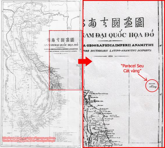
3) The French book "Traité élémentaire de géographie: contenant un abrégé méthodique du Précis de la géographie universelle en huit volumes" (volume 2) was published in Paris, 1831. Page 221 said that: "equal-spaced between Hainan and Cochinchina, Paracels archipelago was depended on Annam Empire". "A une egale distance de la cote de Cochinchine et de l'ile d'Hai-nan, l'archipel de Paracels est une dependance de l'empire d'Annam".
No near-coast islands in Central Vietnam is equal-spaced between Vietnamese coast and Hainan. So the archipelago which was drawn by Westerners is real Paracel, because in Central Vietnam only Paracel is equal-spaced between Hainan and Vietnamese coast.
You can also search for "Nuovo dizionario geografico universale", Venezia, 1831
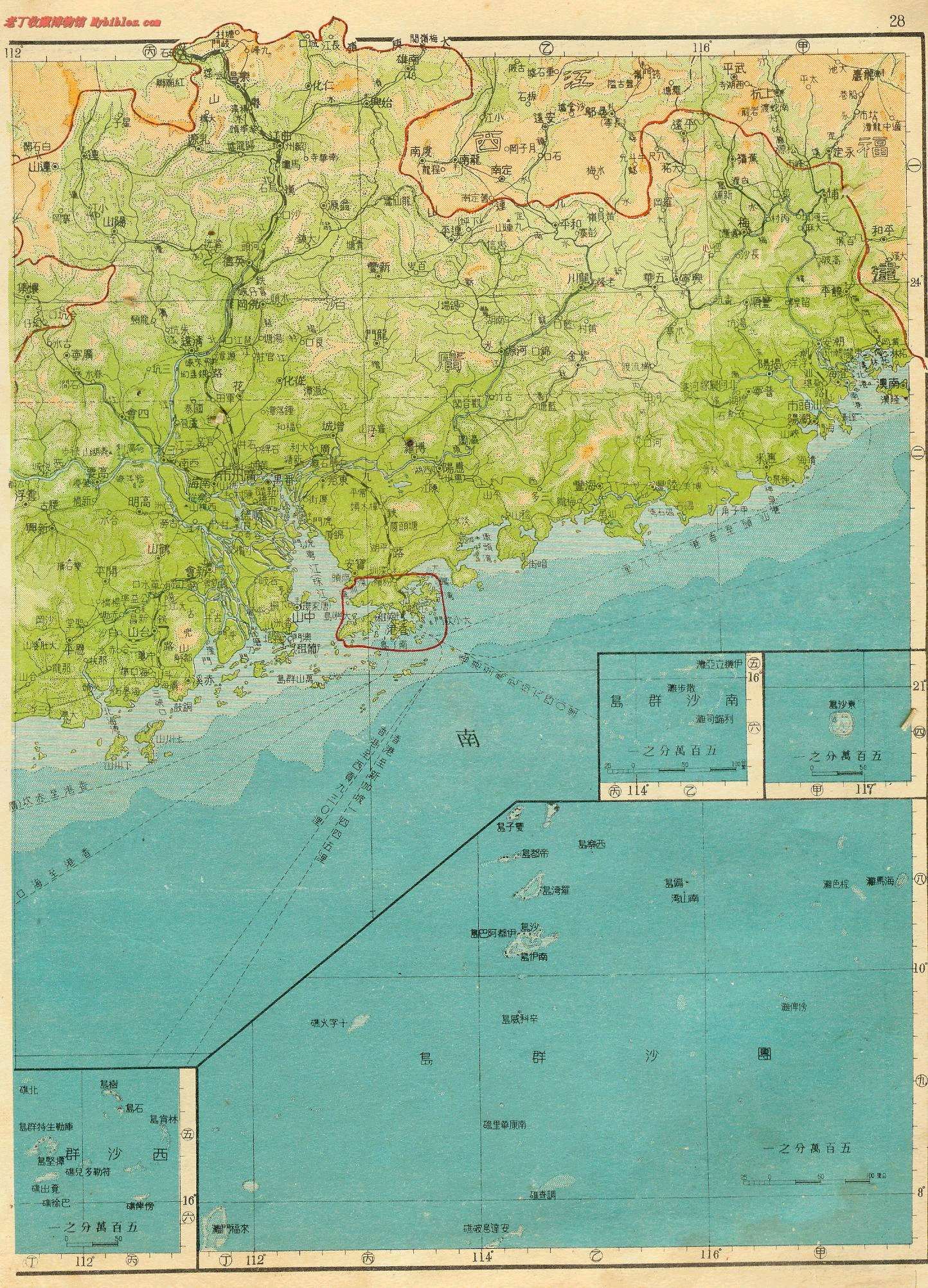
4) The map-drawing technique in that period was still poor, so the map can't provide the extract distance and size. They even drew Western Malaysia too close to Southern Vietnam than what it has to be. The size and appearance of the Gulf of Thailand is another problem. So some nautical miles different is not a big problem. When the technique was advanced, they drew the real distance:
Don't argue that Western Malaysia and Gulf of Thailand are not big problem. Other people will see it's a big problem or not. Just answer why the better-technique map in 1838 has the real distance?
5) Our Paracel Teams (Đội Hoàng Sa and Đội Bắc Hải, check our 1776 book) started their annual journeys from our near-coast islands to go to Paracel, and it took 3 days 3 nights to reach the Paracel in sailing season (windy season). For example, Ly Son island, just go and search it on google, oh if you have google there.
Why do they go to a "near-coast islands" from the same "near-coast islands" to "set sovereignty" at where they had already lived, and it took 3 days 3 nights in sailing season just to reach the same archipelago?
6) You said that the Paracel in Vietnamese maps is just "the near-coast island" in Central Vietnam, but that near-coast island even appeared in that map beside Paracel:
So,
your argument about "near-coast islands in the Central Vietnam" is invalid.
7) And finally, if you Chinese are confident in your "evidences", why don't go to an international court instead of this:
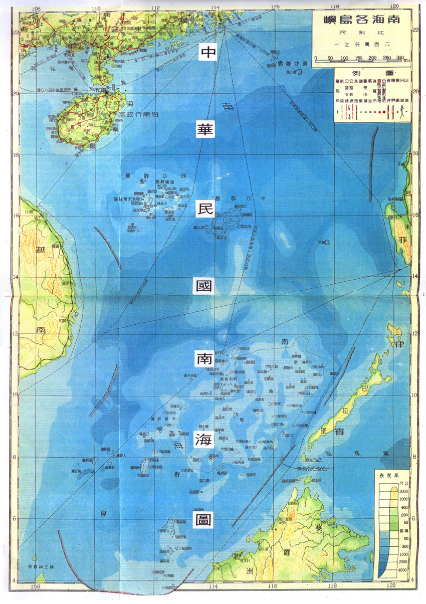
1.You are a fool ? When I say that the West 400 years did not find true of the Paracel Islands? I have already said very clearly: In 1613, the English captain discovered that the Xisha Islands, At that time he will Xisha Islands named "LES Lunet TES", The geographic coordinates: latitude 16 ° to 17 °, longitude 111 ° 30 'to 112 ° 42'. "Pracel" long region (central Vietnam coast, islands and sandbars), East to West Wide 106.5km, North-South length 500km, geographic coordinates: 12 ° ~ 16 ° 30 North, longitude 110 ° ~ 111 °. You need to use Google Maps, View them geographic coordinates where in the South China Sea!
2. Western countries define Pracel, Representative regions are different at different times. Before 1851,Western countries will be the bar area (central Vietnam coast, islands and sandbars) called "Pracel, After 1851, Western remove long strips of area, "Pracel" transferred to the Xisha Islands now. (See the previous Western map evolution)
3. France 1831 description "Pracel" for long region. This area: wide 106.5km long 500km. Use Google Maps to view the northern part of the region, To Vietnam and hainan island almost equal distance.
4. 1838 Map of Vietnam, Approximate outline of Vietnam can draw out, why only these two Islands and scale such a big difference? Vietnam to the actual distance of hainan island for more than 200 kilometers, the xisha islands to the actual distance for 300 km, to the distance to nansha more than 700 km, and the xisha islands to the spratly islands is more than 700 kilometres. If according to this map scale, Vietnam to the xisha islands distance to hainan island ,should be almost. Vietnam to the Nansha Islands in the distance, equal to the distance of two Vietnam to Hainan Island. The xisha islands to the distance of the nansha islands, More than Hanoi to Hoi An distance. If according to this ratio, the Vietnamese side as long as necessary, Can put the coast of Vietnam some islands , Apply to become Java and Timor. It is simply not yet reached the time.
5. In 1776, when Vietnam in coastal sailing ships, general is "紅船" or "田姑船", the ship is not only small, and the speed is slow. "紅船":其船體狹長,狀如龍舟,昂首尾丹漆之,船上不能容炊具,僅贮淡水一缸,船上掉軍赤體暴烈日中,渴則勺飲馁腹, Physical exertion, the speed is slow can be imagined. For example, in July 1795, Guangzhou monk da shan chang weng, "ready to return from Vietnam, Vietnamese officials are preparing a 40 ship田姑船" for his farewell. The monks Ride "红船", at noon on the 19th, set sail from Hoi An, until the next morning to arrive at the "占婆島", Ride "洋船". From "廣南江口" to "占婆島", a distance of about 12 km, more than Half a day, day and a half of the voyage can only go up to more than 30 km. Vietnam so-called the Xisha fleet, from now (Quảng Ngãi Bình Sơn) Departure: geographic coordinates: latitude 15 ° 22'51 ", longitude 109 ° 07'03, For three days and three nights to reach the Xisha Islands ", in fact, only sailed about 100 km.. From here through the Pracel the so-called Vietnam: "黃沙" and "萬里長沙", Need 197.5km, reach the Xisha Islands would need at least 250.75km.
6. It seems you do not have the exact geographical concept. Vietnam's most eastern longitude 109 ° 50 ', "Pracel", the so-called Vietnam: "sand" and "黃沙" and "萬里長沙", its geographical coordinates of longitude 110 ° to 111 °.Paracel Islands east longitude 111 ° 30 ' to 112 ° 42'. In this region, a longitude of approximately equal to 106.5km, In other words: Vietnam closest to the "黃沙" and "萬里長沙"17.75km, But do not forget, this long bar district wide 106.5km, Even if the Paracel Islands, also in this region in eastern 53km.
7. Many Chinese map is no Marked south China sea islands, because the Chinese territory too big, If the land and the sea to draw together, Can not show in detail the geographic profile of the South China Sea islands, We specialize in drawing the map of the South China Sea, Oath of China's sovereignty over the South China Sea Islands!
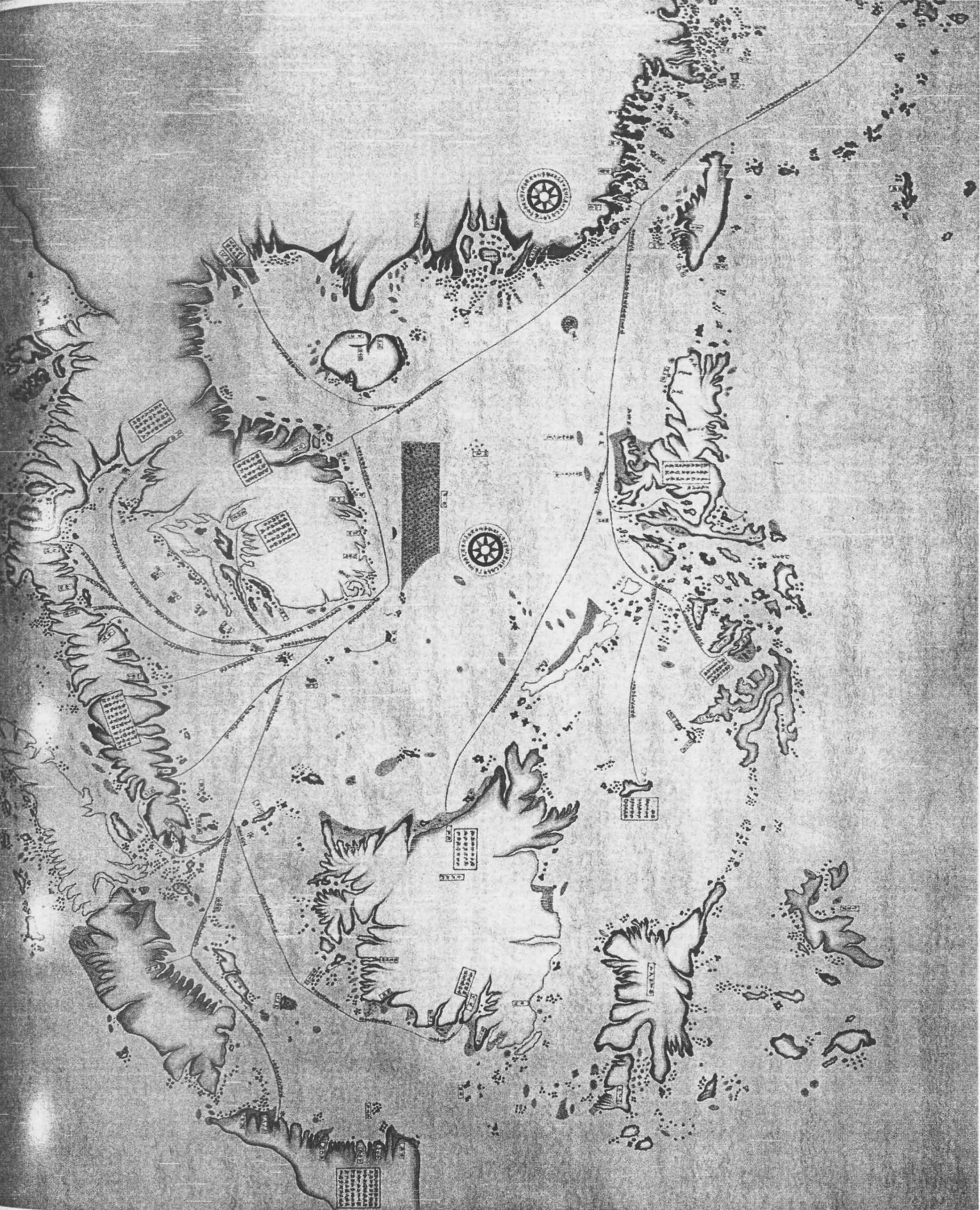
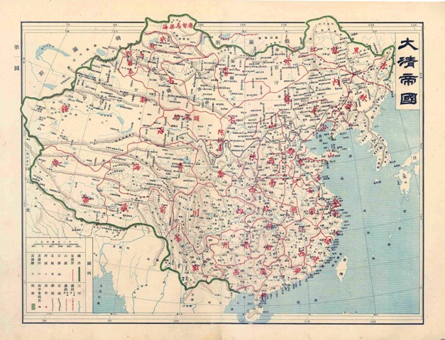
The Map of South and East Ocean Sea Routes was drawn in between 1712-1721 by Qing (Ching) Dynasty Fujian (Fuchien) Province Navy Commander Shi Shibiao, the son of a famous early Qing Dynasty Imperial Officer. This map shows clearly the sea routes, time and decriptions from Chinese coastal ports to Japan, Laos, Vietnam, Indonesia,Brunei, Cambodia and the Phinllipines. In this map, the locations and names of the Southern Sea Islands(Nanhai Zhudao) are very accurate. The map shows clearly Chinese sovereignty over the South China Sea Islands including Nansha Islands, Xisha Islands, Zhongsha Islands and Dongsha Islands.Also note the "long bar area" shown in this map which locates close to the Vietnamese coast, which clearly tells that the so called "Truong Sa" and "Hoang Sa" as shown in the 1838 "Complete Map of Unified Great Nam" are not the Nansha (Spratlys) and Xisha (Paracels) Islands of China at all, but refers to the Pullo Canton near the central Vietnamese coast, which was also once been identified as "dangerous group" and named Paracels before Paracels was used to refer to China's Xisha Islands later in the history.
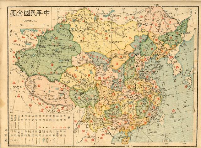
Republic of China 1935:
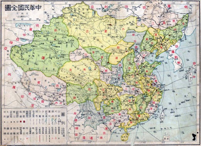
Republic of China 1937:
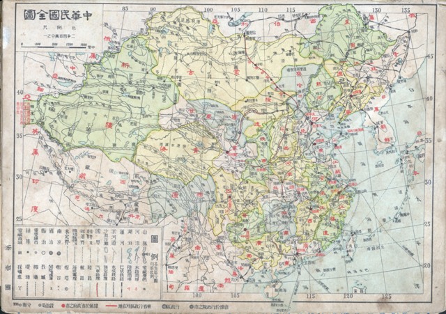
Republic of China 1946:
I personally do not support an international court.As the victors in World War I, China is fully justified reasons, Recovery of the German concession in Shandong, but because at that time China national small and weak, from western countries the manipulation of the Paris peace conference was prescribed by Japan in the shandong inherited Germany all right. Now though China began to rise, but western society has been looking for opportunities to contain China, China can't take the second risks, will Its own sovereignty, Handed over to the Western countries to control international court.


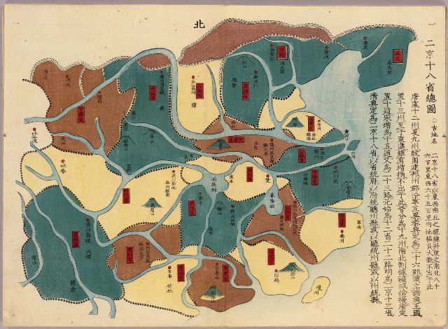
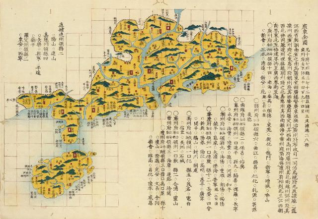
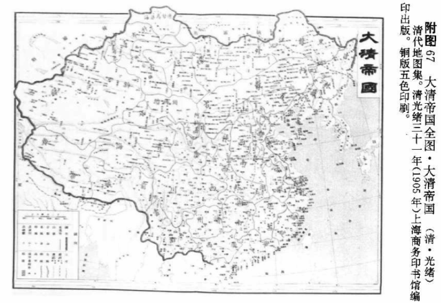
") in the book "清代地图集, 清光绪三十一年(1905年,上海商务印书馆编印出版
in the book "清代地图集, 清光绪三十一年(1905年,上海商务印书馆编印出版