thesolar65
SENIOR MEMBER

- Joined
- Jul 3, 2012
- Messages
- 4,922
- Reaction score
- -12
- Country

- Location
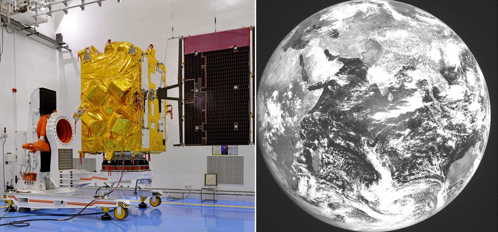
The satellite's imager captured the Earth disk on Wednesday. The image was widely shared on Twitter after ISRO shared it on the social networking site on Thursday. The images of Earth also has Moon in the background.
INSAT-3DR, which has been configured with an imaging system and an atmospheric sounder, was launched on-board GSLV-F05 powered by indigenous cryogenic engine on September 8. The rocket injected the satellite in the geostationary transfer orbit. It took another two days for the satellite to reach its final geostationary orbit after scientists fired its on-board thrusters.
The satellite multi-spectral imager can capture images of the Earth disk from an altitude of 36,000km once in every 26 minutes. It can provide information on various parameters like radiation, precipitation, sea surface temperature, snow cover, cloud motion winds. Images can be captured in six wavelength bands.

An atmospheric sounder on-board the satellite gives information on temperature, humidity and integrated ozone. There are also two transponders -- one for relaying data from automatic weather stations and rain gauges and the other for search and rescue purposes.
ISRO has also released a video of the GSLV-F05 launch captured by a camera onboard the rocket.
http://www.indiatimes.com/news/indi...nced-weather-satellite-insat-3dr_-261802.html


