What's new

Showing IOK Kashmir in Pakistan and Arunachal Pradesh in China: WSJ

Bravo Lion

FULL MEMBER
Joined
Sep 30, 2016
Messages
291
Reaction score
-4
Country
Pakistan
Location
Pakistan
The northeastern Indian state of Arunachal Pradesh, which China claims, seems included in China. Territory claimed by India in IOK Kashmir and Ladakh was also portrayed as belonging to China and Pakistan. :china::pakistan:


Indian newspaper publishes Chinese map- showing Indian Occupied Kashmir in Pakistan and Arunachal out of India- in China :yahoo::dance3: :china::pakistan::cheers::smitten:

r4G5ec6.png


http://blogs.wsj.com/indiarealtime/...nese-publishers-ad-sparks-social-media-storm/

@long_
 
Last edited:
The northeastern Indian state of Arunachal Pradesh, which China claims, seems included in China. Territory claimed by India in IOK Kashmir and Ladakh was also portrayed as belonging to China and Pakistan. :china::pakistan:


Indian newspaper publishes Chinese map- showing Indian Occupied Kashmir in Pakistan and Arunachal out of India- in China :yahoo::dance3: :china::pakistan::cheers::smitten:

r4G5ec6.png


http://blogs.wsj.com/indiarealtime/...nese-publishers-ad-sparks-social-media-storm/

@long_
Thank god!! Now Pak Army and Rangers can withdraw from their positions along the LoC. :)
 
Accurate map is always good to have. China and “India” never had more border talks than the 1962 conflict primed by Indian forward policy. Basically, what belonged to Tibetan and Qing Dynasty should be considered China's territory. We are friendly open for dialogues with India.

As everybody knows we support Pakistan position on Kashmir.

:pakistan::china:

:yahoo::china::pakistan::smitten::cheers::enjoy::welcome:
 
Accurate map is always good to have. China and “India” never had more border talks than the 1962 conflict primed by Indian forward policy. Basically, what belonged to Tibetan and Qing Dynasty should be considered China's territory. We are friendly open for dialogues with India.

As everybody knows we support Pakistan position on Kashmir.

:pakistan::china:

I would have loved it if China had annexed indian occupied Sikkim. This would have ended our geographical isolation. I hope you understand the implication of my post.
 
Its a " Paper Town " initiative
 
Pakistan has to work on this map, things just don't come true out of idle planning. India and her allies have always been working on another map even when Pakistan was not. So, sitting idly doesn't make sense.
We went just slow you haven't noticed

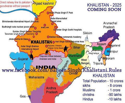
Khalistan, Naxals and many other things.
 
Khalistan Includes Pakistan Punjab as well

You dupe Khalistan only includes Indian east Punjab and cover up to Delhi and Mumbai, and they says our capital would be Delhi and provincial base would be Amritsar. Jay Khalistan Jay Khalsa :lol:

7387654738_e4445dc519.jpg
:cheers::lol:
 
Coming soon...........

Br82rd0CAAItSog.jpg

Bhai-Sukhwinder-Singh-Pappu-Gora-Bhai-Tarsem-Singh-Jatt-and-Unknown-KCF-Commandos-2.jpg


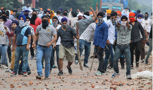
And in Jammu and Kashmir
jammu-and-kashmir-023.jpg

Sikh protesters blocked Jammu-Pathankhot National Highway today after there were clashes in the region on Thursday following violent clashes over removal of posters of Khalistani militant in Jammu city by Indian forces.
 

Back
Top Bottom