What's new

Gilgit-Skardu Strategic Highway (S-1)

ghazi52

PDF THINK TANK: ANALYST
Joined
Mar 21, 2007
Messages
101,794
Reaction score
106
Country
Pakistan
Location
United States
S-1 Strategic Highway

Maintained by National Highway Authority

Length:
167 km (104 mi)
Existed: 1982 – present

Major junctions

West end: Juglot
East end: Skardu

Strategic Highway 1 (S-1) or more popularly known as Gilgit–Skardu Road is a 167 km long .

Route

440px-Gilgit-Skardu_Road.JPG


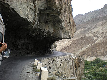
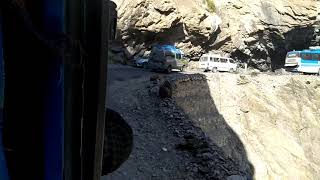
Dangerous Skardu Road

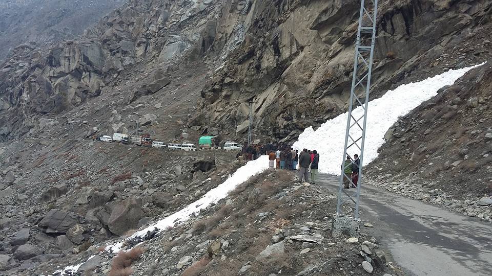
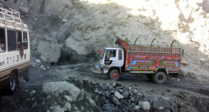
The highway begins south of Gilgit on the N-35 National Highway (Karakoram Highway), near Juglot, and extends eastwards towards Skardu city. Initially the surface was gravel, but over the years some sections were paved. The road is winding and in some places only wide enough for one vehicle to pass. On other parts of the highway it is bordered by a cliff drop of hundreds of meters unprotected by guardrails. Total travel time between Gilgit and Skardu is around 8 hours.

The highway can be blocked for weeks at a time depending on conditions (though two to five days is more common). The road ends in Skardu, the capital of Skardu District and Baltistandivision, at an elevation of 2,226 m (7,303 ft) above the sea level. It is one of the most dangerous roads in the world. The road has not been repaired since its construction.

It was constructed by Pakistan Army Engineers with the Association of Chinese Engineers in 1982.

Improvements and upgrades

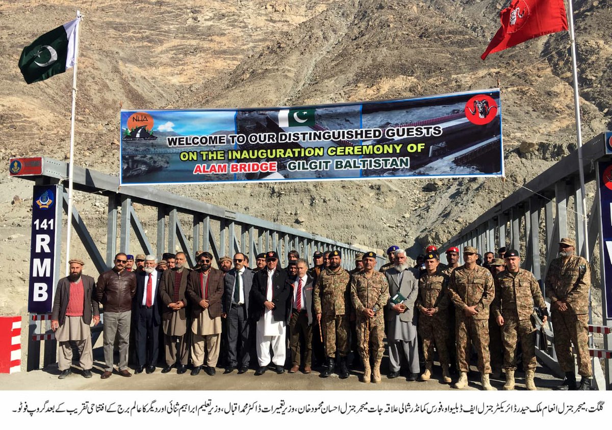
The Skardu Road Project has been facing delays since 2008. started in 2017.


Gilgit-Skardu-Proposed-Expressway-Route-Map.jpg
 
Road design includes five tunnels one of which is eight kilometers long. It will be completed with Rs. 33 Billion in Dec 2019.

26993822_1137941769675018_9216071779087600306_n.jpg


26991766_1611635102258635_6515626827741382988_n.png


27752268_796693223865183_7343403624750175576_n.jpg


27655116_796693100531862_8354070288870536254_n.jpg


27857977_796693120531860_1371379483021339466_n.jpg
 
Gilgit-Skardu Road

Gilgit-Skardu00.jpg

Gilgit - Skardu Road is a spectacular and dangerous mountain road located in Gilgit–Baltistan, Pakistan. The road is 167km long.

The road starts off the Karakoram Highway, in Gilgit, the capital of Gilgit-Baltistan within the namesake district, at an elevation of 1,500 m (4,900 ft) above the sea level.

Gilgit-Skardu%201.jpg


The road is paved but includes gravel sections. It goes along the River Indus. It’s an all-weather road. The road is winding, in some places only wide enough for one vehicle, and in many places bordered by a drop of hundreds of meters (many hundreds of feet) unprotected by guardrails.

Gilgit-Skardu%202.jpg


The travel is around 8 hours. The roads can be blocked for weeks at a time depending on conditions (though two to five days is more normal). This road was constructed by Pakistan Army Engineers with association of Chinese Engineers in 1982.

Gilgit-Skardu%203.jpg
Gilgit-Skardu%204.jpg


The road ends in Skardu, a town and capital of Skardu District, in Gilgit–Baltistan, at an elevation of 2,226 m (7,303 ft) above the sea level.
 
ISLAMABAD: The National Highway Authority (NHA) intends to build a 216 kilometre-long Gilgit-Shandur road and has issued tenders for hiring services of a consultant or engineering organization to conduct a feasibility study and make the preliminary design of the project. An official of NHA told APP that pre-proposal conference will be held on March 2, in the NHA Auditorium here and the last date for submission of proposals will be March 20. He added that technical proposals shall be opened on the same day, whereas the financial proposals of only technically qualified firms shall be opened after finalization of technical evaluation. He said that project would form part of the Gilgit-Shandur-Chitral road which would provide an alternative route to the China-Pakistan Economic Corridor (CPEC). He said that detail design and feasibility study of the Shandur-Chitral section has been completed while pre-feasibility study for Gilgit-Shandur section has been completed. The official said that new road will be an all-weather road and so that it could provide an alternative route to CPEC during the winter season. Moreover, it will provide another route to Chitral other than the Lowari Tunnel. The estimated cost of 345 kilometre-long road is Rs45 billion.
 
Five bridges were opened on the under-construction Gilgit-Skardu road on Monday.

The 175-kilometer road is being reconstructed by the Frontier Works Organisation, which got the contract last year.

Speaking at the inaugural ceremony of Alam bridge, which connects Gilgit-Skardu road with Karakoram Highway, in Skardu, Commander FCNA Maj-Gen Ehsan Mehmood said that Gilgit-Baltistan was part of Pakistan and its people had unprecedented contributions and sacrifices for the defence and development of the country.

Acknowledging the sacrifices and services of GB, the force commander said that CPEC had further increased the region’s importance.

He reiterated that Pak Army would continue supporting the federal and Gilgit-Baltistan governments in resolving problems of the common people, besides assisting them in completion of ongoing development projects.

Gen Mehmood also lauded the role of FWO for completing mega development projects in the region.

On the occasion, FWO director general Maj-Gen Inaam Malik Haider said the important project would be completed within a record period.

After completion of the project, trade and tourism activities will get boost in Baltistan division, he added.

Senior minister Akbar Taban, education minister Ibrahim Sanai , GB Council Member Ashraf Sada, civil and military officials were also in attendance.

DujOjmwXQAYhHQL.jpg
 
ISLAMABAD: The National Highway Authority (NHA) intends to build a 216 kilometre-long Gilgit-Shandur road and has issued tenders for hiring services of a consultant or engineering organization to conduct a feasibility study and make the preliminary design of the project. An official of NHA told APP that pre-proposal conference will be held on March 2, in the NHA Auditorium here and the last date for submission of proposals will be March 20. He added that technical proposals shall be opened on the same day, whereas the financial proposals of only technically qualified firms shall be opened after finalization of technical evaluation. He said that project would form part of the Gilgit-Shandur-Chitral road which would provide an alternative route to the China-Pakistan Economic Corridor (CPEC). He said that detail design and feasibility study of the Shandur-Chitral section has been completed while pre-feasibility study for Gilgit-Shandur section has been completed. The official said that new road will be an all-weather road and so that it could provide an alternative route to CPEC during the winter season. Moreover, it will provide another route to Chitral other than the Lowari Tunnel. The estimated cost of 345 kilometre-long road is Rs45 billion.
how we keep shadur top open there is lot of snow. we are unable to keep babusar top open in winters as well as khunjrab pass
 
How exactly is it strategic?
Can anyone explain?
To reach Siachin.. you eithee have go to skardu and than towards Siachin .. or via Astore-Chillum-deosai-skardu and than towards Siachin.


I did that 167 KM “road” in like 6 hours or something.

It is a very dangerous “track”.. landslides blocking roads .. full of huge craters and potholes!

And you have to park your vehicle to the edge of the cliff (just some extra feet left for the purpose) to let oncoming traffic (buses,trucks,PVs) etc pass.

Yet the route is epic.

Five bridges were opened on the under-construction Gilgit-Skardu road on Monday.

The 175-kilometer road is being reconstructed by the Frontier Works Organisation, which got the contract last year.

Speaking at the inaugural ceremony of Alam bridge, which connects Gilgit-Skardu road with Karakoram Highway, in Skardu, Commander FCNA Maj-Gen Ehsan Mehmood said that Gilgit-Baltistan was part of Pakistan and its people had unprecedented contributions and sacrifices for the defence and development of the country.

Acknowledging the sacrifices and services of GB, the force commander said that CPEC had further increased the region’s importance.

He reiterated that Pak Army would continue supporting the federal and Gilgit-Baltistan governments in resolving problems of the common people, besides assisting them in completion of ongoing development projects.

Gen Mehmood also lauded the role of FWO for completing mega development projects in the region.

On the occasion, FWO director general Maj-Gen Inaam Malik Haider said the important project would be completed within a record period.

After completion of the project, trade and tourism activities will get boost in Baltistan division, he added.

Senior minister Akbar Taban, education minister Ibrahim Sanai , GB Council Member Ashraf Sada, civil and military officials were also in attendance.

DujOjmwXQAYhHQL.jpg
Yeah thats nice.. those old wodden hanging bridges are ticking time bombs to say the least.
 
Gilgit Skardu Road Work In Progress.


Back
Top Bottom