Shahzaz ud din
SENIOR MEMBER

- Joined
- Jun 12, 2017
- Messages
- 7,877
- Reaction score
- 14
- Country

- Location

Pakistan mulls alternate CPEC route to cut down distance to China border
'The new route, after crossing the border at Yarkand, will connect GB's Shigar, Skardu and Astor districts to Muzaffarabad'

ByGhulam Abbas
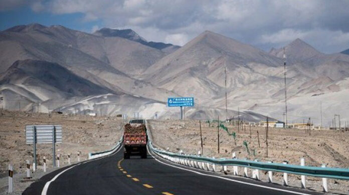
ISLAMABAD: In a major development, Pakistan is going to consider another major route connecting China under the China-Pakistan Economic Corridor (CPEC). The new route would be around 350km shorter than the existing routes via Khunjerab pass.
According to documents available with this scribe, the Gilgit-Baltistan’s Works Department, through a letter on January 8, was asked to prepare the ‘concept clearance proposal’ for the new route of CPEC, which would pass through Shigar, Skardu and Astor districts of GB and connect to Muzaffarabad district of Azad Jammu and Kashmir (AJK).
The concerned departments in these districts have also been asked to submit the concept clearance proposals for the “Construction of 33 feet wide truckable road from Yarkand (China border) to Gorikot in Astor via Shagarthang, Skardu” at the earliest.
Talking to Profit, GB Minister Maisam Kazim, who held a meeting with Federal Communications and Postal Services Minister Murad Saeed on Friday, informed that the communication minister was also optimistic on the approval of the new route, which would be a historic step by this government.
“After the approval of concept clearance proposals by relevant CPEC forums, the government would initiate work on the mega project by the end of this year,” he quoted the federal minister as saying.
According to the minister, the route from Yarkant to Skardu via Shigar was an ancient trade route between China and Baltistan region. Restoration of the already existing route would revolutionise economic activities in the area, he opined.
It may be noted that a Chinese delegation had earlier visited Shigar and Skardu districts of GB where the locals and political representatives had informed them about the historic trade route between Baltistan region and China’s Yarkand.
According to officials, this new route would be around 350km shorter than the existing land route between Pakistan and China.
The route, after crossing the border at Yarkand, an oasis city in southwestern Uygur Autonomous Region of Xinjiang, far western China, would connect Shigar, Skardu and Astor districts of GB before finally touching Muzaffarabad in AJK, they added.
This route, according officials, is comparatively straighter, safer and more weather resistant.
'The new route, after crossing the border at Yarkand, will connect GB's Shigar, Skardu and Astor districts to Muzaffarabad'
ByGhulam Abbas
ISLAMABAD: In a major development, Pakistan is going to consider another major route connecting China under the China-Pakistan Economic Corridor (CPEC). The new route would be around 350km shorter than the existing routes via Khunjerab pass.
According to documents available with this scribe, the Gilgit-Baltistan’s Works Department, through a letter on January 8, was asked to prepare the ‘concept clearance proposal’ for the new route of CPEC, which would pass through Shigar, Skardu and Astor districts of GB and connect to Muzaffarabad district of Azad Jammu and Kashmir (AJK).
The concerned departments in these districts have also been asked to submit the concept clearance proposals for the “Construction of 33 feet wide truckable road from Yarkand (China border) to Gorikot in Astor via Shagarthang, Skardu” at the earliest.
Talking to Profit, GB Minister Maisam Kazim, who held a meeting with Federal Communications and Postal Services Minister Murad Saeed on Friday, informed that the communication minister was also optimistic on the approval of the new route, which would be a historic step by this government.
“After the approval of concept clearance proposals by relevant CPEC forums, the government would initiate work on the mega project by the end of this year,” he quoted the federal minister as saying.
According to the minister, the route from Yarkant to Skardu via Shigar was an ancient trade route between China and Baltistan region. Restoration of the already existing route would revolutionise economic activities in the area, he opined.
It may be noted that a Chinese delegation had earlier visited Shigar and Skardu districts of GB where the locals and political representatives had informed them about the historic trade route between Baltistan region and China’s Yarkand.
According to officials, this new route would be around 350km shorter than the existing land route between Pakistan and China.
The route, after crossing the border at Yarkand, an oasis city in southwestern Uygur Autonomous Region of Xinjiang, far western China, would connect Shigar, Skardu and Astor districts of GB before finally touching Muzaffarabad in AJK, they added.
This route, according officials, is comparatively straighter, safer and more weather resistant.