How to install the app on iOS
Follow along with the video below to see how to install our site as a web app on your home screen.
Note: This feature may not be available in some browsers.
You are using an out of date browser. It may not display this or other websites correctly.
You should upgrade or use an alternative browser.
You should upgrade or use an alternative browser.
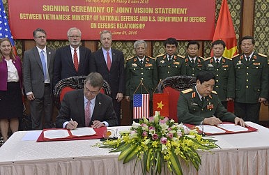
Vietnam Defence Forum
- Thread starter Viet
- Start date


Aqsuperman
FULL MEMBER

- Joined
- Mar 19, 2015
- Messages
- 736
- Reaction score
- 0
- Country

- Location

Viet
ELITE MEMBER

- Joined
- Jun 18, 2012
- Messages
- 29,949
- Reaction score
- 0
- Country
- Location

Vietnam backs latest US challenge to Beijing’s sovereignty in South China Sea, say analysts
PUBLISHED : Tuesday, 02 February, 2016, 10:33am
Kristine Kwok
[email protected]

A file picture of the USS Curtis Wilbur, which sailed close to an island claimed by Beijing in the South China Sea on Saturday. Photo: AFP
Washington may claim its latest operation in the South China Sea was aimed at challenging Vietnamese territorial claims in the region as much as China’s, but analysts say Hanoi is likely to have viewed the development positively.
The USS Curtis Wilbur sailed within 12 nautical miles of Triton Island in the Paracel archipelago on Saturday, attracting immediate protest from Beijing, which claims and controls the area.
But Hanoi, another claimant of the island as well as others in the Paracels, issued a relatively mild response the next day, saying all countries should make a “positive and practical contribution to the peace and stability” of the sea.
“As a state party to the United Nations Convention on the Law of the Sea, Vietnam respects the right of innocent passage through its territorial seas conducted in accordance with the relevant rules of the international community,” Vietnamese foreign ministry spokesperson Le Hai Binh said in a statement posted on the ministry’s website.
READ MORE: China urged to get tough with the United States over USS Curtis Wilbur’s sail-by near Triton Island in disputed South China Sea
Like previous patrols under its “freedom of navigation” operations, the US navy said that by sending the destroyer it had sought to challenge attempts by the multiple claimants to restrict navigation rights in the area. Triton Island is claimed by mainland China, Taiwan and Vietnam.
But analysts said the US operations mainly targeted China’s ambitions and that Vietnam would see them as a positive move.
“The fact is that the Paracels are now occupied by China,” said Le Hong Hiep, a visiting research fellow at the ISEAS-Yusof Ishak Institute in Singapore.
“From the Vietnamese perspective it’s good because it challenges the Chinese claim.”
The US defence ministry said no claimant had been notified prior to the navy operation.
But Hiep said Saturday’s operation was likely to have involved a mutual understanding between Washington and Hanoi. Many analysts in China said the latest patrol was an escalation of the freedom of navigation operations, which began when the USS Lassen sailed near Subi Reef in the Spratly islands in October.
Some called for a more robust response from Beijing. The Pentagon said no Chinese naval ships were in the area at the time of the operation.
China and Vietnam have long been locked in a sovereignty dispute in the South China Sea. Beijing sent a large oil rig to Triton Island in 2014 and later to other areas, sparking the worst diplomatic crisis between the two countries in decades.
Aqsuperman
FULL MEMBER
- Joined
- Mar 19, 2015
- Messages
- 736
- Reaction score
- 0
- Country
- Location

Welcome home
")

Aqsuperman
FULL MEMBER
- Joined
- Mar 19, 2015
- Messages
- 736
- Reaction score
- 0
- Country
- Location

Preparing ammunition for an excersise . Mainly the 7.62mm for LMG and the 23mm for auto-cannon
Viet
ELITE MEMBER
- Joined
- Jun 18, 2012
- Messages
- 29,949
- Reaction score
- 0
- Country
- Location
...and now the opposite opinion
Vietnam Should Not Abandon Non-Alignment in its Foreign Policy
Calls for Hanoi to shift its approach are unrealistic and problematic.
By Ngo Di Lan for The Diplomat
February 03, 2016
In a recent article for The Diplomat, Nhung Bui essentially argues that Vietnam should abandon its non-alignment foreign policy because such course of action provides Hanoi with more flexibility in the longer term and best serves Vietnam’s security interests in the face of an increasingly assertive China. Although her arguments are reasonable and merit a close reading, I ultimately disagree with her analysis and conclusion. Abandoning non-alignment without provoking Beijing is hardly realistic and in any event, pursuing the current hedging strategy is still the best way to serve Vietnamese national interests.
Nhung opens by arguing that “there is a middle path that Vietnam can walk by simultaneously abandoning the non-alignment policy as well as avoid provoking China” and that given General Secretary Trong’s conservative and possibly pro-China credentials, he is well-suited to convince Beijing of Hanoi’s benign intentions in the event Vietnam abandons its non-alignment principle and more specifically, the “three Nos” policy. Theoretically, she is correct but realistically, this is impossible for several reasons.
First of all, Chinese leaders are not naive, they certainly know that in the past few years, Vietnam-U.S relations have been much better than Vietnam-China relations. After all, Obama broke the protocol in giving Trong a head-of-state’s welcome and the U.S has eased its arms embargo on Vietnam. While I cannot recall the last time the U.S and Vietnam had a diplomatic crisis, the May 2014 oil rig crisis between China and Vietnam easily comes to mind. Beijing is also not under any illusion that Vietnam is buying Russian submarines in order to counterbalance the U.S Navy. In this context, I could not imagine how abandoning non-alignment could be interpreted charitably in Beijing. Thus Nhung’s claim that by abandoning non-alignment, Hanoi would allow Beijing to “see an opportunity” to form an alliance with Hanoi in the future, is largely wishful thinking. As long as the South China Sea (SCS) dispute remains, the chance of a Sino-Vietnamese alliance is practically zero.
Secondly, while she is right that Trong is better positioned than Dung to convince China that “even if Vietnam drops its non-alignment position, it would not form an alliance with an outside actor any time soon,” this is still problematic for two reasons.
First, just because Trong can do a better job than Dung does not mean he would be able to successfully convince the Chinese. After all, anti-Chinese sentiments in Vietnam is only growing stronger by the day and in Vietnam, even the top leader cannot impose his will on the rest, given institutional structure.
Second, even if Trong were able to do so, knowing that Vietnam would “not form an alliance with an outside actor any time soon” is hardly assuring from Beijing’s perspective. After all, the implication is that one day Vietnam might seek an alliance and that would not be something China looks forward to.
Even if abandoning non-alignment without provoking Beijing were realistic, it is still not the best course of action for Vietnam. Nhung apparently assumes that the United States or Japan might seek an alliance with Vietnam in the future. Yet this is highly unlikely. The United States is already overstretched in terms of resources and commitment and it would not formally pledge to defend an ally that it has little control over for fear of entrapment, which is the same reason why the U.S rejected a defense treaty proposal in 2015. Given Japan’s history with China, Tokyo would not to exacerbate tensions further by formally committing to an ally whom Tokyo would probably not able to defend given the distance and its military capacity. Thus abandoning alignment does not invite others to form alliances with Vietnam. If Vietnam’s security were so vital to U.S interests, they would come to Vietnam’s aid anyway, just as they defended Kuwait in the face of Iraqi invasion despite having no formal alliance with Kuwait.
Contrarily, genuine non-alignment actually gives Vietnam some real diplomatic flexibility. While I am pessimistic about resolving the SCS dispute diplomatically, I also believe that abandoning non-alignment and therefore provoking hostility from Beijing would mean that there would be absolutely no chance of resolving this dispute peacefully through diplomatic means. This diplomatic flexibility also allows Vietnam to continue benefiting from its ties with China for the time being while reducing the risk of abandonment for Vietnam in the unlikely event that the U.S and China could somehow cut a deal in the future.
The only way for Vietnam to inch closer to the U.S and avoid provoking China at the same time is to actually pursue the current hedging strategy. After all, the current strategy does not force Vietnam to be exactly halfway between the two superpowers. It only requires Vietnam to avoid “leaning to one side.” For the time being, this seems tolerable to Beijing, which is important because it gives Hanoi some breathing room to maneuver.
Lastly, the current policy gives Vietnam the most leverage in dealing with both superpowers. On the one hand, if China knows that Vietnam is definitely siding with the United States, Hanoi would lose all bargaining power with Beijing and if it knows for sure that Vietnam will not join the U.S camp, Beijing will not shy away from more intense pressure on Hanoi. On the other hand, if the United States knows for sure that Vietnam will not turn pro-U.S, it will most likely not assist Vietnam but if it knows for sure that Vietnam is dependent on U.S security guarantee, Hanoi would have no leverage in dealing with Washington. Either of these scenarios is bound to happen under Nhung’s policy prescription and neither of them serves Vietnam’s security interests. The current strategy can avoid both because it adds a layer of uncertainty to Vietnamese strategic intentions.
Given the current deadlock in the SCS, everyone wants a change and abandoning non-alignment does just that. However, we have to be mindful that change is not always good and in abandoning non-alignment, Vietnam might needlessly provoke China and endanger its security, without receiving anything tangible in return.
Ngo Di Lan is a PhD student at Brandeis University, where he focuses on U.S foreign policy and U.S-China relations. He is also a research associate at the Center for International Studies (SCIS) at the University of Social Sciences and Humanities in Ho Chi Minh City.
Aqsuperman
FULL MEMBER
- Joined
- Mar 19, 2015
- Messages
- 736
- Reaction score
- 0
- Country
- Location

Still shiny up to today , we do have a high lvl of vehicle maintaince
Viet
ELITE MEMBER
- Joined
- Jun 18, 2012
- Messages
- 29,949
- Reaction score
- 0
- Country
- Location
images and info taken from our northern neighbor: Vietnam controlled Cornwallis South Reef (Đá Núi Le). our people need to look at how the Chinese and Japanese create islands and learn from them.
Typhoon Blows Away Illegal Island Made by Vietnam in South China Sea
Pub Date: 16-02-03 09:02 Source: English--People's Daily Online

Satellite photos: Before (L) and after (R) the Typhoon Jamine
Photos of the recent satellite photos show that the island Vietnam has illegally built on the reef Nanhua Jiao in the South China Sea has been blown away by the Typhoon Jasmine, China Youth Net reported on February 2, 2016.

The illegal construction site of Vietnam on the southwestern corner of the reef
Typhoons are rarely seen in the region during December. It seems this Jasmine one at the end of 2015 was less than expected for Vietnam. Satellite photos taken on April 4, 2015, show that Vietnam had begun illegal construction to build a manmade island on China's Nanhua Reef.

The illegal construction site of Vietnam on the northeastern corner of the reef
Altogether a land of 0.03 square kilometers can be seen made on both the east and west side of the reef.

Typhoon Blows Away Illegal Island Made by Vietnam in South China Sea
Pub Date: 16-02-03 09:02 Source: English--People's Daily Online
Satellite photos: Before (L) and after (R) the Typhoon Jamine
Photos of the recent satellite photos show that the island Vietnam has illegally built on the reef Nanhua Jiao in the South China Sea has been blown away by the Typhoon Jasmine, China Youth Net reported on February 2, 2016.
The illegal construction site of Vietnam on the southwestern corner of the reef
Typhoons are rarely seen in the region during December. It seems this Jasmine one at the end of 2015 was less than expected for Vietnam. Satellite photos taken on April 4, 2015, show that Vietnam had begun illegal construction to build a manmade island on China's Nanhua Reef.
The illegal construction site of Vietnam on the northeastern corner of the reef
Altogether a land of 0.03 square kilometers can be seen made on both the east and west side of the reef.
Viet
ELITE MEMBER
- Joined
- Jun 18, 2012
- Messages
- 29,949
- Reaction score
- 0
- Country
- Location
Vietnam’s Master Plan for the South China Sea
The country’s plan for intelligence, surveillance and reconnaissance is taking shape.
By Koh Swee Lean Collin
February 04, 2016
For many years, Vietnam has been steadily accumulating new military capabilities to reinvigorate its antiquated Cold War arsenal, sourcing from mostly Russia but increasingly from other suppliers too. However, military effectiveness clearly does not depend on only kinetic capabilities; the means of detecting, tracking and guiding weapons against the intended targets constitute another essential element. Cognizant of this, besides continuing to acquire new kinetic capabilities Hanoi has undertaken nascent but nonetheless crucial steps in establishing a comprehensive intelligence, surveillance and reconnaissance (ISR) suite.
It is through this context that one may interpret recent revelation about the potential military significance of an Indo-Vietnamese deal to establish a satellite tracking station in Ho Chi Minh City, and an earlier report last year about Vietnam’s new unmanned aerial vehicle (UAV) that will soon patrol the South China Sea (SCS).
An ISR Master Plan in the Offing?
Vietnam’s UAV and remote-sensing earth observation satellite programmes have often been emphasized for their utility in agriculture, disaster management and fishery management. At first glance, these initiatives correspond with general patterns observed in Southeast Asia – Indonesia (see here and here) and Singapore for example have active UAV programmes. As for earth observation satellites, Singapore launched TeLEOS-1, jointly designed by ST Electronics, Nanyang Technological University and Defence Science Organisation Laboratories in December 2015. The Philippines is also poised to launch the Diwata-1 earth observation microsatellite.

India Spy satellite Risat-2. image resolution: 10cm.
But such capabilities clearly have military applications, since they generate data that could be utilized for various purposes. Even though civilian satellites for instance may not possess the sort of capabilities possessed by their military counterparts, they may still fulfill less demanding military peacetime and wartime requirements. And some of such ostensibly civilian-purpose satellites demonstrate performance close to military specifications. TeLEOS-1 for example has a panchromatic resolution of 1 m (at nadir), which may generate militarily useful data. Indeed, the lines between civilian and military applications are often blurred in such dual-use technologies. This is especially true in the maritime domain.
In the recent years, there are signs of Vietnam implementing a strategy of establishing what can be deemed “maritime domain awareness” in the SCS. Notably, in February 2013, the Ministry of Natural Resources and Environment (MONRE) said that it would gradually modernize existing “marine environment and hydrometeorology observation stations” as well as build new ones in key maritime zones as part of a master plan to establish a marine resources and environment observation network of 35 such stations in total by 2020. This integrated network, a crucial part of a three-phase project developed by Vietnam Administration of Seas and Islands (VASI), will help improve national management of the seas and islands under Vietnam’s sovereignty and jurisdiction. Among various purposes, this network is designed with national defense in mind, thus giving an obvious strategic context to Vietnam’s ISR drive.
Therefore, it seems very likely that Vietnam’s ISR advances are at least partly in response to developments to date in the SCS, which has seen recurring tensions. Hanoi appears to also be matching Beijing’s moves, including the latter’s vision of creating a new HY-3 “constellation” of maritime surveillance satellites in 2019 which has, according to Lin Mingsen, deputy director of the National Satellite Ocean Application Service, “an important role in reinforcing China’s marine rights protection, marine law enforcement and supervision, management of its offshore waters and marine disaster relief and reduction.” This is not to overlook China’s steady development of military UAVs such as the Wing Loong I medium-altitude, long-endurance (MALE) drone, said to have entered mass production in 2015, the same year its enhanced successor Wing Loong II was unveiled.
With a long 3,444-kilometers coastline (not counting islands) and vast maritime zone including claims in the disputed SCS waters, Vietnam clearly needs a comprehensive ISR strategy to bolster maritime domain awareness and targeting in times of peace and war. Unlike its acquisition of “big ticket” military kinetic capabilities, such as Su-30MK2 fighter jets and Kilo-class submarines, Vietnam’s discrete ISR-related projects have until now managed to evade much public attention while progressing steadily in the shadows.
Earth Observation Satellites for Civilian Purposes?
Space-based ISR capabilities, often couched within the ambit of civilian-sounding “earth observation satellite” development, constitute a key facet of Vietnam’s ISR quest. It started with the “Strategy for Research and Application of Space Technology of Vietnam until 2020” approved in June 2006 with a $2 billion investment. Less than year later, the Space Technology Institute (STI) was created to undertake space science and technology research, which appeared to focus on innocuously civilian applications. Vice-chairman of the Vietnam Academy of Science and Technology (VAST), Nguyen Dinh Cong, said that Strategy called for the indigenous development of small earth observation satellites.
But there is clearly a military intent; back in December 2008, Chairman of the National Research Programme on Space Science and Technology Nguyen Khoa Son said that “If we have our own satellite, we can respond more promptly to natural disasters and be more active in defence and security activities.” Also, the Vietnam Space Committee, established in 2010 and tasked to advise the prime minister on implementing the space strategy, was enhanced in January 2013 to comprise representatives from various national agencies, notably the Defense Ministry.
Towards this aim, typical of many emerging satellite aspirants, Vietnam first started out with communications satellites. After some delay, it launched VINASAT-1 in April 2008, followed by VINASAT-2 in May 2012. The Vietnamese proved to be quick learners. Lockheed Martin, contractor for both VINASATs, praised Vietnamese engineers for their ability to master the skills of controlling the satellites. Indeed, Lockheed Martin handed over control of VINASAT-2 to Vietnamese authorities in July 2012, two months after satellite was launched. This was half the time taken for VINASAT-1, the control of which has relinquished to Hanoi in August 2008 – thereby demonstrating a certain level of Vietnamese technical mastery.

Vietnam VinaSAT-1 and -2 communications satellites
But Vietnam faces a much steeper learning curve as it progresses into the remote-sensing arena. In July 2012, Vietnam launched its first indigenous earth observation satellite, the F-1, designed by the Space Research Division (FSpace) of FPT Technology University. It measures 10 x 10 x 10 cm, weighs just 1 kg and is capable of taking low resolution (640×480) pictures. Vu Trong Thu, Head of FSpace, said that Vietnam aims to master space technology for various purposes, including SCS surveillance – thus hinting at the F-1’s ISR role. But this microsatellite failed to transmit signals back to Earth, possibly because of battery problems.
Nonetheless, this setback did not stymie Vietnam’s ambitions to wean itself of reliance on foreign-sourced remote-sensing data which has to be acquired “at a huge cost,” according to Pham Anh Tuan, Director of the Vietnam National Satellite Center (VNSC). During an interview in March 2015, Pham explained: “Currently, to produce a satellite photo, Vietnam has to order it in advance, and will only receive the image two days later. In fact, on several occasions Vietnam has not been able to receive the photos it needed on time. However, if we have our own satellites and a space center, everything can be done within 6-12 hours, including taking photos and processing data.”
So Vietnam’s second attempt, VNREDSat-1, which measures 600 x 570 x 500 mm and weighs 120 kg, was put into orbit in May 2013 and successfully transmitted the first images back to Earth two days after launch. VNREDSat-1 was designed by Astrium SAS, a European Aeronautic Defence and Space (EADS) affiliate, and its $70-million project cost bankrolled jointly by the French and Vietnamese governments. Whffen Astrium SAS handed over VNREDSat-1’s control to VAST four months later, Deputy Prime Minister Nguyen Thien Nhan called that a milestone in Vietnam’s space technology development, claiming full mastery of “small satellite technology” and the ability to independently process images. Most importantly, according to the National Space Science and Technology Research Programme chairman Nguyen Khoa Son, VNREDSat-1 helps reduce Vietnam’s reliance on foreign-sourced images.

Vietnam VNREDSat-1 earth observing satellite
To be sure, the military significance of VNREDSat-1 cannot be overlooked. In February 2014, Nguyen Xuan Lam, Head of MONRE’s National Remote Sensing Department, said that VNREDSat-1 will used for monitoring Vietnam’s waters and islands for the purpose of socioeconomic development as well as defense and security purposes, under the project “Monitoring Offshore Key Waters and Islands with Remote Sensing Technology.” At a conference in May the same year, Deputy Minister of MONRE Nguyen Thai Lai said that VNREDSat-1 serves as an effective tool in managing Vietnam’s environmental resources and defending national sovereignty over its land, sea, islands and airspace.
Vietnam is evidently buoyed by the success of VNREDSat-1 – and of Pico Dragon, which has roughly the same dimensions as the ill-fated F-1 and was launched shortly after, managing to transmit its first signals to Earth. By 2016, according to Pham, Vietnam plans to launch the 10 kg NanoDragon, which will be entirely developed locally, to be followed by the 50 kg MicroDragon in 2018, and then LOTUSat-2, a 500-600 kg satellite capable of capturing X-band synthetic aperture radar images with 1-16 m resolution, by 2020. Clearly, Hanoi has adopted an incremental approach, moving from small to bigger and more capable satellites.
As it stands, VNREDSat-1 carries a camera that can capture images with a 2.5 m resolution – certainly falling short of the high resolution of one meter or less afforded by military satellites. This hampers Vietnam’s ability to identify and observe with high precision the types of activities taking place in the SCS. VNREDSat-1’s limitation and the growing urgency of the SCS situation thus catalyze follow-on initiatives. In October 2014, Hanoi inked a deal with Belgium to develop VNREDSAT-1B, planned for launch in 2017. Unfortunately, however, it later backed out of the deal, following the breakdown of prolonged negotiations over its terms.
Hence the deal with India to build a satellite tracking station in Vietnam, allowing Hanoi access to data from India’s constellation of civilian and military remote-sensing satellites. Facing a remote-sensing capability gap until the more capable LOTUSat-2 comes on line, Vietnam possibly views this as a short-term stopgap measure to acquire more precise, militarily useful data generated from sophisticated Indian military satellites such as the radar imaging satellite RISAT-2 which, despite Indian officials’ insistence that it is used solely for disaster management, is capable of monitoring objects with dimensions as small as 10 cm. In the longer term, Hanoi may have assessed that collaboration with New Delhi may facilitate its ultimate goal of attaining self-sufficiency in its satellite remote-sensing capabilities.
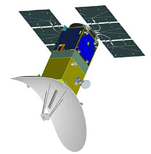
Vietnam LOTUSat-1 and -2 radar Earth observation satellites
Drones Seeing Steadier Progress
Compared to satellites, UAVs constitute a field where Vietnam has arguably achieved more success, in no small part attributable to the relative ease of accessing dual-use technologies commonly found in such platforms. Indeed, UAVs have been a critical facet of Hanoi’s quest to develop ISR capabilities, and rightfully so since drones have become a perennial asset in modern warfare. In fact, Vietnam had begun developing UAVs as far back as 1978 when its air force’s Institute of Technology launched the TL-1 program. The first dedicated military UAV, HL-1, was based on a French model but financial constraints meant it was only partially completed.
In recent years, Hanoi has taken steps to revitalize its UAV program. Since 2010, it has cooperated with the Russian aerospace corporation Irkut to develop UAVs. Russo-Vietnamese UAV cooperation was enhanced in March 2012 with a new agreement signed between Vietnam Aerospace Association (VASA) and Irkut to develop a UAV weighing less than 100 kg with endurance of 16 hours. The deal was reportedly worth $10 million and covers technology transfers to Vietnam. But it is also evident that Hanoi seeks to diversify its sources of UAV technology. Notably, in November 2012, VASA inked a UAV deal with a Swedish firm, with its first phase covering Swedish support to initially build two Magic Eye-1 UAVs, each weighing 40 kg and capable of staying up for six hours. The subsequent two phases cover technical collaboration in associated UAV electronics, such as automatic drive mechanisms and cameras, and joint exports.
Hanoi appears to have adopted a double-pronged strategy of acquiring foreign systems while developing them through technology transfers. At least five UAV models had been tested so far, equipped with various specialized payloads. However, not all such effort yielded success. For example, also in February 2014 Vietnam’s navy reportedly discussed with Austrian firm Schiebel to purchase the Camcopter S-100 rotary-winged UAV, ostensibly for deployment from the Dutch SIGMA corvettes Hanoi was earlier said to be acquiring. But the corvette deal has since fallen through, though it is not implausible for the same UAV to be flown from other types of warships if Vietnam remains keen on it. Undeterred, Hanoi persists with this double-pronged UAV development strategy, starting with tactical systems optimized for short-range battlefield ISR.
Following the successful test flight of a prototype AV.UAV.S2 over the Central Highlands province of Lam Dong in May 2013, touted by Vietnam’s state media as paving the way for follow-on development of UAVs to perform “other necessary tasks”, in February the following year military-owned Viettel Group unveiled its indigenous Patrol VT tactical UAV, reportedly equipped with a high-definition infra-red sensor capable of taking high-quality images within 600 meters. About seven months later, Vietnam acquired the Orbiter-2 mini-UAV from Israel. It debuted on Vietnamese television in December, supporting a navy coastal defense artillery live-firing exercise featuring an Israeli-made EXTRA rocket system. Hanoi is possibly satisfied with the Orbiter-2 and therefore decided to acquire more of the system, as well as the larger Orbiter-3 that is capable of 7-hour endurance.
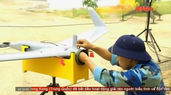
Vietnam Orbiter-2 drone, as forward observation asset for VPA artillery corps.
But such tactical UAVs are typically handicapped by limited endurance and payload. Vietnam clearly seeks more capable UAVs. A senior official responsible for UAV development at Viettel’s Flight Instrument Center stated in June 2013 that the firm’s longer-term goal is to develop a UAV capable of 15-24 hours’ endurance. In this respect, Vietnam seems to have reaped the most out of its military-technical links with Belarus, following a UAV purchase and joint development pact signed in May 2013. It is very plausible that HS-6L, a high-altitude, long-endurance (HALE) drone reported in December 2015, is developed with Belarussian assistance. Capable of a 4000km-range and 35-hour endurance, this UAV is poised to conduct SCS flight tests during the second quarter of 2016.

Vietnam first high-altitude, long-endurance drone HS-6L
Clearly, while its scope is dwarfed by China’s, Vietnam is keen to develop a holistic range of UAVs optimized for various tactical and strategic-operational missions. Within barely a decade, it has made notable progress in no small part due to its access to foreign technologies. In the near future, Hanoi would attain a degree of self-sufficiency in UAVs to complete such an important facet of its envisaged suite of ISR capabilities.
Persistent ISR Capability Gaps
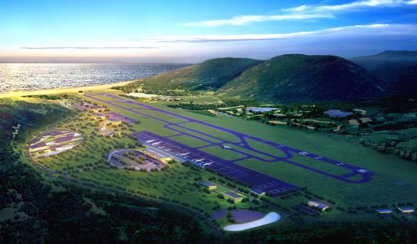
While the pathway undertaken by Hanoi in building its ISR capabilities has so far been sound and pragmatic, clearly there is still some way to go before a comprehensive, multi-layered suite of ISR capabilities can be established for maritime domain awareness and targeting purposes in the SCS. There is a persistent capability shortfall in manned aerial ISR platforms, and particularly in airborne early warning and control (AEW&C) and maritime patrol aircraft.
An AEW&C plane is primarily optimized for aerial surveillance while possessing a secondary maritime surveillance function but such platforms are expensive. Maritime patrol aircraft are the next alternative, being optimized for maritime surveillance roles. At present, Vietnam’s stable of such planes – the Canadian DHC-6 Guardian-400 and Spanish CASA-212 – are handicapped by limited endurance, payload and range. Time-sensitive, close-in ISR can be accomplished with only larger MPAs in view of the vast maritime area of responsibility Vietnam has.

Vietnam DHC-6 patrol plane
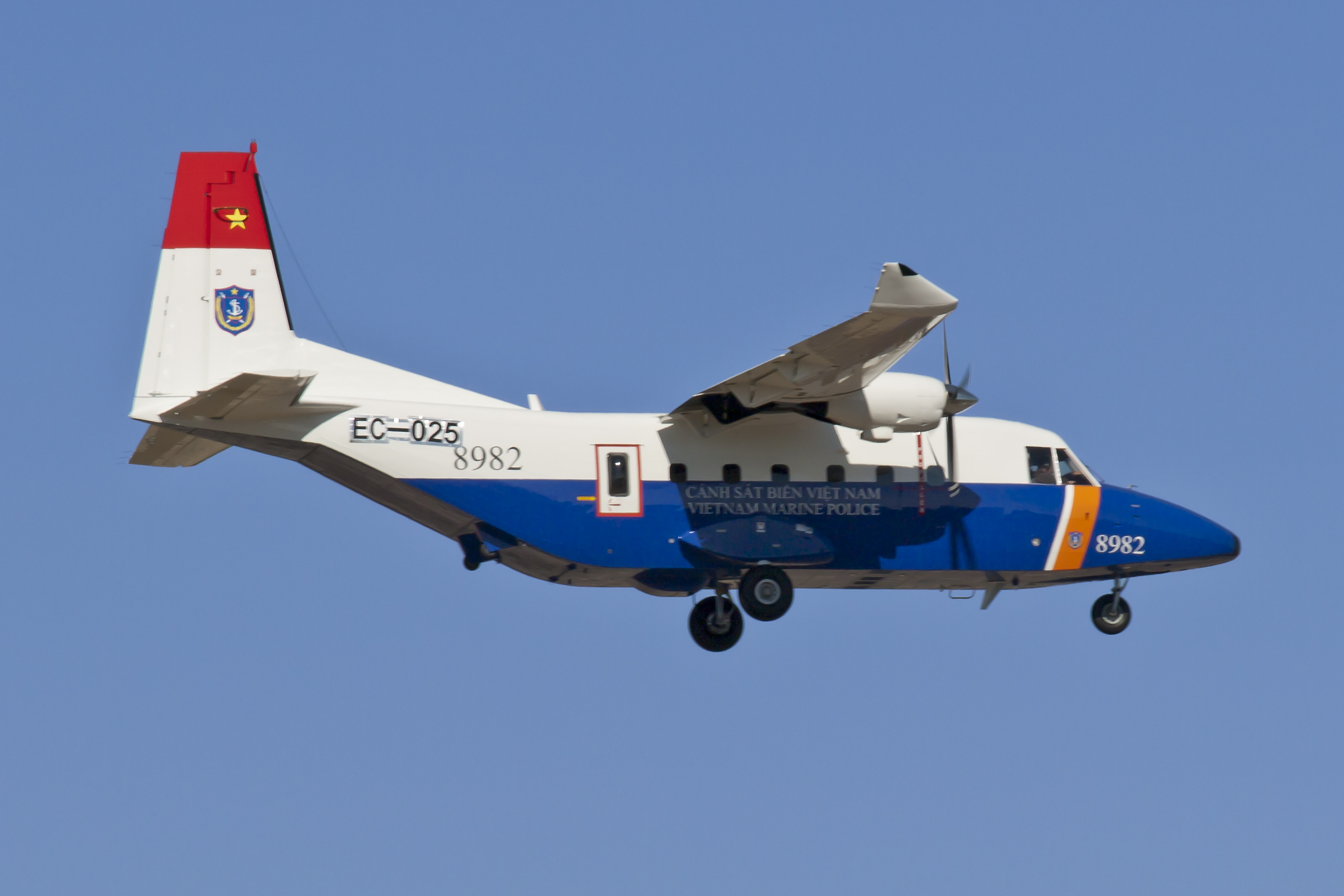
Vietnam CASA-212 patrol plane
Ever since Hanoi reportedly expressed “a lot of interest” in acquiring the P-3C Orion from the United States back in April 2013, thus far no follow-on moves had been made even though Washington partially relaxed its arms export ban on Vietnam in September the following year. A less costly strategy could be to modify Vietnam’s new C-295 medium airlifters to perform ISR roles. But these planes are intended in the first place to replace the antiquated fleet of Soviet fixed-wing air transports, leaving little or no surplus assets for such conversions.
In any case, Vietnam’s current ISR focus constitutes a logical progression from the previous emphasis on reinvigorating its kinetic military capabilities. Having already invested so much in new fighter jets, missiles, warships and submarines, Hanoi clearly recognizes the need for more attention to ISR. Its ongoing programs are geared towards building space-based remote-sensing and unmanned aerial ISR assets that would augment “traditional” ISR capabilities found in Vietnam’s existing aerial, surface, sub-surface and shore-based platforms.
Ultimately, the eventual realization of a comprehensive ISR capability suite would allow Vietnam to maximize the potential of its arsenal for the purpose of conducting sea denial and defensive sea control missions, in effect realizing its own version of anti-access and area denial (A2/AD) strategy in the SCS. Considering the relatively small arsenal mustered by Hanoi vis-à-vis China’s, a comprehensive suite of ISR capabilities would serve as a valuable force multiplier.
Koh Swee Lean Collin is associate research fellow at the Institute of Defence and Strategic Studies, a constituent unit of the S. Rajaratnam School of International Studies, Nanyang Technological University based in Singapore. He can be reached at [email protected]
The country’s plan for intelligence, surveillance and reconnaissance is taking shape.
By Koh Swee Lean Collin
February 04, 2016
For many years, Vietnam has been steadily accumulating new military capabilities to reinvigorate its antiquated Cold War arsenal, sourcing from mostly Russia but increasingly from other suppliers too. However, military effectiveness clearly does not depend on only kinetic capabilities; the means of detecting, tracking and guiding weapons against the intended targets constitute another essential element. Cognizant of this, besides continuing to acquire new kinetic capabilities Hanoi has undertaken nascent but nonetheless crucial steps in establishing a comprehensive intelligence, surveillance and reconnaissance (ISR) suite.
It is through this context that one may interpret recent revelation about the potential military significance of an Indo-Vietnamese deal to establish a satellite tracking station in Ho Chi Minh City, and an earlier report last year about Vietnam’s new unmanned aerial vehicle (UAV) that will soon patrol the South China Sea (SCS).
An ISR Master Plan in the Offing?
Vietnam’s UAV and remote-sensing earth observation satellite programmes have often been emphasized for their utility in agriculture, disaster management and fishery management. At first glance, these initiatives correspond with general patterns observed in Southeast Asia – Indonesia (see here and here) and Singapore for example have active UAV programmes. As for earth observation satellites, Singapore launched TeLEOS-1, jointly designed by ST Electronics, Nanyang Technological University and Defence Science Organisation Laboratories in December 2015. The Philippines is also poised to launch the Diwata-1 earth observation microsatellite.
India Spy satellite Risat-2. image resolution: 10cm.
But such capabilities clearly have military applications, since they generate data that could be utilized for various purposes. Even though civilian satellites for instance may not possess the sort of capabilities possessed by their military counterparts, they may still fulfill less demanding military peacetime and wartime requirements. And some of such ostensibly civilian-purpose satellites demonstrate performance close to military specifications. TeLEOS-1 for example has a panchromatic resolution of 1 m (at nadir), which may generate militarily useful data. Indeed, the lines between civilian and military applications are often blurred in such dual-use technologies. This is especially true in the maritime domain.
In the recent years, there are signs of Vietnam implementing a strategy of establishing what can be deemed “maritime domain awareness” in the SCS. Notably, in February 2013, the Ministry of Natural Resources and Environment (MONRE) said that it would gradually modernize existing “marine environment and hydrometeorology observation stations” as well as build new ones in key maritime zones as part of a master plan to establish a marine resources and environment observation network of 35 such stations in total by 2020. This integrated network, a crucial part of a three-phase project developed by Vietnam Administration of Seas and Islands (VASI), will help improve national management of the seas and islands under Vietnam’s sovereignty and jurisdiction. Among various purposes, this network is designed with national defense in mind, thus giving an obvious strategic context to Vietnam’s ISR drive.
Therefore, it seems very likely that Vietnam’s ISR advances are at least partly in response to developments to date in the SCS, which has seen recurring tensions. Hanoi appears to also be matching Beijing’s moves, including the latter’s vision of creating a new HY-3 “constellation” of maritime surveillance satellites in 2019 which has, according to Lin Mingsen, deputy director of the National Satellite Ocean Application Service, “an important role in reinforcing China’s marine rights protection, marine law enforcement and supervision, management of its offshore waters and marine disaster relief and reduction.” This is not to overlook China’s steady development of military UAVs such as the Wing Loong I medium-altitude, long-endurance (MALE) drone, said to have entered mass production in 2015, the same year its enhanced successor Wing Loong II was unveiled.
With a long 3,444-kilometers coastline (not counting islands) and vast maritime zone including claims in the disputed SCS waters, Vietnam clearly needs a comprehensive ISR strategy to bolster maritime domain awareness and targeting in times of peace and war. Unlike its acquisition of “big ticket” military kinetic capabilities, such as Su-30MK2 fighter jets and Kilo-class submarines, Vietnam’s discrete ISR-related projects have until now managed to evade much public attention while progressing steadily in the shadows.
Earth Observation Satellites for Civilian Purposes?
Space-based ISR capabilities, often couched within the ambit of civilian-sounding “earth observation satellite” development, constitute a key facet of Vietnam’s ISR quest. It started with the “Strategy for Research and Application of Space Technology of Vietnam until 2020” approved in June 2006 with a $2 billion investment. Less than year later, the Space Technology Institute (STI) was created to undertake space science and technology research, which appeared to focus on innocuously civilian applications. Vice-chairman of the Vietnam Academy of Science and Technology (VAST), Nguyen Dinh Cong, said that Strategy called for the indigenous development of small earth observation satellites.
But there is clearly a military intent; back in December 2008, Chairman of the National Research Programme on Space Science and Technology Nguyen Khoa Son said that “If we have our own satellite, we can respond more promptly to natural disasters and be more active in defence and security activities.” Also, the Vietnam Space Committee, established in 2010 and tasked to advise the prime minister on implementing the space strategy, was enhanced in January 2013 to comprise representatives from various national agencies, notably the Defense Ministry.
Towards this aim, typical of many emerging satellite aspirants, Vietnam first started out with communications satellites. After some delay, it launched VINASAT-1 in April 2008, followed by VINASAT-2 in May 2012. The Vietnamese proved to be quick learners. Lockheed Martin, contractor for both VINASATs, praised Vietnamese engineers for their ability to master the skills of controlling the satellites. Indeed, Lockheed Martin handed over control of VINASAT-2 to Vietnamese authorities in July 2012, two months after satellite was launched. This was half the time taken for VINASAT-1, the control of which has relinquished to Hanoi in August 2008 – thereby demonstrating a certain level of Vietnamese technical mastery.
Vietnam VinaSAT-1 and -2 communications satellites
But Vietnam faces a much steeper learning curve as it progresses into the remote-sensing arena. In July 2012, Vietnam launched its first indigenous earth observation satellite, the F-1, designed by the Space Research Division (FSpace) of FPT Technology University. It measures 10 x 10 x 10 cm, weighs just 1 kg and is capable of taking low resolution (640×480) pictures. Vu Trong Thu, Head of FSpace, said that Vietnam aims to master space technology for various purposes, including SCS surveillance – thus hinting at the F-1’s ISR role. But this microsatellite failed to transmit signals back to Earth, possibly because of battery problems.
Nonetheless, this setback did not stymie Vietnam’s ambitions to wean itself of reliance on foreign-sourced remote-sensing data which has to be acquired “at a huge cost,” according to Pham Anh Tuan, Director of the Vietnam National Satellite Center (VNSC). During an interview in March 2015, Pham explained: “Currently, to produce a satellite photo, Vietnam has to order it in advance, and will only receive the image two days later. In fact, on several occasions Vietnam has not been able to receive the photos it needed on time. However, if we have our own satellites and a space center, everything can be done within 6-12 hours, including taking photos and processing data.”
So Vietnam’s second attempt, VNREDSat-1, which measures 600 x 570 x 500 mm and weighs 120 kg, was put into orbit in May 2013 and successfully transmitted the first images back to Earth two days after launch. VNREDSat-1 was designed by Astrium SAS, a European Aeronautic Defence and Space (EADS) affiliate, and its $70-million project cost bankrolled jointly by the French and Vietnamese governments. Whffen Astrium SAS handed over VNREDSat-1’s control to VAST four months later, Deputy Prime Minister Nguyen Thien Nhan called that a milestone in Vietnam’s space technology development, claiming full mastery of “small satellite technology” and the ability to independently process images. Most importantly, according to the National Space Science and Technology Research Programme chairman Nguyen Khoa Son, VNREDSat-1 helps reduce Vietnam’s reliance on foreign-sourced images.
Vietnam VNREDSat-1 earth observing satellite
To be sure, the military significance of VNREDSat-1 cannot be overlooked. In February 2014, Nguyen Xuan Lam, Head of MONRE’s National Remote Sensing Department, said that VNREDSat-1 will used for monitoring Vietnam’s waters and islands for the purpose of socioeconomic development as well as defense and security purposes, under the project “Monitoring Offshore Key Waters and Islands with Remote Sensing Technology.” At a conference in May the same year, Deputy Minister of MONRE Nguyen Thai Lai said that VNREDSat-1 serves as an effective tool in managing Vietnam’s environmental resources and defending national sovereignty over its land, sea, islands and airspace.
Vietnam is evidently buoyed by the success of VNREDSat-1 – and of Pico Dragon, which has roughly the same dimensions as the ill-fated F-1 and was launched shortly after, managing to transmit its first signals to Earth. By 2016, according to Pham, Vietnam plans to launch the 10 kg NanoDragon, which will be entirely developed locally, to be followed by the 50 kg MicroDragon in 2018, and then LOTUSat-2, a 500-600 kg satellite capable of capturing X-band synthetic aperture radar images with 1-16 m resolution, by 2020. Clearly, Hanoi has adopted an incremental approach, moving from small to bigger and more capable satellites.
As it stands, VNREDSat-1 carries a camera that can capture images with a 2.5 m resolution – certainly falling short of the high resolution of one meter or less afforded by military satellites. This hampers Vietnam’s ability to identify and observe with high precision the types of activities taking place in the SCS. VNREDSat-1’s limitation and the growing urgency of the SCS situation thus catalyze follow-on initiatives. In October 2014, Hanoi inked a deal with Belgium to develop VNREDSAT-1B, planned for launch in 2017. Unfortunately, however, it later backed out of the deal, following the breakdown of prolonged negotiations over its terms.
Hence the deal with India to build a satellite tracking station in Vietnam, allowing Hanoi access to data from India’s constellation of civilian and military remote-sensing satellites. Facing a remote-sensing capability gap until the more capable LOTUSat-2 comes on line, Vietnam possibly views this as a short-term stopgap measure to acquire more precise, militarily useful data generated from sophisticated Indian military satellites such as the radar imaging satellite RISAT-2 which, despite Indian officials’ insistence that it is used solely for disaster management, is capable of monitoring objects with dimensions as small as 10 cm. In the longer term, Hanoi may have assessed that collaboration with New Delhi may facilitate its ultimate goal of attaining self-sufficiency in its satellite remote-sensing capabilities.
Vietnam LOTUSat-1 and -2 radar Earth observation satellites
Drones Seeing Steadier Progress
Compared to satellites, UAVs constitute a field where Vietnam has arguably achieved more success, in no small part attributable to the relative ease of accessing dual-use technologies commonly found in such platforms. Indeed, UAVs have been a critical facet of Hanoi’s quest to develop ISR capabilities, and rightfully so since drones have become a perennial asset in modern warfare. In fact, Vietnam had begun developing UAVs as far back as 1978 when its air force’s Institute of Technology launched the TL-1 program. The first dedicated military UAV, HL-1, was based on a French model but financial constraints meant it was only partially completed.
In recent years, Hanoi has taken steps to revitalize its UAV program. Since 2010, it has cooperated with the Russian aerospace corporation Irkut to develop UAVs. Russo-Vietnamese UAV cooperation was enhanced in March 2012 with a new agreement signed between Vietnam Aerospace Association (VASA) and Irkut to develop a UAV weighing less than 100 kg with endurance of 16 hours. The deal was reportedly worth $10 million and covers technology transfers to Vietnam. But it is also evident that Hanoi seeks to diversify its sources of UAV technology. Notably, in November 2012, VASA inked a UAV deal with a Swedish firm, with its first phase covering Swedish support to initially build two Magic Eye-1 UAVs, each weighing 40 kg and capable of staying up for six hours. The subsequent two phases cover technical collaboration in associated UAV electronics, such as automatic drive mechanisms and cameras, and joint exports.
Hanoi appears to have adopted a double-pronged strategy of acquiring foreign systems while developing them through technology transfers. At least five UAV models had been tested so far, equipped with various specialized payloads. However, not all such effort yielded success. For example, also in February 2014 Vietnam’s navy reportedly discussed with Austrian firm Schiebel to purchase the Camcopter S-100 rotary-winged UAV, ostensibly for deployment from the Dutch SIGMA corvettes Hanoi was earlier said to be acquiring. But the corvette deal has since fallen through, though it is not implausible for the same UAV to be flown from other types of warships if Vietnam remains keen on it. Undeterred, Hanoi persists with this double-pronged UAV development strategy, starting with tactical systems optimized for short-range battlefield ISR.
Following the successful test flight of a prototype AV.UAV.S2 over the Central Highlands province of Lam Dong in May 2013, touted by Vietnam’s state media as paving the way for follow-on development of UAVs to perform “other necessary tasks”, in February the following year military-owned Viettel Group unveiled its indigenous Patrol VT tactical UAV, reportedly equipped with a high-definition infra-red sensor capable of taking high-quality images within 600 meters. About seven months later, Vietnam acquired the Orbiter-2 mini-UAV from Israel. It debuted on Vietnamese television in December, supporting a navy coastal defense artillery live-firing exercise featuring an Israeli-made EXTRA rocket system. Hanoi is possibly satisfied with the Orbiter-2 and therefore decided to acquire more of the system, as well as the larger Orbiter-3 that is capable of 7-hour endurance.
Vietnam Orbiter-2 drone, as forward observation asset for VPA artillery corps.
But such tactical UAVs are typically handicapped by limited endurance and payload. Vietnam clearly seeks more capable UAVs. A senior official responsible for UAV development at Viettel’s Flight Instrument Center stated in June 2013 that the firm’s longer-term goal is to develop a UAV capable of 15-24 hours’ endurance. In this respect, Vietnam seems to have reaped the most out of its military-technical links with Belarus, following a UAV purchase and joint development pact signed in May 2013. It is very plausible that HS-6L, a high-altitude, long-endurance (HALE) drone reported in December 2015, is developed with Belarussian assistance. Capable of a 4000km-range and 35-hour endurance, this UAV is poised to conduct SCS flight tests during the second quarter of 2016.
Vietnam first high-altitude, long-endurance drone HS-6L
Clearly, while its scope is dwarfed by China’s, Vietnam is keen to develop a holistic range of UAVs optimized for various tactical and strategic-operational missions. Within barely a decade, it has made notable progress in no small part due to its access to foreign technologies. In the near future, Hanoi would attain a degree of self-sufficiency in UAVs to complete such an important facet of its envisaged suite of ISR capabilities.
Persistent ISR Capability Gaps
While the pathway undertaken by Hanoi in building its ISR capabilities has so far been sound and pragmatic, clearly there is still some way to go before a comprehensive, multi-layered suite of ISR capabilities can be established for maritime domain awareness and targeting purposes in the SCS. There is a persistent capability shortfall in manned aerial ISR platforms, and particularly in airborne early warning and control (AEW&C) and maritime patrol aircraft.
An AEW&C plane is primarily optimized for aerial surveillance while possessing a secondary maritime surveillance function but such platforms are expensive. Maritime patrol aircraft are the next alternative, being optimized for maritime surveillance roles. At present, Vietnam’s stable of such planes – the Canadian DHC-6 Guardian-400 and Spanish CASA-212 – are handicapped by limited endurance, payload and range. Time-sensitive, close-in ISR can be accomplished with only larger MPAs in view of the vast maritime area of responsibility Vietnam has.
Vietnam DHC-6 patrol plane
Vietnam CASA-212 patrol plane
Ever since Hanoi reportedly expressed “a lot of interest” in acquiring the P-3C Orion from the United States back in April 2013, thus far no follow-on moves had been made even though Washington partially relaxed its arms export ban on Vietnam in September the following year. A less costly strategy could be to modify Vietnam’s new C-295 medium airlifters to perform ISR roles. But these planes are intended in the first place to replace the antiquated fleet of Soviet fixed-wing air transports, leaving little or no surplus assets for such conversions.
In any case, Vietnam’s current ISR focus constitutes a logical progression from the previous emphasis on reinvigorating its kinetic military capabilities. Having already invested so much in new fighter jets, missiles, warships and submarines, Hanoi clearly recognizes the need for more attention to ISR. Its ongoing programs are geared towards building space-based remote-sensing and unmanned aerial ISR assets that would augment “traditional” ISR capabilities found in Vietnam’s existing aerial, surface, sub-surface and shore-based platforms.
Ultimately, the eventual realization of a comprehensive ISR capability suite would allow Vietnam to maximize the potential of its arsenal for the purpose of conducting sea denial and defensive sea control missions, in effect realizing its own version of anti-access and area denial (A2/AD) strategy in the SCS. Considering the relatively small arsenal mustered by Hanoi vis-à-vis China’s, a comprehensive suite of ISR capabilities would serve as a valuable force multiplier.
Koh Swee Lean Collin is associate research fellow at the Institute of Defence and Strategic Studies, a constituent unit of the S. Rajaratnam School of International Studies, Nanyang Technological University based in Singapore. He can be reached at [email protected]
Last edited:


Viet
ELITE MEMBER
- Joined
- Jun 18, 2012
- Messages
- 29,949
- Reaction score
- 0
- Country
- Location
I hope the Navy builds hardened bunkers for the subs. otherwise...they are very vulnerable to aerial, under water and surface attacks. one two hits, and we stand without submarine force. How about asking the Germans for assistance? they have experience, knew how to build bunkers for their submarines, U boots in WW II ")


Last edited:
Barmaley
FULL MEMBER

- Joined
- Oct 9, 2014
- Messages
- 1,034
- Reaction score
- 6
- Country

- Location
bunkers for the subs is a bad idea. With modern cruise missiles there is a high chance they will stay in those bunkers forever.
The best way is to hide subs in sea and of course cover the base with modern air defence.
The best way is to hide subs in sea and of course cover the base with modern air defence.
Similar threads
- Replies
- 21
- Views
- 5K
- Replies
- 1
- Views
- 1K
- Replies
- 1
- Views
- 985
Latest posts
-
-
Why Pakistan’s JF-17 Thunder Is Outshining India’s Tejas on the World Stage
- Latest: FourMikeEcho
-