Hamartia Antidote
ELITE MEMBER

- Joined
- Nov 17, 2013
- Messages
- 35,188
- Reaction score
- 30
- Country

- Location

HawkEye 360 gets U.S. Navy contract for maritime surveillance in the Pacific
HawkEye 360 gets U.S. Navy contract for maritime surveillance in the Pacific
 spacenews.com
Credit: HawkEye 360 illustration
WASHINGTON — HawkEye 360, a commercial operator of remote-sensing satellites, announced Oct. 31 it won a $12.2 million contract from the U.S. Navy’s Naval Information Warfare Center Pacific.
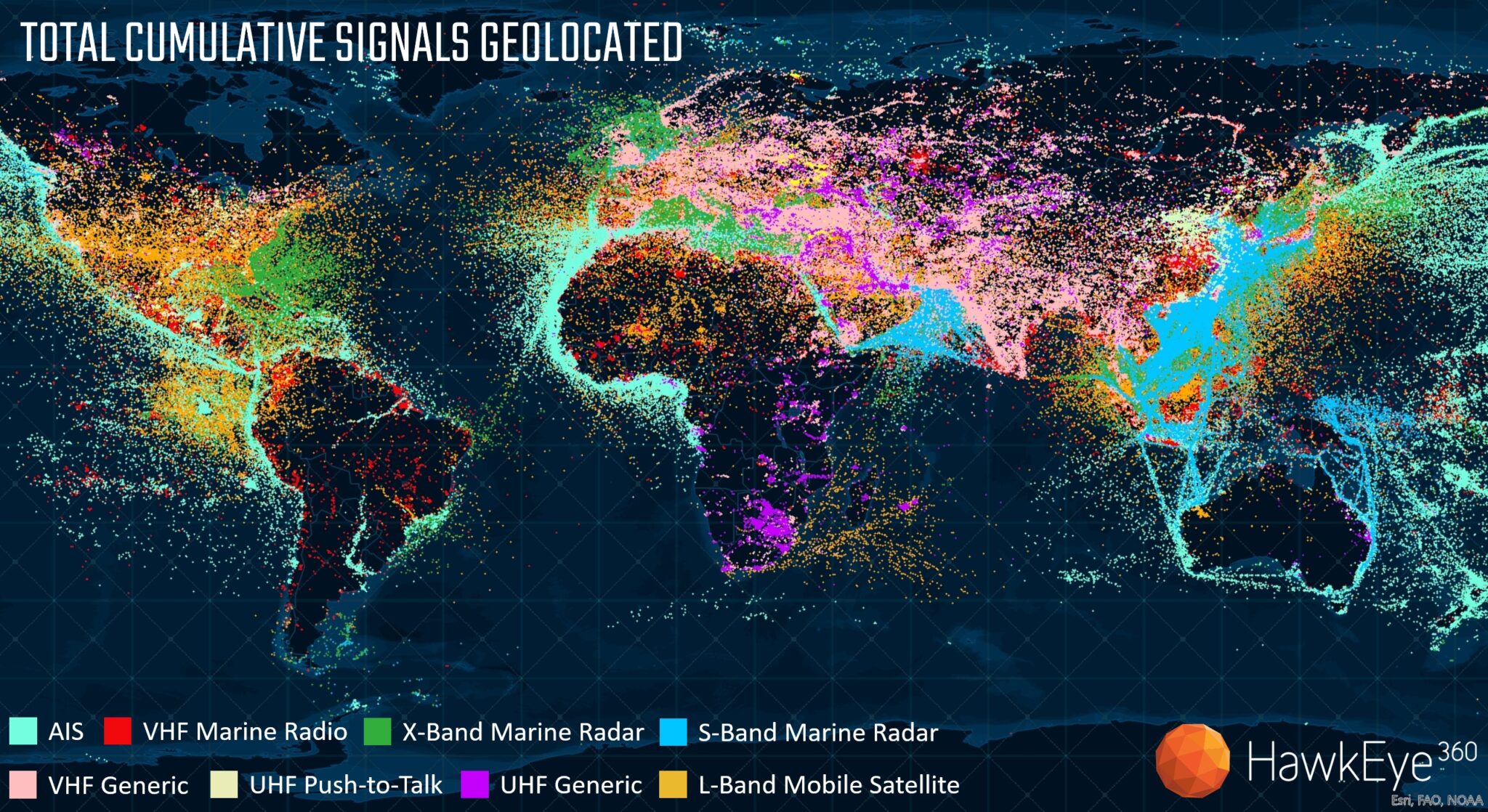
Based in Herndon, Virginia, HawkEye 360 uses radio-frequency (RF) data collected by satellites to geolocate electronic emissions and draw insights.
Under the one-year contract, the company will share satellite RF data, provide analytics and training services to partner nations in Southeast Asia and the Pacific Islands. The unclassified data will be shared via SeaVision, a web-based platform used by the U.S. and allies to improve maritime domain awareness.
Tracking maritime activity
The Naval Information Warfare Center and the SeaVision platform support the Indo-Pacific Partnership for Maritime Domain Awareness.
The “Quad” nations — the United States, Australia, Japan and India — announced the creation of the Indo-Pacific Partnership for Maritime Domain Awareness in May 2022. The goal is to help nations in the region monitor illegal fishing, humanitarian crises and maritime security threats.
HawkEye 360 became an early commercial partner of the IPMDA. The partnership is focused on disseminating unclassified data collected by commercial satellites to gain insight into maritime activity across the Indo-Pacific region.
The new contract marks “an expansion of our involvement in supplying data,” said Alex Fox, chief growth officer at HawkEye 360.
“The Indo-Pacific represents one of the most highly trafficked regions of the world, an epicenter of global trade with waters rich in resources,” he said. “The sheer size of these waters, coupled with endless vessel activity, demands vigilant maritime observation.”
HawkEye 360 operates a constellation of 21 satellites that detect, characterize and geolocate radio frequency signals from electronic emitters used for communication, navigation and security.
The company said it plans to launch two additional clusters — of three satellites each — in a mid-latitude orbit to address growing demand in the Indo-Pacific region.