About Shigar and Gilgit-Baltistan
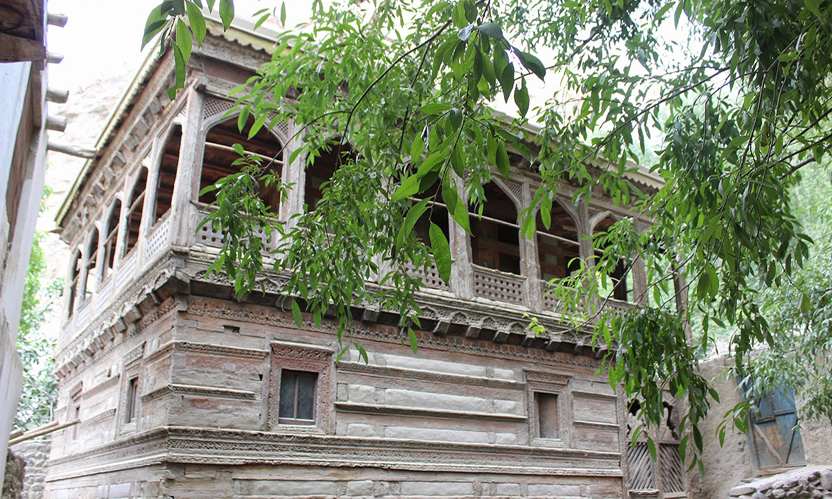
Shigar is a small peaceful village, which stands on the banks of the Shigar River in the Gilgit-Baltistan region of Pakistan. The valley in which it stands is one of only two routes leading from Skardu into the High Karakoram, and was once a separate Kingdom in its own right. Nowadays, all that remains of this kingdom is the Shigar Fort Palace, which is known locally as Fong Khar and was once the palace of the former Raja. The village also features some beautiful wooden mosques: Khlingron Mosque, which stands beside Fong Khar; the Kanqa-e-Moalla Mosque, and the 14th century Amburiqu Mosque. Shigar is also the setting for the ruins of an early Buddhist monastery and some rock inscriptions that are thought to date back to the 5th century.
About Gilgit-Baltistan
The territory of Gilgit-Baltistan borders Afghanistan to the north, China to the northeast, the Pakistani-administered state of Azad Jammu and Kashmir (AJK) to the south, and the Indian-administered state of Jammu and Kashmir to the southeast. It is a non-self-governing territory under Pakistani control. The territory was formerly known as the Northern Areas and is the northernmost political entity within the Pakistani-controlled part of the former princely state of Jammu and Kashmir. The territory became a single administrative unit in 1970 under the name "Northern Areas" and was formed by the amalgamation of the Gilgit Agency, the Baltistan District of the Ladakh Wazarat, and the states of Hunza and Nagar. Before the independence of Pakistan and the partition of India in 1947, Maharaja Hari Singh extended his rule to Gilgit and Baltistan. After the partition, Jammu and Kashmir, in its entirety, remained an independent state. The Pakistani parts of Kashmir to the north and west of the cease-fire line established at the end of the Indo-Pakistani War of 1947, or the Line of Control as it later came to be called, were divided into the Northern Areas (72,971 km²) in the north and the Pakistani state of Azad Kashmir (13,297 km²) in the south. The name "Northern Areas" was first used by the United Nations to refer to the northern areas of Kashmir.
Geography
The region is home to some of the world's highest mountain ranges-the main ranges are the Karakoram and the western Himalayas. The Pamir mountains are to the north, and the Hindu Kush lies to the west. Amongst the highest mountains are K2 (Mount Godwin-Austen) and Nanga Parbat, the latter being one of the most feared mountains in the world. Three of the world's longest glaciers outside the polar regions are found in Gilgit-Baltistan - the Biafo Glacier, the Baltoro Glacier, and the Batura Glacier.
Climate
The climate of Gilgit-Baltistan varies from region to region, surrounding mountain ranges creates sharp variations in weather. The eastern part has a moist zone of western Himalayas but going toward Karakoram and Hindu Kush the climate dries considerably. There are towns like Gilgit and Chilas that are very hot during the day in summer, yet cold at night, and valleys like Astore, Khaplu, Yasin, Hunza, and Nagar where the temperatures are cold even in summer.
Rock art and petroglyphs
There are more than 20,000 pieces of rock art and petroglyphs all along the Karakoram Highway in Gilgit-Baltistan, concentrated at ten major sites between Hunza and Shatial. The carvings were left by various invaders, traders, and pilgrims who passed along the trade route, as well as by locals. The earliest date back to between 5000 and 1000 BCE, showing single animals, triangular men and hunting scenes in which the animals are larger than the hunters.
Transport
Prior to 1978, Gilgit-Baltistan was cut off from Pakistan due to the harsh terrain and the lack of accessible roads. All of the roads to the south opened towards the Pakistani-controlled state of Azad Jammu and Kashmir (AKJ) and to the southeast towards the present-day Indian-controlled state of Jammu and Kashmir. During the summer, people could walk across the mountain passes to travel to Rawalpindi. The fastest way to travel, however, was by air, but air travel was accessible only to a few privileged local people and to Pakistani military and civilian officials. Then, with the assistance of the Chinese government, Pakistan began construction of the Karakoram Highway (KKH), which was completed in 1978. The Karakoram Highway (KKH) connects Islamabad to Gilgit and Skardu, which are the two major hubs for mountaineering expeditions in Gilgit-Baltistan. The journey from Islamabad to Gilgit takes approximately 20 to 24 hours. Landslides on the Karakoram Highway are very common. The KKH connects Gilgit to Taxkorgan and Kashgar in China via Sust (the customs and health inspection post on the Northern Areas side) and the Khunjerab Pass, the highest paved international border crossing in the world at 4,693 metres (15,397 feet).
Demographics
The population consists of many diverse linguistic, ethnic, and religious groups, due in part to the many isolated valleys separated by some of the world's highest mountains. Urdu is the lingua franca of the region, understood by most male inhabitants. The Shina language (with several dialects) is the language of 40% of the population, spoken mainly in Gilgit, throughout Diamer, and in some parts of Ghizer. The Balti dialect, a sub-dialect of Ladakhi and part of Tibetan language group, is spoken by the entire population of Baltistan.
Shigar Fort Residence - about Shigar and Gilgit-Baltistan


 -
-