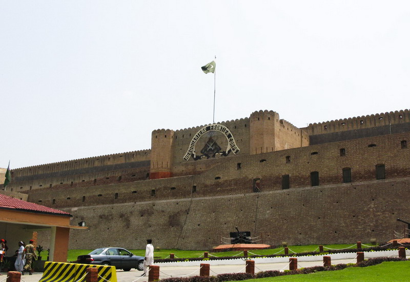
What's new

Forts in Pakistan

ghazi52

PDF THINK TANK: ANALYST
Joined
Mar 21, 2007
Messages
101,643
Reaction score
106
Country
Pakistan
Location
United States
FORT JUMROOD AT ENTRANCE TO KHYBER PASS - c1880's


603997_457411944339264_136718876_n.jpg


Fort Attock, Indus River near Nowshera 1860s


11072_457339187679873_1477295404_n.jpg


GT Road, Peshawar Fort and surroundings from Jail 1878

534883_457338787679913_867289133_n.jpg
 
The Ranikot Fort also known as Dewar-e-Sindh (Great Wall of Sindh), with a circumference of about 26 km or 16 miles, is reputed to be the largest unexplored fort in the world. Since 1993, it has been on the list of tentative UNESCO World Heritage Sites. It is located in the Kirthar Range, about 30 km southwest of Sann, in Jamshoro District, Sindh,

Ranikot_Fort_Sindh_cxpfo.jpg


13100898_1117699364948533_8478277303037413276_n.jpg


1121.jpg


10527483_1522367911318524_2448045582226822466_n.jpg


10527532_1522367924651856_4388785520749625187_n.jpg


10401491_1522367931318522_6914876110217767352_n.jpg


10425378_1522367854651863_4622573265370834961_n.jpg
 
Attock fort

The Attock fort stands picturesquely on the left bank of the Indus by the side of the Grand Trunk Road (Sarak-i-Azam). It was completed in two years under the supervision of Shams-ud-din Kawwafi, later Diwan of the Punjab, and the inscription on a slab of marble, now set above the inner north gateway, dated 991 A.H. (A.D. 1583) thus gives the date of the completion.

“Unlike the palace-fortresses of Fathpur Sikri and Lahore the Attock fort appears to have been a purely military post designed to hold the river-crossing and guard the bridge of boats which from ancient times until A.D. 1883, when the modern steel bridge was opened, adjoined the site of the fort.

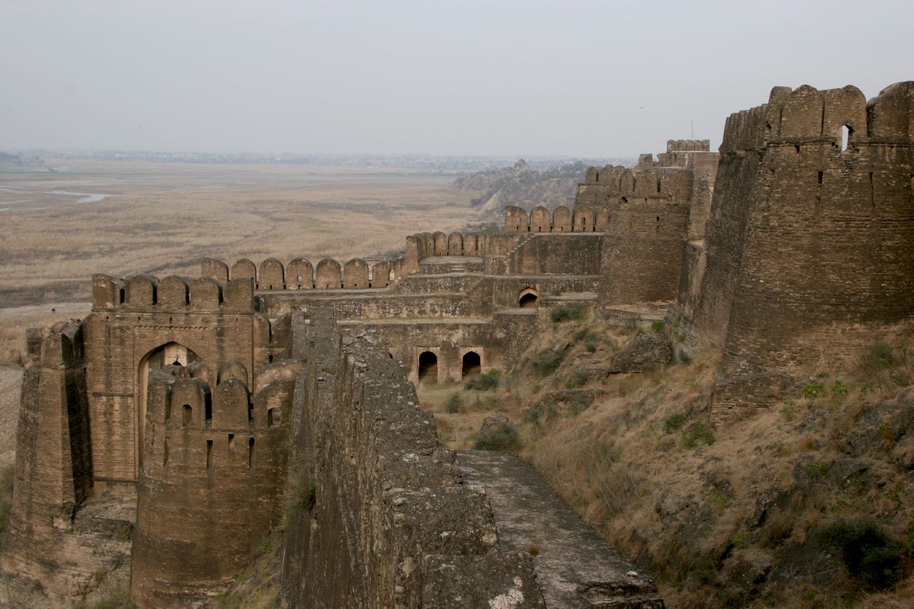
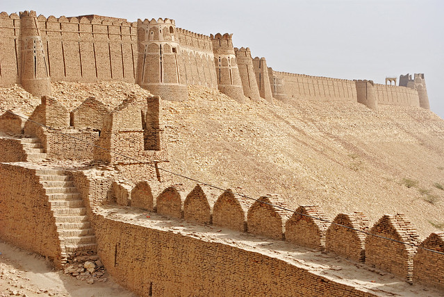
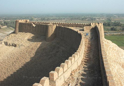
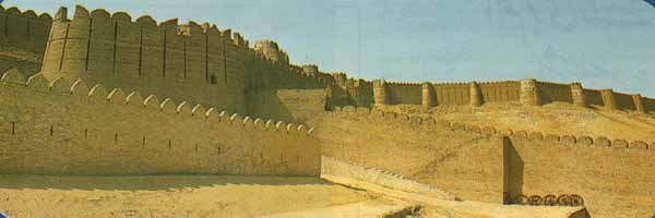
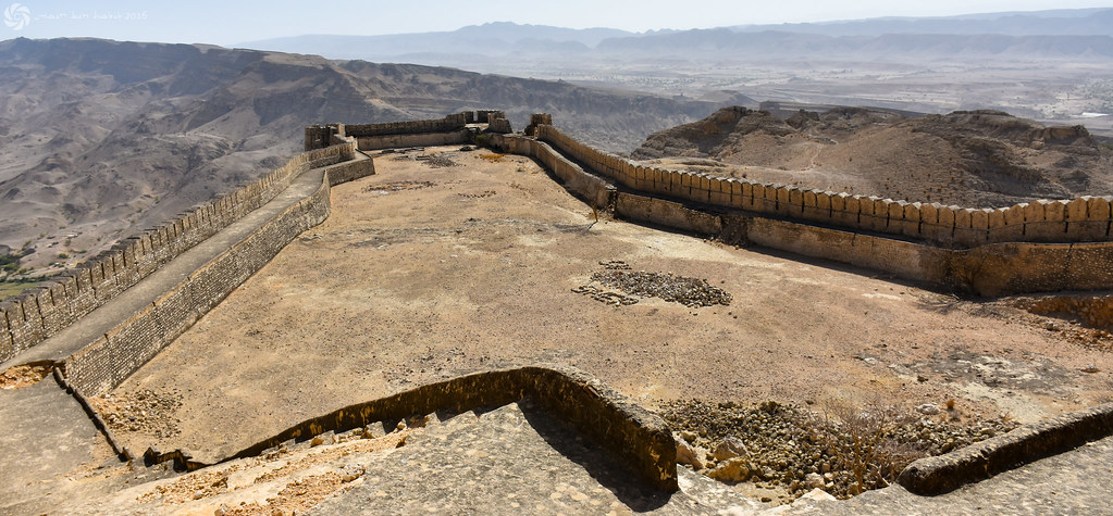
The fortifications are over a mile in circumference and are strengthened with upwards of eighteen bastions, all circular except one, which is rectangular. They are built mostly of a local shaly rock set in thick lime mortar, but for arches, vaulting, domes, and external string-course small Lakhuri brick is used, and for the original gateways a sand-stone resembling that found at Taraki in the Jhelum district.

An interesting feature of the Attock fort is a narrow gallery contrived high up in the walls to give the defenders head and back cover. The greater part of the gallery has a vaulted roof but in one stretch thick fiat roofing-slabs replace the brick vaulting. The battlements, loopholes and machicoulis bear evidence of changes to meet new needs arising from changing armament.

Midway up the wall of a tower on the north and overlooking an extensive stretch of the river is a balcony approached through a four-centred doorway in the front of the tower, and sheltered by a pent or Chajja above. Attock fort is the only building in the fortifications which is designed for residential purposes and, with alterations, is still used as such.

None of the original gateways of Attock fort is now in use, but three are traceable, respectively near the modern Lahori, Kabuli and Water gates. A further modern gateway, known as the Mallahitola Gate, has been opened in the west wall, and another, known as the Delhi Gate, pierces the long modern wall of the British period running north to south from the Lahori Gate and dividing the fort into an upper and a lower area.

The present main entrance, the Mori Gate, facing the Grand Trunk Road on the north-east, probably dates from the Sikh period, but its horn-work and ramp are British.

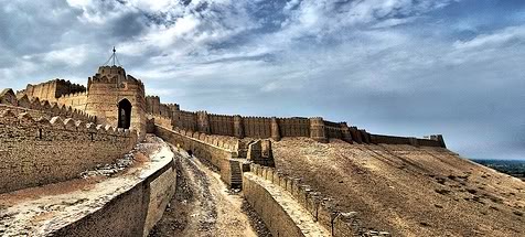
The Kabuli Gate on the west is the only old entrance now open to view. It is double and flanked by round towers; the outer gate is in line with the fortification wall, and is backed by a square court from which the inner gate opens into the interior. The gates are of sandstone, with four-centred openings under musketry-slits. The inner gate also has three windows with balconies, and is panelled.


In the centre of the north wall is a rectangular projection known as the Magazine. Originally this must have been the principal entrance to the Attock fort, and the modern magazine occupies the courtyard between the inner and outer gateways. The latter is no longer traceable. The top of the inner gateway is still visible and is surmounted by an inscription of the year 991 A.H. In general design it resembles the Kabuli Gate but has on either side a small oriel window with Chajjas and decorated cresting.

There are no old buildings in the interior except some underground chambers in the upper part near the modern Delhi Gate. At present these are inaccessible, but traces of water-channels and reservoirs have been observed in one of them and they appear to have been cool chambers for use in summer. In the lower Attock fort area the small road from the Clyde Battery to the modern Lahori Gate at many places cuts through old walls and ruined vaulted chambers built in small bricks.

1860

10246247_462450140552525_3363141756636035086_n.jpg


Attock%20-%20Attock%20Fort%20-%20Satelite%20Image%20-%202009%20-%2002.jpg


10385315_542487655855991_3653004527035633727_n.jpg


12986939_978363555604852_7131602085595698044_n.jpg


66424_408951242516349_220345965_n.jpg


13082538_1044205808971180_731653636848809237_n.jpg
 
Last edited:
Rohtas Fort is a historical garrison fort built by Sher Shah Suri, located near the city of Jhelum in Pakistan. This fort is about 4 km in circumference and the first example of the successful amalgamation of Pashtun and Hindu architecture in the Indian Subcontinent. Rohtas Fort is one of the most imposing historical monuments which represents the Pathan period of architecture style in Pakistan.

An Aerial View of Rohtas Fort - Jehlum

10405510_484498311693720_3472962205579770851_n.jpg


One of the 12 gates of Qila Rohtas

12341560_1708798249392943_7317421558317332966_n.jpg


12391779_1708798389392929_4301395709092465762_n.jpg


12705277_952530481462893_4242057781035947234_n.jpg


12647271_952530664796208_6904738940171353187_n.jpg


12647389_952530758129532_5638976699120424531_n.jpg


maxresdefault.jpg


100509114_7b28b7f0e9_o.jpg
 
Bala Hissar Fort, Peshawar

Near the Afghan border is the famous Khyber Pass through which almost every conqueror came. As soon as you enter Pakistan from Afghanistan within 10 miles is the city of Peshawar which by it's very location has been a the first place to get hit from Central Asia. Therefore it always has had major forts. I believe it still is the headquarters of the Frontier Corps who have been battling the Taliban on the Afghan border. before that it was British Army HQ. It has been destroyed, rebuilt countless times.

This fort is not to far from the centre of the city and has been surrounded by urban sprawl. Also because it's still a active military HQ of the frontier Corp it is well taken care off but is out of bounds to the public and now has these ugly concrete blocks to prevent a suicide bomb attack or truck with explosives to ram the entrance. Because Frontier Corp are in the forefront of the fight against Taliban their HQ is primary target by the Taliban and being close to the Afghan border does not help.


Main entrance and Frontier Corp insignia


Aerial view of Fort Balahisaar. Peshawar

1013302_593656734039578_1927094344_n.jpg
 
Kot Diji Fort in Sindh,

The general area is desert and stone is not available so other means of construction are used in this very dry arid desert region of the country. There are about four differant climate zones in Pakistan ranging from high alpine glaciers, temperate cool, semi desert to desert and high plateaux desert. The matariels used and designs reflect the changing environment. Along with the changing climate zones there is also changing ethnic groups who range from Meditearanean on the west side to more Indic on the east side. In the extreme cold north there is even populations groups resembling northern Europeans. Generally the north is cooler and wetter with south the reverse. Attock Fort [ as in the previous post ] is in cooler and wet zone.


Pharwala Fort, Rawalpindi District.

The Pharwala Fort is believed to have been built by Sultan Kaigohar Gakhar in the 11th century. This is the most fabled fort in Islamabad territory. Sultan Kaigohar was an associate of Sultan Mehmood of Ghazna. The fort was supposed to have been built over the ruins of a fort of the Hindu Shahi period. It is located some 20 km north of Airport Chowk or Karal on the left bank of Soan River. This fabled and formidable fort is now in a crumbling condition. However, a few Gakhar families still reside in the fort.

The fort was entirely renovated by Hathi (also called Hatti) Khan Gakhar, one of the chieftains of the Gakhar tribe. He was the first ruler to rise from among the Gakhars and establish a dynasty. He fought against the Janjua Rajputs and drove them away from the present tehsils of Kallar Syedan, Kahuta and Rawalpindi. The Janjuas were the lords of these tehsils. It was Hathi Khan Ghakhar who defeated them in many battles and brought their state under his dominion.

Soan%20gate.jpg


It was during the reign of Hathi Khan Gakhar, in 1519, that Pharwala Fort was attacked by Babur and captured. Later Babur returned the fort and reconciled with Hathi Khan. In the battle between the Gakhars and the army of Babur, many Gakhar soldiers died fighting bravely. Their graves and tombs are located in four villages of Islamabad. Two graveyards are located at Bagh Jogian village, one near the mosque of Mai Qamro and the other close to an unidentified tomb. The third graveyard is situated inside the fort. The fourth is a necropolis on a hillock overlooking Darwala village. All these people died while putting up a tough resistance to the army of Babur. One of Hathi Khan’s eminent generals, Bora Bangial or Bugial (now the name of a whole branch of Gakhars), also died in that encounter. His tomb is located in the necropolis. The gallantry of Bora Bangial is still preserved in the memories of the folk storytellers of Darwala, Bhimber Tarar, Gora Mast and Pharwala villages.

Graves%20of%20Gakhar%20soldiers%20at%20Darwala%20village.jpg


Ghakhars were loyal to the Mughals. When Humayun lost his kingdom to Sher Shah Suri, the Gakhars did not change their loyalties. They launched a guerrilla war against Sher Shah. It was to subdue the Gakhars that Sher Shah built the awe-inspiring Rohtas Fort. But he could not crush the resistance of the Gakhars.

After the death of Hathi Khan Gakhar, Sultan Sarang shifted his capital to Rawat. Pharwala lost its splendor, and its cultural flowering came to an end with the shift of the capital.

Apart from Hathi Khan and Sultan Sarang Khan, the Gakhar tribe has produced many powerful rulers, including women such as Mai Qamro (wife of Hathi Khan) and Rani Mungo (wife of Sultan Quli Khan Gakhar, d.1674). Both of them are still remembered for their social welfare activities, such as constructing mosques for the faithful, water-wells for the poor and serais for travelers.

With the decline of Mughals, the Gakhars became weak politically and were eventually replaced by Sikhs in 1819 A.D. The Pharwala Fort came under the control of the Sikhs. It began losing its past glory in the Sikha Shahi period.

The Pharwala Fort had seven gates, of which only three survive today. However, all the surviving gates – namely Soan, Lashkari and Hathi – are crumbling to pieces. All the ramparts have caved in, and only the three gates have withstood the weather.
 

Latest posts

Back
Top Bottom