What's new

China's High Frequency (HF) or Over-The-Horizon (OTH) radars

Martian2

SENIOR MEMBER
Joined
Dec 15, 2009
Messages
5,809
Reaction score
-37
China's High Frequency (HF) or Over-The-Horizon (OTH) radars Part I

HF Asia

Saturday, April 30, 2011
Chinese LPDA HFDF
An HFDF using LPDA array and probably using wavefront analysis method.
29°49'19.79" N 121°39'06.08" E

XVZUIfs.jpg


[Note: LPDA stands for "log periodic dipole antenna." HFDF is an acronym for "high frequency direction finding."]

-----

A map of Chinese coastal military radars shows that China deserves its reputation for having the world's most densely integrated radar network.

Chinese military RADAR in the South China Sea

qbqZZX8.jpg


-----

Here is an interesting Chinese VHF (anti-stealth) radar on a South China Sea island.

Fiery Cross Reef (9°38'57.37"N 112°58'37.08"E)
VHF RADAR

fhw32KY.jpg
 
China's High Frequency (HF) or Over-The-Horizon (OTH) radars Part II

HF Asia

Chinese Over-the-horizon surface wave RADAR

System 1
27°46'10.00" N 120°44'44.34" E
6omfrth.jpg


Transmitter site
cOnjjzV.jpg


Receiver site
6z2mUHb.jpg


System 2

22°55'26.51" N 116°13'32.07" E
4CoQ3xP.jpg

[Note: The inland description is "Control Site."]

Transmitter site
oVYaUQl.jpg


Receiver site
rdWXBms.jpg


System 3
25°47'25.10" N 119°37'08.79" E
cAIOpSH.jpg


System 4
24°04'56.97" N 117°54'06.38" E
CToBWgM.jpg
 
Radar Interferometry

We know China uses HF (high frequency), Over-The-Horizon Backscatter (OTH-B), and Over-The-Horizon Surface Wave (OTH-SW) radars.

sshlsCj.jpg

Chinese Over-The-Horizon (OTH) radars become exponentially more powerful with radar interferometry.

Instead of using the Chinese OTH radars individually, we will use radar interferometry to network them together to function as one unit. With massively increased resolution and location identification via triangulation, China should be able to see an incoming stealth aircraft.

Just like radio or laser interferometry, a synchronized system of radars will greatly magnify its power.

1. Networked OTH radars will have resolution equal to the furthest distance between two radars.

"Interferometry does increase the total signal collected, but its primary purpose is to vastly increase the resolution through a process called Aperture synthesis. This technique works by superposing (interfering) the signal waves from the different telescopes on the principle that waves that coincide with the same phase will add to each other while two waves that have opposite phases will cancel each other out. This creates a combined telescope that is equivalent in resolution (though not in sensitivity) to a single antenna whose diameter is equal to the spacing of the antennas furthest apart in the array."

-----

Interferometric Synthetic Aperture Radar | Cal Tech

I7zQ6RN.jpg

With the fixed Chinese OTH radars, the radar interferometry technique used will be Simultaneous Baseline. However, the Chinese NOSS satellites (e.g. Yaogan Weixing-9, Yaogan Weixing-16, and Yaogan Weixing-17) can use either the Simultaneous Baseline and/or Repeat Track.

2. A single OTH radar (transmitter and receiver) will only provide direction. With two or more OTH radars, we know the position of the stealth aircraft in space.

Shuttle Radar Topography Mission | JPL NASA

I3y2Tnv.jpg

The Space Shuttle used Simultaneous Baseline radar interferometry to map the Earth.

HKrBpm4.jpg

Having data points from two simultaneous sources in space (via Simultaneous Baseline) or a single displaced source in time (via Repeat Track) will yield an unique point via triangulation.

3. With the Chinese NOSS satellite trio flying in fixed formation, radar interferometry can be used to increase the resolution of the Chinese NOSS satellite receivers. The HF emitters are on the ground, but the receivers can be either on the ground or in space.

4. Interferometric Synthetic Aperture Radar (InSAR) sensitivity has been shown to be accurate at the cm-level scale. This level of sensitivity is sufficient for detection of stealth aircraft.

USGS - VHP InSAR Research Group

ZljyLeM.jpg


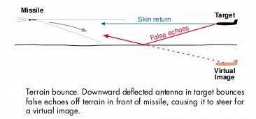
5. Radar interferometry can be used to detect the lack of a radar signature.
Phase change in the radar signal can also be used to glean information. Thus, radar receivers are useful in detecting the radar reflection of a stealth aircraft and it can also be used to notice the absence of a radar signal. In other words, with the right software, a stealth aircraft can be detected when it creates a void of radar reception that is expected by orbiting satellites.

"Interferometers are widely used in science and industry for the measurement of small displacements, refractive index changes and surface irregularities. In analytical science, interferometers are used in continuous wave Fourier transform spectroscopy to analyze light containing features of absorption or emission associated with a substance or mixture."

6. A radar enthusiast has reported that daily Chinese HF radar signals at 5.8 MHz are reaching the Mojave Desert in California. We know they are not American HF radar signals, because the three on the West Coast have been shut down. Also, they would be coming from the wrong direction in the sky.


"Published on Apr 5, 2013

This is a probable Chinese OTHR (Over The Horizon Radar) as received in the Mojave Desert, California, USA, on April 05, 2013, at about 1321 UTC. This, and other, Chinese radar can be seen daily. Note that in this video there are two 'sync' periods, one at 1321:58 UTC and the next at 1325:37 UTC. During the sync period it can be seen that there is another radar on the upper end of the displayed bandwidth."

----------

5LHZewg.jpg

At 5.8 MHz, the Chinese radar signals are within the HF band.

----------

AN/FPS-118 Over-The-Horizon-Backscatter (OTH-B) Radar - United States Nuclear Forces | GlobalSecurity

"With the end of the Cold War, just months after their deployment, the three OTH radars on the West Coast were mothballed, and the incomplete Alaska System cancelled, but the three radars in Maine were redirected to counter-narcotics surveillance. In 1994 the Congress directed the Air Force to continue operating the East Coast OTH-B radar at no less than a 40 hour per week schedule, and to ensure that all OTH-B tracking data was transmitted directly to DOD and civilian agencies responsible for providing counterdrug detection and monitoring support to law enforcement agencies. In order to utilize the full potential of this wide-area sensor, the Congress directed DOD to (1) assist the Air Force in linking the East Coast OTH-B radar site data directly to users, including but not limited to the U.S. Customs/Coast Guard C3I Center, Miami; Joint Task Force 4 Operations Center, Key West; U.S. Southern Command Operations Center, Key West; and U.S. Southern Command Operations Center, Panama; and (2) fully cooperate with efforts of other government agencies to utilize the dual-use capabilities of this system for remote environmental and weather monitoring and other purposes.

The Air Force maintains the six East Coast and West Coast OTH-B radars in a state called "warm storage," which preserves the physical and electrical integrity of the system and permits recall, should a need arise. It would require at least 24 months to bring these first generation OTH-B radars out of caretaker status and into an operational status-if such a decision to do so were made. Major upgrades costing millions of dollars would be necessary to bring the outdated technologies up to modern standards. The incremental cost of operating the East Coast OTH-B system for environmental research and services is about $1.0M to $1.5M per year. The environmental monitoring aspects of the system are unclassified. Similar coverage in the eastern Pacific could be obtained at about the same cost."
 
Last edited:
China's Skywave Over-The-Horizon (OTH) Radar

As you can see in the picture below, China's Skywave Over-The-Horizon (OTH) radar is a huge structure. This is necessary due to the laws of physics.

An ideal antenna is half the wavelength of the signal. It's a sinusoidal wave and you need a receiver that is half the wavelength as it pulses up and back down.

An OTH radar is designed to detect reflected radar signals with a low frequency and large wavelength. Thus, the antenna must be half-a-meter or more in length.

Do not confuse the low frequency of an OTH radar with the term "high frequency" band. It is relative and they are referring to two different aspects.

----------

The PLA Air Force Over the Horizon Radar Brigade

"The PLA Air Force Over the Horizon Radar Brigade
Thursday, December 24, 2009

Over the last year, there has been substantial interest in China’s development of an anti-ship ballistic missile (ASBM). When deployed, its strategic goal would likely be to influence Taiwan’s domestic polity and manipulate the cost-benefit calculus of U.S. policymakers.

mytr8LC.jpg


The ballistic missile program itself – the DF-21D – has been the primary focus. However, the cueing and surveillance architecture that would support an ASBM capability remains somewhat of a mystery. An integrated sensor network would be needed for initial situational awareness of maritime activity in the Western Pacific Ocean and to cue an ASBM before launch. A key element is believed to be a skywave over the horizon (OTH) radar. In November 2008, Sean O'Connor posted a great analysis of the OTH radar system and its role in an ASBM program on his IMINT & Analysis website, including the Google Earth image above. Andrew S. Erickson and David D. Yang (Naval War College and RAND), Mark Stokes (Project 2049 Institute), Eric Hagt and Matthew Durnin (China Security), and Tony Capaccio (Bloomberg) also have addressed the OTH radar cueing issue. However, limited information exists on specific capabilities and how an OTH radar system would fit in to a broader architecture.

CFRMpSN.jpg


One interesting insight is its subordination. A Chinese blogger posted an article in November 2007 that highlighted a PLA Air Force (PLAAF) “Skywave Brigade” (天波旅). The post first appeared on the Wangchao bulletin board website and has been reposted hundreds of times since then. The author asserts that the brigade operates China’s first strategic early warning system in over 20 years, when a brigade operated a missile early warning system in the area of Xuanhua, north of Beijing. The missile early warning radar has been dismantled. The author, careful to avoid censors, uses Pinyin abbreviations for locations of the transmitter and receiver and names of the commander and political commissar of the PLAAF radar brigade. He/she also notes a requirement for additional sites in Fujian and presumably other locations along the east coast for measuring the ionosphere.

Taiwan Link research confirms much of the Chinese author’s analysis. A relatively new PLA Air Force radar brigade – the 95980 Unit – operates the OTH radar system. The PLAAF “Skywave Brigade" is situated in the southern edge of Xiangfan [襄樊], Hubei province, or specifically in Yingpan Village in the Xiangcheng District. On Google Earth, a guarded underground facility can be seen to the east of the village. While not confirmed, the mountain complex could house the OTH surveillance and warning system.

The PLAAF radar brigade has at least six subordinate elements (fendui). Two are near Xiangfan: the 52nd Element in the Zaoyang Municipal District and the 53rd in Nanzhang County. The blog poster notes that the OTH transmitter is in “ZY” and receiver is in “NZ.” The OTH receiver array that Sean O’Connor discovered on Google Earth indeed is in Nanzhang county. The coastal sites subordinate to the OTH brigade are:

-- 61st Element based near Xitangqiao Village [西塘桥镇];

-- 64th Element located near Fuqing [福清],

-- 66th Element near Jinjiang [晋江], Fujian province Sanshan Village [三山镇]; and

-- 67th Element near Wenlin City Shitang Village [石塘镇].

XEkPAiq.jpg


Most likely subordinate to the Guangzhou Military Region Air Force (GMRAF), the radar brigade's priority probably is air activity. Maritime tracks that the system generates could be filtered off to PLA Navy watch centers for tagging and correlation. More analysis would have to be done to figure out the command and control and service coordination arrangements."
 
What are the major purpose of OTH Radars and why they are used?
 
What are the major purpose of OTH Radars and why they are used?


OTH radars are used to detect enemy aircraft, naval ships, cruise missiles, and ballistic missiles.

Since OTH radars use low frequency, they are very effective in detecting "stealth" aircraft (which is really only stealthy in the high frequency X-band).

In conclusion, OTH radars (especially when linked via fiber-optic cables and computers to work as one integrated unit) can see enemy units coming and allow the defender to focus their defensive assets. For example, the Chinese OTH radar network should be able to see a slow-moving subsonic B-2 approaching China. There will be a greeting party awaiting the B2.
 
Last edited:
OTH radars are used to detect enemy aircraft, naval ships, cruise missiles, and ballistic missiles.
Since OTH radars use low frequency, they are very effective in detecting "stealth" aircraft (which is really only stealthy in the high frequency X-band).

What range they offer and can they guide weapons to targets? and why they are called Over The Horizon?
 
What range they offer and can they guide weapons to targets? and why they are called Over The Horizon?


Range is 3,000 to 4,500 kilometers depending on whether it's HF or UHF (see citation below).

They can guide weapons to the general target and the on-board missile radar takes over at 10 miles or so.

They are called Over the Horizon, because the radars can see past the curvature of the horizon by bouncing the radar waves off the ionosphere.

----------

Cooperating With Russia on Missile Defense: A New Proposal | Arms Control Association

"The radar upgrades include improvements in tracking and object classification for ballistic missile defense, which at the same time strengthen attack-warning and attack-assessment capability. Space surveillance is a secondary mission. The radars operate in the UHF radar band (at approximately 435 megahertz); have multiple faces, each of which can track objects close to the zenith and covers an azimuth sector of 120 degrees; and can track objects to a range of approximately 4,800 kilometers. Apparently, the track accuracy from these radars is good enough to provide a “fire control solution” for ground-based interceptors located at Fort Greely and Vandenberg Air Force Base, i.e., they can predict the intercept point sufficiently accurately that a ground-based interceptor has a reasonable chance of successfully homing in on the target.[6]"
 
Range is 3,000 to 4,500 kilometers depending on whether it's HF or UHF.
They can guide weapons to the general target and the on-board missile radar takes over at 10 miles or so.
They are called Over the Horizon, because the radars can see past the curvature of the horizon by bouncing the radar waves off the ionosphere.

Can they be jammed or fooled? in case of war they will be enemy's first target so they also need good air and land defense.

Pakistan should look into those so they can track IN & IAF effectively, but protecting them will also need allocation of good number of resources.

China must initiate at least regional integrated missile + air defense, it will help its allies and China it self to improve defenses a lot and may help change some of international geopolitical picture.
 
Can they be jammed or fooled? in case of war they will be enemy's first target so they also need good air and land defense.

Pakistan should look into those so they can track IN & IAF effectively, but protecting them will also need allocation of good number of resources.

In Indo-Pak scenario, they are meaningless, because of the proximity. OTH radars are useful tracking long distances.
 
Can they be jammed or fooled? in case of war they will be enemy's first target so they also need good air and land defense.


It will be hard to jam an OTH radar. These are massive ground units with powerful generators. I don't see how an airplane can generate enough power to overwhelm an OTH radar.

It will be almost impossible to fool an OTH receiver. It would be hard to reproduce a meter-wave signal, which the law of physics requires a meter-length antenna.

An OTH radar would be an enemy's first target. However, how do you attack an OTH radar that can see you coming and is protected by multiple layers of defenders? A cruise missile attack is useless, because land-based anti-missile missiles and land-based CIWS will shoot down the incoming cruise missile.

An OTH radar can be destroyed by a submarine-launched ballistic missile, but China will interpret a sub-launched ballistic missile as a nuclear strike and retaliate with its land-based ICBMs. Thus, a sub-launched ballistic missile attack on an OTH radar is extremely unlikely.
 
In Indo-Pak scenario, they are meaningless, because of the proximity. OTH radars are useful tracking long distances.

OTH radars will be very effective against IN & IAF in open sea, they will allow PN & PAF to keep sea lines safe and open because they will be able to guide long range missiles to their targets.

Also if proximity matter then why India have purchased long range radar and deployed them near Pak-India border? OTH radar will allow PAF to see more then half of Indian air space so IAF cant do any surprises against us.
 
It will be hard to jam an OTH radar. These are massive ground units with powerful generators. I don't see how an airplane can generate enough power to overwhelm an OTH radar.

It will be almost impossible to fool an OTH receiver. It would be hard to reproduce a meter-wave signal, which the law of physics requires a meter-length antenna.

An OTH radar would be an enemy's first target. However, how do you attack an OTH radar that can see you coming and is protected by multiple layers of defenders? A cruise missile attack is useless, because land-based anti-missile missiles and land-based CIWS will shoot down the incoming cruise missile.

An OTH radar can be destroyed by a submarine-launched ballistic missile, but China will interpret a sub-launched ballistic missile as a nuclear strike and retaliate with its land-based ICBMs. Thus, a sub-launched ballistic missile attack on an OTH radar is extremely unlikely.
Are you serious ? It is 'almost impossible' to deceive an OTH system ? More 'Chinese physics' ? :lol:

An OTH system is practically -- THE EASIEST TO DECEIVE.

IEEE Xplore Abstract


-
Improved over-the-horizon radar accuracy for the counter drug mission using coordinate registration ...

For the relocatable over the horizon radar (ROTHR) counter-drug radar system accurate knowledge of target position is an important part of the detection and interdiction of drug smuggling aircraft. An improvement in the radar's target track positional accuracy has been obtained by using external reference sources at known locations in the radar coverage area. Tracks formed on these reference sources provide position corrections that are applied to targets for removal of common bias errors due to ionospheric modeling uncertainties. Results from a 1993 R&D study show that such corrections must be applied independently for each propagation mode comprising a track in order to achieve the most improvement in positional accuracy. Additional data taken in 1996 has enabled investigations into the relationship between target distance from the reference source and the amount of positional improvement obtained by correcting a target
Am going to translate that for you. Important is the highlighted above.

You may have done the basic research into the concept and it may have earned you a few 'Thanks' from the gullibles, here and over at your playground, but because you do not have the relevant practical experience, you do not understand the relationships between the elements involved inside the concept. And your ego prompted you to make pronouncements that real physics and practical engineering do not support.

An OTH system works by atmospheric reflection and propagation. That is true. But that is also the main weakness of the system because the layers of the atmosphere is not constant. The layers are affected by changes in weather patterns, local and remote, changes in temperature when an area is under transition from day to night, and even solar activities. There will always be some penetration by the signal into the layers and said penetration will cause some signal loss by the time the signal is reflected off the layers. An OTH signal is essentially a 'look down' signal and the more steep the 'look down' angle, the greater the system must deal with ground clutter. Then when there is a reflected signal, this signal must go thru the same hardship journey as the original transmission signal.

Take the first highlighted sentence '...bias errors due to ionospheric modeling uncertainties.'

Mentally delete the 'modeling' word and focus on 'ionospheric uncertainties'. This is the first cause of any target uncertainty by the receiver portion of any OTH system. The Earth's atmosphere is not solid like a wall with many layers and they are constantly in flux. Now return the word 'modeling' into the phrase 'ionospheric modeling uncertainties' and we have the common problem that we simply cannot model the Earth's atmosphere accurately.

Now take the second highlighted sentence '...corrections must be applied independently for each propagation mode'....

Focus on the words 'propagation mode'. When a transmission is first sent out, it have an initial propagation cause: the antenna. If the signal is reflected off something, like a a building for example, while on the way to somewhere, the reflected signal now have a different propagation mode or path. For an OTH transmission, substitute the building for the atmospheric layers, a degree of penetration into the atmospheric layers prior to exit or bounce will produce a different propagation mode and just like bouncing off a building, the signal will have energy loss and will approach a target at a different angle than originally theorized.

This is called 'multi-path propagation'.

IEEE Xplore Abstract


-
Over-the-horizon radar multipath track fusion incorporating track history

This paper describes an algorithm for associating and fusing multipath tracks in over-the-horizon radar (OTHR). The algorithm extends earlier work by using a model based approach to incorporate track history in its computation of association probabilities and fused estimate calculations, thus exploiting temporal as well as spatial relationships. The algorithm can be easily extended to achieve asynchronous fusion of non-OTHR tracks (e.g. microwave radar or GPS) with the multipath OTHR tracks.

In any radar operation, multi-path propagation is a very bad thing outside of the laboratory and/or outside of a very few narrowly designed radar systems specifically engineered to produce and receive multi-path target signals. Those systems are well beyond the scope of this discussion.

Multi-path propagation = BAD. Something like this...

radar_multi-path_ex.jpg


With multi-path propagation, from a single transmission signal, there WILL BE four return signals:

- Direct/Direct: This is where a portion of of the transmission signal go directly from antenna to target and a portion of the reflected signal will take the same direct path in returning to source.

- Direct/Indirect: This is where a portion of of the transmission signal go directly from antenna to target but a portion of the reflected signal will take an alternate path before returning to source.

- Indirect/Direct: This is where a portion of of the transmission signal from antenna will take an alternate path to target and a portion of the reflected signal will take a direct path in returning to source.

- Indirect/Indirect: This is where a portion of of the transmission signal from antenna will take an alternate path to target and a portion of the reflected signal will take an alternate path before returning to source.

Similar to how water make the straw looks 'bent' between water and air, the atmospheric layers will do the same thing to an OTH transmission signal except worse: the layers will take portions of the one signal and create multiple signals, each with slightly different characteristics such as amplitude, angle of approach, and even change the frequency slightly.

What this means is that even without deliberate actions, nature already works against an OTH system in producing false targets which can be from one target. That is why those two IEEE Xplore sources speaks of doing some math on the multiple signals inevitably produced by any OTH system.

September | 2011 | RadioHobbyist.org

The above link have a couple of scope views of OTH signals. Not what most people see in popular entertainment where there is a clean radar scope with a few 'blips' here and there and people casually talks over them in a story line.

Still thinks it is 'almost impossible' to deceive an OTH system ?

Can they be jammed or fooled?
Yes. Please take your time and read above.
 
Gambit, I told you this before and I'm getting tired of repeating myself.

Stop quoting a citation from 1997, which was 17 years ago. Signal processing has advanced tremendously during the last two decades. "Look down shoot down" radar has been able to exclude terrain clutter.

How hard is it to write a software filter to exclude the false echo and virtual image? You are like a simpleton.

Try paying attention to your own stupid outdated citation.

Results from a 1993 R&D study show that such corrections must be applied independently for each propagation mode comprising a track in order to achieve the most improvement in positional accuracy. Additional data taken in 1996 has enabled investigations into the relationship between target distance from the reference source and the amount of positional improvement obtained by correcting a target

----------

Look at your diagram. Are you telling me that this is a serious problem? The missile knows its own GPS coordinates. The enemy aircraft is either at a positive altitude or somewhere below ground. Are you claiming the software is unable to exclude the negative altitude solution? Get real.

Where altitude = zero, ignore the signal. Duh!

Put in an allowable range where target may deviate from prior signal return by five degrees. This should allow a correct and continuous track to the target.

radar_multi-path_ex.jpg
 
Last edited:

Back
Top Bottom