What's new

South China Sea Forum

about 0.9m ~ 1.8m elevation over sea-surface ... data read from a Chinese SCS forum.
Even if it's 1.8 m or 6 feet; that's still really low. How can these islands sustain their presence when high tide comes or if there is a storm. Not to mention artificial islands tend to sink like the kansai international airport (the airport is 17 ft above sea level).
 
Even if it's 1.8 m or 6 feet; that's still really low. How can these islands sustain their presence when high tide comes or if there is a storm. Not to mention artificial islands tend to sink like the kansai international airport (the airport is 17 ft above sea level).
From 1980s ~ 2000s, photo of China 1-gen to 3-gen navy marines camp on SCS reef ... 0.9m~1.8m elevation that seems okay.
17296_347840_945282.jpg
0021976eb60814442b722b.jpg


Chinese built digues around whole artificial island
20150320040354498.jpg

f4202bfcf4be1b0096db_size148_w950_h576.jpg
 
Last edited:
Scholars welcome The Hague ruling for East Vietnam Sea at int’l workshop

TUOI TRE NEWS

UPDATED : 08/18/2016 16:02 GMT + 7

P3ynAN5J.jpg

Vietnamese and international experts at the workshop on the East Vietnam Sea in the south-central city of Nha Trang on August 17, 2016
Tuoi Tre
Judges at the arbitration tribunal in The Hague rejected China's claims to economic rights across large swathes of the East Vietnam Sea in a lawsuit brought by the Philippines.

The scholars emphasized ASEAN’s centrality in building regional security and promoting diplomatic and legal processes in the resolution of differences in the seaway, as per Article 33 of the United Nations Charter.

The bloc should also focus on the full implementation of the Declaration on the Conduct of Parties in the East Vietnam Sea (DOC) and early conclusion of a Code of Conduct (COC) to open more opportunities for the preservation of peace and stability.

The delegates hoped for the organization of more international seminars on the topic of East Vietnam Sea to extend the network amongst scholars.

They expected to “build public opinions and to make policy recommendations to government agencies, and international organizations with the aim of creating an environment conducive to the maintenance of peace, stability, cooperation, and a legal order based on international law in the [East Vietnam Sea].”
 
China opens service center in Xisha
2016-08-05 08:35Global TimesEditor: Li Yan

Yongxing island office issues residence permits

China has opened an administrative service center in its southernmost city in Hainan Province as part of efforts to safeguard the country's sovereignty over the South China Sea and provide more convenience to residents of the islands.

The center opened by Sansha city in Yongxing Island primarily issues residence permits, and will also provide other permits like exit-entry permits to Hong Kong and Macao to cope with the difficulties experienced by island residents in obtaining residence certificates, the China News Service (CNS) reported on Thursday.

Sansha city was officially established in 2012 to administer the Xisha, Zhongsha and Nansha island groups and their surrounding waters in the South China Sea. Its government sits in Yongxing, the largest island of the Xisha chain in the South China Sea.

Temporary residents who work or do business in the city for over 30 days should apply for residence permits, which allow them to apply for public rental housing and use transportation in and out of the island, as well as to register their businesses with industry and commerce departments, CNS reported in 2013.

As for those who apply for household registration in the city, they might be eligible if they have lived there for over two years, with stable and legal jobs, as well as stable residence.

The city issued its first identity cards and residence permits on July 17, 2013.Ten people were given identity cards and another 68 received residence permits. They qualified for social insurance, employment and support for starting a business, medical treatment and education, the Xinhua News Agency reported.

Sansha's infrastructure has significantly improved since 2012, including its transportation, medical and communication facilities.

Commercial flights will soon be available from Yongxing. Two airfields on the island and Yongshu Reef will improve air services in the South China Sea and provide more information on weather conditions, aeronautics, communication, navigation and surveillance, Xinhua reported in March.

Before Sansha was established, only one regular passenger ship connected Yongxing to Hainan Island.

The city added another ship with telephone and Internet access on board. Sansha 1 was added within a year of the city's establishment, doubling the number of regular trips between Sansha and Hainan from two to four a month.

The two passenger ships, along with a law enforcement vessel, function as base stations for mobile communications and have significantly improved wireless access in neighboring areas.

Sansha also provides waste water treatment facilities, garbage collection and transfer stations, and marine environmental monitoring stations.
 
Last edited:
Hanoi seminar spotlights PCA’s East Sea ruling

A seminar was held in Hanoi on August 16, focusing on dissecting the content of the recent ruling of the Permanent Court of Arbitration (PCA) in The Hague, the Netherlands, on the Philippines’s lawsuit against China’s claims in the East Sea.


ch.jpg

.

A project constructed illegally by China in Vietnam's Phu Lam Island (Source: scmp.com)


The activity aimed to make it easy for historians to make studies of the advantages and difficulties facing Vietnam in safeguarding national sea and island sovereignty, thus giving relevant advice to Party and State leaders, towards effectuating activities that raise public awareness of national sea and island sovereignty protection and measures to ensure security at sea.

Deputy Foreign Minister Dang Dinh Quy briefed the gathering on the legal concept concerning disputes and types of disputes in the East Sea in accordance with international law, while detailing the contents of the ruling.

According to Tran Viet Thai, Deputy Director of the Strategic Research Institute of the Foreign Ministry, on the legal aspects, the lawsuit has clarified the actions made by China in the East Sea over the last three years, which changed the status quo of the sea.

The lawsuit creates a crucial and permanent foundation for involved parties to define the rights of relevant parties and seek to solve East Sea disputes.

Participants heard that the East Sea dispute is not merely the sovereignty dispute or a regional security-related issue, but about global governance concerning big countries and regulations of international law.

The East Sea issue is just at the stage of conflict management and confidence-building, rather than going to the next stage to determine rights of parties and find the final solution to the issue, Thai said.

VNA
 
...Taiping Island, with an area of 0.51 square kilometers, can sustain human habitation and an economic life of its own, and meets the criteria of an island as defined in Article 121 -

... In the Tribunal’s view, the use in Article 121(3) of the term “habitation” includes a qualitative element that is reflected particularly in the notions of settlement and residence that are inherent in that term. The mere presence of a small number of persons on a feature does not constitute permanent or habitual residence there and does not equate to habitation. Rather, the term habitation implies a non-transient presence of persons who have chosen to stay and reside on the feature in a settled manner. Human habitation would thus require all of the elements necessary to keep people alive on the feature, but would also require conditions sufficiently conducive to human life and livelihood for people to inhabit, rather than merely survive on, the feature....

...In the Tribunal’s view, the term “habitation” also generally implies the habitation of the feature by a group or community of persons. No precise number of persons is specified in the Article, but providing the basic necessities for a sole individual would not typically fall within the ordinary understanding of human habitation: humans need company and community over sustained periods of time...the Tribunal considers that the text of Article 121(3) does not directly indicate the threshold that would separate settled human habitation from the mere presence of humans...Article 121(3) provides that “[r]ocks which cannot sustain human habitation or economic life of their own shall have no exclusive economic zone or continental shelf.”...

...The final element of the text of Article 121(3) is the phrase “economic life of their own.” In the Tribunal’s view, two elements of this phrase require consideration...a feature itself (or group of related features) must have the ability to support an independent economic life, without relying predominantly on the infusion of outside resources or serving purely as an object for extractive activities, without the involvement of a local population...

...The Tribunal notes the expert evidence submitted by the Philippines on the limited capacity to be expected of the freshwater lens at Itu Aba, but also notes that these conclusions are predicated in part on the fact that the construction of the airstrip on the feature would have reduced the soil’s capacity to absorb rainwater and regenerate the freshwater lens.614 Ultimately, the Tribunal notes that the freshwater resources of these features, combined presumably with rainwater collection, evidently have supported small numbers of people in the past...

...the Tribunal accepts the point that the capacity for [vegetable] cultivation would be limited and that agriculture on Itu Aba would not suffice, on its own, to support a sizable population...

...For the Tribunal, the criterion of human habitation is not met by the temporary inhabitation of the Spratly Islands by fishermen, even for extended periods. As discussed above at paragraph 542, the Tribunal considers human habitation to entail the non-transient inhabitation of a feature by a stable community of people for whom the feature constitutes a home and on which they can remain. This standard is not met by the historical presence of fishermen that appears in the record before the Tribunal. Indeed, the very fact that the fishermen are consistently recorded as being “from Hainan”, or elsewhere, is evidence for the Tribunal that they do not represent the natural population of the Spratlys. Nowhere is there any reference to the fishermen “of Itu Aba”, “of Thitu”, or “of North Danger Reef,” nor is there any suggestion that the fishermen were accompanied by their families. Nor do any of the descriptions of conditions on the features suggest the creation of the shelter and facilities that the Tribunal would expect for a population intending to reside permanently among the islands. Rather, the record indicates a pattern of temporary residence on the features for economic purposes, with the fishermen remitting their profits, and ultimately returning, to the mainland...

...Finally, the Tribunal does not consider that the military or other governmental personnel presently stationed on the features in the Spratly Islands by one or another of the littoral States suffice to constitute “human habitation” for the purposes of Article 121(3). These groups are heavily dependent on outside supply, and it is difficult to see how their presence on any of the South China Sea features can fairly be said to be sustained by the feature itself, rather than by a continuous lifeline of supply and communication from the mainland...

...The Tribunal sees no indication that anything fairly resembling a stable human community has ever formed on the Spratly Islands. Rather, the islands have been a temporary refuge and base of operations for fishermen and a transient residence for labourers engaged in mining and fishing. The introduction of the exclusive economic zone was not intended to grant extensive maritime entitlements to small features whose historical contribution to human settlement is as slight as that. Nor was the exclusive economic zone intended to encourage States to establish artificial populations in the hope of making expansive claims, precisely what has now occurred in the South China Sea. On the contrary, Article 121(3) was intended to prevent such developments and to forestall a provocative and counterproductive effort to manufacture entitlements.
The Tribunal sees no evidence that would suggest that the historical absence of human habitation on the Spratly Islands is the product of intervening forces or otherwise does not reflect the limited capacity of the features themselves. Accordingly, the Tribunal concludes that Itu Aba, Thitu, West York, Spratly Island, South-West Cay, and North-East Cay are not capable of sustaining human habitation within the meaning of Article 121(3) -
 
China opens service center in Xisha
2016-08-05 08:35Global TimesEditor: Li Yan

Yongxing island office issues residence permits


China has opened an administrative service center in its southernmost city in Hainan Province as part of efforts to safeguard the country's sovereignty over the South China Sea and provide more convenience to residents of the islands.

The center opened by Sansha city in Yongxing Island primarily issues residence permits, and will also provide other permits like exit-entry permits to Hong Kong and Macao to cope with the difficulties experienced by island residents in obtaining residence certificates, the China News Service (CNS) reported on Thursday.

Sansha city was officially established in 2012 to administer the Xisha, Zhongsha and Nansha island groups and their surrounding waters in the South China Sea. Its government sits in Yongxing, the largest island of the Xisha chain in the South China Sea.

Temporary residents who work or do business in the city for over 30 days should apply for residence permits, which allow them to apply for public rental housing and use transportation in and out of the island, as well as to register their businesses with industry and commerce departments, CNS reported in 2013.

As for those who apply for household registration in the city, they might be eligible if they have lived there for over two years, with stable and legal jobs, as well as stable residence.

The city issued its first identity cards and residence permits on July 17, 2013.Ten people were given identity cards and another 68 received residence permits. They qualified for social insurance, employment and support for starting a business, medical treatment and education, the Xinhua News Agency reported.

Sansha's infrastructure has significantly improved since 2012, including its transportation, medical and communication facilities.

Commercial flights will soon be available from Yongxing. Two airfields on the island and Yongshu Reef will improve air services in the South China Sea and provide more information on weather conditions, aeronautics, communication, navigation and surveillance, Xinhua reported in March.

Before Sansha was established, only one regular passenger ship connected Yongxing to Hainan Island.

The city added another ship with telephone and Internet access on board. Sansha 1 was added within a year of the city's establishment, doubling the number of regular trips between Sansha and Hainan from two to four a month.

The two passenger ships, along with a law enforcement vessel, function as base stations for mobile communications and have significantly improved wireless access in neighboring areas.

Sansha also provides waste water treatment facilities, garbage collection and transfer stations, and marine environmental monitoring stations.
 
Hoàng Sa Islands is part of sea territory of Vietnam from long time ago. Vietnam has been controlled Islands officially, it is accepted by westerner scholars in the past.

This map is printed in Brussels 1827 indicated clearly that Hoang Sa (Paracel Islands) in center of map, is part of Cochin (Jiao Zhi) Vietnam today.
images1037484_14_pihx.jpg
.
 
It is time to rename the South China Sea
filipinos-rally-over-the-west-philippine-sea-or-south-china-sea-e1471867234924.jpg

Feeling the current. (Reuters/Erik De Castro)
SHARE
WRITTEN BY

Steve Mollman@stevemollman
OBSESSION
The Sea
August 22, 2016

For all the complexities of the territorial struggle between China and its neighbors in the South China Sea, there’s a growing recognition that part of the problem is simply the name of the place.

Indonesia became the latest country to propose a renaming last week, when the government announced it will submit a proposal to the United Nations regarding the exclusive economic zone (EEZ) surrounding its Natuna Islands. “If no one objects… then it will be officially the Natuna Sea,” said Ahmad Santosa, who heads an agency combating illegal fishing.

In 2012 the Philippines officially renamed part of the South China Sea on its own maps and government correspondence. Manila declared that waters falling within its EEZ would be called the West Philippine Sea, an important step to clarifying “which portions we claim as ours,” president Benigno Aquino said at the time. The nation submitted its administrative order and an official map to the United Nations.

Of course, getting the international community to go along with a name change is another matter. Government agencies in Manila might use “West Philippine Sea,” but “South China Sea” is still common usage. UN submission or no, “Natuna Sea” might be similarly ignored outside of Indonesian government circles.

Vietnam, for its part, has long called the waterway the East Sea. Malaysia goes with South China Sea, although after the tribunal’s ruling some are questioning why that is.

China claims nearly all the strategic waterway as its own territory, based on a nine-dash line drawn up after World War 2. Though an international tribunal invalidated the line in a July ruling, Beijing continues to uphold its expansive claims.
spratly-paracel-scarborough-v3.png

A contested sea.
A Change.org campaign started about five years ago that proposes a name change to the “Southeast Asia Sea” brings up some interesting points. Among them:

The countries of Southeast Asia encompass almost the entire South China Sea with a total coastline measuring approximately 130,000 km (81,250 miles) long; whereas the Southern China’s coastline measured about 2,800 km (1,750 miles) in length.

Other proposals have included the “Indochina Sea” and the “Asean Sea,” though that last one bumps into the problem of Cambodia, a member of ASEAN, siding more with China (and earning Beijing’s appreciation along the way).

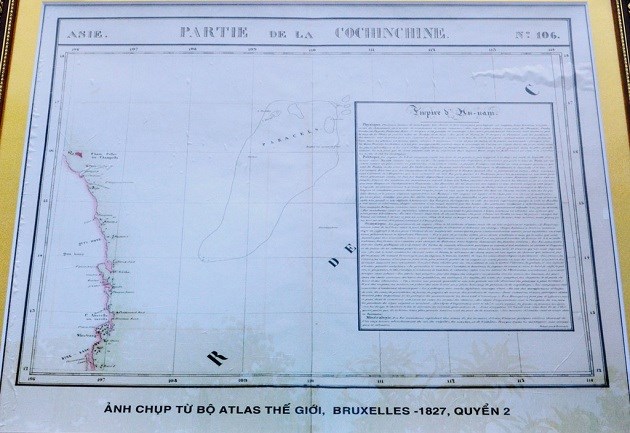
The sea has had a variety of names throughout history, with “South China Sea” being a relatively recent invention (paywall), coming into use in the 1930s as a way to distinguish the waterway from the East China Sea.

China can play the name game, too. In the Chinese language, the sea is called simply Nanhai, or the South Sea. Some have proposed renaming the southern Hainan Province, which faces the sea, to “Nanhai Province.” Proponents contend the name change would help fortify China’s claims to the sea.

In English, changing the name of the sea to “South Sea” might work, argued Ellen Frost, a senior adviser at the East-West Center, earlier this year. Chinese nationalists would surely reject the “Southeast Asia Sea,”she noted (pdf). But they’d have a harder time arguing against the “South Sea”—even though it removes “China”—since in Chinese the name “Nanhai” has been around for centuries.

That change, she contended, “would signal a small, seemingly technical, but meaningful contribution to peace.”

http://qz.com/763161/it-is-time-to-rename-the-south-china-sea/
 

Very nice pace of development.

As for the mysterious structures; that's to increase the suspense and make life more interesting.

But, joke aside, I guess, those structures have to do with the upcoming South China Sea ADIZ.

China is building up capability, which requires time, money, expertise and logistics.
Chinese will put something on islands to protect those 3,000m-long runways, also need them to protect ADIZ.
 
ASEAN dialogue post tribunal ruling on East Sea dispute

The Jakarta based Habibie Centre hosted the 36th Talking ASEAN Dialogue post The Hague tribunal’s ruling on the East Sea dispute, in the Indonesian capital city on July 26.


On July 12, the Permanent Court of Arbitration (PCA) in The Hague, the Netherlands, issued its ruling on a case brought by the Philippines against China’s nine-dash line claim in the East Sea, saying China’s claims to historic rights for waters within the nine-dash line are contrary to the 1982 United Nations Convention on the Law of the Sea. The tribunal also found no legal basis for China to claim historic rights to resources within the nine-dash line.

The talk was the first of scholars and experts from major research centres and institutes of Indonesia and the country’s Foreign Ministry to define the consequences of the ruling on regional stability, as well as post-ruling challenges and opportunities for the central role of ASEAN in maintaining peace and stability in the region.

Siswo Pramono, Director General and Head of the Foreign Ministry’s Policy Analysis and Development Agency, said that ASEAN member states have to date issued their particular statements on the PCA ruling which all emphasised the need to exercise self-restraint, avoid tense actions, and conduct actions in accordance with international law and ASEAN’s legal standards.

He also affirmed that the ruling will have certain effects on the ASEAN Economic Community, the Trans-Pacific Partnership (TPP) agreement and the region’s security situation.

Vietnamese Ambassador to Indonesia Hoang Anh Tuan said that all parties involved are keeping a close watch on the ruling’s effects, so as to have appropriate responses.

Participants agreed that this is a final and legally-binding ruling, whose results depend much on the relevant parties, as there is no common mechanism to enforce it.

VNA
 
Very nice pace of development.

As for the mysterious structures; that's to increase the suspense and make life more interesting.

But, joke aside, I guess, those structures have to do with the upcoming South China Sea ADIZ.

China is building up capability, which requires time, money, expertise and logistics.

Chinese will put something on islands to protect those 3,000m-long runways, also need them to protect ADIZ.
I hear the threat China declaring ADIZ since a time. several questions:

- how large will it cover? will it cover the airspace within 9 dash?
- how will China enforce it?
- how will China respond if Vietnam declares ADIZ covering the entire East Sea, with radars, air assets including missiles?

- Vietnam ADIZ will overlap with China in big parts. How to avoid confrontations?

you should keep in mind it is not a one-way game.

http://nationalinterest.org/feature/how-vietnam-can-stop-the-south-china-sea-adiz-16474
 
Vit konk can declair adiz if they want but would they dare to shoot down chinese plane? The answer is no. Chinese otoh shot down viet su30 and casa plane with impunity via electronic warfare or missiles. Thats the reason why viet refused help from airbus for help to investigate the crash of casa plane. R u kidding me? Vit konk can't produce anything properly n now they act like they can investigate a plane crash on their own?
 

Back
Top Bottom